 Close
Close

Healthy cities aren’t a question of boring or exciting buildings but about creating better public space
By Sarah Flynn, on 6 February 2024
Originally published in The Conversation by Haim Yacobi, Professor of Development Planning and Programme Leader of the MSc Health in Urban Development.

Interstate 5 near downtown San Diego, US. Abraham Barrera | Unsplash
The US developers of a 300ft glowing orb, set to be built in the middle of Stratford, east London, and accommodate upwards of 21,500 concert goers, have withdrawn their planning application.
Las Vegas, in the US, already boasts one such venue, known as Sphere. Citing its “extreme” disappointment at London residents not similarly benefiting from what a spokesperson said was its “groundbreaking technology and the thousands of well-paying jobs it would have created”, Madison Square Garden Entertainment (MSG) has decided the British capital is not one of the forward-thinking cities it aims to work with.
Campaigners have responded with glee, not least because, in response to concerns over the proposed structure’s potential noise and light pollution, developers had initially suggested they invest in blackout curtains. “Residents would be served far better by building social housing on the site,” a representative for Stop MSG Sphere London reportedly said.
Quite how a city both caters to its residents’ needs and sustains its economy is an enduring debate. The tension is between innovation aimed at boosting investment (in this instance, in the entertainment industry) and what urban geographer Colin McFarlne terms the “right to citylife”.
Projects like the Sphere sit on one extreme end of what gets built in a city. The British designer Thomas Heatherwick recently highlighted what he sees as another extreme, though no less harmful: “boring buildings”.
In his new book, Humanise – a Maker’s Guide to Building Our world, Heatherwick says “bland architecture” causes stress, illness, loneliness, fear, division and conflict. Research shows, however, that more than individual buildings, how the city is planned as a whole variously harms or improves people’s lives.
The city as a complex system
The physical and social environment of any given city are just two contributing factors in the complex system that shapes residents’ wellbeing. Public health research has found a positive, non-linear relationship with a higher prevalence of mental health problems in more urbanised countries, particularly for anxiety disorders.

Copenhagen: public space is the very essence of urban life. Brian Kyed | Unsplash
Mental health problems now account for over a third of the total burden of disease in adolescents in urban settings. Research shows that, for young people (a significant proportion of urban populations), health and wellbeing constitute major determinants in their future life prospects.
In Humanise, Heatherwick ignores this complexity. The book is a collection of thoughts, ideas, visuals and reflections on the role of contemporary architecture and architects. In it, the designer suggests that the world is facing a “global epidemic of inhuman buildings” and suggests a list of what to do and what not to do to achieve the reverse: “interesting buildings”.
Heatherwick sees cities as collections of buildings, of architectural objects. The problem here, of course, is that the various aesthetic merits of any given structure can be endlessly debated.
Some of Heatherwick’s arguments (“boring places contribute to division and war”; “boring buildings help to cause climate change”) are plainly simplistic. They also beg the question of who decides what is and what isn’t interesting.
As examples of interesting buildings that bolster people’s wellbeing, he cites, among others, the Parkroyal Collection hotel in Singapore and the Edgewood Mews housing project in Finchley, north London for their generosity.
The first, he says, is “enthusiastic to share its wonder with everyone” and the second offers “more than minimum to the world”.
To me, though, these are extravagant architectural statements of capitalist power (the Singaporean hotel) and an over-designed fortress building (London’s Edgewood housing project).

Singapore’s Parkroyal Collection hotel. Meric Dagli | Unsplash
Recognising the importance of public space in cities
In the early 1900s, the German sociologist and philosopher, Georg Simmel, hailed the advent of a new urban condition. Compared to rural life, he said, the metropolis made people more individualistic, prioritised capitalist modes of production and intensified sensory exposure. As a result, he said: “Instead of reacting emotionally, the metropolitan type reacts primarily in a rational manner”. City dwellers were, Simmel said, less sensitive and further removed from “the depths of personality”.
Mid-20th century architects and planners further explored the socio-psychological damage wrought by urban expansion in the post-war era. In his 1971 book, Life Between Buildings, Danish architect and urban planner Jan Gehl underlined how, more than architecture, urban space itself had the potential to either harm or affirm social interactions.
The capitalist logic underpinning modernist urban planning was harming residents. More and more people were living in high-rise buildings. Open, green spaces were commodified. Private transport was prioritised. Gehl thought it was precisely in these daily situations, where people move between home and work and play, that cities should both “function and provide enjoyment”.
In over-emphasising the design of exciting buildings, Heatherwick overlooks this: that it is between and around buildings that you find the essence of urban life.

Architectural objects in themselves cannot tackle the issues city residents face. Ricardo Gomez Angel | Unsplash
Research shows that urban policies have evolved since the 1970s, largely to try to shape cities for the better and to ensure better accessibility, better quality and diversity of housing, open spaces, more reliable infrastructure and more robust services.
After joining the World Health Organisation’s healthy cities initiative in 1987, Copenhagen developed a holistic urban policy. This included walkable streets, public transportation, diverse housing opportunities, more pointed social policies around ideas of community and using taxation to encourage smoking control. Nearly four decades on, the Danish capital continues to be upheld as one of the world’s healthiest cities.
However “good” or “interesting” architecture might be, it cannot tackle poverty, social exclusion and public health on its own. But even high-rise buildings can make a difference to people’s lives if they’re well designed and well regulated. How the built environment is shaped as a whole is crucial.
In denying MSG planning permission for a London Sphere, city authorities have prioritised residents’ concerns over private investment. Everyone benefits from public space and infrastructure being seen as public goods, not commodities.
Claudia Sheinbaum and the future of Mexico’s Fourth Transformation
By Sarah Flynn, on 5 February 2024
A blog written by Étienne von Bertrab, Lecturer (Teaching) at The Development Planning Unit.
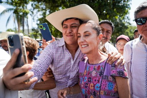
Claudia Sheinbaum greeted by supporters at an informative assembly in Acapulco. Source: Wikimedia Commons
The original version of this text was presented at the seminar “Mexico’s 2024 elections and continuation of the Transformation” during the Latin America Conference 2024 on January 27th in Hamilton House, London. DPU’s Étienne von Bertrab was joined in the panel by William Booth (UCL Institute of the Americas) and by David Raby and María Pérez Ramos from Mexico Solidarity Forum.
On June 2nd Mexico will elect its first female president in 200 years as independent nation. It won’t be Xóchitl Gálvez, candidate of the opposition considered instrument of the country’s oligarchy, but Claudia Sheinbaum, an environmental scientist and social leader who has accompanied the political movement of Andrés Manuel López Obrador (AMLO) for over two decades. She is one of the founders of the Morena party and has admirably governed Mexico City this sexenio (six-year term) until stepping down last June to pursue the presidency.
Apart from this being a momentous event for Mexican society, the coming elections will be highly significant for the life of Morena after AMLO, as Claudia (for short) will be accompanied by five female gubernatorial candidates including leftist Clara Brugada who aspires to build on Claudia’s legacy in Mexico City. Indeed, as journalist Kurt Hackbarth puts it in his latest piece in Jacobin, “the next chapter in Morena’s history is set to be shaped by leftist women”.
The certainty I start with is founded both on AMLO’s remarkably high approval rates (unprecedented at this point in a presidential term) and on the numerous opinion polls that consistently give Sheinbaum a significant lead (20 to 30%) ahead of the opposition’s strongest candidate (Gálvez). But who is Claudia Sheinbaum and what could be expected from a second moment of Mexico’s Fourth Transformation?
There isn’t much space to elaborate on Claudia’s fascinating background and significant public life, but I would like to highlight some things from her trajectory and ways of thinking and doing.[1]
As a young student in the National University, UNAM, Claudia became an activist, first in movements of solidarity with workers and peasants and then as part of the wider student mobilisations of the 1970s and 1980s. She took part in the Comité de Lucha of her university campus and became prominent in the Consejo Estudiantil Universitario (CEU), a movement in defence of public education, at a time when neoliberalism started creeping up in Mexico’s education system.
Claudia got her first degree in Physics and did a masters in Energy Engineering. She was the first woman to enter the doctorate in energy engineering at UNAM and to obtain, in this institution, a PhD in the field. As a young mother she moved with her family to Berkeley, California, to undertake her doctoral research, but even there continued her political activism. Together with other activists she bravely gave President Carlos Salinas de Gortari a hard time in a triumphalist visit to sell the North American Free Trade Agreement (NAFTA). She worked hard as student while nurturing her political awareness and social commitment towards marginalised communities in her work on energy.
As a climate scientist, Claudia was a contributing author to the IPCC’s Fourth Report. For this work the panel received the Nobel Peace Prize (2007). She is a respected scholar in the energy and climate fields, and academia is a part of her life that she never fully abandons (although her life might become even a bit busier for a while).
Due to her solid trajectory on environmental matters and their clear political affinity Claudia was invited by AMLO to be the environment minister for his government of the capital city, then called Distrito Federal, from 2000 to 2005. As minister, Claudia was entrusted with key projects and led significant initiatives.
She supported the struggle against the desafuero of López Obrador[2] and was fundamental in the documentation of the electoral fraud that stripped AMLO from the presidency in 2006 (his first attempt). We need to remember that, since then, Mexico’s government and the business elites worked closely in well-funded smear campaigns to portray him as “un peligro para México” (a danger for Mexico). After the 2006 fraud Claudia returned to her academic activities at UNAM, but never abandoned her political action alongside AMLO.
Claudia was key in the defence of energy sovereignty —a central component of the proyecto obradorista de nación that took AMLO to the presidency in 2018— and was a great mobiliser of women in defence of such sovereignty.
Once AMLO broke with the then leftist party PRD as it allied with the conservative alliance (PRI-PAN) when Enrique Peña Nieto took power, Morena was founded, first as a civic organisation, and later —after discussions in assemblies— as a political party. Claudia Sheinbaum was part of Morena’s foundational process. The rest is history. Morena competed electorally for the first time in 2015 and only 9 years later governs, together with its allied parties, 23 of the 32 states that form the Mexican federation. It could win a few more states in the coming elections.
As mayor of Mexico City, Claudia Sheinbaum’s government expanded fundamental rights to public education, health, housing, culture, dignified employment at a fair wage, sustainable mobility, and a healthy environment. It also drove significant innovation. For example the integration of a solar power plant (now the world’s largest in an urban area) in the city’s food market, and public and free Internet connectivity throughout the city. The accomplishments of her administration are impressive and long is the list of international recognitions and prices. Mirroring what occurs at the national level, public investment in infrastructure and social protection are unparalleled, achieved through republican austerity (not the neoliberal version) and good governance, including combating corruption, without incurring in additional debt. A recurrent argument of the opposition is that Claudia Sheinbaum is candidate because of being AMLO’s favourite (or its “handpicked successor” as it is often framed in the media).[3] This (also misogynist) trope neglects her outstanding leadership and the extraordinary results of her government, putting, for the benefit of all, the poor first.
Claudia Sheinbaum’s programme is under construction. An anachronic electoral law forbids candidates to spell out specific proposals until campaigns officially start in March. However, political documents and ongoing processes are useful indications:
- Proyecto de Nación 2024-2030, consulted and written by a special commission of Morena (before the candidacy was determined). It addresses 19 themes considered major challenges of the Fourth Transformation. More than 15 thousand people participated in this process.
- An initial diagnostic produced by Claudia’s closest team.
- The ongoing Diálogos por la Transformación, a public, participatory process coordinated thematically by a team of advisors (a transition team of sorts).
The dialogues’ resulting document will be presented in March and will complement both Morena’s project (abovementioned) and the programme registered before the National Electoral Institute, INE, which already indicates a boost in the energy transition, a further impulse for women, and a National Guard of proximity oriented to ending violence in the country.
Challenges are many and Claudia Sheinbaum won’t have it easy, not least before a huge popular movement in mourning with AMLO’s full retirement in October. AMLO has been an extraordinary leader and political mastermind and is impossible to substitute him. Mexico’s oligarchy will continue working hard to try to end the political project in power and lawfare is likely to intensify in the next administration, including attempts to seek US intervention. But Claudia Sheinbaum has many things in her favour, not least the demonstrated success of the Fourth Transformation, the palpable results of her government in Mexico City and, above all, her personal integrity. Undoubtedly, a key goal is to achieve a two-thirds super majority in Congress (dubbed Plan C), as this would allow constitutional reforms needed to expand, extend and deepen Mexico’s transformation.
In sum, barring an unforeseen reversal of circumstances in the country, Claudia Sheinbaum will be Mexico’s next president, taking office on October 1st, 2024, and this will be very good news for Mexico, for Latin America and for the world.
Footnotes
[1] For those interested in knowing more about her I recommend the recent documentary Claudia, and Arturo Cano’s book Claudia Sheinbaum: Presidenta.
[2] A political manoeuvre aimed at stopping him from being candidate to the presidency in the 2006 elections.
[3] Claudia Sheinbaum became candidate after winning an internal, transparent process through national polling against five other contestants from Morena and allied parties.
References
Cano, Arturo, 2023, Claudia Sheinbaum: Presidenta, Grijalbo, Ciudad de México.
Hackbarth, Kurt, 2023, “MORENA’s Next Chapter Will Be Written by Leftist Women”, Jacobin, 22 December 2023 https://jacobin.com/2023/12/morena-claudia-sheinbaum-clara-brugada-mexico-women-politics
Raby, David, 2024, “Mexico’s transformation advances”, Morning Star Saturday/Sunday January 27-28 2024. https://morningstaronline.co.uk/article/mexicos-transformation-advances
Unlocking collective trauma: Knowledge production, possession, and epistemic justice in “The Act of Killing” and the 1965 genocide in Indonesia
By Dana Sousa-Limbu, on 20 September 2023
A blog written by Kafi Khaibar Lubis, 2022-23 student of the Environment and Sustainable Development MSc
“Your acting was great. But stop crying.”
Not more than 20 years ago, I was called by my hysterical mom to quickly get inside the house while playing outside as a sunburnt pre-teenager. She was upset like I had never seen before, locked the doors, and shouted things at me, my dad, my uncle, and everyone in my family. She cried. I was just wearing a normal-sized T-shirt gifted by my beloved uncle, the only sibling my mother had. I never understood why it upset her so much until decades later.
Chapter 1: Sickle and Hammer
A couple of months ago, I crashed into a screening held by a film society at one of University College London’s neighbouring universities. It was for a film that I had always wanted to see but was never able to: “The Act of Killing”, or “Jagal” in Indonesian (literal English translation: “slaughter”), a documentary by Joshua Oppenheimer, Christine Cynn, and an anonymous Indonesian co-director. It was about the mass murder that happened in Indonesia around 1965-1966 to millions of people associated, or assumed to be associated with, the Indonesian Communist Party.
This film was never formally distributed in Indonesia. It was only known through underground screenings and word of mouth, which was not a surprise since the topic of the 1965 mass murder itself is very hard to talk about in the country. One could risk being distanced from, labelled a communist (pejorative), or even prosecuted. The film, therefore, plays a significant role in opening and normalizing discussions about the topic and taking a step in unlocking what has been, for so many decades, a painfully silenced collective trauma.
Chapter 2: Confrontation with Reality, Truth, and Knowledge
At the beginning of the screening, they invited Soe Tjen Marching, writer of the 2017 book titled “The End of Silence: Accounts of the 1965 Genocide in Indonesia” to give an introduction. Her father would have been a victim of the mass murder, if it had not been for the delay in processing his name to join the party’s organizing committee. She introduced the film by bringing to light recently declassified documents from the government of the United States of America that played a significant role in setting off the chain of events that led to the 1965 mass murder. However unsettling, the documents act as robust evidence against justifications made for the mass murder, including and especially the government-produced film of the event that was once a mandatory watch for schoolchildren in Indonesia in the 1980-1990s. These forms of knowledge possession have perpetuated the exclusion, silencing, and denial of genocide, leaving the victims at the hand of many types of injustice (Oranli, 2018; Oranlı, 2021).
“The Act of Killing”, on the other hand, used a unique approach to documentary filmmaking that allowed the perpetrators to participate in the production process and shape the story themselves. The film asks former commanders of the Indonesian death squads, who oversaw the execution of hundreds of thousands of suspected communists and other political dissidents in the 1960s, to recreate their atrocities. Devoid of remorse, the perpetrators were proud of their actions, even providing creative choices to narrate the reenactment in the style of their favourite Hollywood genre: action western.
The film’s epistemology is based on the belief that by allowing the subjects to participate in the production process and control the narrative, the film can achieve a level of authenticity and emotional depth that traditional documentaries may not be able to achieve. One might question why after decades of silencing and exclusion, a filmmaker would give a platform to the perpetrators. They are, after all, most often indifferent to the injury they have done and lack any understanding of the extent of harm they have caused. But as the film progressed, it was clear that this was a well-calculated strategy. It was precisely by giving space for the perpetrator to show off their crime that the truth became plain and visible, the genocide clear and undeniable.

Figure 1. Herman, one of the perpetrators, comforting his daughter, Febby, while she is crying in the aftermath of shooting a scene re-enacting the terror towards families of the 1965 mass murder victims (Oppenheimer, 2012).
There was one powerful scene in which the daughter of one of the perpetrators could not stop crying after they shot a reenactment of women and kids being taken away from their homes and their houses set on fire (Fig. 1). She was just an actress, playing one of the kids in the scene. The perpetrator was visibly aware of his daughter’s distress and was trying to comfort her: “Your acting was great,” he said, “but stop crying.” It was followed by depictions of other actors, children, and adults alike, looking traumatized by the reenactment, some requiring physical assistance to calm them down and remove themselves from the situation. Although obviously much milder than what truly happened in the 1960s, the activity incited an exchange of knowledge, blurring the reality and fiction of what they wanted to portray. It was no hidden knowledge that their crime caused significant terror; it was simply something that everybody was afraid to say. Now, by loudly narrating their own ruthless crimes, the perpetrators got a taste of their own medicine.
This method of filmmaking provides an interesting basis for analysis of epistemic injustice, delving into the nature and limits of knowledge. By allowing the perpetrators to narrate the story, the film not only exposes society’s normalization of celebrating brutal murderers but also places the killers in the position to confront their own past actions and their consequences. Another interesting example was Anwar Congo, a prominent leader in the death squad. Throughout the film’s first half, Congo seemed unrepentant and rather laid-back while recounting the murderous event. However, as the cowboy style film he had directed about his killing past neared its end, he started feeling nauseous. He cried, seemingly having an extremely late epiphany (Fig. 2). In that scene, a vivid connection is built between having knowledge and being aware of one’s own actions.
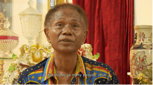
Figure 2. Congo showed regret near the end of the film. “Did all the people I killed feel what I felt in that scene?” Joshua responded, “Actually, the people you tortured and killed felt far worse because you knew it was only a film. They knew they were being killed.” (Oppenheimer, 2012)
The fact that the filmmakers tried more than 30 times to find and interview different subjects is, in some ways, an attempt to understand the many forms of knowledge and the chase of finding the hidden knowledge held by an individual, as categorized in the Johari window (Bhakta et al., 2019; Shenton, 2007). Also, such effort was a sign that the film was not about them or the filmmaking. Oppenheimer had his realization moment and shifted the focus to the perpetrators; that what they did, was almost like a multi-layer fiction, a simulacrum, to say the least, of hidden knowledge, unknown knowledge, and blind knowledge of the genocides, their regrets, and their pride that in itself is a hidden remorse trying to justify their past actions.
Reflexivity and self-awareness become the central theme in the film’s method of unveiling the truth about the tragic past. With the denialism of the perpetrators that have been observed elsewhere, the creators might or might not be intentionally utilizing this reflexive participation measure to disclose objective information and even to induce empathy in people who were detached from their cruelty. With the surfacing of the declassified government documents, the fear and secrecy of the victims, and the genocide denialism, the injustice of knowledge possession has been hiding in plain sight, crossing identities and the reality of a whole nation.
Chapter 3: Empathy, Trauma, and Dreams of Justices
The images of my memories started to become clearer. I understand better about that day, the day my mother was upset beyond measure towards everyone. I remember the T-shirt I wore, which my uncle gave to me. It was a dark blue T-shirt with a sickle and hammer logo and the bold black writing of “SOVIET UNION”.
The discourse on epistemic justice and participatory measures extends beyond academia and into fieldwork, practice, and lived experience. My own family had their own trauma regarding the 1965 mass murder, which I never entirely understood since it could never be talked about openly. “The Act of Killing” tried to unveil the chronic terror of the tragedy both loudly and delicately, borrowing the voice of the perpetrator to raise the volume of the victims’ collective voice. The film confronted the perpetrators not with a team of obvious enemies, but with the most powerful confronter of all: a mirror image of themselves.
The fruit of participation, or engaging people, can open and lead to many kinds of knowledge, whichever type and however vile or inspirational that is, that leads to something minuscule such as being free to wear anything we want, to be anything we want, to justice, and the truth. Moreover, the disclosure of information, whether it be from the state to the people, from the victims to the public, or even from the very perpetrators to their own eyes and mind, can be the first step to opening up a complex dialogue, taking responsibility and addressing a proper apology, healing a collective trauma, and marching towards a better, more empathetic and just future.
References
Bhakta, A., Fisher, J., & Reed, B. (2019). Unveiling hidden knowledge: Discovering the hygiene needs of perimenopausal women. International Development Planning Review, 41(2), 149–171.
Oppenheimer, J., Anonymous, & Cynn, C. (2012). The Act of Killing. Drafthouse Films
Oranli, I. (2018). Genocide Denial: A Form of Evil or a Type of Epistemic Injustice? European Journal of Interdisciplinary Studies, 4(2), 45–51.
Oranlı, I. (2021). Epistemic Injustice from Afar: Rethinking the Denial of Armenian Genocide. Social Epistemology, 35(2), 120–132. https://doi.org/10.1080/02691728.2020.1839593
Shenton, A. K. (2007). Viewing information needs through a Johari Window. Reference Services Review.
The temporality and plurality of sustainability
By Dana Sousa-Limbu, on 20 September 2023
A blog written by Sophie Avent, 2022-23 student of the Environment and Sustainable Development MSc
Like all professions, academia has its own jargon; words that are typically unused in day-to-day life. During my albeit brief foray back into the world of academia, I frequently found academic terminology inaccessible and intimidating. Words such as ‘discourse’, ‘hypothesizing’ and ‘methodology’ are words that I seldom muttered before and will use scarcely again in the future. Whilst academia is its own profession, like many others it must be able to converse outside its own sphere. For the disciplines of sustainability and environment, the ability to connect with sectors and people outside its four walls is arguably its most important task. For cities, countries, and the World to meet the Sustainable Development Goals (SDGs) we are reminded that solutions need to be context specific and co-produced. For this to be achieved we require knowledge diversification, collaboration and ground up strategies that bring together local citizens, local government, and academics alongside other professionals.
Throughout the Environment and Sustainable Development master’s at UCL we have developed knowledge on the topic of sustainability and the environment. It encompasses balancing environmental considerations and social justice, and our program has been shaped to expose the importance of decolonizing knowledge, historicizing, and identifying unequal power distribution that has shaped environmental injustice. Our collective positionality, however, is one of Global North privilege and Western knowledge, from which it is all too easy to critique practices in the Global South. We frequently base our critiques solely on literature review, from which I question if we can ever truly understand the lived experience of those situations we are critiquing and the complexities that accompany them. In the era of decolonizing and diversifying knowledge, I have frequently found this somewhat ironic. Yet, it has reinforced the importance of collaboration and engagement with a cross-section of diverse stakeholders from geographies and disciplines to ensure a holistic view is obtained.
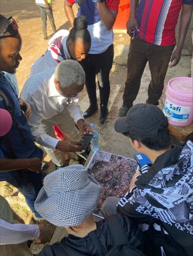
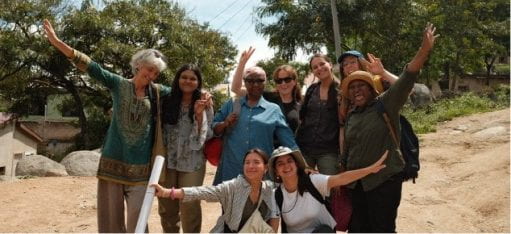
Students and research project partners gathering around a map
In April 2023, we embarked on our overseas practice engagement to Mwanza, Tanzania. Arguably, the perfect opportunity to put our learning into practice and work alongside residents, NGO partners, and the city utility (MWAUWASA). Our research focused on advancing just sanitation in the city of Mwanza and provided an opportunity to learn from others beyond academia. Mwanza is a city with limited water and sanitation infrastructure, a situation that is not uncommon in Africa. In 2015 African leaders committed to achieving universal access to adequate and sustainable sanitation, hygiene services and eliminate open defecation by 2030.
In Mwanza, our research considered the sustainability of the simplified sewerage system (SSS). SSS is a sewerage system technology that collects household wastewater in small-diameter pipes laid at shallow levels, making it significantly less expensive compared to conventional sewerage technology. Mwanza’s water and sewerage utility has implemented the SSS that is spatially focused on deploying the technology in unplanned settlements. Here, the landscape is steep, rocky, and predominantly only accessible via footpaths, making it a good fit for the technology. The SSS connects to the centralized sewerage system, thereby expanding the networked infrastructure. Prior to the ongoing SSS implementation, only around 5% of the city was connected to the sewerage network, perhaps the only positive legacy of colonial rule. Today, coverage extends to around 25% and SSS beneficiaries collectively commend the development as “life changing”.
Notwithstanding the considerable advancement of sanitation service coverage achieved via SSS, we suggested MWAUWASA expand their feasibility study to consider environmental impacts and the long-term financial commitments wedded to beneficiaries once connected to the service. The latter concern being that the ongoing financial commitments would be unsustainable for some residents. Our suggestion was met with opposition and the response from the SSS project manager (resident expert on the project) outlined that such an approach would have drained all the available funds, leaving nothing for infrastructure development. Whilst we failed to effectively articulate our suggestion, I took pause at the response. Cognizant of epistemic justice and decolonial thought, it reminded me that in the spirit of contextualization, knowledge diversification, and sensibility, we should not assume our suggestions would be met without challenge.
Without both conscious thought, attention and/or challenge there is risk of colonization manifesting in new forms. Further, and in acknowledgment of the tension between progress and sustainability that ricocheted through both our suggestion and the response that followed, I became aware that I had overlooked a few critical considerations in Mwanza.
The first is the importance of ethical responsibility in context. Remorse describes African ethical responsibility as promoting living, avoiding death, and leaving the land untouched for future generations (Kumalo, 2017). This stance alters the objectives of sustainability which in turn modifies the output of just decision making, bringing to life the plurality and relational nature of both concepts.
Second, was the realization that the World has competing development priorities, that do not always complement one another, or fully align. In the Global North, the priority is climate change and its consequences; biodiversity loss, extreme weather conditions, ice sheets melting, etc. Whilst these eventualities are already materializing, we are striving towards prevention rather than facilitation. In Mwanza, and in Africa more broadly, the main development challenge is to end poverty. Poverty is multidimensional and encompasses health, education, and living standards. At its core it is people-centered. In Mwanza, the utility priority is the delivery of wastewater services to improve sanitation, thereby contributing towards alleviating poverty and protecting the water quality of Lake Victoria, the city’s water source. Of a lesser concern are the future potential environmental consequences of the technical solution upon the land. In contrast to many development projects, MWAUWASA has focused on developing services within the informal spaces of the city for low-income residents, reinforcing resident’s right to the city. The tangible output of ethical decision making cannot be critiqued and has contributed towards facilitating environmental justice for beneficiaries, a decision that should be championed.
Lastly, I overlooked the temporary nature of sustainable development discourse. The LV WATSAN (Lake Victoria Water and Sanitation) project, under which the SSS forms part of was first launched in 2004. Nineteen years ago, the dominant development discourse was the Millennium Development Goals (MDGs). Today, the focus is Agenda 2030 and its seventeen Sustainable Development Goals (SDGs) which now include a specific goal for water and sanitation (SDG 6). In this respect, LV WATSAN was ahead of the game. But in others, it is another example of a project that is contributing to the slow progress of SDG 6. It has taken nineteen years for Mwanza to develop wastewater services to cover circa one-quarter of the city, a testament to the fact that progress in sanitation can be made, albeit often at a snail’s pace. In nineteen years’ time, the development discourse will no doubt change, and accordingly, I wonder if the mainstream development discourse will deem this development unsatisfactory.
2023 marks the halfway point towards Agenda 2030 and globally all SDGs are off track. Limited funding is often cited as the dominant reason for the slow progress of SDG 6. But on reflection, I ponder if a contributing factor may be due to Northern epistemic superiority. Northern epistemic superiority cuts across all sectors but I fear it will not dissipate unless our blinkers are removed regularly. Collaboration through research is one way to facilitate such removal in academia. As we have experienced in Mwanza, research forces you to step away from academic jargon that is by nature superior, and converse in the most accessible way feasible alongside research partners, that in turn harnesses knowledge development.
Our field trip taught me the practicalities of embracing all things ‘local’ and that ‘context’ incorporates landscape, knowledge, and ethics, which cannot be learned from texts but from people who are resident experts in the local context. It also taught me the plurality of sustainability and the changeable priorities of development. For true progress to be made and epistemic justice to become a reality in research, it is imperative to trust local partners, residents, and professionals who have lived experience and intrinsic knowledge of local ethics that result in just decision making. We need to be accepting that the outcomes of due process will be just, although they might present a rich dichotomy. This will facilitate our ability to embrace the plurality of sustainability, and the differing development priorities across geographies. Without embracing and confronting the limitations of Northern epistemic superiority, development outcomes will be prohibited, and existing environmental injustices will be reinforced.
I am, however, still left wondering if this is enough or if this reflection can become reality. Moreover, whilst I am no closer to grasping how I consider temporality in the context of sustainability, I do now question if our status quo limits our ability to fully understand, consider and justify others’ development priorities that do not fully align with our own.
References
Elden, S. (2007). ‘There is a Politics of Space because Space is Political: Henri Lefebvre and the Production of Space’, Radical Philosophy Review. V.10, p.101-116.
Kumalo, S. (2017). ‘Problematising development in sustainability: epistemic justice through an African ethic’. Southern African Journal of Environmental Education. V. 33 (1), p. 14–24.
Plessis, C. du. (2001). ‘Sustainability and sustainable construction: the African context’. Building Research and Information: The International Journal of Research, Development and Demonstration. V. 29 (5), p. 374–380.
Sustainable Sanitation Alliance (n.d.). The Ngor Declaration on Sanitation and Hygiene. Available at: https://www.susana.org/_resources/documents/default/3-2260-7-1433512846.pdf (Accessed 8 May 2023).
UN- Habitat (2023). (LVWATSAN-Mwanza) Project: Mobilization and Institutional Facilitation of Sanitation. Available at: https://unhabitat.org/the-lake-victoria-water-and-sanitation-project#:~:text=LVWATSAN%20was%20designed%20by%20UN,for%20the%20utilities%20and%20town (Accessed 10 May 2023).
We know your problem, and we’re going to fix it
By Dana Sousa-Limbu, on 20 September 2023
A blog written by Tywen Thomas, 2022-23 student of the Environment and Sustainable Development MSc
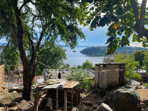
Settlements underneath trees with a view of Lake Victoria in Tanzania
Invisible Domination
Until recently, I had been happy to engage with decolonisation at a discursive or theoretical level, using it as a guideline for political thought and action. My personal politics, leaning on a historical materialist understanding of the injustices of capitalism, often align with strands of decolonial thought. I have sympathised with and supported decolonial initiatives that some would term radical, such as the return of land and its socio-economic power to its rightful indigenous stewards. In hindsight, I leaned on these moments of alignment to justify a lack of further work and self-reflection. Confident in a surface-level application of what decolonisation could be, I had not worked to come to my own nuanced understanding of what it meant for me and how my decisions, and very existence, fit within it.
Decolonisation has been woven throughout the Environment and Sustainable Development programme. I digested assigned readings on topics such as decolonising academia in South Africa. As a white Canadian studying in the seat of empire, I was aware of the inherent conflicts and potential hypocrisy.
Reckoning with your relationship to decolonisation is not a simple process. The majority of people in my privileged position have not done the work. This fact indicates the entrenched coloniality of Western society. Maistry (2019) explains the difference between colonialism and coloniality:
“The former refers to the institutional or legislative governing power of the coloniser over the colony as a result of military conquest. Its counterpoint is decolonisation, the ‘return’ of the colonised territory to its original inhabitants. Coloniality, on the other hand, is a systematic, enduring process of displacement of indigenous ontologies and epistemologies within that of the colonisers… it permeates all aspects of our contemporary existence, our dress, consumption patterns, values, aspirations and our worldviews. It holds an ideological hegemony over the social, economic and political” (page 186).
Using this interpretation, I have long aligned ideologically with decolonisation – the return of indigenous lands – for various reasons, from justice to climate practicality. However, problematically from the perspective of continuing to frame decolonisation as a vague concept to ideologically align with, this understanding of decoloniality asks much more of the individual.
A difficult realisation comes with acknowledging the degree of my entanglement in the ontological supremacy of Western worldviews. Despite ongoing efforts to decolonise the curriculum I have been studying, the media I engage with, and the institutions I am a part of, it will take a concerted effort on my part to mitigate my complicity in perpetuating coloniality. How does one decolonise their thought patterns, ways of knowing, and attitudes towards the world?
These complex thoughts swirled as my colleagues and I deliberated on how to best approach each coming day of our fieldwork in Tanzania. While it is no longer a German or British colony, contemporary Tanzania exists in a reality inseparable from coloniality. Not only were our ideas, proposed solutions and approach as researchers sitting in this shadow, but so were many of the existing Tanzanian ideas, ongoing attempts at solutions, and the hierarchical structure of stakeholders. Again from Maistry (2019):
“coloniality then is the ever-pervasive ‘invisible’ structure of management and domination in contemporary society. Its counterpoint, decoloniality might refer to the project of disrupting coloniality’s cycle of reification” (page 187).
Speaking with people experiencing simultaneous realities so different to mine brought into sharp focus that my capacity to envision a solution free from the coloniality that supports these realities is limited by my ability to escape my own coloniality. I might be able to empathise with those suffering in large part due to the extant coloniality of their society. Still, I will never be able to experience their reality (Maistry 2019 from Burrell and Flood 2019).
Dining tables on the waterfront in Tanzania during sunset
Constructing Imaginaries
One of the identifiable manifestations of coloniality in the context of our work in Mwanza was in the discourse around infrastructure. The discussion was frequently binary, have or have not, the unimproved or the upgraded, connected or unconnected. It did not take a sophisticated analysis to determine who or what was likely to fit into which category or to hypothesise why that might be the case. As Fanon wrote in his famous and sadly still pertinent work The Wretched of the Earth:
“The colonial world is a compartmentalised world…The colonised world is a world divided in two.” (Fanon 2004, page 3).
This compartmentalised, divided world was evident in Tanzania. We stayed in a gated hotel set in stark relief to the surrounding unplanned settlement. Our buses lurched down unpaved roads over channels carved by previous rains before popping out onto a smooth arterial highway. The tall buildings in the bustling centre of Mwanza illuminate the night sky while providing a view of squat tin-roofed communities perched on surrounding hillsides conspicuous in their relative darkness. These contrasting inequalities of capitalist imperialism are softened in the centres of colonial power where I come from, with much of the unsightly struggle and exploitation exported to the so-called developing world to sustain the reification of coloniality.
Infrastructure plays a complicated role in this dichotomy. It is a tool to create and sustain this disparity while also representing a potential path across the chasm. In development discourse, infrastructure can lift a household, a community, or a city across the divide. However, infrastructure as a construct is characterised by a duality: it can support motion and mobility but also restrict and limit.
“every day by neglect or design infrastructure fails to meet basic needs. But this conception of infrastructure, perhaps an engineer’s definition, is only one of its forms” (Cowen in Pasternak et al. 2023, page 2).
One of the biggest takeaways from our group’s work was recognising the utility of a broader people-centred conception of infrastructure, where people are more than the implementor, the beneficiary, or the victim. People themselves can form infrastructures. This people-centred view of infrastructure frees it from being limited to moving things or people, allowing it to play a role in creating emotion and, importantly, constructing realities (Cowen in Pasternak et al. 2023).
The most rewarding aspect of our project was working with community members to co-produce a sustainable ecological sanitation solution for their community. Participants grasped not only our theoretical framework of multi-scalar loops but applied a combination of theory and knowledge of sanitation technologies to imagine an alternate reality beyond the connected/unconnected binary.
Overwhelmingly, community members sought decentralised and community-driven solutions. The attraction is not hard to understand. Aside from a lack of trust in authorities, these solutions’ flexibility, adaptability, and potential empowerment works toward decoloniality by pushing against the hierarchical binaries of post-colonial realities.
Infrastructure provides opportunities to think about design, ownership, financing, process, labour, and each aspect’s political economies and ecologies (Cowen in Pasternak et al., 2023). These questions create space for community co-design, co-ownership, co-financing, etc., all of which serve as windows for decoloniality. However, we can go further.
There is yet more potential in moving conceptually beyond infrastructure as either human-made physical constructs or human-centred systems. Borrowing indigenous ways of knowing historically cast aside by coloniality, nature should be considered infrastructure.
“If we think of a river as infrastructure, then it’s not something that is built and then walked away from, nor something that just exists in space as material” (Spice in Pasternak et al. 2023, page 3).
The example of a river is particularly relevant to our work in Tanzania which exists in the context of efforts to improve water quality in the Lake Victoria watershed. If the watershed is seen as infrastructure alongside many that comprise a sanitation system, binary solutions give way to a broader understanding of potential avenues of improvement. This conceptual opening moves beyond the colonial dichotomy of have and have-not and leaves behind the constructed humanity-nature duality. This allows coloniality to be tackled not by opening a discursive window but by knocking down walls to identify processes and solutions that target root causes. As an indirect goal, supporting decoloniality aligns with many explicit intentions of social justice, aid, and research programmes. It also intentionally enables them to be lifted out of their colonial box, increasing the likelihood of real change being made along the way.
Citations
Fanon, F., Bhabha, H. K., & Sartre, J.-P. (2004). The wretched of the earth: Frantz Fanon. (R. Philcox, Trans.) (1st ed.). Grove Press.
Maistry, S. M. (2019). The Higher Education Decolonisation Project: Negotiating Cognitive Dissonance. Transformation: Critical Perspectives on Southern Africa, 100(1), 179–189. https://doi.org/10.1353/trn.2019.0027
Pasternak, S., Cowen, D., Clifford, R., Joseph, T., Scott, D. N., Spice, A., & Stark, H. K. (2023). Infrastructure, Jurisdiction, extractivism: Keywords for decolonising geographies. Political Geography, 101, 102763. https://doi.org/10.1016/j.polgeo.2022.102763
Beyond the mango tree: An exploration and reflection on women, care and sanitation in Kigoto
By Dana Sousa-Limbu, on 20 September 2023
A blog written by Annabel Collinson, 2022-23 student of the Environment and Sustainable Development MSc
“My house is just beyond the mango tree”
Naomi* explained, the stream gurgling quietly behind us. My hand, covered in a thin layer of dirt and sweat, added blotches to the page as I wrote furiously. After a long first day in the field we stumbled upon Naomi, washing clothes in the stream on an increasingly warm day. In the heat of the afternoon we felt overwhelmed by the prospect of another interview, but we knew we needed to speak to her; we promised we’d return. The next day, as we began our ascent into the hills of Kigoto, her house seemed to creep further and further away. Her house was behind the mango tree, sure, but far, far behind. We hiked almost vertically up a precarious hill, jumping over gaps in rocks and sliding over boulders. We grew more tired with each step we took, but the warm breeze behind us and the music coming from the homes we passed made our journey joyous. When we reached Naomi she was sitting with her nine children at the top of the hill next to her home. She helped lay out a blanket for us, her now very pregnant belly getting in the way as she tried to bend over to smooth out its woven edges. Breathless, she pulled herself up to perch on a nearby rock. We clambered onto the rug. It felt like I was five again, joining story time at the local library. As I turned to look behind me, the sea stretched out wide; islands peppered the ocean and clouds dotted the sky. The hill on which Naomi’s house was positioned dropped off almost directly beneath me—she was easily at the highest elevation of any of our participants.
All our interviews in Kigoto took almost an hour and half, including a time use survey to outline each woman’s day. Naomi’s day was by far one of the most strenuous.Without a husband and little help from other family members, Naomi is simultaneously consumed by childcare and her work as a clothes washer. The stream where we first met Naomi is where she spends most of her days, washing clothes and collecting water. Her trek to the stream devours a large part of her week; five times a day she climbs up and down the hill, carrying water back for bathing and cleaning clothes. This hike used to only take a few minutes a day, but Naomi is pregnant with her tenth child. These commutes now take almost forty minutes round trip. Her family’s clothes are washed once a week at best, once a month at worst.
Our team’s research sought to understand women’s everyday experiences as they pertained to time, labor and care. We hypothesized, initially, that improved access to sanitation would improve women’s mental and physical wellbeing. We knew that they were burdened with the majority of care work and that the taboos within the community, compounded by social norms and gender roles, created an intense environment which diminished opportunities for capacity building.

Students and research project partners on a boat trip in Tanzania
After an incredibly gruelling second day of interviews our team sat around a table, time use surveys spread out before us, swimming in an ocean of data and information. We were determined not to lose sight of these women and their stories, to make sure they remained at the forefront of our work. I poured over the surveys and the research, examining each one to understand underlying patterns of behavior and circumstance.We met women with no access to water or a connection via MWAUWASA, a pit latrine or an indoor toilet, a one-room home or a three-bedroom home. As I continued to scour the data I was constantly reminded of Joy.
When we met Joy we were sure we were meeting a woman in the best circumstances. She had five bedrooms in her home—so many she admitted she couldn’t use them all. She had help taking care of her children and she had both a working indoor toilet and an outdoor toilet.My assumption, at least, was that she would be the perfect example of the positive impact of improved sanitation. When we sat down with her and she shared her experience with us, however, what became undeniably clear was that her wellbeing was only partially impacted.The transformation I had been naively anticipating wasn’t there. Joy’s days were monopolized by childcare but, more importantly, she was completely isolated from anyone in the community. She wasn’t living in Kigoto out of want but rather out of necessity, and she didn’t feel connected to a community or network of other women.
Joy’s issue wasn’t sanitation—a practical need that could, with time, be fixed—but rather a feeling. Joy was incredibly lonely, and she wasn’t the only one. Time and again, no matter the circumstance, the women we spoke to were isolated and alone. In a quantitative analysis of our data Naomi and Joy could not be more dissimilar, but, through an emotional lens, their stories were incredibly alike. It was evident that, as emotional political ecology indicates, political conflicts are emotion alone; the subjectivities are contextual, but the output is the same (González-Hidalgoet al, 237). The personal is political (Crow,113). In both instances Joy and Naomi were at odds with their circumstances and without control, forced to extend themselves to accommodate for the lack of support they received. Emotional political ecology would contend that this emotional labor is to be anticipated.
Sitting at the table I concluded that, no matter what demographics we chose or what circumstances we focused on, we would continue to find women who felt hopeless and lonely, resigned to believe they were not capable of achieving better conditions. These were women with wishes and ambitions, who in many instances wanted more but felt that it just wasn’t possible. In some cases, it would be difficult to dramatically improve their situation but, for many of these women, the variable that could drastically change their lives was community.
At the intersection of pragmatic and strategic needs was the need for a network of women, a place to engage with the community and find opportunities for growth and change. Our multi-pronged solution, comprised of the introduction of female-focused, female run “care hubs,” the encouragement of increased resources for women and inclusion of their voices at every level of decision-making, and the enforcement of cluster household improvements, highlights the need to support women on multiple scales and underlines the necessity for intersectional spaces. In the case of the care hub, the women we spoke to were adamant that they wanted a space in which they could “relax and feel comfortable.” With a focus on systems of care, our solutions demand space for women and carers within infrastructure. It acknowledges that the production of infrastructure has, thus far, been disjointed and unsupportive. Underlining the methodology set out by Donna Haraway, our propositions seek to position women to create and establish knowledge, to encourage the “persistence of their vision” (Haraway, 581).
Using both emotional political ecology and feminist political ecology our solutions renegotiate the everyday, reimagining what the community could look like if it were centered around intersectional knowledge production. In this way, these ideals have the power to support meaning-making and solution- creation at both the practical and strategic level.
Each woman we spoke to unraveled a hypothesis, challenged a prediction and reconfigured an observation. We left each interview feeling rich with knowledge, and their stories have shaped our recommendations for the better. After almost every interview we invited each woman to our focus group or our final meeting with local officials. I was convinced only a handful would show, now knowing how busy and difficult their daily schedules were and how exhausted they must be. On the day of our focus group, in a small church hall hung with colorful drapes and lined with plastic chairs, in walked almost every woman we invited, eager to share and support our work. Our focus group was fruitful and vibrant, filled with poignant remarks and effervescent conversation. On the final day, knowing how far each woman had to travel, I would not have anticipated that every one of the five women we invited would have joined. I felt so grateful that they believed in our work enough to attend and that they felt comfortable with us to let us share their experiences.
Arguing for a community of care to support the needs of women in Kigoto and beyond was difficult, and we knew that our attempt to shift the narrative around women’s needs would be challenging. Feminist political ecology acknowledges the need to focus on the everyday, and emotional political ecology notes the critical gap between the emotional and the political; both of these issues, as we saw in Kigoto, shape and impact the burden of care on women (González-Hidalgo et al, 250). Critical knowledge can only be gained and supported through community; our research helped us understand the power of storytelling and the value of community for women in Kigoto. Through our insights and recommendations, we hope to empower and embolden the women of Kigoto to see themselves as part of a powerful collective and to use this power to seek opportunity and call for change.
*Names have been changed to maintain confidentiality.
Students, staff and research partners from the Environment and Sustainable Development overseas practice engagement in Tanzania
Listen to the ‘Tanzania 2023’ playlist by Annabel on Spotify.
References
Crow, B.A. (2000). Radical feminism a documentary reader. New York New York University Press.
González-Hidalgo, M. and Zografos, C. (2019). Emotions, power, and environmental conflict: Expanding the ‘emotional turn’ in political ecology. Progress in Human Geography, [online] p.030913251882464. doi:https://doi.org/10.1177/0309132518824644.
Haraway, D. (1988). Situated Knowledges: the Science Question in Feminism and the Privilege of Partial Perspective. Feminist Studies, [online] 14(3), pp.575–599. Available at: https://www.jstor.org/stable/3178066
Land security through food security
By Pamela Hartley-Pinto, on 31 August 2023
What would land security for urban informal settlement residents look like if the state prioritised, and rewarded, food sovereignty and security instead of automatically turning first to questions of land tenure and property rights? This question is a provocation to think land security for marginalised groups anew, and simultaneously address a key dimension of food and nutrition in concerns for social protection.
When the state talks about land and addressing insecurity of residents in informal settlements, the first issues they reach for are always tenure and property rights. This is because the framing of land as a commodity within the interaction of supply and demand is so prevalent. However, there are other ways of considering land and food systems which could also form the basis for a contract between the state and residents in informal settlements so that food security could become a guarantee for land security.
Status quo of land use management
It has already been established that “clear and secure land tenure can improve livelihoods and sustainable management of natural resources, including forests, and promote sustainable development and responsible investment that eradicates poverty and food insecurity (Mennen, 2015).” UN SDGs talk about “access to ownership and control over land and other forms of property” as well as “including secure and equal access to land.” Despite this and the evidence around benefits of secure land tenure, governments dither, but rethinking it from a food security perspective could open new avenues
When flipping the order of things and re-prioritizing, putting food security first could lead to land tenure for those providing the food, taking care of the community gardens and looking after the produce, as well as act as a quantifiable alternative to social protection reducing the burden on the state. As Li puts it, the meaning given to land varies depending on who you are asking and as well as the “materiality” and the “inscription devices define what type of resource land is (Li, 2014).” Also, “land tenure has usually been viewed as a supply-side’ issue, while food security has been considered a `demand-side’ issue (Maxwell and Wiebe, 1999).” Having this distinction in mind and rethinking the relationship between food security and land tenure has the potential to flip the politics of the discourse and the relations of power within the territories, in fact giving other actors who have a stake in the discourse a seat at the table. Empowered and organised communities or coalitions could use a new narrative when referring to the land they take care of and shift the supply and demand logic.
Peru and food insecurity
Drawing on the example of contemporary Peruvian food security: data from the Food and Agriculture Organization states that over 51% of the population is living in moderate food insecurity, meaning that “people have reduced the quality of their diet or are eating less than they need (FAO, 2022).” Exploring the links between land tenure and food security, Maxwell and Wiebe highlight how “access to food derives from opportunities to produce food directly or to exchange other commodities or services for food (Maxwell and Wiebe, 1999).”
Currently, the Peruvian government has a variety of social programmes tackling food insecurity but none of them address the root of the problem. The programmes established now include food handouts, cash transfers or government-sponsored soup kitchens with little to no capacity building. What would other strategies to tackle food insecurity look like? Perhaps involving communities themselves and supporting co-produced solutions to move away from a top-down welfare practice to a bottom-up coalition of government and non-government actors.
Working with informality
Acknowledging and rewarding the existence of established community networks, artisanal risk prevention and natural disaster management from the grassroots as well as community-led soup kitchens should be taken seriously as solid examples of community infrastructures and human and social capital (Moser, 1998). Reframing these assets into food security and governance is just a matter of recognising and working with informality rather than punishing it.
Collaborative bottom-up strategies through their “invented spaces of citizenship” (Miraftab, 2004) fight exclusion and aim to support local collective action for survival whilst ensuring food security for the communities they serve. Seeing that these initiatives at the grassroots are working well, why not add additional government support in the form of land for community gardens specifically for those community soup kitchens that are already mapped and established?
Overall, considering the materiality of land, there could be “an expanded capacity to envision underutilised land as a globally important asset capable of producing food, profits, and a reduction of poverty as well (Li, 2014).”
In conclusion, the question of refocusing on food security and sovereignty as the starting point for land urban security as well as looking at it as an alternative to current social protection policies changes priorities. It gives a strengthened platform to insurgent planners and bottom-up community-led strategies of survival while promoting ownership and a sound alternative to the state’s responsibility to its citizens regarding social protection.

Community-led soup kitchen-Absalon Alarcon in Lima, Peru (Photo: TECHO Peru)
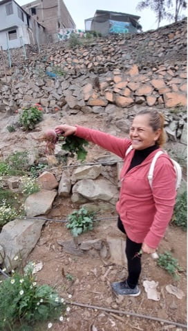
Maria, community leader, holding produce from her urban community garden (photo: TECHO Peru)
References
Li, T.M. (2014) “What is land? assembling a resource for Global Investment,” Transactions of the Institute of British Geographers, 39(4), pp. 589–602. Available at: https://doi.org/10.1111/tran.12065.
Maxwell, D. and Wiebe, K. (1999) “Land tenure and Food Security: Exploring Dynamic Linkages,” Development and Change, 30(4), pp. 825–849. Available at: https://doi.org/10.1111/1467-7660.00139.
Mennen, T. (2017) Know your SDGS: Land matters for sustainable development, Chemonics International. Available at: https://chemonics.com/blog/know-your-sdgs-land-matters-for-sustainable-development/ (Accessed: January 8, 2023).
Miraftab, F. (2004) Invited and Invented Spaces of Participation: Neoliberal Citizenship and Feminists’ Expanded Notion of Politics. Wagadu: Journal of Transnational Women’s and Gender Studies. (e journal). http://appweb.cortland.edu/ojs/index.php/Wagadu
Moser, C.O.N. (1998) “The asset vulnerability framework: Reassessing urban poverty reduction strategies,” World Development, 26(1), pp. 1–19. Available at: https://doi.org/10.1016/s0305-750x(97)10015-8.
Peru’s food crisis grows amid soaring prices and poverty: FAO | UN News (2022) United Nations. United Nations. Available at: https://news.un.org/en/story/2022/11/1130737#:~:text=According%20to%20a%202021%20 FAO, eating%20less%20than%20they%20need.%E2%80%9D (Accessed: January 6, 2023).
Exploring the public role of a Global University: Reflecting on the potential of embedded learning alliances in promoting planning justice
By Debayan Chatterjee, on 15 August 2023
Authors: Chauncie Bigler, Yuka Aota, Debayan Chatterjee, Corin Menuge (Graduates of MSc Urban Development Planning, Bartlett DPU, UCL)
Introduction
In the Autumn of 2019, a group of MSc Urban Development Planning students partnered with community groups in London’s Old Kent Road (/OKR) Neighbourhood to explore the potential of social audits as a tool for just urban transformation in the city. As part of the multi-year teaching partnership, our group had a specific objective of collaboratively designing a social audit tool with local community groups in OKR area. The purpose of this exercise was to both test the concept of social audits in London planning whilst also supporting community groups in the gathering of data on neighbourhood assets that held significant value for locals. At that time, interrupting the speculative real estate development planned for what had become a London ‘Opportunity Area’ (See Figure 1) was a key priority for the long-term residents, businesses and other groups in the area.
In July of 2021, almost two years later, we reached out to a highly-engaged community resident who had been involved in the 2019 engagement. Our intention was to ascertain whether the social auditing toolkit we had designed was still in use and, if possible, to compare its application in both a pre-pandemic and mid-pandemic context. This resident explained that the pandemic had sharpened the priorities of community organisers and those demanding more participatory development across London: “What we want is a plan B, in light of these huge changes in the last 18 months. We want a realistic appraisal of where things are at for the people who live here” (Community resident, 21 Aug 2021).
This experience of revisiting our research partnership after two years–and a global pandemic–later caused our group to reflect further on both our positionality as researchers and practitioners, and the role that academic partnerships such as ours may have in relation to the underlying goal to leave lasting and positive community impacts. Mere months after coproducing research with community activists – the COVID-19 pandemic shifted the ground upon which priorities and strategies would be developed. As is common with planning praxis, all parties active in fighting for just planning in London, or globally, needed to reflect and react in order to move forward in highly changeable circumstances. Learning alliances such as the one we were engaged in must adapt, even in a global pandemic.
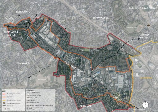
Figure 1: Old Kent Road opportunity area (Source: Southwark Council)
Revisiting Prior Engagement
Revisiting our study, the local groups see the multidimensional barriers of realising meaningful participation in planning. Many scholars (Fainstein, 2010; Healey, 2005) have tried to improve the UK’s institutionalised public participation system by highlighting the potential of a collaborative approach in planning and local governance. However, communities have continued to face difficulties in reflecting their insights on the OKR regeneration plan, such as when they could not attend in-person consultations due to COVID-19 pandemic impacts. Thus, this situation can lead to dominant decision-making over a particular plan (Arnstein, 1969). Community participation requires both Invited and Invented spaces (Miraftab, 2004). Invited spaces involve local authorities engaging with and integrating diverse perspectives during the initial phases of planning, acknowledging the value of individuals’ insights and experiences as future end-users (Ball, 2004). However, effective community participation also demands autonomous, Invented spaces for community knowledge development and counter-planning. Indeed the two should work iteratively.
Just Space, an informal alliance comprising approximately 80 community groups, is dedicated to amplifying local voices and perspectives from grassroots levels up to London’s major planning strategies. In their “Community-Led Plan for London” (Just Space, 2013), the alliance proposed to metropolitan planning authorities the adoption of Social Impact Assessments (SIAs) as a fundamental basis for making planning decisions. SIAs are essential in evaluating the potential impact of development proposals on existing residents and businesses within a neighbourhood. Recognizing the historical shortfall in communication and genuine participation, the Just Space network has been advocating for the incorporation of these impact assessments within borough and metropolitan planning frameworks to secure a more community-led planning process.
Later on, Just Space collaborated with faculty at the DPU to initiate a multi-year project, which our group joined in 2019. During our cohort’s involvement, we were briefed on the displacement pressures arising from the Old Kent Road’s designation as an Opportunity Area. Our primary task was to engage in propositional work: co-creating a “social audit” tool in collaboration with local communities. Social audits serve as a means to establish an evidence base that reflects the neighbourhood assets as perceived by community members. These audits are a part of the broader concept of Social Impact Assessments (SIAs), a tool which seeks to materialise a more ‘just city’ (Fanstein in Yiftachel and Mandelbaum, 2017). The overarching objective of SIAs is to empower community members to visualize and address spatial inequalities in their surroundings.
Figure 2: Social Audit Handbook prepared for the residents of Old Kent Road opportunity area (Source: Author)
Drawing on interviews with community members and field research, the social audit handbook (See Figure 2) was designed to be a pre-emptive, modular, adaptable and reflexive toolkit for communities. The handbook visually shows the process for identifying local assets, collecting data, and seeking further support to protect what is valued by the community in the face of development. The handbook starts with contextual data on Old Kent Road and provides guidance on community goal-setting using existing data and the voices least likely to breach traditional planning approaches. Four types of community assets (green infrastructure, housing, social/community spaces and economic infrastructure) were showcased as data collection categories based on field research and interviews with Just Space (See Figure 3). The final section emphasises the significance of visualising local data and seeking options to deliver community needs (See Figure 4).

Figure 3: Different community assets identified for the Social Audit Handbook (Source: Author)

Figure 4: Social Audit Handbook demonstrating the data collection process (Source: Author)
At the time of this action-research collaboration in 2019, the social audit handbook received positive feedback from the Old Kent Road activists and groups engaged in its coproduction. The exercise was also good practice for the budding urban development planners in our group. As students, we developed collaborative listening skills through rounds of interviews with residents, local business owners, and non-profit workers, as well as countless learning site walks. The research that underpinned the design of the tool involved an examination of best practices from social audit initiatives in different locations such as South Africa, Israel, and London. This exploration deepened our understanding of social practices within diverse contexts. The benefits to us as researchers were clear and immediate – but what about longer-term outcomes for the community groups and individuals who gave their time and insights to the work?
All components of the social audit handbook were designed according to the interpreted needs of communities at the time, yet since its original production so much has changed. Begging the question, how relevant does the tool remain in a post-COVID moment?
As one community resident noted in 2021, the city’s priorities shifted due to COVID related financial constraints. The Bakerloo line extension, upon which the original plan rested, has been effectively stopped ‘indefinitely’. What does this mean for the OKR? Perhaps counter intuitively, this withdrawal of committed public investment, combined with new local leadership within the Borough’s controlling Labour Party, could open an opportunity to achieve a more just development trajectory for OKR.
However, if this opportunity is to be realised and a Plan B is to emerge, then tools such as the social audit tested in pre-pandemic conditions may gain renewed relevance. Indeed, given that our 2019 research demonstrated how the aspiration to protect local assets is most impactful in the earliest stages of planning process, a social audit tool feels particularly salient. Rather than attempting to influence plans at a planning application stage when many decisions have already been locked in, a social audit would reflect community priorities and identify valued networks, local heritage, businesses, and public spaces as plans are being made and well before applications and capital investment arrive at the community’s door.
Principles for Strengthened Academic Partnerships

Figure 5: Academic-civil society co-production (Source: Author)
Through this retrospective re-examination of a project, the group synthesised three key themes which can prompt further examination by parties hoping to engage in academic-civil society co-productions and learning alliances:
(a) Barriers to collecting local information
Residents often face barriers when trying to access planning-related data and information about ongoing urban development in their neighbourhoods. While the toolkit outlines steps for data collection and visualization of community assets and needs to present to the government, updating it for longevity should include a clearer roadmap to overcome technical skill barriers. This might involve providing support for accessing and interpreting open-source community data for those with minimal formal training, suggesting low-cost programs for basic mapping and document creation, and offering straightforward project management and budgeting templates. Encouraging community members to assess their key skills related to social audits and formulating partnerships with students or business owners to address gaps could be a preliminary step. Nurturing interactions for creating living documents by connecting relevant information with residents requires time and planning. Despite community members’ superior knowledge of their needs, neighbourhood histories, and dynamics compared to decision-makers, capacity-building and skill-sharing are essential steps for promoting effective social audits or community-led plans.
(b) Ensuring Continuity of Moment-Driven Work within a Context of Rapid Change
The government can change urban development plans suddenly, making it difficult for communities to formulate interventions aligned with the government’s timeline and request them to amend formal plans. Thus, communities learn to respond rapidly to changes in local dynamics and political priorities, and learning alliances must also face this reality. Some of the ways that the DPU-Just Space learning alliance (See Figure 5) ensures continuity while continually adapting are by building multi-year partnerships, retaining faculty engagements around them, and designing new projects each year based on priorities from partners. The UDP cohort that followed ours (2020-21) first contributed to Just Space’s Community-led Recovery Plan for London and later shifted their attention to Southwark, where they examined the utilization, challenges, and potential of public land. This latter project connected with some of the community groups and ideas that emerged from the social audit work conducted previously. As seen in this example, COVID-19 revealed amplified inequalities of the people’s lives and has mobilised or reanimated a number of initiatives targeting alternative development visions for London. This project demonstrates a strong example of building on previous efforts while coping with changing circumstances, such as those presented by COVID-19. Under the guidance and direction of UDP faculty and with continual input from the learning alliance’s partners, later cohorts continue to support long-term attempts to promote community-led planning in the city.
(c) Structuring the Engagement for Mutually-Beneficial Outcomes
A key organising skill employed by the most successful activist groups is never-ending creativity in the face of changing circumstances. Activists must adjust their strategies and efforts in order to seize opportunities as they come. This hard-earned skill-set can be even less straightforward to apply to an academic setting. Academia, even when a strong ethos of practice in community engagement is present, must balance adaptability with the structure needed for executing a project within a fixed academic term in a classroom setting.
The task of structuring academic co-production processes is not straightforward, and creative ways to extend the work could be explored to maximize what both the community and the students take forward from the engagement. For example, rather than attempt to theoretically frame, develop and part pilot a tool all in one term, the learning alliance could be split into curricula and extra-curricular components with students given the opportunity to continue their engagement with the project’s community partners after the completion of the assessed project. In the case of our project, such an approach could have allowed time for a more in-depth piloting and testing phase. Through that further coproduction moment, additional findings would surely surface from the community on its design, such as local capacity to collect and take forward the fact-based data, which would provide even more support towards sustainable realisation of the community’s needs. That said, given such an approach relies on voluntary capacity and will, there is a small risk that momentum wains without the incentive of assessment.
Conclusion
During the autumn academic term of 2019, our cohort of 11 UDP students actively immersed themselves in the Old Kent Road project, forging connections between academic theory and practical application. Through engaging with community leaders and collaborating closely with community groups and Just Space members, the cohort shaped the framework and toolkit. Student groups navigated the intricate local political landscape, stakeholder dynamics, Social Impact Assessments (SIAs), planning procedures, and inclusive engagement approaches. UCL, as a global university, sends its Master’s graduates into diverse sectors worldwide. Our cohort’s immersive experience enriched subsequent chapters of our journeys: from supporting grassroots initiatives at the Japanese Embassy in New Delhi, to a role as an Urban Designer in Dubai and Germany, Green Infrastructure Planner in the U.S., and a contributor to London’s social housing sector. While challenging to quantify, the impacts of such alliances extend beyond classroom walls and the Old Kent Road. Academic research underscores the notion of ‘seeding’ hope for communities grappling with injustices by both recognising and amplifying their campaigns and also nurturing a new generation of planning practitioners attuned to the diverse needs and aspirations of cities worldwide.
The multiyear learning collaborations between UCL and community groups emphasize the pivotal role of community planning and the potential to transmit the principles of socially just planning to the succeeding cohort. By introducing the social audit handbook to communities, we supported Just Space in testing a responsive tool aligned with the community’s strategies within specific times and conditions as well as amplifying an idea whose time may yet come. This endeavour aimed to integrate a degree of procedural justice into practice by transforming environmental governance through inclusive engagement that values diverse voices and perspectives (York and Yazar, 2022). It’s crucial to acknowledge that existing communities are integral participants in regeneration, capable of enhancing their neighbourhoods, and the outcomes of their collective efforts can ripple throughout the entire city (Ball, 2004). Tools like the social audits we examined can serve as valuable documentation of neighbourhood changes and shared lessons, facilitating action planning for like-minded communities and organizations. Nevertheless, as exemplified by disruptions caused by the COVID-19 pandemic, what holds greater resilience than specific tools are the skills cultivated in response to the inherent complexities of multi-stakeholder engagement in development planning. Primarily, this involves the ability to be adaptable and strategic in action planning, consistently reassessing the scope for manoeuvring (Safier, 2002) toward community objectives.
Reference
Arnstein, S.R. (1969). ‘A ladder of citizen participation’, Journal of the American Institute of planners, 35(4), pp.216-224.
Ball, M. (2004). ‘Co-operation with the community in property-led urban regeneration’, Journal of Property Research, 21:2, pp.119-142, DOI: 10.1080/0959991042000328810.
Fainstein, S. (2010). The Just City, Ithaca, NY: Cornell University Press.
Healey, P. (2005). Collaborative Planning (2nd ed.), Basingstoke, Macmmillan.
Just Space (2013). Towards a Community-Led Plan for London Policy directions and proposals. [online]. Available at: https://justspacelondon.files.wordpress.com/2013/09/just-space-a4-community-led-london-plan.pdf.
Langlois, A. (2023). ‘TfL Bakerloo line extension, Southwark to Lewisham: Part of tunnel design work restarted’. LondonWorld. National World Publishing Ltd, 1st June 2023. [online]. Available at: https://www.londonworld.com/news/traffic-and-travel/tfl-to-restart-part-of-tunnel-design-work-for-bakerloo-line-extension-4077412.
Safier, M. (2002). ‘On Estimating Room for Manoeuvre’, City, 6(1). pp.117-132.
Yiftachel, O. and Mandelbaum, R. (2017). ‘Doing the Just City: Social Impact Assessment and the Planning of Beersheba, Israel’, Planning Theory & Practice, 18 (4). pp.525-548.
York, A. and Yazar, M. (2022).’Leveraging shadow networks for procedural justice’, Current Opinion in Environmental Sustainability, Vol.57. Available at: https://doi.org/10.1016/j.cosust.2022.101190.
Bio Statement:
This group reflection comes from four DPU alumni from the 2019-2020 Urban Development Planning cohort, on the work Social Impact Assessment as a tool for Just Planning in Southwark, London. Yuka, Chauncie, Debayan, and Corin are now in four different parts of the world (India, USA, Germany, and the UK, respectively) working within differing sectors, all engaging with the core themes from this community-led planning practice module in some capacity. The group thanks the module leaders, Tim Wickson and Barbara Lipietz, and countless community organizers past and present for the ability to participate in this work.
RECLAIM-FUTURE Mini-Project
By Wacera Thande, on 3 August 2023
By Wacera Thande and Robert Biel

The Radical Exploration of Co-Learning through Artificial Intelligence for Managing a Food-centric Urban Territory of Unprecedented Resilience and Equity or RECLAIM-FUTURE is a mini project co-lead by Prof. Robert Biel and MSc student Wacera Thande. We are both co-creators in this project seeking to understand how AI can be used to facilitate a co-learning experience to enable students to learn and understand complex systems within the Development Planning Unit’s Food and the City module headed and curated by Prof. Robert Biel.
This project is underpinned by Paulo Freire’s pedagogy and includes these three concepts:
- Dialogue/Co – learning as a model of creating knowledge as a collective where participants are equal. Mutual respect and trust underpin this form of learning process. Each participant including the teacher/lecturer must be willing to question the knowledge they have acquired and be open to change and the creation of new knowledge.
- Praxis – This means the testing of ideas through practice or action learning. It is not enough for people to come together in dialogue, it is key that we act upon our environment to be able to critically reflect on the knowledge we create for further action and critical reflection.
- Liberation – Through practice and dialogue, knowledge should be used to awaken the consciousness of teachers and students to empower them to transform an unjust world through liberating ourselves from the dominating ideologies both cognitively and also in practice.

Paulo Freire: Image from Google
How does this relate to the Food and the City module?
The Food and the City module seeks to enable students to understand some underlying issues of the food crisis, understand agriculture in relation to the climate crisis, and outline the features of sustainable alternatives such as Agroecology, and link these technical solutions to social struggles of emancipation from oppressive systems such as unjust property relations and the democratization of knowledge. From the module handbook, this module shows how the city can implement these principles both within itself, and in its relations to the surrounding countryside. Internally, the city should evolve an urban metabolism (using compostable waste, heat, gray water) in order to grow some of its own food, as well as various food-related social networks acting to eliminate waste; externally, it can – through ‘community-supported agriculture’ and other means – work to revitalise small farms and free them from the tyranny of globalised value chains. The module uses systems theory to understand these complex systems within the city in relation to food.
What is the potential role of AI?
Simply put AI employs feedback in an attempt to answer prompts/questions it has been asked. Our key role in this mini project is to understand these feedback loops and understand how we can use AI in class to enable an understanding. We ask these questions.
- Can AI enhance the ability for students to embrace complexity?
- Can AI be a collaborative problem solver in the classroom?
- Can AI enhance our reflective and reflexive skills within the classroom?

If we imagine in a Food and the City classroom, we would have a discussion across 3 agents: the students, the lecturers and the AI all as collaborators. Potentially AI could help in structuring a discussion by generating prompts through interaction with it. This counts AI as an agent that is not based on creative thought; but as an agent that helps stimulate it. Furthermore, AI can be a good agent in structuring discussions in group activities where open dialogue and reflective sessions may be carried out to enable a more collaborative approach of generating knoweldge. Using student to student and student to teacher dialogue for a co-creative space. Collaborative problem solving seeks to solve questions or problems through pooling their knowledge, skills, and efforts. With the help of AI as an agent can stimulate our human pooling and collaboration that is key for collaborative problem solving. In these cases the AI can generate maps, data sets, and other creative tools that enable greater collaboration processes amongst students. This can be linked to a form of collaborative commons, a concept that is central to the Food and the City module. Mapping and other creative tools can be created within the classroom as a form of commoning such as creating an AI version of a Miro board.
If we are redesigning the module AI’s role seems to be quite useful in those aspects especially when we are seeking to liberate our minds from the alienation of ruling ideology. An Interesting idea we have is that AI seems to have less of a bias in terms of the historic cause and is open to different forms of knowledge and experience.
AI is a tool that has many potential benefits that encourage inquiry based learning, collaborative problem solving, enhancing critical thinking of students and teachers and finally employability beyond the classroom. As described earlier our work is underpinned by Freire’s pedagogy. Therefore, collaborative problem solving may look like interacting with the AI in a classroom as a collaborator in facilitating conversations that are critical and help students reflect on already existing knowledge and newly made knowledge. We recognise the potential of AI in helping to co-design learning environments that replicate the structure and tools that students may find in real world situations. AI could potentially be used as a virtual avatar of the real world to enable the praxis paradigm that Freire talks about before they make it into the real world. Practically for the food and the city course an idea would be to have the real world situation of already existing food systems be replicated by AI. Where AI can design food systems that create an avatar of various ideas generated by students as a trial of potential food systems. Having a customized AI that generates virtual food systems that are conceptualized and imagined by the students. This can foster enquiry based learning, which comes from a drive by curiosity which in turn helps learners cultivate critical thinking and problem solving.
There are many opportunities we have identified with AI and we hope this mini project will at least address some of those opportunities.
Designing child-friendly cities: play spaces outside playgrounds
By Andrea Rigon, on 19 July 2023
By Qianxi Zhang
This blog was written as a synthesis of a DPU Dialogues in Development event “Designing child-friendly cities: play spaces outside playgrounds”, co-hosted with the UCL’s Critical Childhood Studies Research Group (CCSRG). Qianxi is a one-year visiting researcher at the DPU, working with Dr Andrea Rigon and CatalyticAction on the codesign of child-friendly cities and communities.
Bringing together the designers of cases from China, Lebanon and Italy, the event discussed the challenges and opportunities to make urban neighbourhood child-friendly and play-friendly. Through different marginalised and low-income contexts, the session discussed the importance of unstructured play, play everywhere, intergenerational play, and children’s participation. The session also explored what are the context-specific elements and what learning can be drawn from across the different cases. The event was followed by an open discussion with the discussants Dr Rachel Rosen from the Institute of Education, UCL, Dr Yat Ming Loo from the University of Nottingham Ningbo China, and Dr Helen Woolley from the University of Sheffield. The Bartlett Development Planning Unit and UCL’s Critical Childhood Studies Research Group (CCSRG) co-hosted the event.
Case 1: Designing Play Spaces for Children in Migrant Workers’ Communities in China

As the first speaker from NingboTech University and University of Nottingham Ningbo China, Qianxi Zhang introduced a child-friendly school-to-home street intervention she designed, which is located in a representative migrant worker’s community named Mingdong community in Ningbo City. The child-friendly street in the community holds great social-ecological value for mitigating the challenges of play insufficiency and social isolation among children in migrant workers’ communities in China.
Mingdong community was built in 1996 and has 120,000 square meters of construction areas with 56 residential buildings, 170 households, and 5500 residents, of which the migrant population is around 3000. It has a well-developed external urban infrastructure with a lot of public amenities. By contrast, its internal public space is extremely full of tension. It’s a typical gated community characterized by a grid-like road network. Large parks or public spaces are scarce within the community, and residents’ outdoor activities are restricted to the streets which mainly serve as internal transportation and parking services. In this ecological environment, children’s outdoor play and independent mobility are also severely inadequate, and sidewalks become their primary daily activity areas. Additionally, 56% of residents are from outside Zhejiang Province, such as Anhui and Henan provinces, etc. Most of them face language and cultural barriers with limited social support networks.
Figure: The social-ecological environment of the Mingdong community
The Mingdong community was designated in 2019 as the host site for the Young Planning Professionals (YPPs) workshop, which was arranged as part of a collaboration among international organizations (ISOCARP, UNICEF) and local authorities (the Urban Planning Society of China and the Ningbo Urban Planning Bureau). The primary objective of this workshop was to provide international young planners with actual community planning while engaging with children, to achieve the goal of ‘Child-friendly Urban Planning’. This was the first time that the concept of a Child-friendly City has been recognized by local community managers and residents. In 2020, the Mingdong community received specialized funding from the Ningbo Municipal Government for the purpose of renovating the overall infrastructure and public space environment of old communities. In light of this development, community managers extended an invitation to a local university (NingboTech University) design team and a regional design company (Ningbo Urban Planning and Design Institute) to collaborate in exploring methods of incorporating child-friendly concepts within the overall regeneration plan. Subsequently, the decision-making team designated a street linking the community and the school to create the most beautiful and playful child-friendly walking route.

Figure: Development and actor-network dynamic of the intervention
Before regeneration, the site size was very limited and the buildings along it lacked attractive interfaces and engaging functions. It was devoid of any street furniture or ancillary amenities and was consistently encroached upon by motor vehicles. The design strategy was dividing the layout planning of the existing sidewalk space into four major functional zones: frontage zone, clear path, street furniture zone, and buffer zone. In conjunction with site-specific characteristics, physical elements such as play and learning spaces, green landscape areas, street furniture and seating were adaptively integrated. Moreover, a traffic calm intervention was incorporated. Additionally, the community volunteer culture and school football culture were identified as opportunities to shape the public spirit of the community and were manifested through spatial elements design. For instance, various community cultural materials such as community slogans, story photos, exemplary figures, and important events, were posted on the interfaces of the rotatable boxes in the arch door, allowing children and residents to learn about community culture and governance stories in a fun and interactive way.

Figure: Streetscape before and after intervention
The renovated sidewalk exhibited significantly higher usage rates than its previously neglected state. The various affordance of play, learning, nature, and other amenities provided by the sidewalk were used by children as anticipated by the designer. Additionally, children displayed creative use of these amenities. In addition, nearby elderly residents have also begun to move tables and chairs to this area to play cards. This space has gradually become a shared space for all residents, thereby building new forms of common

Figure: Diverse usage behaviors of children and other residents in the renewed street
The design team organized a community open day to showcase the regeneration design schemes for the entire community in the public space. The design intentions were presented to the residents in a more intuitive and vivid form, such as environment drawings, renderings, and models. Additionally, representative children participated in the discussion of the design plans for the child-friendly sidewalk renovation project.
Figure: Children and resident’s participation in the design scheme discussion
Reflections: play-based street intervention can bring a lot of positive effects on migrant workers’ community in China, such as (1) creating more play spaces and opportunities for children’s physical activity and recreation, and improving the overall health and wellness of children, (2) provide a platform for children and caregivers to interact with their neighbors, build relationships and form a sense of community, and (3) create opportunities for children to engage in social and cultural exchange with other members of the community, fostering mutual understanding and respect.
However, challenges remain. The construction of play spaces is very dependent on government policy support and special funding subsidies. But government funding can only guarantee necessary projects, such as playgrounds, while play spaces outside playgrounds are not a mandatory indicator in Chinese communities, resulting in similar projects only being attached to other project packages, the landing of this project is therefore highly contingent. Without the call of professionals and the involvement of the private sector, it is difficult to scale up similar projects at present in China. Secondly, more evidence and interdisciplinary knowledge are needed to understand how children interact with the urban environment and their preferences, so as support the evidence-based design of play spaces outside playgrounds. This knowledge needs more children’s lens and voices.
Case 2: Designing child-friendly cities: play outside playgrounds in Lebanon

The second speaker is Riccardo Conti, co-founder and Executive Director at CatalyticAction which is a charity that uses design and architecture to empower vulnerable children, young people, and their communities. Children’s participation in every step of the process from initialization to design, but also the construction. The methods of participation include mapping in the neighborhood, one-to-one interviews to discuss ideas and identify solutions, and also model making and mural painting in the construction. CatalyticAction generates an impact mostly on children’s well-being, but also improves the local capacity and the local economy. In particular, as it prioritizes the use of local materials and skills, it also has an impact on social cohesion and inclusion as they work with different groups inside the community.
It’s really important to speak about play outside playgrounds, especially in a context like Lebanon, where playgrounds in public spaces are really scarce. There is a common observation that whether it’s a street or a parking lot, or basically anywhere where there are no cars, kids playing could be found.

Four play space projects in different urban sites were introduced, including one on public steps, one on a waterfront, one on a street, and one on a residual space.
Play space project on public stairs:
The project on public steps involves the rehabilitation of a public stair that was damaged in the 4th explosion in 2020. The design objectives include improving the physical environment, enhancing accessibility, and restoring social activities. Several design elements will be incorporated, including a slide, handrails with wooden spheres painted by local residents, and speaking pipes. In addition, the project will involve organizing activities to help residents reclaim the stair and its social value. Due to budget constraints, the design incorporates multiple functions into a single element, and some conventional design rules were negotiated with the municipality. Finally, the project will incorporate a unique participation method using Minecraft, a video game, to co-design with children.

Play space project along the waterfront.
The play space project along the waterfront is challenging due to the lack of basic facilities and a limited budget. The design objectives and strategies aim to provide caregivers with facilities that are easily accessible from their homes for daily use. The project is divided into three separate locations along the waterfront, each with a different focus – some encourage physical play, while others are designed for people to enjoy the natural beauty of the waterfront. The design incorporates items suitable for all age groups. Local researchers will be engaged as a participation method. The success of the project will be indicated by the site being populated by people of different ages and nationalities after the regeneration.

Play space project on street
The project is located on a street between a public hospital and a public park, which has the problem of excessive space allocated to cars. The design strategy is to increase the pedestrian space by reducing the space for cars, but this involves negotiation with the municipality. Design elements include permanent floor games, bicycle rocks that are popular with children for playing and going under, funky benches or climbable elements, safe crossings, and seating arrangements. To ensure long-term maintenance, pigments are included directly in the cement mix. The project also incorporated a unique participation method, as children were involved in marking the location.

Play space project in residual space
The project in the residual space involves designing a space that is larger than a sidewalk but not big enough to be a public park or playground. The design strategy involves transforming the space into a larger sidewalk. The design element includes a colorful bench. After construction, children were observed using the space as predicted – running, sitting, and jumping over the bench. Unexpectedly, some people also came to skateboard in the area. Children used the division of the colors on the bench to play marbles, as well as the slope of the bench to slide. The participation method used for this project involved design consultation.

Case 3: San Siro child-friendly neighborhood in Italy: a design perspective
The third speaker Gianfranco Orsenigo from Politecnico di Milano introduced a Grow up well project in San Siro, which is a social housing neighborhood in Milano. In his research, he investigates how architectural design can equip itself to become a key stage in the process of transformation of marginal territories. He is a member of Mapping San Siro, an action-research project in the public housing neighborhood of San Siro in Mila
The San Siro neighborhood is located in the North-west part of the city and is one of the largest public housing projects built between the 1930s and 1950s, adhering to the modern movement. The neighborhood consists of around 6,000 housing units and is inhabited by approximately 11,000 people, with 77% being owned and managed by Aler Milano, the Regional Housing Agency. Despite its size and population, the neighborhood has been suffering from institutional neglect and mismanagement, resulting in a sense of abandonment and decay of the built environment, leading to its classification as an “internal periphery.” However, the area is surrounded by areas of significant urban development, including City Life and the San Siro Stadium, and is well-connected to the city as a whole via the M5 underground and stadium.
The neighborhood is super diverse, with residents from over 85 different nationalities. More than 48% of the population has foreign origins, and there is internal diversity in terms of culture, religion, social status, dwelling conditions, and migratory backgrounds. However, there is polarization between the younger (18% of whom are foreigners) and the elderly population (mostly Italians, comprising 36% of the population). Unfortunately, the Roma population is excluded from this diversity. The largest foreign communities in the neighborhood are from Egypt (37.2%), Morocco (10.4%), the Philippines (9.5%), and Peru (6.1%), according to Anagrafe Comunale 2012.

The Mapping San Siro project and the West Road Project are two action-research initiatives that aim to promote positive change in neglected urban areas of Milan. Mapping San Siro began in 2013 with a workshop that focused on countering the negative perception of the San Siro neighborhood through research and pilot projects, including the Trentametriquadri space, SoHoLab Project, and Off Campus San Siro. The project involved reopening spaces, building trust-based relationships with the local community, and creating a multisource observatory to combine different forms of knowledge. It was carried out in collaboration with Aler Milano and Regione Lombardia. The West Road Project, which won the Polisocial Award in 2017, is part of the social engagement and responsibility program at the Politecnico di Milano. It employs spatial analysis and co-design methods to improve neglected spaces and promote the development of local cycling connections, using multidisciplinary approaches and building prototypes of transition through experiments to establish local relationships based on trust. Together, these two groups focus on (co)design, networking, and project development as tools to directly support local actors and communities.
The Pillar of Public Spaces and common spaces focuses on improving the quality and dignity of the public and common spaces in San Siro, using them as a tool to understand the neighborhood and build relationships based on trust with locals. This helps create a constantly updated image of the area and formulate more precise questions for future change. The group employs two main approaches: first, the use of prototypes of transition, which are small realizations that demonstrate the potential for change and act as drivers for new experiences. These prototypes also help evaluate project hypotheses and activate imaginaries for future transformations, engaging both locals and public institutions in triggering a future of change. Second, the group has developed a vision for the future called “Growing up well in San Siro.” This vision focuses on the young population, who are a fragile group in the neighborhood due to their status as newcomers and second-generation immigrants. School dropout rates are high among these young people, who represent 36 different nationalities and 95% of the student population. This leads to issues of school segregation. However, the group sees the young people as an opportunity to reimagine the neighborhood as an infrastructure for growing well, with public spaces as support for new paths of protagonism, expression, and creativity.

In San Siro, the younger population is considered fragile due to their status as almost newcomers and second generations of immigrants. The school dropout rate is a significant issue in this neighborhood, with 95% of students being foreign and representing 36 different nationalities, leading to a problem of scholar segregation. However, this challenge also presents an opportunity to reimagine the neighborhood as an infrastructure for growing well. By providing space and support for new paths of protagonism, expression, and creativity, the community can create a brighter future for the younger generation.

The Patto via Gigante project is a prototype for transition and aims to create an accessible connection for pedestrians and cyclists between social places and schools in Milan. The project involved rethinking a portion of the pavement on Via Gigante that was improperly used as a car park and storage for bulky goods. The new public space was designed and constructed between March 2019 and October 2020, using public collaboration agreements, a new instrument that the municipality of Milan recently implemented. The project was carried out in cooperation with 11 local association partnerships Overall, the project serves as a model for how public collaboration agreements can be used to transform urban spaces and improve accessibility for pedestrians and cyclists.
The design elements of the project included a new graphic along the pavement, a wooden platform with flower boxes, new furniture donated by Vestre AS, and two bicycle racks. The new graphic along the pavement served as a visual cue to the transformation of the area, while the wooden platform with flower boxes provided an inviting and aesthetically pleasing space for people to gather and socialize. The new furniture donated by Vestre AS, including the only public table in the neighborhood, created a functional space for people to sit and enjoy the area. Additionally, the two bicycle racks were an important addition for encouraging sustainable transportation and reducing the use of cars.
![]()
The building day played a critical role in involving and engaging locals, particularly through the curiosity of children. This initial contact served as a foundation for future engagement when the project was completed. The project also involved students from the faculty, incorporating educational art and practical education. Observations have shown that the transformed space has the potential to become an actively engaged tool in daily life. This engagement extends beyond children and also includes parents and relatives, creating relationships that can lead to the development of co-design services with local associations. For instance, children from the public space could participate in cultural events or assist with homework, among other possibilities. This prototype serves as a tool for building cooperative networks and triggering new interventions.
The project team has developed five additional prototypes to improve public spaces in Milan. The first prototype is the green living lab, which rethinks the pavement of Via Abbiati by transforming a street corner into a green space. The second prototype is the Trabucco Gigante, which is a deck platform in a courtyard that can be used for cultural events, daily activities, and free play. The third prototype, Cortile Cadorna, aims to redesign the school backyard with more natural elements to support the school’s activities and the parents’ initiatives. The fourth prototype, Campo Gioco Aretusa, is a new playground located in a traffic island and sponsored by Recordati spa. This playground is an excellent example of collaboration between public, private, and local community organizations. It provides an opportunity for students to use the neighborhood as a field of experience and encourages them to be more active in their community.
Insights from discussants
- Rachel Rosen, Institute of Education, UCL
Richel’s sociological perspective on childhood and space design highlights the social construction of childhood and the role of space in transforming social relations. By designing space for childhood, it can address the challenge of generational segregation and promote intergenerational connections. The importance of spaces in between is emphasized, as children prefer to play in spaces that are not solely designated for play. It is meaningful to design for openness and new imaginaries. Reclaiming rights in urban public spaces are also highlighted, as low-resource initiatives through co-design, coordination, and co-building can create a sense of reclaiming commons. Co-designing play spaces outside of playgrounds can build new forms of common. The questions raised are how designers and researchers can challenge and disrupt generational segregation and address power relations, such as unequal access to resources.
- Yat Ming Loo, University of Nottingham Ningbo China
Yat Ming focuses on the contextual differences in play space design in different cultures. One important factor is cultural differences, such as intergenerational nurturing and the intercultural environment caused by internal migration in China. These cultural factors can affect the understanding of play and childhood, and therefore impact the design of play spaces. Another aspect to consider is the power relation between top-down government funds and bottom-up NGO support in China. The role of memory also plays a significant role in creating childhood experiences. All of these factors should be taken into account when designing play spaces in different cultural contexts.
- Helen Woolley, University of Sheffield
Helen, an expert in landscape architecture, shares several perspectives on play spaces and childhood: Firstly, she believes that play is an integral part of childhood, and children will find ways to play everywhere. Even elements within streets can provide opportunities for play. Secondly, she observes that children often use spaces that were not initially designed for play, calling them “children’s constructed and found spaces”. Thirdly, she suggests that small interventions can be impactful in building a bigger matrix of a child-friendly city. Fourthly, she proposes that a successful play space is one that is well-used by people of all age groups, and that improving the physical environment can enhance social cohesion. Finally, she raises the question of how to effectively evaluate and demonstrate to politicians and funders the positive impact of play space interventions on quality of life.
