X Close

The Survey of London

Home

Recording the history of London's built environment since 1894

Menu

Archive for the 'South-East Marylebone' Category

Welbeck Street Car Park

By the Survey of London, on 22 February 2019

Earlier this month, it was announced that Westminster Council has approved plans to demolish the Welbeck Street Car Park. The following account of this arresting multi-storey car park was published in volume 51 of the Survey of London, part of a two-volume set on South-East Marylebone (2017) that was recently awarded the annual Colvin Prize by the Society of Architectural Historians of Great Britain.

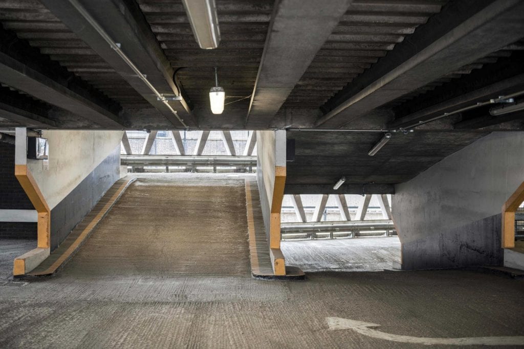
Welbeck Street Car Park, view from the south (© Historic England, Chris Redgrave)

Occupying the sites of Nos 74–78, the Welbeck Street Car Park was part of the extensive redevelopment undertaken locally by Debenhams in the 1960s and 70s, beginning with head offices at 1 Welbeck Street opposite in 1962–4. Multi-storey car parks were not then new, but they still carried an air of novelty and offered scope for experimentation in design. Such a building fitted well into the modernization and rationalization of Debenhams overseen by the chairman and managing director John Bedford. Car parks, said Bedford, were ‘essential to the profitability of modern stores’, and lack of parking was behind the closure of a number of the groups’ provincial stores including that of Marshall & Snelgrove in his native Birmingham. Debenhams had in fact provided some parking before the war, at Mill Hill Place and Stratford Mews, but in any case the new car park was insisted upon by Westminster Council. Intended particularly for shoppers at Debenham & Freebody, Bradleys the furriers at 2 Welbeck Street, and Marshall & Snelgrove in Oxford Street, the project for 400-plus cars was announced at the end of 1963, but there was then a long delay before construction was carried out in 1970, to be completed the year after Bedford retired. Initially it seems to have been under-used despite the intensive local deployment of meters. [1]

The third level, looking south (© Historic England, Chris Redgrave)

The building was designed by Michael Blampied & Partners (F. D. Kahn and R. R. Le Duc being the architects in charge), with John de Bremaeker & Partners, structural engineers; the contractor was Cementation Construction Ltd. Though small, it is justly regarded as one of the most aesthetically accomplished buildings of its kind. Often described as Brutalist, it has little or nothing of that style. The exterior walls above the ground floor are built using triangular precast concrete units, carrying floors made up of precast concrete beams and slabs with a topping of reinforced concrete poured in situ. Split-level throughout on account of the sloping site, with a mezzanine over part of the ground floor, it has eight full upper floors for parking, including the rooftop. Most of the ground floor not required for vehicle entry and exit was given over to a restaurant, while most of the basement was designed as a cold store for Debenham & Freebody, to which it was linked by tunnel.

The third level, looking north-west (© Historic England, Chris Redgrave)

The obvious appeal is in the bright modular geometry of the wall units, enhanced by their load-bearing status; the disjunction caused by the split level, and the conventional colonnaded ground floor, show the practical limitations of the essentially sculptural approach. To save drawing time, the design of the modules was worked out with carved polystyrene blocks, and a full-size mock-up was used to test their draining and staining characteristics. The final units, made by the Atlas Stone Co. Ltd, incorporate drainage grooves at the junctions of the facets. Their overall scale is large, and the safety aspect of the openings is addressed by means of stainless steel wires threaded vertically through the building as a barrier, unseen from outside. [2]

Welbeck Street Car Park (© Historic England, Chris Redgrave)

In advance of a full online version of volumes 51 and 52 of the Survey of London, the draft chapters have been made freely available online. A volume on Oxford Street is set to be published next year.

References

[1] Financial Times, 6 December 1963, p. 15; 25 November 1968, p. 9; 19 January 1970, p. 9: Architects’ Journal, 18 August 1971, p. 358.

[2] Architects’ Journal, 18 August 1971, pp. 351–61: Builder, 9 April 1971, pp. 35–8: Concrete, vol. 6, 1972, p. 356: Simon Henley, The Architecture of Parking, 2007, pp. 125–31.

Seasons Greetings from the Survey of London

By the Survey of London, on 21 December 2018

Thank you for reading the Survey of London’s blog posts over the last year. Here follows a selection of our favourite wintry photographs from our past and present studies of London. Happy Christmas and all good wishes for the New Year.

Oxford Street

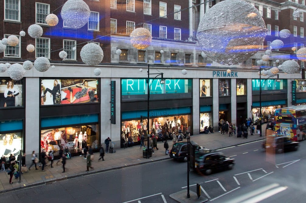
As the longest continuous shopping street in Europe since the eighteenth century, Oxford Street is a unique phenomenon. Though it has witnessed almost continuous change, it has never lost its popularity. The character of Oxford Street is defined above all by its shops, and Christmas is its busiest time of the year. In 2015 we asked Lucy Millson-Watkins to photograph the lights, sights and decorations of Christmas on Oxford Street. Here is a selection of the photographs that she took, first published online in a blog post that considered the festive season on Oxford Street and its enduring traditions. The Survey’s work on Oxford Street is nearing completion, and the volume is expected to be published by Yale University Press, with support from the Paul Mellon Centre for Studies in British Art, in 2020.

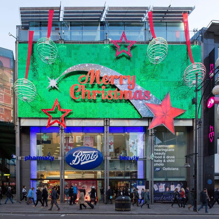
Boots at 385–389 Oxford Street, photographed in December 2015. (© Lucy Millson-Watkins)

West end of Oxford Street looking towards Marble Arch, with Marks & Spencers flagship store. (© Lucy Millson-Watkins)

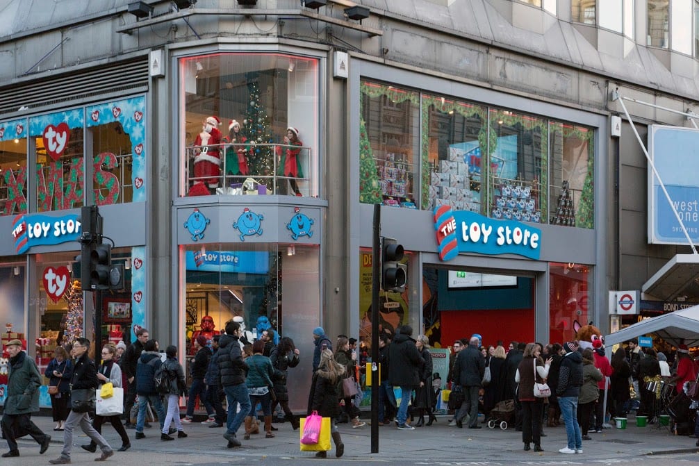
The Toy Store at 381 Oxford Street, a Dubai-based chain which opened its first UK store in 2014 close to Bond Street Station. (© Lucy Millson-Watkins)

Whitechapel

Research is continuing in Whitechapel, a district with a long and rich history, currently in the throes of intense change. One of this year’s highlights for the Survey was the Whitechapel History Fest, which took place at the Whitechapel Idea Store in October. The festival marked the closing stages of the three-year Arts and Humanities Research Council funded research project, ‘Histories of Whitechapel’. Local experts, residents and historians convened to discuss the past and present of Whitechapel, with talks, film, poetry readings and panel discussions.

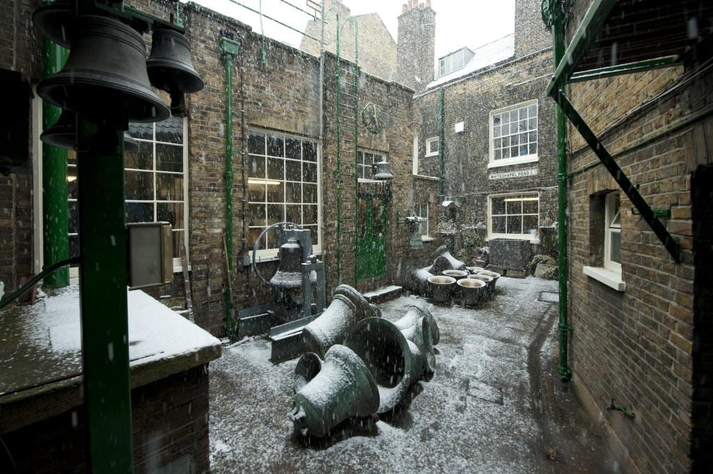
The Whitechapel Bell Foundry, 32–34 Whitechapel Road, in 2010. (© Historic England Archive, photographed by Derek Kendall)

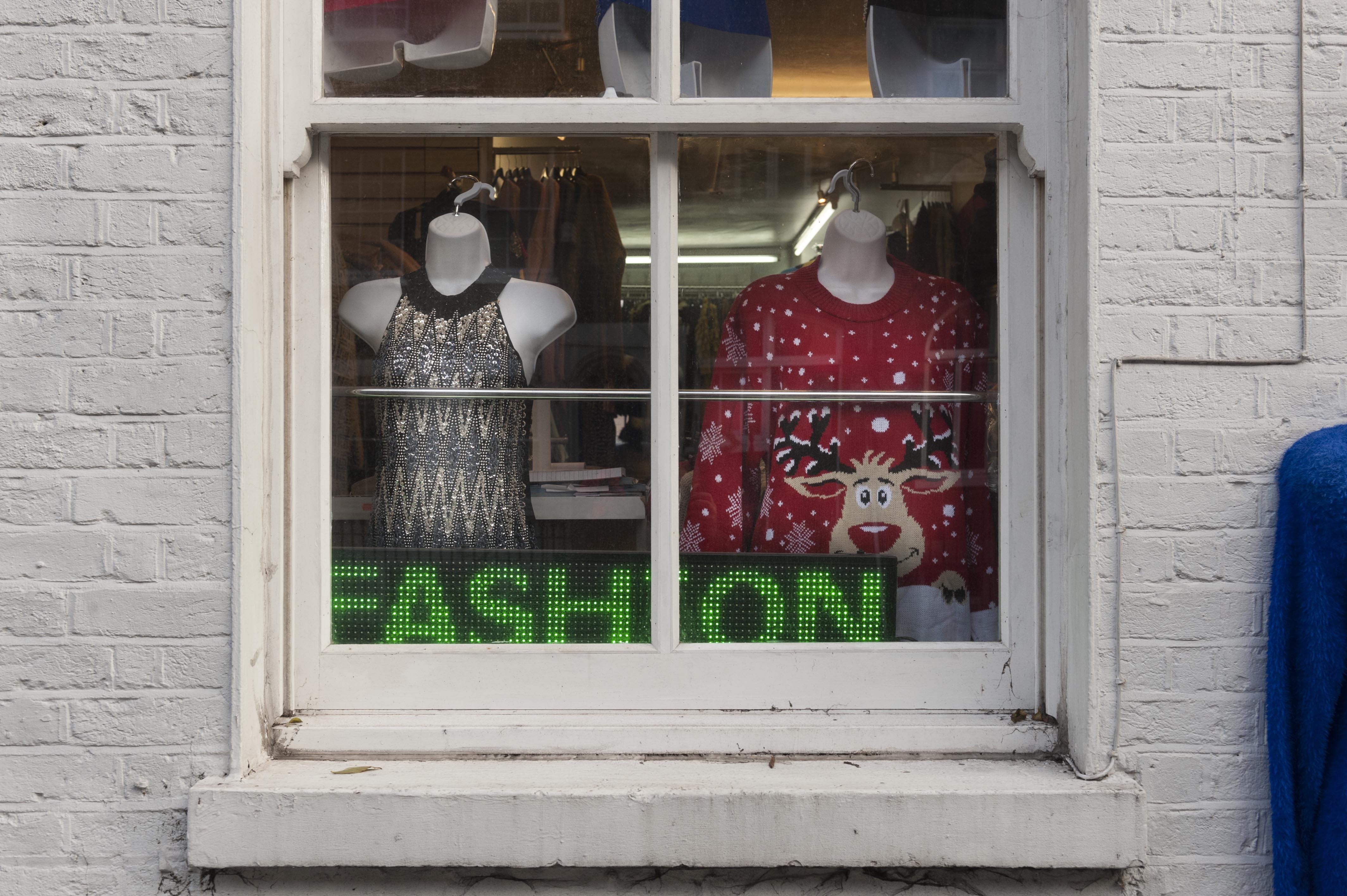
Gee 8 Fashions, 14 New Road, Whitechapel, photographed in November 2018. (© Derek Kendall)

View into vehicle dispatch bay at the East London Mail Centre and E1 Delivery Office, Whitechapel Road, photographed in October 2018. (© Survey of London, photographed by Derek Kendall)

South-East Marylebone

In 2017, two volumes (Nos 51 & 52) were published on South-East Marylebone, covering a large swathe of the parish of St Marylebone. In November 2018, the Survey was honoured to received the prestigious Colvin Prize from the Society of Architectural Historians of Great Britain in recognition of the volumes as an outstanding work of reference on an architectural subject. The draft chapters are available to download via our website, pending a full online version. The Survey is following up these volumes with a study of South-West Marylebone, covering the area west of the boundary of the previous volumes as far as Edgware Road.

17–18 Cavendish Square, view from the east in December 2015. (© Historic England, Chris Redgrave)

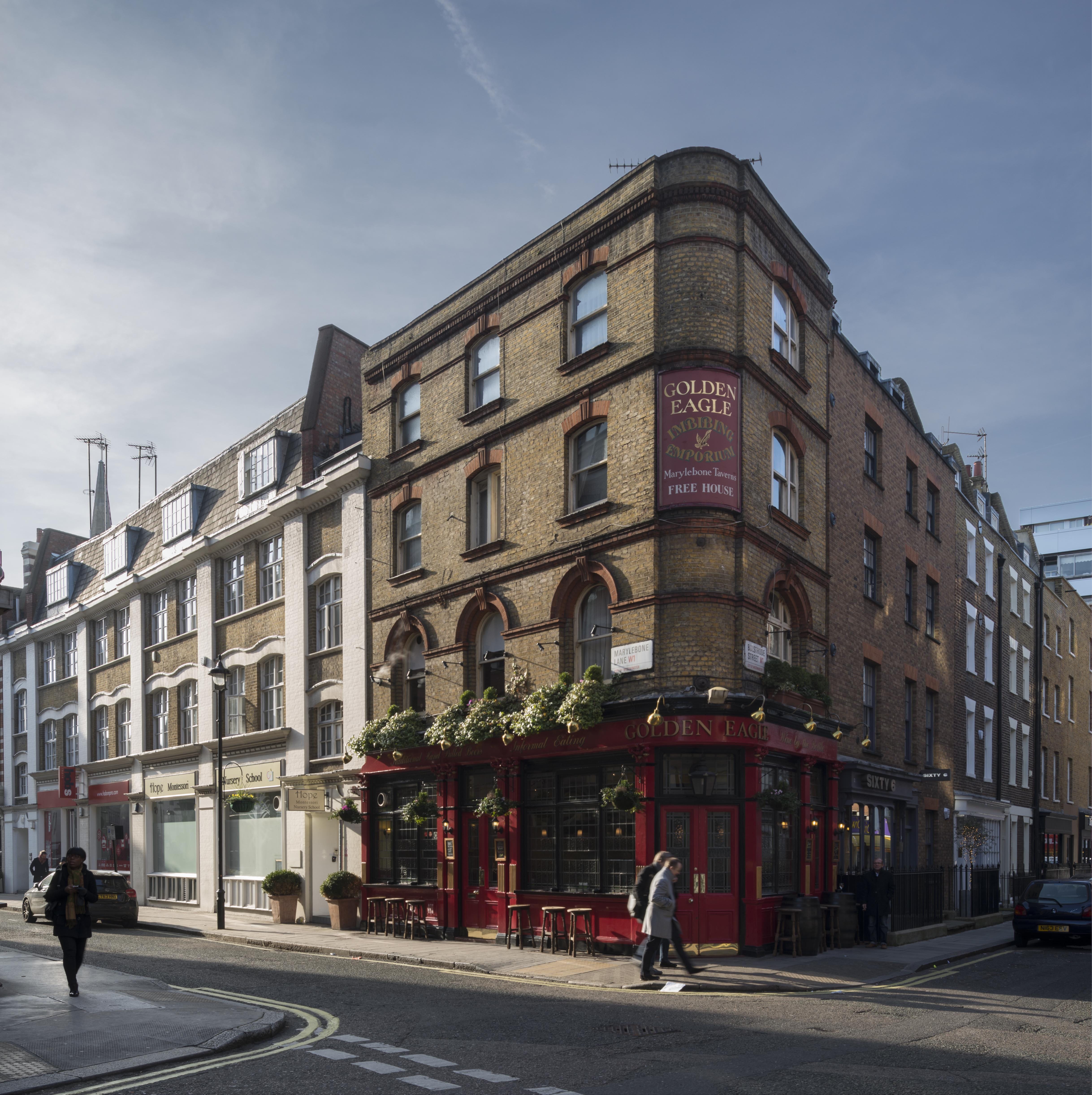
The Golden Eagle Public House, 59 Marylebone Lane, view from the north-east in January 2016. (© Historic England, Chris Redgrave)

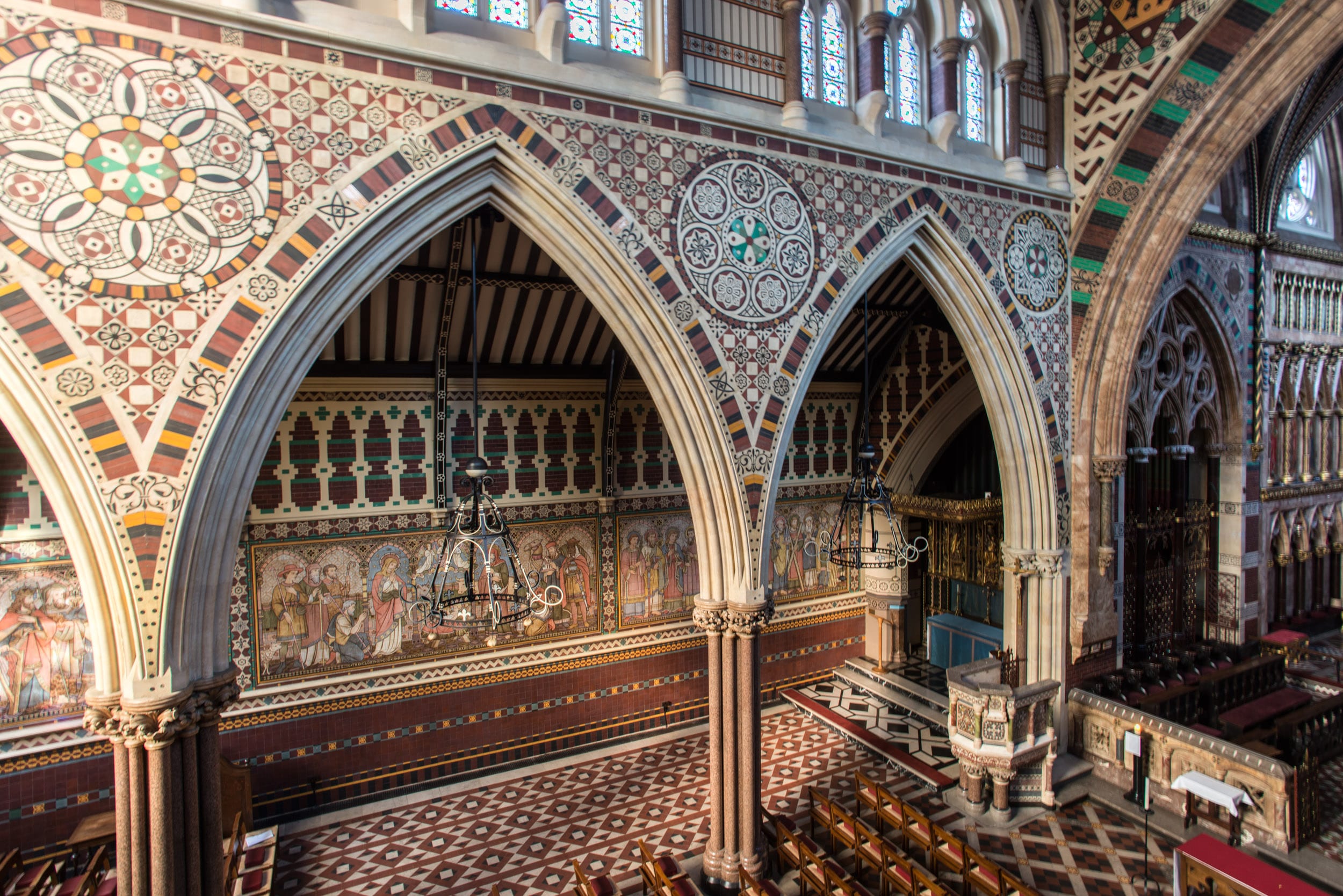
Nativity with six apostles on the lowest row of the reredos at All Saints Church, Margaret Street, South-East Marylebone. The tilework at All Saints was designed by Butterfield, painted by Alexander Gibbs and executed by Henry Poole & Sons. (© Historic England, Chris Redgrave)

Battersea

The Survey completed its work on Battersea in 2013, with the publication of two volumes (Nos 49 and 50) by Yale University Press. The draft texts of all thirty-two chapters from the Battersea volumes are available via our website, prior to the release of a full online version.

Battersea Square, photographed in December 2012. (© Historic England, Chris Redgrave)

Clapham Common under snow in 2013. St Barnabas’s Church on Clapham Common North Side is within view in the distance, its pitched roofs adorned by a dusting of snow. (© Historic England, Chris Redgrave)

Clapham Common under snow in 2013, looking towards towards Clapham Common North Side. (© Historic England, Chris Redgrave)

Woolwich

Finally, 2018 saw the online publication of the Survey’s volume (No. 48) on Woolwich, first published in 2012 and now digitally available here.

Woolwich Covered Market, Plumstead Road, listed in 2018, photographed in 2007. (© Historic England, Derek Kendall)

Mosaic detail from St George’s Garrison Church, Woolwich, photographed in 2007. (© Historic England, Derek Kendall)

Mosaic and painted decoration, St Michael and All Angels Church, Woolwich, reconstruction. (© Historic England, George Wilson)

Staircases in South-East Marylebone

By the Survey of London, on 9 November 2018

Earlier this week, the Survey of London team was honoured to receive the prestigious Colvin Prize from the Society of Architectural Historians of Great Britain, for two volumes (Nos 51 and 52) covering south-east Marylebone. This blog post follows an earlier exploration of doorcases in that area, which has remarkable richness and variety in its history and architecture. We would now like to present an assortment of staircases, photographed by Chris Redgrave and Lucy Millson-Watkins as part of the study.

Dignified Edwardian blocks designed for entertainment and shopping such as the Wigmore Hall (1900–1), the Berners Hotel (1905–11) and the former Debenham & Freebody store (1906–7) contain luxurious staircases in marble-clad halls. More variety is to be found in buildings designed as private residences, including an original decorative scheme by Arthur Beresford Pite at 37 Harley Street (1897–9), and sleek interwar glamour and high-quality materials at 39 Weymouth Street (1936). The architect there, G. Grey Wornum, oversaw the design of the new RIBA headquarters at Nos 66–68 Portland Place (1933–4), which has a dramatic staircase dominated by giant fluted marble columns.

Practicality and economy are in evidence at the Western District Post Office in Rathbone Place (1956–65, demolished), which had a staff of more than a thousand. The metal staircase of the Central Synagogue in Great Portland Street (1956–8) is also utilitarian, but with a touch of glamour in its angular detailing. The staircase of 99 Mortimer Street, a converted terraced house occupied by stringed-instrument dealers since the 1940s, is modest in its size and pretensions.

Staircase at former Debenham & Freebody store, 33 Wigmore Street. The south side of Wigmore Street offers a sudden change in scale and monumentality with the silvery bulk of No. 33, built as headquarters for the drapery business of Debenham & Freebody in 1906–7 to designs by architects William Wallace and James G. S. Gibson. Internally, the decorative scheme for the building was unusual but luxurious, with grey and green marble setting the tone in the entrance hall and room above – in the columns framing the staircase, the stair treads, ceiling ribs, floors and walls. The bronze work was by Singers of Frome: balusters, handrails, gallery railings and the capitals to the columns supporting the vast showrooms. (© Historic England, Chris Redgrave)

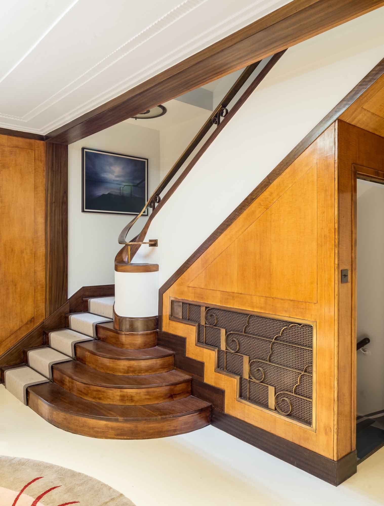
39 Weymouth Street is one of the 1930s rebuildings in the area by Bovis Ltd, in this instance the work of G. Grey Wornum, the architect of the new RIBA headquarters on Portland Place. That commission won him renown for spatial dexterity and commitment to high-quality fittings, qualities apparent in this interesting house. Wornum’s involvement is not readily discernible from the rather staid Georgian-style frontage, but his hand was to the fore inside. Although the house is not listed and has been modernized on several occasions, its interior retains much of the character and some of the features of his original design, such as this curved staircase in the hallway. The first resident from 1936 until the 1950s was Thomas Lyddon Gardner, chairman and managing director of the Yardley Perfumery and Cosmestics Company, and it is possible that the house was designed specifically for him through Bovis. Pictures of it newly finished were reproduced in the Architect & Building News in 1936. (© Historic England, Chris Redgrave)

37 Harley Street is one of the major surviving works in Marylebone by the versatile architect Arthur Beresford Pite, and exhibits his powerful originality. Dating from 1897–9, it was one of several commissions of that period in Marylebone where Pite was associated with the local builders Matthews Brothers. A small iron bay window, projecting into the internal area, was added to the first-floor landing at the suggestion of Matthews Brothers. Pite ornamented the window with decorative leaded lights in coloured glass. For a fuller account of 37 Harley Street in an earlier blog post, please click here. (© Historic England, Chris Redgrave)

Western District Post Office (demolished), Nos 35–50 Rathbone Place. This was planned soon after the Second World War to replace two of three existing West End offices, connected with the Post Office Underground Railway. Designs for the building were reworked in 1960 by Alan Dumble, a senior architect in the Ministry of Works, and the new office was opened on 3 August by the Postmaster-General, Anthony Wedgwood Benn. The new postal office was among the most mechanized in Europe, with chain conveyors in the sorting halls and spiral chutes to despatch mail down to the railway, and its opening coincided with the introduction of both postcodes and electro-mechanical sorting machines. Even so, the fourth-floor canteen and other facilities served a staff complement of more than a thousand. A reconfiguration in 1974–6 provided a bar, games room and lounge, and incorporated stained glass and war memorials salvaged from other post offices. For a full account of the Western District Post Office in an earlier blog post, please click here. (© Historic England, Chris Redgrave)

Central Synagogue, Nos 131–141 Great Portland Street, was built to designs by C. Edmund Wilford & Sons in 1956–8, replacing its bomb-damaged predecessor of 1869–70. Wilford had made a name with cinemas before the war. He and his assistants were directed to look at synagogues in London and perhaps also Venice. The result, built by Tersons Ltd, was a conventional, dignified building with close correspondences to its predecessor but an internal touch of cinematic glamour. The Great Portland Street façade is clad mainly in Portland stone, but the plinth and the columns flanking the high and hooded windows are of red Swedish granite. At the north end the entrance doors are set back in a high frame covered in gold mosaic. The galleried interior gives a powerful impression of height and restrained opulence, with a focus on the ark at the south end. For more photographs of the Central Synagogue in an earlier blog post, please click here. (© Historic England, Chris Redgrave)

7 Cavendish Square replaced a nineteenth-century successor to the original early eighteenth-century house. In 1908 Frederick John Dove negotiated an 80-year rebuilding lease, undertaking to erect a ‘mansion’. This was done through his family firm, Dove Brothers Ltd, but he was probably acting on behalf of Alfred Ridley Bax, FSA, the first occupant of the new house. It was built in 1909–11 to designs by the architect James G. S. Gibson, a vice-president of the RIBA when he took the job. Bax, a wealthy non-practising barrister, local historian, homeopath and father of the composer Sir Arnold Bax and writer Clifford Bax, moved here from Hampstead and died in 1918. As a domestic building, No. 7 is a rarity in Gibson’s work. It has more classical or Beaux Arts restraint than his usual Baroque Revival manner, perhaps a nod to the context of the square. Inside, the house was given fireproof floors and roofs and a mahogany-panelled lift. A shapely cedar-panelled staircase sweeps up the hallway in curves reminiscent of the stairs in Gibson’s contemporary Middlesex Guildhall. It rises to the second floor with intricately patterned, open-work balustrade panels carved by Dove Brothers. (© Historic England, Chris Redgrave)

19 Portland Place was one of several houses in the street to be leased to the plasterer Joseph Rose. The Rose plasterwork extends to the stairwell, where there are scallops and garlands around the skylights, as well as guilloche bands and wall arabesques containing moulded plaques of dancing bacchantes and other classical figures. Early residents here in the 1780s and 1790s included Lord Lisburne and Lady Templeton. (© Historic England, Chris Redgrave)

63 Harley Street is one of the street’s few inter-war houses, having been built in 1933–4 to designs by Wimperis, Simpson & Guthrie for the ophthalmic surgeon Sir Steward Duke-Elder and his wife Lady Phyllis. The façade is understated, blending the proportions and classical elegance of the Georgian house it replaced with Art Deco touches. The interior was a tour de force of thirties design, all sinuous curves and sumptuous wood panelling, brilliantly illuminated by lighting designed by Waldo Maitland. The bespoke fittings included much furniture, from fixed umbrella stands in the hall to desks, filing cabinets and bookcases by Betty Joel. There was also a circular rug designed by Marion Dorn, then at the peak of her career in London. Overall the impression was of a chic American or central European clinic. (© Historic England, Chris Redgrave)

Stairs and balcony over the foyer at the Wigmore Hall, Wigmore Street. Tucked away behind the street frontage of Nos 36–38 lies the small but sumptuous Wigmore Hall, built in 1900–1 as Bechstein Hall for Carl Bechstein & Sons, whose showrooms were by then at No. 40. As at the showrooms, the architect was T. E. Collcutt. The entrance passage and foyer were paved in black and white marble and featured, along with the staircase and balcony, dadoes of Numidian marble with red Verona marble edging. With the opening concert on 31 May 1901, the hall was acclaimed as ‘unquestionably the handsomest in London’. (© Historic England, Chris Redgrave)

44 Hallam Street was erected in 1915 to house the General Medical Council. The council had begun to investigate a move to larger premises from its offices at 299 Oxford Street in 1903, but the initiative was not taken forward until a decade later. An enquiry to the Howard de Walden Estate in 1914 elicited the offer of a development site at 44–48 Hallam Street. The northern part of the building was not added until 1922–3. The architect at both stages was Eustace C. Frere, of South African origins and Beaux Arts trained, and the builder Chinchen & Co., of Kensal Green. For a fuller account of the former General Medical Council headquarters in an earlier blog post, please click here. (© Historic England, Lucy Millson-Watkins)

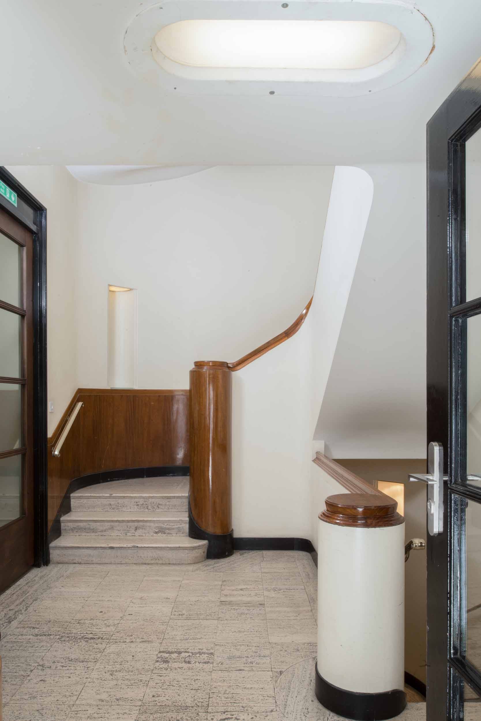
23 Queen Anne Street. The Howard de Walden Estate office was built in 1937 to designs by Ernest Joseph, working in conjunction with the Estate’s in-house architect V. Royle Gould. The exterior of the building, stripped-Classical in style and faced in Portland stone, was designed to blend with 35 Harley Street adjoining. The interior is fairly understated and conservative in taste; its best feature is the staircase, with dark wood handrails and newels, and pale terrazzo treads. Trollope & Colls were the main contractors. (© Historic England, Chris Redgrave)

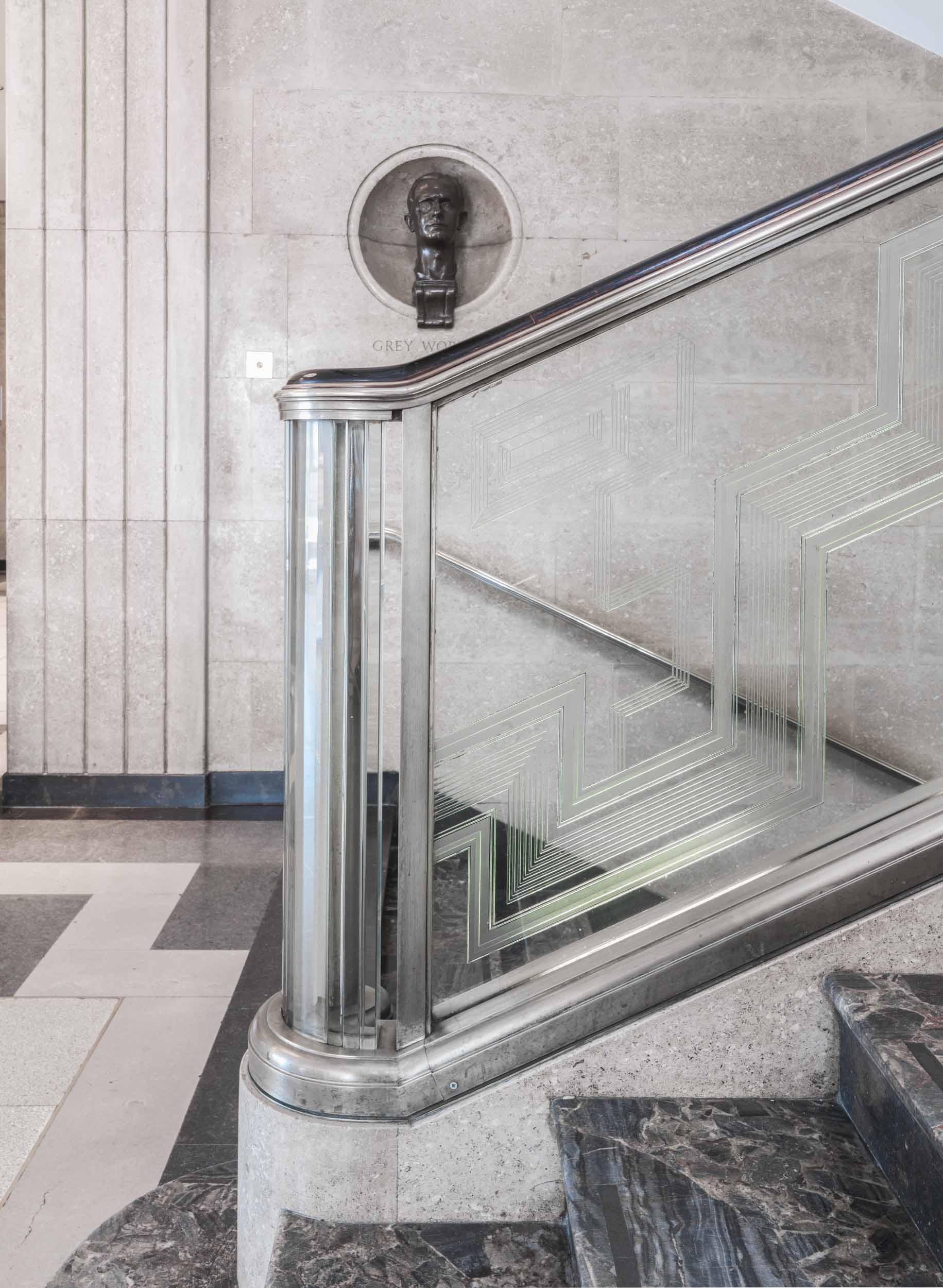
RIBA headquarters, Nos 66–68 Portland Place. In the entrance hall, it is the staircase that is G. Grey Wornum’s tour de force. It is a dramatic space, dominated and held together by four giant fluted columns of green Ashburton marble, star-shaped in plan and without bases or capitals, that rise nearly 30ft to the coffered glass ceiling. Within them are the enormous stanchions of the steel frame, the elegant proportions of which provided one of the aspects of Wornum’s design greatly admired at the time. As elsewhere in the building, fine materials and craftsmanship contribute to the overall effect, with walls lined in limestone; risers and treads of black Derbyshire and blue Demara marble respectively; and, above all, Jan Juta’s etched-glass balustrade, lit by concealed tubular lights in its base. For more photographs of the RIBA headquarters in an earlier blog post, please click here. (© Historic England, Chris Redgrave)

Berners Hotel, Berners Street. The Berners Hotel is a rare instance of continuity in this area. The hotel can be traced back to 1826. In the following year, The Times recorded that a ‘fine double house’ at 6–7 Berners Street had been converted into the Berners Hotel. It was rebuilt on a much enlarged site in stages between 1905 and 1911, under the superintendence of Slater & Keith. To read a full account of the Berners Hotel in an earlier blog post, please click here. (© Historic England, Chris Redgrave)

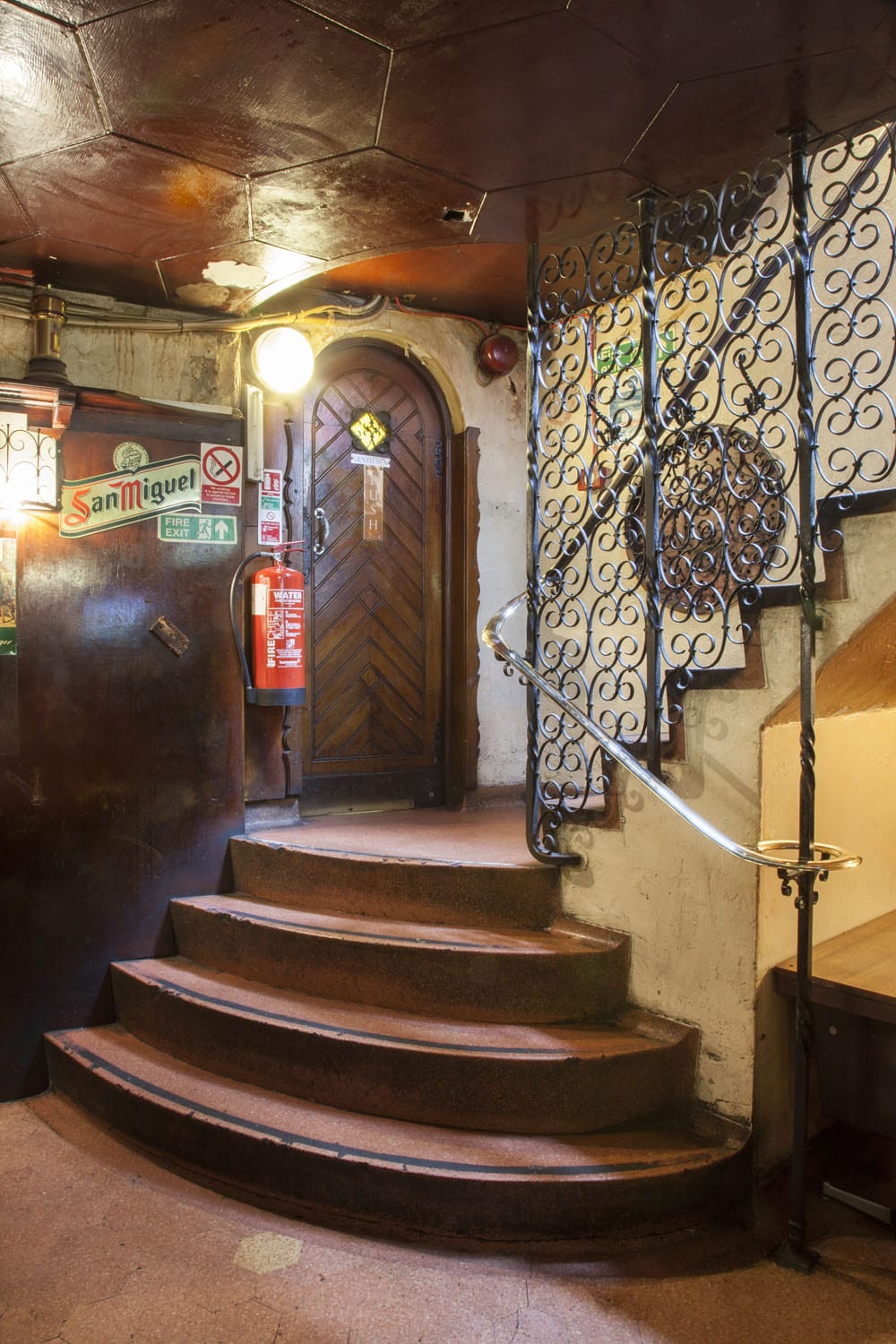
J. P. Guivier & Co. Ltd, 99 Mortimer Street. This dignified little building of 1899–1900 owes its remarkable state of preservation to its occupancy since the 1940s by J. P. Guivier, stringed-instrument dealers. It was built by Antill & Co. for Charles Kempton, tailor, probably to the designs of the architect A. J. Hopkins, who dealt with the Portland Estate on Kempton’s behalf. J. P. Guivier & Co. Ltd took part of the building around 1947 and have slowly expanded into all floors. Joseph Prosper Guivier, son of Jean Prospere Guivier, an exponent of the ophicleide, had begun his career in London in 1863, importing violin strings. The shop and first-floor front room are showrooms for stringed instruments and accessories, the back extension and upper floors offices and repair shops. (© Historic England, Lucy Millson-Watkins)

Bradley’s Spanish Bar at Nos 42–44 has long been one of Hanway Street’s most colourful establishments. The house itself was built in the mid 1860s, and the first commercial occupiers were sewing-machine makers. In 1869 the premises were fitted up as a ‘first class eating house’ with a wine licence, and remained a wine house under successive proprietors for well over a century. By the mid 1890s it was run by Long & Co. and described as ‘a cut above the public house’, serving biscuits and sandwiches with wine. Long’s came into the ownership of Robertson Brothers and Company, port merchants, and in the 1950s of an associated company, Williams & Humbert, one of the leading sherry shippers. Williams & Humbert opened a Spanish bar here (together with an English bar and cellar) around 1959. They sold up in 1966 or 1967 and the wine house continued under Short’s Ltd, being taken over at some point by the Milo twins. By the late 1970s it was known officially as Bradley’s Bar, taking the name of a former patron, William Bradley, a decorative glass-cutter in Hanway Place, who apparently ran a social club for his employees here. (© Historic England, Chris Redgrave)

Doorcases in South-East Marylebone

By the Survey of London, on 27 July 2018

In 2017 the Survey of London published two volumes (Nos 51 and 52) covering South-East Marylebone, an area comprising much of the West End north of Oxford Street. Historically and architecturally, this is an area of extraordinary richness and variety, resonant with famous names and associations, from the Adam brothers’ Portland Place and Nash’s Park Crescent to the medical specialists of Harley and Wimpole Streets, and much more besides.

We would like to present here a varied assortment of doorcases in the area, from handsome eighteenth-century survivals and neo-Georgian designs, to plain doorways for blocks of modest flats and elaborate entrances for shops and institutions.

Hereafter, the Survey of London’s blog will take a summer break. Posts will resume in September.

Mansfield Street was laid out by the Adams on the Portland estate from c.1768, and was largely complete by 1772. Elevationally the Mansfield Street houses were typical of the Adams’ approach to terrace compositions, with the exteriors generally subservient architecturally to the interiors. The plain but elegantly proportioned brick façades resembled the less-decorative ranges of the Adelphi, any ornament being reserved for the entrance door surrounds. (© Historic England, Chris Redgrave)

13 Mansfield Street and other neighbouring houses exhibit an early use of one of Robert Adam’s most successful designs for street architecture – a grand door surround with a wide semicircular fanlight comprising concentric inner and outer rings of delicate glazing, but extending beyond the width of the doorway to embrace slim rectangular side-lights. There are obvious similarities with Serliana, but it has been suggested that Adam derived this idea of a wide semicircle from the Porta Aurea of Diocletian’s Palace in Spalatro (now Split). It was a form that recurred throughout his work, both externally and in internal features, such as mirrors. (© Historic England, Chris Redgrave)

29 Beaumont Street, a house built c.1890 for the livery-stableman William Burton, with an elaborate entrance in rubbed brick. Burton ran livery stables and a horse dealership in Marylebone High Street from 1857. From about 1872 he was also operating as a job master from stables in Paddington and Notting Hill, and in 1877 in Oxford Street. By the late 1880s the Marylebone stables were mostly or wholly used for dealing, and in 1890–1 Burton had them rebuilt, together with a saddler’s shop (now 30 Beaumont Street) and a house for his family (now 29 Beaumont Street). Thomas Durrans was the architect, and H. C. Clifton of Bayswater the contractor. (© Historic England, Chris Redgrave)

93A Harley Street (Harley Lodge), frontage to Weymouth Street. This is a fine example of the double-fronted mews house rebuildings, this time of the early 1900s. Like its dourer stone-fronted equivalent at 90A Harley Street, it was designed in 1911 for the developer Charles Peczenick by Sydney Tatchell, but on this occasion in a more playful red-brick and stone neo-Georgian manner, with a semicircular-headed entrance set in an Ionic doorcase. In medical use from the beginning, it is now, like many of its type, a private dental surgery. (© Historic England, Chris Redgrave)

This purpose-built institute and club connected with the Mission of the Good Shepherd in Paddington Street was designed by the architect and vestryman Thomas Harris. The foundation stone was laid by the Duchess of Portland in July 1898 and the completed premises, built by H. H. Sherwin of Waddesdon, were opened in January 1900 by the Duke and Duchess of Fife. For the front elevation Harris produced an interesting and eclectic design, executed in red sand-faced brick interlarded with blocks of buff terracotta produced by J. C. Edwards of Ruabon. Though the overall manner is Arts and Crafts, Gothic is there in the ogees over the windows and emphatically in the canopied figure of the Good Shepherd, sculpted by John Daymond III or possibly his son John Dudley Daymond. It is mounted over a panel of arty lettering. (© Historic England, Chris Redgrave)

In 1923–4, 17 Cavendish Square was taken by the piano-makers John Brinsmead & Sons Ltd, previously across Wigmore Street, and an ostentatious refurbishment ensued. The architects T. P. Bennett & Hossack oversaw the Adamesque stucco embellishment of the Wigmore Street elevation with a new entrance and shopfront. Gilbert Bayes was the sculptor responsible for lower-storey reliefs of classically draped standing figures representing Science, Music and Art, and a panel depicting an orchestra of eleven naked child musicians. These received gushing encomiums – ‘a delightful conceit’, ‘a captivating piece of work’, and an eight-page spread in the Architects’ Journal(© Historic England, Chris Redgrave)

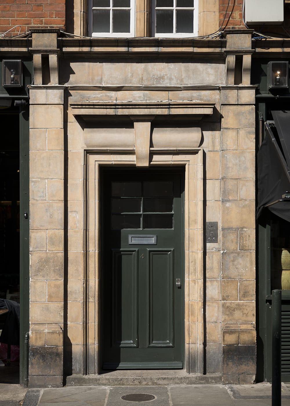
4 Moxon Street (formerly known as Paradise Place) incorporates a plain doorcase and a gateway designed to give access to the premises of W. N. Davis, of Davis & Son, old-established dyers and cleaners with adjoining premises at 91 Marylebone High Street. Davis’s architect was E. V. New of New & Son. (© Historic England, Chris Redgrave)

View of the entrance to 4 Moxon Street. (© Historic England, Chris Redgrave)

11 Queen Anne Street was one of ten houses built by George Mercer between Chandos Street and Harley Street, and completed in 1764. From 1777 to 1780, the house was nominally occupied by ‘the Wicked Lord’, Lord William Byron, great uncle of the poet, but it is doubtful whether he spent much time there. The timber doorcase to this house, Doric columned with a deep open pediment, is similar to that at No. 24. (© Historic England, Chris Redgrave)

No. 68 Harley Street was rebuilt in 1905–6 for Alfred Herbert Tubby, an orthopaedic surgeon. The architect was E. Harding Payne, the builder A. J. Vigor of Westminster. The front is of stone and red brick with some Wren-inspired detailing. (© Historic England, Chris Redgrave)

Melcome Regis Court at 59 Weymouth Street is a block of flats built in 1934–5 by Gee, Walker & Slater Ltd. The architects were Marshall & Tweedy, but elevational design and supervision of details were undertaken by Colonel Blount at the Howard de Walden Estate, the result characteristically heavy-going. The pointed-arched Gothic doorway is framed by a doorcase with tripartite leaded windows and a stepped motif, and flanked by shopfronts. (© Historic England, Chris Redgrave)

No. 28 Welbeck Street was completed and first occupied in 1770–2. It has a handsome Doric doorcase with attached fluted columns and a frieze with paterae. The adjoining No. 27 was rebuilt in 1893 by J. Simpson & Son to designs by C. H. Worley, lessee and architect, replacing the original house built by George Mercer. The façade features a canted bay through all five floors, with a gabled attic. The detailing is straightforward except for an oversized hooded front door. (© Historic England, Chris Redgrave)

Park Crescent: John Nash, Charles Mayor and one of the severest bankruptcies in London building history

By the Survey of London, on 25 May 2018

The Park Crescent of today is a post-war replica. A combination of poor original building methods, wartime damage and heavy-handed reconstruction policies has left little or no old fabric from the ‘semi-circus’ conceived by John Nash and built with much difficulty between about 1812 and 1822. Even that was only half of the full circus Nash had planned. Yet despite those early failures, despite also its present lack of authenticity, Park Crescent remains one of London’s most memorable episodes of urban planning.

Park Crescent. Eastern crescent. (© Historic England, Chris Redgrave)

Three colonnaded circuses featured in Nash’s immortal scheme to link Whitehall and Westminster with Marylebone Park by way of what became Regent Street, as first published in 1811. All occupied critical junctures or points of transition, where traffic-ridden east-west routes broke the new line of procession, for Nash believed that the circus form invested such crossings with dignity and lessened the psychological sense of a barrier – something he strove to overcome so as to make the Crown’s developments around Regent’s Park feel accessible and eligible to Londoners of high standing. Confusingly, all three rond-points went at first by the informal name of Regent or Regent’s Circus. Piccadilly Circus and Oxford Circus, carved laboriously out of existing building fabric by compulsory purchase under the New Street Act of 1813, had to be quite small and in the event lacked the colonnades Nash had hoped for. Both have long gone, and though Oxford Circus survives as a concept, it is higher and slightly wider than Nash’s original creation.

The third circus was to be different altogether. Over 500ft in diameter, it came at the point where the city eased into a gracious modern suburb, beyond the final obstacle of the New (now Marylebone) Road. But the shape and texture of that suburb shifted greatly over the years of its creation, with implications for the third circus. So much can be gathered from the fate of a fourth circus, the largest of all, devised by Nash as a central focus for Regent’s Park. Marked the Great Circus on the plan of 1811, when bands of continuous housing were anticipated within the park as well as on its periphery, it was then reserved for concentric terraces. Ultimately, it acquired a bare smattering of villas and became the Inner Circle, a low-key feature in the park landscape. With the opening-out of that landscape in the 1820s and the failure to develop the northern sector of the third circus, Park Crescent turned into a prelude to the park rather than the transitional interlude Nash intended.

Park Crescent and Portland Place area from the west in 2011. (© Historic England, Damian Grady)

If the circus was the most striking of the crop in town-planning terms, it was also among the first elements of the Office of Woods and Forests’ plan for Regent Street and Regent’s Park to be implemented. Its site, Crown farmland, was in hand, so that it could be started even before the New Street Act authorised the complete scheme in 1813. Not surprisingly, Nash invested energy and urgency in getting it along. By the end of 1811 the hunt was on for a single builder brave and resourceful enough to take on both the whole of the circus, where Nash envisaged large first-rate houses, and the extension of Harley Street, for which he proposed brick-faced houses on narrower frontages. By March 1812 he had hooked his fish. ‘Mr Mayor is willing to adopt the elevation I had proposed to him, which is to encircle the whole with a collonnade of coupled columns surrounded [sic] by a ballustrade’. [1] Charles Mayor had started out as a jobbing carpenter and undertaker. In 1800 he successfully took over the north side of Brunswick Square from James Burton and built other houses near by. More to the point, he and Nash had been collaborating over a house in Foley Gardens south of Portland Place.

By May 1812 Nash and Mayor had worked out a detailed plan and schedule. Together they increased the diameter of the circus to 724ft, giving some houses frontages of up to 100ft but in consequence making them shallower and cramping the mews spaces behind. The timetable stipulated the first roofings-in and issuing of leases at the southern end to be by August 1814 and the final ones in the northern sector by August 1816. Nash projected Mayor’s overall outlay at about £300,000 and urged the Crown authorities to buy the improved ground rents so as to guarantee his liquidity. Mayor got the final go-ahead in July. Soon afterwards Nash was arranging to show his whole plan to the Prince Regent, telling Alexander Milne of the Woods and Forests: ‘It will be very impolitic not to pursue this course if we wish HRH to take up the measure con amore’. [2]
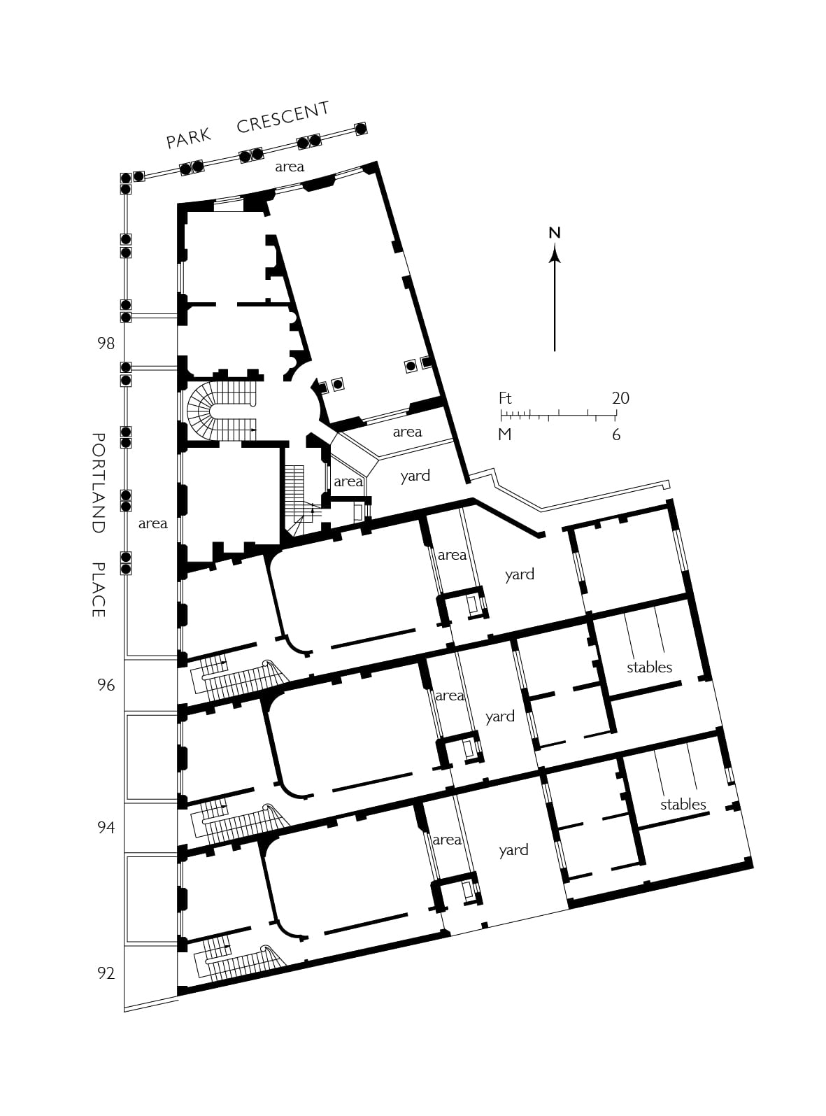
92–98 Portland Place. Original plan of houses as leased to Charles Mayor in 1813. From plans in the National Archives, CRES2/752. (Survey of London, Helen Jones)

Mayor got going fast enough to ask for his first leases between December 1812 and August 1813. These concerned the southernmost houses on both sides of Regent’s Circus and also some smaller brick-fronted ones that were to connect Portland Place with the circus (Nos 77–81 on the west and 92–96 on the east). Though these leases were duly issued, little finishing work can have taken place within the carcasses. For financial reasons Mayor evidently hoped to secure as many leases as he could as fast as might be. To that end he appears to have embarked upon the cellars of almost the whole of the southern semi-circus and even to have done some excavation on the northern side of the New Road.

Then things started to unravel. With the Napoleonic Wars reaching their climax, it was a bad time for builders. Few people were in the market for houses, yet building materials were going up in price. Mayor seems to have done nothing elaborately tricky: with Nash egging him on, he just miscalculated and was drawn into one of the severest bankruptcies in London building history. His slow-down during 1813 must have been well-noted. ‘Every stimulus should be applied to Mr Mayor to complete his Circus,’ urged Nash in a report to the Commissioners on changes planned for the park that December, ‘which will carry that character of respectable building into the heart of the Park and tempt the higher classes of society to come there’. [3]
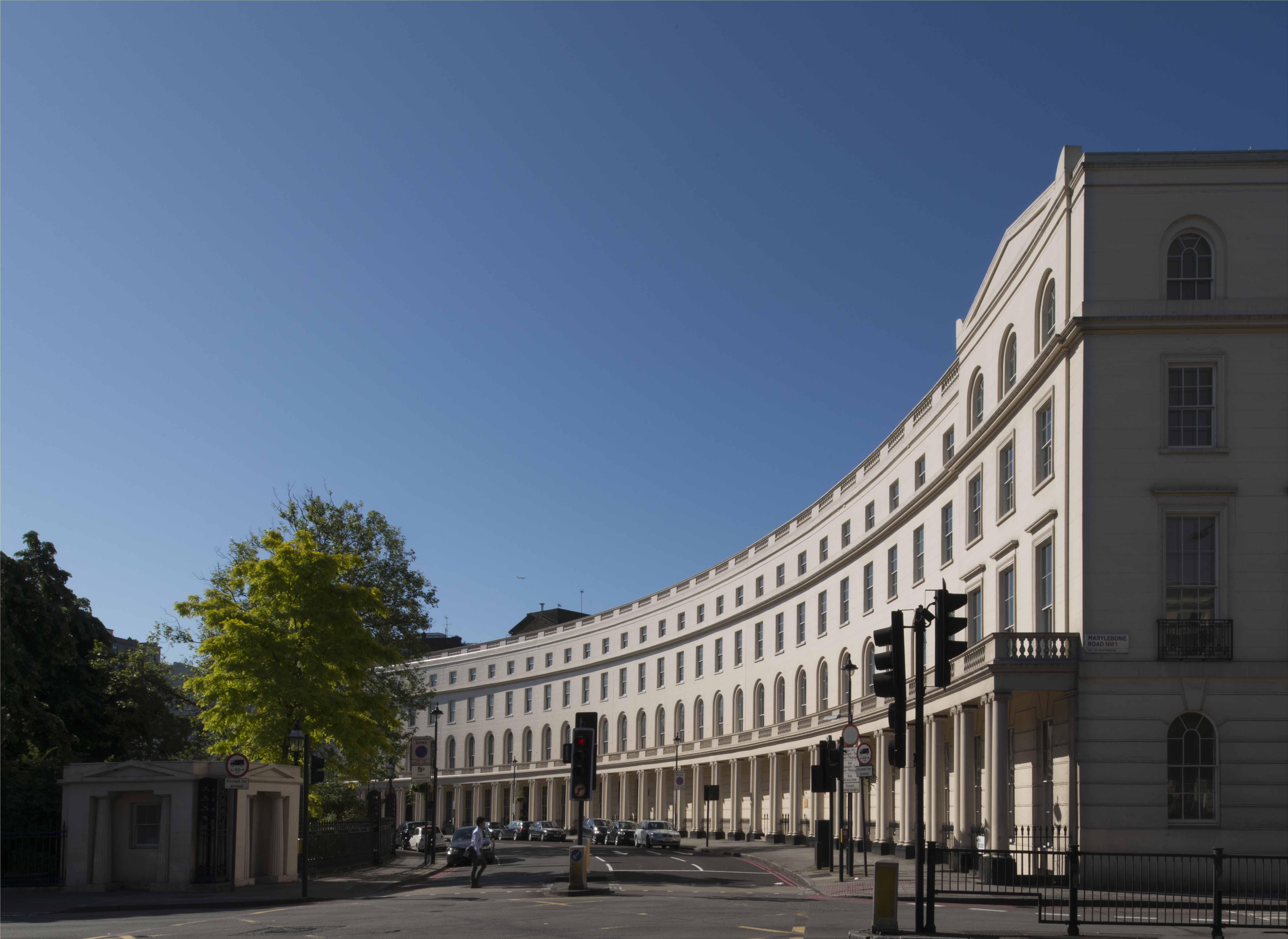
Park Crescent. Western crescent. (© Historic England, Chris Redgrave)

The first half of 1814 saw little progress apart from an intended pub built by James Smith of Norton Street on back land between Harley Street and the circus. In the autumn Mayor appealed to the Woods and Forests for a loan, admitting: ‘I am absolutely at a Stand Still’. Nash, asked for advice, reported just before Christmas with his usual optimism that with eleven houses covered in, another six up to the chamber floor, excavation in some state of forwardness for the whole of the circus and a million and a half bricks on site, the developer ought to have enough security to win through – ‘if the half circus can be completed in the course of the next year (I mean externally)… his speculation will have a favourable issue’. [4] With the Crown declining to lend, vary terms or purchase ground rents, the creditors deemed otherwise. Mayor was carted off to the Fleet Prison early in 1815 and the grindstones of bankruptcy began to turn.

Like other bankrupts, Mayor was allowed out on day release, and made efforts to realize his assets. He managed to let the Foley Gardens house, but a severe injury, incurred while inspecting one of the Regent’s Circus houses in February 1816, cannot have helped. One bankruptcy commission superseded another. So persistent was the post-war slump that Mayor’s assignees were wary of trying to finish the speculation themselves and disappointed when they tried to sell off assets. Meanwhile the carcasses in sundry states of scruffiness and dereliction scared off buyers.
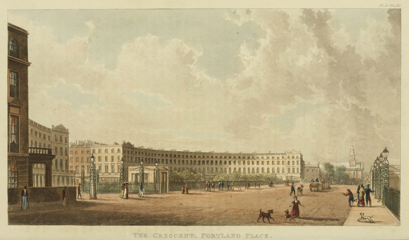
Park Crescent and the New Road, looking west towards Marylebone parish church. From Ackermann’s Repository of Arts, 1822. (Wikimedia Commons, from ianvisits.co.uk)

John Shaw, the architect and surveyor to the Eyre Estate, claimed that it was thanks to ‘a very extraordinary man, Mr. Farquhar’, who put money in as a speculation, that building resumed at what was to become Park Crescent. This was the former East India Company’s gunpowder contractor, John Farquhar. He died in 1826 leaving property in the vicinity of Park Crescent, but no further evidence of his involvement has come to light. [5] In 1817 the Great Portland Street builder William Richardson, apprised that Mayor’s assignees were not going to complete the development themselves, sought terms for both the Harley Street continuation and for finishing the western half of the crescent, where foundations were partly laid. A bigger, City-based contractor, Henry Peto, then bought the three carcasses on the east side of Portland Place (Nos 92–96), completing them ‘in the first style of elegance’, and went on to take most of the eastern quadrant, excepting its tip, assigned to Samuel Baxter and the corner house No. 15. Peto bought the ground rent from this last from a mortgagee, but the house itself was evidently completed by Mayor’s assignees, who decided to sell it in 1820.

In the early stages Peto was hampered by the collapse of a party wall between two of the Portland Place houses during a storm in March 1818. There had been a bad fire in one of these in 1814, on which Nash blamed the fall. Peto was adamant that the houses had been built with bricks ‘mostly of the very worst description and totally unfit for use’, and laxly supervised – accusations that have haunted the Nash developments and Park Crescent in particular ever since – and commissioned an independent report to prove it. ‘I must beg to be allowed to treat the insinuations of my inattention and that of my clerks with contempt’, riposted Nash, adding that Peto ought to have noted the state of the houses when he bought them. [6]

On both sides of the crescent, finishing off Mayor’s carcasses generally preceded the building of the other houses. The western crescent went up mainly in 1819–20; at the same time Richardson undertook the east side of Upper Harley Street, essentially following the original Nash-Mayor plan. Judging from a sketch of Park Crescent in 1820, Peto had as yet made little or no progress with his side. Beyond Mayor’s houses at Nos 13–15, the eastern quadrant was just excavated ground and derelict-looking pavement vaults, while No. 13 was in a ruinous state, with bare roof timbers and fallen brickwork. Perhaps the last of the houses to be started were Baxter’s at Nos 1–6, the first two of which were still in carcass in July 1821. The whole can have been barely finished when Ackermann published his prospect of The Crescent, Portland Place in 1822.

Park Crescent. Eastern Crescent. (© Historic England, Chris Redgrave)

The name ‘Park Crescent’ is first encountered in the year 1821. By then it was abundantly clear that the half-circus north of the New Road would never go ahead. Ideas about the form of the park had radically changed, with a greater openness of landscape prevailing. Around 1820 Nash therefore scrapped the northern crescent altogether in favour of Park Square, square-sided with an open north end. The crescent furnished the park, the New Road and indeed London as a whole with a fresh and uplifting piece of unified urban scenery. Its semicircular profile, albeit only half of what had been planned, offered a decisive depth of sweep that an elliptical crescent would have lacked. On closer inspection the composition, as often with Nash, was sleek but shallow. Minimal projections and pediments at the ends do something to relieve the simple economy of the plastered elevations (originally in Roman cement, Bath-stone coloured, with the jointing perhaps sharper than it is today). But the main compositional trick is in the enfilade of the continuous ground-storey colonnade with coupled Ionic columns, a device integral to Nash’s overall New Street plan and surviving only here. The original agreement with Mayor lays some weight on the balustrades topping the parapets and colonnades, which were to be of stone, and on the iron fencing, which both fronted the deep continuous basements and ran laterally to shield the entrance bridges. As for the houses themselves, they were not the monster 100ft mansions Nash had first dreamt of, just good first-raters with fronts typically of 32ft, backs several feet wider, and ample stone staircases.

References

[1] The National Archives (TNA), CRES2/748.

[2] Ibid.

[3] TNA, CRES2/742.

[4] TNA, CRES2/752; B3/3365.

[5] Report from the Select Committee on Crown Leases, p. 50.

[6] TNA, CRES2/763.

The ‘bijou’ or ‘dwarf’ houses of the Howard de Walden grid. Part 2: the inter-war period

By the Survey of London, on 19 January 2018

A previous blog post (24 November 2017) considered the smaller Victorian and Edwardian mews-corner houses that are such a distinctive feature of the east-west streets of the Howard de Walden Estate in Marylebone. Today we look at three exceptionally fine later examples of the genre, all designed for the Marylebone builders and developers Bovis Ltd by notable architects of the inter-war period – Sir Giles Gilbert Scott, G. Grey Wornum, and Burnet, Tait & Lorne.

22 Weymouth Street – a house by Giles Gilbert Scott

22 Weymouth Street (photographed by Chris Redgrave for the Survey of London, © Historic England)

22 Weymouth Street is one of Marylebone’s jewels – a rare domestic work by Sir Giles Gilbert Scott, designed in the early 1930s when he was at the height of his powers and working also on Cambridge University Library and Battersea Power Station.

The house was a speculation for Vincent Gluckstein, chairman of Bovis Ltd, who had been chasing the site since 1928, having recently rebuilt No. 26, a few doors along. Initially, the Howard de Walden Estate suggested two small residences as possible replacements for the double-fronted house that previously stood here. But Gluckstein eventually had his way and devoted the whole plot to just one, larger house, for which Scott was providing plans by 1933, assisted by his younger brother Adrian.

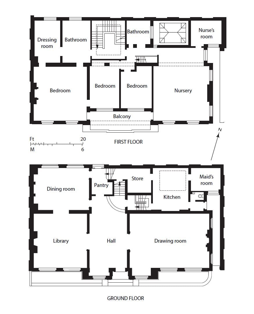
Even so this was still a compact dwelling and as such was carefully planned by the Scotts. There was only a partial basement, occupied by a boiler room. The kitchen, pantry and maid’s room were placed at the rear of the ground floor, which otherwise was given over to a suite of reception rooms: a front library and drawing room either side of a central hall, and a rear dining room. Upstairs were bed and other family rooms, and servants’ accommodation was provided in an attic, lit by rear windows.

Ground- and first-floor plans of 22 Weymouth Street in 1936 (redrawn by Helen Jones)

In form the house is an updated version of the earlier mews corner houses hereabouts, being of two storeys only, though with a tiled mansard roof for the attic. Scott relied on high-quality brickwork and his immaculate sense of proportion for effect. The elevation has a classic, symmetrical simplicity, dominated by the broad, Georgian-style fenestration, with movement provided by the subtle interplay of rectangular forms – the ground-floor windows either side of the door break forward to make an entrance porch (apparently a late alteration to the design), above which the first-floor central windows are recessed as a sun balcony. The overall effect is very similar to the two-storey brick house that Scott had built for himself a decade earlier in Clarendon Place, Bayswater (known as Chester House). Inside No. 22 the feeling of modernity gave way to a more conventional ambience, with much timber panelling, particularly in the library, and the use throughout of antique carved marble or timber fireplaces.

Scott’s exceptional ability to leaven his unpretentious brand of modern architecture with a strong dose of traditionalism eased relations with the Howard de Walden Estate, as did the fact that he and his brother shared an alma mater (Beaumont College) with their fellow Roman Catholic Colonel Blount, the estate surveyor. Thus he was spared the worst of the wearying interference from Blount that plagued his contemporaries G. Grey Wornum and Francis Lorne over the mews corner houses that they were also designing for Bovis. In the end, however, he lost his patience when Blount, a stickler for uniformity, persisted in criticizing the variegation of the bricks – the identical four-inch type that Scott had specified for Cambridge University Library, then also under construction, where they had been roundly praised. ‘It is quite impossible to obtain any coherent effect unless such questions are under one control’, Scott told Blount candidly.

The house must have been close to completion by the end of 1934 when it featured in the architectural press but no acceptable buyer came forward when offered for sale in 1936. Vincent Gluckstein seems to have been using the property himself at that time. Its next occupant in 1938 was (Sir) Eric William Riches, a surgeon at the Middlesex Hospital. As Riches intended also to practice privately, the drawing room was partitioned for him to create a suite of consulting and examination rooms and secretary’s office. Riches was to remain at No. 22 until 1976, since when the partitions have been removed and the drawing room reinstated. Later residents included the multimillionaire Indian businessman G. K. Chanrai and his family in the 1980s and 90s.

Proposals for radical change to the house in 2009, including the addition of another storey, led to its being listed at the request of the Twentieth Century Society.

39 and 40 Devonshire Street – two houses by Burnet, Tait & Lorne

39 and 40 Devonshire Street form a surprising pair of dwellings. The latter has an idiosyncratic neo-Georgian street front, with prominent window shutters and a steep pyramidal roof punctured at the eaves by dormer windows; whereas its partner, tucked away in the mews, is starkly modern in appearance. They were designed as a pair in the early 1930s for Vincent Gluckstein by Sir John Burnet, Tait & Lorne, with some input from the Howard de Walden estate surveyor, Colonel Blount.

40 Devonshire Street, at the corner with Devonshire Close (photographed by Chris Redgrave for the Survey of London, © Historic England)

39 Devonshire Street (photographed by Chris Redgrave for the Survey of London, © Historic England)

By 1930 Gluckstein had decided to buy the old premises on this corner site, which included a mews pub, the Cape of Good Hope, intending to demolish all for new residences. Burnet, Tait & Lorne began planning in the summer of 1931 but financial concerns about the effects of the Depression on property obliged Gluckstein to proceed initially with only the mews house at No. 39. The dapper and worldly Francis Lorne, a recent addition to the practice after a lengthy residence in Canada and the USA, was the partner in charge. He, his American brother-in-law Ludovic Gordon Farquhar (who had worked for Raymond Hood) and their international team of assistants designed a relatively plain two-storey brick box with steel-framed windows. Lorne also dealt effectively with Blount’s disquiet and requests for a more traditional type of house (‘we have a reputation to maintain’, Lorne told him), and was able to carry the scheme through without too much alteration – though the incorporation of window shutters is a familiar Blount touch. Even so, perhaps the style was too raw for Marylebone society as the building never saw residential use, being acquired in 1933 by G. Grey Wornum and converted to his architectural offices. Wornum was succeeded in 1950 by Sydney Clough, Son & Partners. Poor modern refenestration has diluted the building’s vigour.

39 Devonshire Street in 1933 (© Historic England Archive)

39 Devonshire Street, interior in 1933, when in the occupation of G. Grey Wornum (© Historic England Archive)

Lorne and Farquhar must have known that such an uncompromising elevation, difficult enough to achieve in a mews, would be unacceptable on a Marylebone street front. At No. 40 the brand of Georgian Revival architecture they contrived is reminiscent of Lutyens’s domestic Queen Anne style of the 1910s. The obtrusive shutters, which detract from the design’s clarity, were not present in their original drawings. The first resident in 1935 was Louis Donn, of a Whitechapel family of tobacco merchants.

39 Weymouth Street – a house by G. Grey Wornum

Beyond the Harley Street Clinic, at the corner of Wimpole Mews, stands 39 Weymouth Street, one of the 1930s rebuildings in the area by Bovis Ltd, in this instance the work of G. Grey Wornum, architect of the new RIBA headquarters on Portland Place. That commission won him renown for spatial dexterity and commitment to high-quality fittings, qualities apparent in this interesting house.

39 Weymouth Street (photographed by Chris Redgrave for the Survey of London © Historic England)

Wornum’s involvement is not readily discernible from the rather staid Georgian-style frontage. His original plans of 1934 for Vincent Gluckstein of Bovis were more radical, for a flat-roofed modernistic house, but Colonel Blount, the Howard de Walden surveyor, wanted something more ‘pleasing’ and in harmony with the traditional character of the estate. Forced to concede to Blount’s insistence on a pitched roof, he managed largely to conceal it behind a high parapet, but ignored persistent requests for distracting window shutters to be added to the elevation. The only contemporary touch is the Deco curve of the rear wall in the adjoining mews.

39 Weymouth Street, rear view from mews (photographed by Chris Redgrave for the Survey of London © Historic England)

But Wornum’s hand was to the fore inside. Although the house is not listed and has been modernized on several occasions, its interior retains much of the character and some of the features of his original design. The main living space is an exhilarating double-height front room, dominated by an oversized window and giant chimneypiece of pink travertine marble – still with its Wornum-designed firedogs. The room’s original proportions have been restored by the removal of a pair of full-height bookcases either side of the chimneypiece, commissioned from Dennis Lennon in the 1960s. An opening leads to a small dining recess (with its original dumb waiter, concealed in a macassar ebony sideboard), and a curved staircase leads up to a mezzanine in the form of a small wood-panelled study overlooking the main living room. The original finish here was bleached Australian walnut; there were concealed striplights to the fitted bookshelves and a pale leather covering to the balcony handrail (now gone). Two bedrooms on the first floor had built-in wardrobes and the living space was maximized by including a roof garden and also a three-bedroomed staff apartment in the basement alongside a large, rubber-floored kitchen.

39 Weymouth Street, hall and staircase (photographed by Chris Redgrave for the Survey of London © Historic England)

The first resident from 1936 until the 1950s was Thomas Lyddon Gardner, chairman and managing director of the Yardley Perfumery and Cosmetics Company, and it is possible that the house was designed specifically for him through Bovis. Photographs of it newly finished were reproduced in the Architect & Building News in 1936 with furniture by Émile-Jacques Ruhlmann much in evidence. Lyddon Gardner was a great admirer of Ruhlmann, commissioning him to design furniture in the 1920s and 30s for Yardley’s showroom in Bond Street and acquiring pieces to decorate his own apartment; Ruhlmann also designed for the Yardley showroom in Paris. Lyddon Gardner was followed at No. 39 by (Sir) David Webster, Director of the Royal Opera, who lived here with his partner, the designer and fashion businessman James Cleveland Belle, until his death in 1971.

The Survey of London, December 2017

By the Survey of London, on 29 December 2017

Recently we have been looking through our archive on the history of the Survey of London, which traces its beginnings to the 1890s. These large cloth-bound boxes brimming with letters, newspaper cuttings, photographs and pamphlets include detailed reports on the progress of the Survey.

A pamphlet recording the progress of the London Survey Committee, as the Survey was formerly known, at Midsummer 1929.

As it is customary during the festive season to reflect on recent achievements, current research, and plans for the future, we think it might be timely to share an update on the current progress of the Survey. 2017 has been an important year for the Survey of London, marked by the publication of Volumes 51 and 52 on South-East Marylebone by Yale University Press, supported by the Paul Mellon Centre for Studies in British Art. We are delighted that these volumes, which document a rich and varied part of the capital, have been received with glowing reviews:

  • “Superbly researched, well written and comprehensively illustrated…” – John Martin Robinson, Country Life, October 2017.
  • “These two [volumes] cover a chunk of the historic West End in unrivalled detail following years of rigorous research…” – Robert Bevan, Evening Standard, December 2017.

The draft chapters for these volumes have been made freely available online via our website.

Covers of Volumes 51 and 52 of the Survey of London on South-East Marylebone, published in Autumn 2017. 

The Survey is following up its two volumes on South-East Marylebone with a study of South-West Marylebone, covering the area west of the boundary of the previous volumes as far as Edgware Road. A comprehensive study of Oxford Street is also underway to produce a volume covering both sides of the street from Tottenham Court Road to Marble Arch. As the longest continuous shopping street in Europe since the eighteenth century, Oxford Street is a unique phenomenon. Though it has witnessed almost continuous change, it has never lost its popularity. The traffic, the crowds and the modes of transport will be an equal part of the Survey’s study along with the buildings and shops of Oxford Street. Publication date is estimated as 2019.

View of Oxford Circus taken from the roof of Spirella House, 266270 Regent Street, looking north-west. (© Survey of London, Lucy Millson-Watkins)

Research is continuing in Whitechapel, an area with a multifaceted history that is currently in the throes of intense change. In Autumn 2016 the Survey launched a public collaborative website, ‘Histories of Whitechapel’, with the involvement of the Bartlett Centre of Advanced Spatial Analysis at UCL and supported by a grant from the Arts and Humanities Research Council. This ongoing project is an experiment in the public co-production of research, which during the last year has encompassed oral-history interviews, walking tours, exhibitions, and film viewings, all in addition to the combination of rigorous research, field investigation and architectural drawings that is the mainstay of the Survey of London series.

View of Whitechapel Road in 2015, looking east towards the City. (© Survey of London, Derek Kendall)

As many of our readers will know, the Survey has been based at the UCL Bartlett School of Architecture since 2013. Research has recently begun towards an in-depth study of University College London for the Survey’s monograph series, which is devoted to buildings and sites of particular note. The forthcoming monograph will focus on UCL’s Bloomsbury campus, the historic core of the university’s estate. Publication date is intended as 2026, to coincide with celebrations for the bicentenary of the university’s foundation.

View of UCL’s main quadrangle from Gower Street, looking east towards the dignified Corinthian portico of the Wilkins Building. (© UCL Creative Media Services, Mary Hinkley)

Areas covered by the Survey of London in 2017, including current studies in Oxford Street, Whitechapel and South-West Marylebone. Please click to extend the map and view a list of volumes.

The Survey of London’s favourite festive photographs

By the Survey of London, on 21 December 2017

Thank you for taking the time to read the Survey of London’s blog posts over the last year. Here follows a selection of our favourite festive photographs from our past and current studies of the capital’s built environment. Happy Christmas and all good wishes for the New Year.

Oxford Street

The character of Oxford Street is defined above all by its shops, and Christmas is its busiest time of the year. In 2015 we asked Lucy Millson-Watkins to photograph the lights, sights and decorations of Christmas on Oxford Street. Here is a selection of the photographs that she took, first published online in a blog post which considered the festive season on Oxford Street and its enduring traditions.

Oxford Street at dusk, looking east. (© Survey of London, Lucy Millson-Watkins)

Christmas bauble decorations strung across Oxford Street in December 2015. (© Survey of London, Lucy Millson-Watkins)

Boots, with understated decoration. (© Survey of London, Lucy Millson-Watkins)

Whitechapel

Last December it was announced that the Whitechapel Bell Foundry would close in May 2017, and this year has witnessed its closure and the end of what has been a remarkable story. Business cards claim the bell foundry as ‘Britain’s oldest manufacturing company’ and ‘the world’s most famous bell foundry’ – the first not readily contradicted, the second unverifiable but plausible. The business, principally the making of church bells, had operated continuously in Whitechapel since at least the 1570s. It had been on its present site with the existing house and office buildings since the mid 1740s. Derek Kendall’s wintry photographs of the bell foundry in 2010 provide an insight into its historic buildings and the preservation of traditional craftsmanship until its closure. If you would like to read the Survey’s full account, please click here to find the draft text on the Survey’s ‘Histories of Whitechapel’ website.

Shopfront at the east end of 32–34 Whitechapel Road in 2010. (© Historic England Archive, photographed by Derek Kendall)

Inner yard of the bell foundry, looking north-west in 2010. (© Historic England Archive, photographed by Derek Kendall)

Tuning shop in 2010. (© Historic England Archive, photographed by Derek Kendall)

University College London

There is a Survey of London monograph on University College London in the offing. UCL’s first architectural expression was the grand neoclassical building constructed in 1827–9 to designs by William Wilkins, its portico and dome a prominent statement. Only the central range of this scheme was completed, yet successive wing extensions have formed a dignified quadrangle in Gower Street.

The Corinthian portico and dome of the Wilkins Building is instantly recognizable and has been adopted by UCL as its logo. (© UCL Creative Media Services, Mary Hinkley)

View of the Wilkins Building from Gower Street, looking east. (© UCL Creative Media Services, Mary Hinkley)

Even the railings in front of the Cruciform Building, formerly University College Hospital, received a generous helping of snow in February 2009. Alfred and Paul Waterhouse’s triumphant red-brick and terracotta hospital was built on a cruciform plan in 1896–1906. (© UCL Creative Media Services, photographed in 2009 by Mary Hinkley)

Battersea

Clapham Common is one of London’s most-prized public spaces, notable for its wide-open character and the clear sense of definition and urbanity imposed by its boundaries. An essentially triangular and uniform area of some 220 acres, it has lost less ground to development than most metropolitan commons. Archery was a popular pastime in the eighteenth century, as were boxing and hopping matches, and occasional fairs which attracted larger gatherings. Today the common boasts a mixture of formal and informal planting, tree-lined roads, sports facilities, play areas, and broad open spaces. The ponds and the bandstand (1890) are notable remnants of improvements effected in the nineteenth century, when cricket, football, tennis, golf, horse riding, model yachting and bathing were all enjoyed on the common. If you would like to read the Survey’s full account of Clapham Common from the Battersea volumes (published in 2013), please click here to download the draft chapter on ‘Parks and Open Spaces’ from our website.

Clapham Common, the north-western panhandle under snow in 2013. St Barnabas’s Church on Clapham Common North Side is within view in the distance, its pitched roofs adorned by a dusting of snow. (© Historic England, Chris Redgrave)

Sledging on Clapham Common in 2013. (© Historic England, Chris Redgrave)

Clapham Common under snow in 2013, view towards Clapham Common North Side. (© Historic Englnad, Chris Redgrave)

South-East Marylebone

The brick church and lofty spire of All Saints, together with the twin clergy and parish buildings that front it towards Margaret Street, comprise a renowned monument to Victorian religion and architecture. Exuberant and compact, the group was built in 1850–2 by John Kelk to designs by William Butterfield, yet the interior of the church with its painted reredos by William Dyce was not completed and opened till 1859. Butterfield continued to embellish and alter All Saints throughout his lifetime, and it is always regarded as his masterpiece. Among decorative changes to the interior since his death, the foremost were those made by Ninian Comper between 1909 and 1916. Recent restorations have reinforced Butterfield’s original vision of strength, experimental colour and sublimity. A full account of this astonishing church has been published in the Survey’s volumes on South-East Marylebone, published in 2017. Please click here to read the account of All Saints’ Church in the Survey’s draft chapter on Margaret Street.

View of All Saints’ Church, Margaret Street from the west. (© Historic England, Chris Redgrave)

North aisle, looking north-east. (© Historic England, Chris Redgrave)

Nativity scene on the wall of the north aisle. The tilework at All Saints was designed by Butterfield, painted by Alexander Gibbs and executed by Henry Poole & Sons in 1875–6. (© Historic England, Chris Redgrave)

The ‘bijou’ or ‘dwarf’ houses of the Howard de Walden grid. Part 1: the Victorian and Edwardian periods

By the Survey of London, on 24 November 2017

The east–west streets at the northern end of the Howard de Walden Estate in Marylebone – Devonshire Street, Weymouth Street and New Cavendish Street – are notable for the prevalence of a particular building type: the so-called ‘bijou’ house fronting the main street at the corner of a mews, where established rights to light restricted building to two, or at most, three storeys. Sometimes detached, often double-fronted, these smaller houses made a major contribution to the streetscape where there had formerly been only the blank return walls of the big houses in the grander north–south streets like Harley and Wimpole Streets, or their lowly mews additions.

Though this was a predominantly turn-of-the-century phenomenon, there were antecedents. A little house facing Devonshire Street (now 117a Harley Street) had been partitioned out of a corner house on Harley Street (No. 117) by the mid 1840s. In 1855–6 a stuccoed, Regency-style two-storey house was added next door (now 21 Devonshire Street) on the site of a stable building at the corner with Devonshire Mews West, and was imitated twenty years later by a pair in like clothing on former mews plots on opposite sides of Weymouth Street (Nos 36 and 43, of 1870–4). But unlike the later examples, these do not appear to have been part of a conscious trend.

That trend began with Barrow Emanuel, partner in the successful London-Jewish architectural practice Davis & Emanuel. In 1886 he negotiated for a sublease of the old stable block at the rear of a corner house at 90 Harley Street, asking if the Estate would be happy for him to rebuild not with stables but with a small house facing Weymouth Street (now No. 32a). Its success encouraged Emanuel to do likewise in 1894–5 with the similar site opposite, at the rear of 88 Harley Street, where he built another new house (33 Weymouth Street); and he was disappointed in 1898 not to secure a further such plot on New Cavendish Street (No. 55), behind 67 Harley Street, but the fashion had by then caught on, and competition and prices were rising sharply. By that date Emanuel had built a comparable ‘bijou residence’ for his own use at 147 Harley Street (since demolished). No. 114a Harley Street, of 1903–4, erected facing Devonshire Street, seems to be the last of his creations of this type in the area.

The heyday of these mews-side houses was the early 1900s, up to the outbreak of war in 1914, during which period some dozen examples were erected in these three east–west streets. A few more were added in the late 1910s and 20s and then a remarkable group was commissioned by Bovis Ltd in the 1930s from three eminent modern architectural practices: 39 and 40 Devonshire Street (Burnet, Tait & Lorne, 1930–3), 22 Weymouth Street (Sir Giles Gilbert Scott and Adrian Gilbert Scott, 1934–6) and 39 Weymouth Street (G. Grey Wornum, 1935). This says much for the good taste and connections of the Gluckstein and Joseph families, who oversaw the Bovis firm’s rise to prominence in the 1920s and 30s. (These interwar examples will be discussed in more detail in a later blog.)

Stylistically, the red-brick and stone Emanuel-era houses of the 1880s and 90s can be viewed as part of the Queen Anne and neo-Jacobean domestic revival that had proved popular in Kensington for large residences, but here on a more intimate scale. The occasional use of bay windows, porches or asymmetry added to the interest of their façades. Greater variety arrived in the early 1900s when neo-Georgian or freer Flemish styles were also adapted to such plots, and sometimes a more severe Baroque stone-fronted neo-classicism. Such houses were necessarily compact in plan but often offered a more convenient and modern arrangement than the older, bigger terraced house types, all the reception rooms being gathered together at ground-floor level, leaving the upper floor for main bedrooms and bathrooms. As a result they were suited to fewer servants and relatively cheap to run from the domestic point of view. For many turn-of-the-century residents who still preferred a degree of privacy or separation, this was a more attractive alternative to the expensive big houses than the increasingly popular blocks of flats. Though sometimes referred to (inaccurately) as ‘maisonettes’, they were more commonly known at the time as ‘dwarf’ houses, on account of their comparative lack of height.

Howard de Walden Project. Weymouth Street, Marylebone, Greater London. View from.

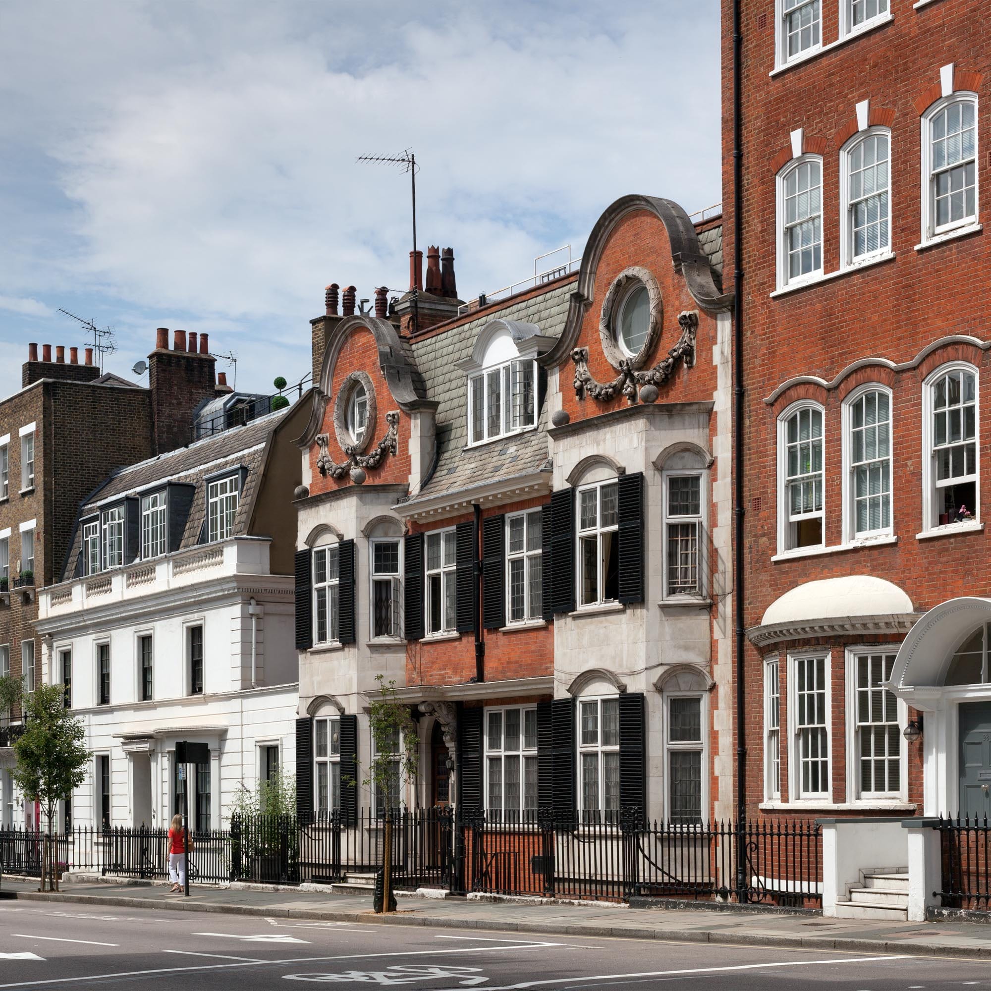
Adjoining mews-end ‘dwarf’ houses on Weymouth Street: No 34 (right), of 1908 (designed by F. M. Elgood); and No 36, of 1874 (photographed by Chris Redgrave for the Survey of London, © Historic England)

It has been suggested that this crop of stylish ‘dwarf’ houses was an attempt by the Howard de Walden Estate to reintroduce residential use in an area where commerce, medicine and institutions had all but taken over. But the process was driven more by speculators and developers than by the Estate; and though frequently proclaimed as ‘private’ residences, they were more often than not first taken by (and many seem always to have been intended for) medical practitioners as consulting rooms with living space above.

Individual examples:

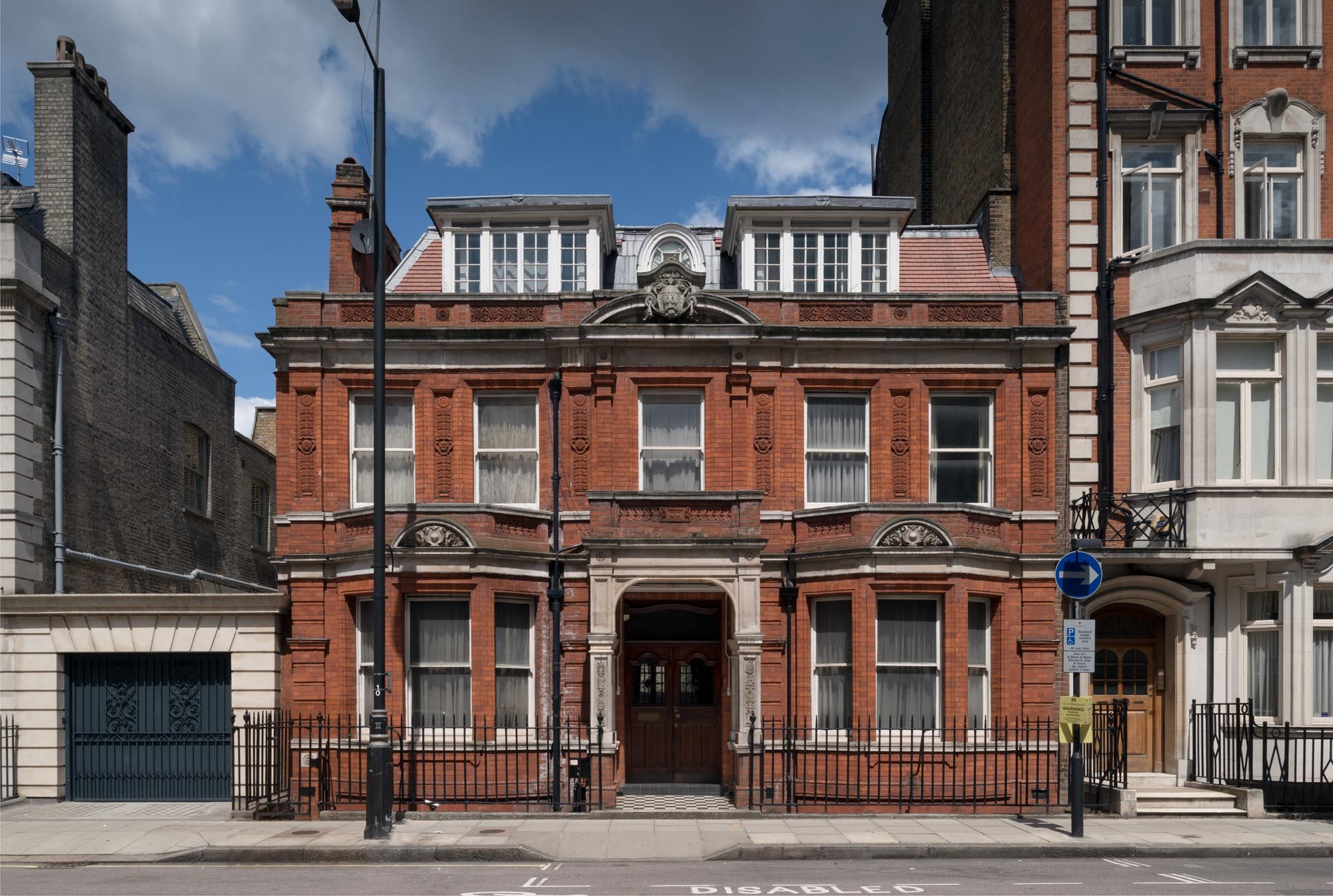
114a Harley Street dates from 1902 and was the last of the architect Barrow Emanuel’s effective mews corner houses – asymmetrical, partially gabled, in red brick and warm stone, and with a pitched red-tiled roof pierced by dormers. Its first resident in 1905 was Dr Louisa Garrett Anderson (d. 1943), daughter of Elizabeth Garrett Anderson. She was in private practice here as well as working at the women’s hospital on Euston Road founded by her mother, whose social reform agenda she shared, establishing a Women’s Tax Resistance League at this house in 1909. Subsequent practitioners at No. 114a included the neurologist and psychotherapist Dr Hugh Crichton-Miller (d. 1951), founder of the Tavistock Clinic.

21 Devonshire Street, of 1855–6, appears to have been the first purpose-built ‘dwarf’ house in the area. It is a simple two-storey box, but with a subtly arranged, stuccoed front incorporating broad relieving arches to the ground-floor fenestration and a bowed central first-floor window. It was a speculation by the Norwich lawyer Merrick Bircham Bircham, who had recently taken on the lease of 117 and 117a Harley Street, in whose grounds it was built. But Bircham’s lease referred to it as a ‘dwelling and studio’, so it is possible that it was purpose-built for its first resident, the sculptor Joseph Durham, who lived here from 1856 until his death in 1877. Many of Durham’s best-known works would have been modelled here, including his monument to the Great Exhibition (unveiled 1863), now outside the Albert Hall. The iron-and-glass canopy to the entrance is an addition of 1910 by Claude Ferrier.

Howard de Walden Project. 21 Devonshire Street, Marylebone, Greater London. View from south west.

21 Devonshire Street (photographed by Chris Redgrave for the Survey of London, © Historic England)

38 Devonshire Street is a double-fronted, red-brick mews corner house of 1902–3, given a neo-Elizabethan twist by double-height bays and heavy, stone-mullioned and transomed windows. The architects were Edward Barclay Hoare and Montague Wheeler. Always in medical use, it was recently refurbished by a private dental practice, who added basement seminar rooms. For over ten years in the 1950s–60s, Stephen Ward, the osteopath at the centre of the Profumo Affair, had his consulting rooms at No. 38. No evidence has come to light to support the repeated claim that his client Lord Astor (who gave him the use of a weekend retreat on the Cliveden Estate) bought the house so that Ward, then in financial difficulties, could continue to occupy it rent-free. There were complaints of noisy female guests in Ward’s apartment many years before the scandal erupted in 1963, by which time he had moved with Christine Keeler to a flat in Wimpole Mews, though he continued to practise at No. 38.

Howard de Walden Project. 38 Devonshire Street, Marylebone, Greater London. View from north east.

38 Devonshire Street (photographed by Chris Redgrave for the Survey of London, © Historic England)

32a Weymouth Street, the first of the area’s late Victorian and Edwardian ‘dwarf’ mews corner houses, was designed by Barrow Emanuel and built in 1886–7 on a site formerly occupied by stabling in Devonshire Mews attached to Nos 90 and 90a Harley Street. Its vernacular Queen Anne Revival style, in red brick with stone dressings, and the two-storey, double-fronted design set the tone for many of the others that followed. Attractive sunflower panels enliven the brickwork and there are carved arabesques to the stone entrance porch and a small monogram (‘BE’) set into the front wall, commemorating the architect. The first residents in the later 1880s and 90s were the cigar importer Arthur Frankau and his wife Julia (née Davis) – better known for her popular novels of London-Jewish life under the pseudonym Frank Danby.

Howard de Walden Project. Weymouth Street, Marylebone, Greater London. View from.

32a Weymouth Street (photographed by Chris Redgrave for the Survey of London, © Historic England)

93a Harley Street (Harley Lodge) is another fine example of the double-fronted mews house rebuildings, this time of the early 1900s. Like its dourer stone-fronted equivalent at 90a Harley Street it was designed in 1911 for the developer Charles Peczenick by Sydney Tatchell, but on this occasion in a more playful red-brick and stone neo-Georgian manner, with a degree of asymmetry within the flanking pedimented end bays. In medical use from the beginning, it is now, like many of its type, a private dental surgery.

Howard de Walden Project. Harley Street, Marylebone, Greater London. View from.

Howard de Walden Project. Harley Street, Marylebone, Greater London. View from.

93a Harley Street (photographed by Chris Redgrave for the Survey of London, © Historic England)

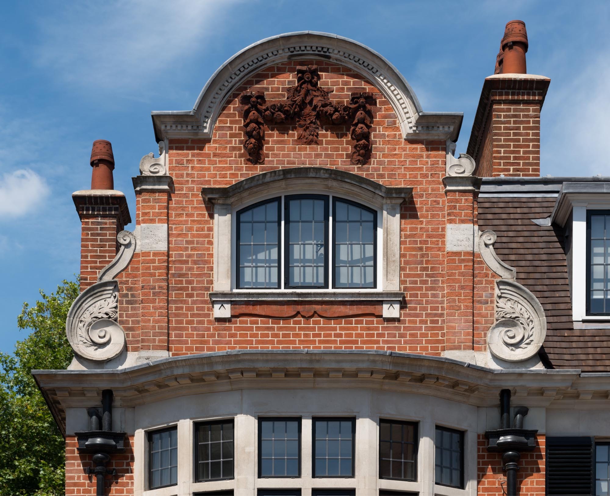
More of a Baroque air attaches to its neighbour of 1908–10 at 1a Upper Wimpole Street, the work of W. Henry White, with its prominent Flemish-looking gables and giant scrolls. The first-floor window shutters were originally painted green to complement the cherry-red brickwork. The house was a speculation for Samuel Lithgow, the Wimpole Street solicitor and Progressive LCC representative for St Pancras. Its first occupant from 1910 until at least 1937 was Peter Lewis Daniel, a senior surgeon at Charing Cross Hospital, who had a private practice here. Having been in medical use for some time, in 2012 the house was the subject of a high-tech conversion to a five-bedroom family home (by Urban Mesh Ltd).

Howard de Walden Project. 1a Weymouth Street, Marylebone, Greater London. View from south.

Howard de Walden Project. 1a Weymouth Street, Marylebone, Greater London. Detail of gable, view from south.

1a Upper Wimpole Street (photographed by Chris Redgrave for the Survey of London, © Historic England)

55 New Cavendish Street is another of the area’s characteristic mews-side houses, with its stripey red-brick and stone gables, and bows to the front ground-floor drawing and dining rooms. It was built in 1901 to designs by W. Henry White, perhaps reusing an earlier design that he had published in 1888. The developer was the surgeon and cinema pioneer Dr Edmund Distin Maddick.

Howard de Walden Project. 55 New Cavendish Street, Marylebone, Greater London. View from south east.

55 New Cavendish Street (photographed by Chris Redgrave for the Survey of London, © Historic England)

59 New Cavendish Street is a double-fronted ‘dwarf’ house, though here on a more lavish scale, being entirely fronted in Portland stone in a strong Baroque neoclassical style. Set behind a carriage sweep, it has a prominent central entrance porch with a pediment and heavily blocked columns. It was built in 1910 by Kingerlee & Sons to the designs of F. M. Elgood and was another of the speculations in the area funded by the solicitor Samuel Lithgow. The first occupants, there until the 1940s, were Reuben Goldstein Edwards and his wife Edith. He had made a fortune from Edwards’ Harlene hair restorer and colourant. Edith’s philanthropic work later earned her an MBE, and during the First World War their house was given over to the Red Cross Central Workrooms for the production of hospital garments for the wounded. Since the Second World War it has been predominantly in commercial or medical use.

Howard de Walden Project. 59 New Cavendish Street, Marylebone, Greater London. View from south.

59 New Cavendish Street (photographed by Chris Redgrave for the Survey of London, © Historic England)

Harley Street

By the Survey of London, on 13 October 2017

Harley Street has long been synonymous with the top echelon of the medical profession, a Harley Street consultant the apogee of the profession. This reputation was forged in the second half of the nineteenth century, and although it dimmed a little in the years after the Second World War, it enjoyed a resurgence in the late twentieth century with the growth of private health care.

Howard de Walden Project. Harley Street, Marylebone, Greater London. View from.

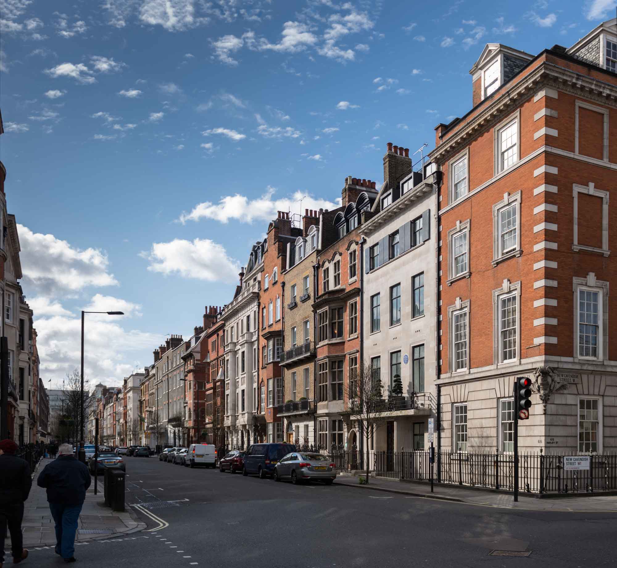
General view of the west side of Harley Street looking south from New Cavendish Street. Photographed by Chris Redgrave for the Howard de Walden Estate and the Survey of London. © Historic England

The street itself has preserved its residential appearance, despite the fact that for the most part residence is now confined to upper-floor flats. It was first conceived in the early eighteenth century, but largely laid out and built up between the 1750s and 1780s. Although much Georgian fabric remains, there has been considerable rebuilding, particularly in the southern stretches of the street.

Detail of the 1 - 5 Harley Street on the corner with Cavendish Square. Photographed by Chris Redgrave

Detail of  1–5 Harley Street on the corner with Wigmore Street, designed by Robert J. Worley and built in 1896-9. Photographed by Chris Redgrave © Historic England

From the beginning Harley Street was one of the more fashionable addresses hereabouts, with aristocracy, gentry, politicians, high-ranking clergymen, military and naval officers resident for the London season. Here too were the portraitist Allan Ramsay, and J. M. W. Turner before he decamped round the corner to Queen Anne Street. Increasingly in the early nineteenth century wealthy merchants took up residence. Many owed their wealth to slavery, from sugar plantations in the colonies and later from the huge sums paid out in compensation to plantation owners following the abolition of the slave trade. Others had grown rich through the East India Company, so many that Harley Street became as notable for its ‘nabobs’ as it became for its doctors. As late as 1841 Blackwood’s Edinburgh Magazine reckoned that ‘the claret is poor stuff, but Harley Street Madeira has passed into proverb, and nowhere are curries and mulligatawny given in equal style’.

DP176911

This general view of 74 to 82 Harley Street gives a good impression of the street’s Georgian character, and perhaps a sense of that monotony so disliked by the Victorians. The houses date from the 1770s, with the usual later alterations of balconies, stuccoed ground storeys and raised upper floors. Photographed by Chris Redgrave © Historic England

During the earlier decades of Victoria’s reign members of parliament and lawyers were prominent in Harley Street. The street so epitomised dull respectability that it was chosen by Charles Dickens as the home of Mr Merdle in Little Dorrit, first published in 1855–7. Disraeli too, in Tancred published in 1847, derided ‘your Gloucester Places, and Baker Streets, and Harley Streets, and Wimpole Streets, and all those flat, dull, spiritless streets, resembling each other like a large family of plain children’. Disraeli’s great political opponent Gladstone occupied 73 Harley Street from 1876–82. His arrival coincided with his campaign on the Eastern Question, arising from the massacre of Orthodox Christians in the Balkans. On a Sunday evening in 1878 a ‘jingo mob’ gathered outside his house, hurling stones and verbal abuse at his windows.

73 Harley Street. Gladstone lived in the house previously on this site, which would have resembled those on either side. The present No. 73

73 Harley Street. Gladstone lived in the house previously on this site, which would have resembled those on either side. The present No. 73 was rebuilt in 1904 to designs by W. Henry White for the ophthalmic surgeon Walter Hamilton Hylton Jessop. The blue plaque commemorates not only Gladstone’s residence from 1876–82 but also Sir Charles Lyell who lived there from 1846–75. Photographed by Chris Redgrave © Historic England

By this time Marylebone had long been associated with medicine. Indeed, medicine arrived at the same time as the housing boom of the 1750s onwards. Most of the early evidence relates to institutions for treating the poor. Hospitals, like housing, gravitated to healthy suburban locations close to open fields and fresh air. When the Middlesex Hospital was built on Mortimer street in 1757 it was at the very edge of the expanding city, as was the parish workhouse in Paddington Street.

Entrance to No. The size and number of doctor's brass plates were strictly controlled by the Howard de Walden Estate, with regular checks against the Medical Directory to weed out interlopers.

Entrance to No. 118. The Georgian house on this site was rebuilt in around 1909–10 to designs by F. M. Elgood with stone carvings by A. J. Thorpe. Together with its neighbours to the south, Nos 114 and 116, it was reconstructed behind the retained façade in 2005–9 as consulting suites and a pathology laboratory for the London Clinic by the architects Floyd Slaski Partnership. Photographed by Chris Redgrave © Historic England

Today, Marylebone generally, and Harley Street in particular, is most closely linked with front-rank medicine and private consultants. From the mid eighteenth century, proximity to London’s teaching hospitals became important for top medical men who held prestigious posts in them. Closeness to aristocratic patients was another major consideration. By the 1840s there were sufficient eminent physicians and surgeons in Cavendish Square and Queen Anne Street to act as a magnet for others. However, around this time those at the top of their profession were as likely to reside south of Oxford Street as north. The medical directory for 1854 shows an even distribution between Marylebone, Mayfair and Bloomsbury.

Detail of the door to No. 72. The size and number of doctor's brass plates were strictly controlled by the Howard de Walden Estate, with regular checks against the Medical Directory to weed out interlopers.

Detail of the door to No. 72. The size and number of doctor’s brass plates were strictly controlled by the Howard de Walden Estate, with regular checks against the Medical Directory to weed out interlopers. Photographed by Chris Redgrave © Historic England

Harley Street’s subsequent primacy is probably accounted for by its immediate proximity to Cavendish Square – the acme of fashionable Marylebone. Even by 1874, when Harley Street’s significance was already established, being close to the square still mattered. In that year Sir Alfred Baring Garrod, physician and gout specialist, moved from 84 Harley Street further south to No. 10 simply to be nearer to Cavendish Square. Twelve years later the surgeon Sir John Tweedy’s move in the opposite direction, from No. 24 to No. 100, was regarded by colleagues as committing professional suicide.

For most of its history, the southern end of Harley Street was the more fashionable address. Nos 6 and 8 to the left were built in 1825-7, probably by the architect Thomas Hardwick.

For most of its history, the southern end of Harley Street was the more fashionable address. Nos 6 to 10 (to the left) were built in 1825–7, probably by the architect Thomas Hardwick. Photographed by Chris Redgrave © Historic England

As fashionable society ebbed away from Marylebone in the late nineteenth and early twentieth centuries, a similar shift of smart medical practice might have been expected, but that never happened. By then many patients of all classes were travelling to see doctors rather than the reverse. But the main reason seems to have been that once a distinct medical community had been established it was found to be enormously beneficial to those within it. This professional interaction is recalled in many memoirs of consultants, who placed great value on the ability to call on the advice or second opinion of a neighbour. In the twentieth century there was also an active policy on the part of the Howard de Walden Estate to preserve the Marylebone grid as a medical enclave.

Nos 51 (left) and 53 Harley Street. No. 51was built in 1894 to designs by F. M. Elgood for the surgeon William Bruce Clarke on the site of the Turk's Head pub. No. 53 was designed by Wills & Kaula and completed in 1914-15 as a home and practice for the surgeon and urologist Frank Seymour Kidd.

Nos 51 (left) and 53 Harley Street. No. 51 was built in 1894 to designs by F. M. Elgood for the surgeon William Bruce Clarke on the site of the Turk’s Head pub. No. 53 was designed by Wills & Kaula and completed in 1914–15 as a home and practice for the surgeon and urologist Frank Seymour Kidd. Photographed by Chris Redgrave © Historic England

The image of the Harley Street doctor relies much on the traditional kind of premises he inhabited. The standard London town house needed little alteration to turn it into a doctor’s house. Ground-floor front rooms became waiting rooms instead of dining rooms, with a consulting room either immediately behind or in the closet wing.

Nos 82 to 86 Harley Street. No. 84 in the centre was rebuilt in 1909 to designs by Claude W. Ferrier. The neurologist Walter Russell Brain had consulting rooms in No. 86 (on the left) in the 1960s.This retains its rich Georgian interior and was home to Russian ambassadors after 1780, including Count Simon Woronzow and Prince Andreyevich Lieven.

Nos 82 to 86 Harley Street. No. 84 in the centre was rebuilt in 1909 to designs by Claude W. Ferrier. The neurologist Walter Russell Brain had consulting rooms in No. 86 (on the left) in the 1960s. This retains its rich Georgian interior and was home to Russian ambassadors after 1780, including Count Simon Woronzow and Prince Andreyevich Lieven. Photographed by Chris Redgrave © Historic England

Originally, the doctor’s dependants occupied the remainder of the house above, but after families moved to the suburbs, houses might be converted or rebuilt as suites of consulting rooms for multiple medical occupation.

40 and 42 Harley Street show the contrasting architectural taste of the 1890s (No. 42 on the left, by C. H. Worley) and 1930s (No. 40 on the right, by Charles W. Clark, architect to the Metropolitan Railway Company). No. 40 was designed to resemble a private house but provided suites of consulting rooms behind a modish Art Deco entrance hall. No. 42 decked in Worley's characteristic orange-pink terracotta was given Jacobean-style interior decor.

Nos 40 and 42 Harley Street show the contrasting architectural taste of the 1890s (No. 42 on the left, by C. H. Worley, brother of Robert J. Worley) and 1930s (No. 40, on the right, by Charles W. Clark, architect to the Metropolitan Railway Company). No. 40 was designed to resemble a private house but provided suites of consulting rooms behind a modish Art Deco entrance hall. No. 42 decked in Worley’s characteristic orange-pink terracotta was given Jacobean-style interior decor. Photographed by Chris Redgrave © Historic England

In the later twentieth century many consultants gave up their private rooms for the better-equipped universities and hospitals. In their place came alternative practitioners and aesthetic therapists for whom the individual consulting rooms in elegant domestic settings provided a soothing backdrop. In the latest conversions encouraged by the Howard de Walden Estate there has been a policy of reconstruction to create purpose-built consulting suites over reinforced basements, allowing the latest diagnostic equipment to be installed behind retained facades, which preserve the historic character of the district.

Early twentieth century Birn Brothers postcard, poking fun at the Harley Street consultants and their patients. © H. Martin. Reproduced by permission of H. Martin

Early twentieth century Birn Brothers postcard, poking fun at the Harley Street consultants and their patients. © H. Martin. Reproduced by permission of H. Martin