X Close

The Survey of London

Home

Recording the history of London's built environment since 1894

Menu

Archive for the 'Whitechapel' Category

The Survey of London, December 2017

By the Survey of London, on 29 December 2017

Recently we have been looking through our archive on the history of the Survey of London, which traces its beginnings to the 1890s. These large cloth-bound boxes brimming with letters, newspaper cuttings, photographs and pamphlets include detailed reports on the progress of the Survey.

A pamphlet recording the progress of the London Survey Committee, as the Survey was formerly known, at Midsummer 1929.

As it is customary during the festive season to reflect on recent achievements, current research, and plans for the future, we think it might be timely to share an update on the current progress of the Survey. 2017 has been an important year for the Survey of London, marked by the publication of Volumes 51 and 52 on South-East Marylebone by Yale University Press, supported by the Paul Mellon Centre for Studies in British Art. We are delighted that these volumes, which document a rich and varied part of the capital, have been received with glowing reviews:

  • “Superbly researched, well written and comprehensively illustrated…” – John Martin Robinson, Country Life, October 2017.
  • “These two [volumes] cover a chunk of the historic West End in unrivalled detail following years of rigorous research…” – Robert Bevan, Evening Standard, December 2017.

The draft chapters for these volumes have been made freely available online via our website.

Covers of Volumes 51 and 52 of the Survey of London on South-East Marylebone, published in Autumn 2017. 

The Survey is following up its two volumes on South-East Marylebone with a study of South-West Marylebone, covering the area west of the boundary of the previous volumes as far as Edgware Road. A comprehensive study of Oxford Street is also underway to produce a volume covering both sides of the street from Tottenham Court Road to Marble Arch. As the longest continuous shopping street in Europe since the eighteenth century, Oxford Street is a unique phenomenon. Though it has witnessed almost continuous change, it has never lost its popularity. The traffic, the crowds and the modes of transport will be an equal part of the Survey’s study along with the buildings and shops of Oxford Street. Publication date is estimated as 2019.

View of Oxford Circus taken from the roof of Spirella House, 266270 Regent Street, looking north-west. (© Survey of London, Lucy Millson-Watkins)

Research is continuing in Whitechapel, an area with a multifaceted history that is currently in the throes of intense change. In Autumn 2016 the Survey launched a public collaborative website, ‘Histories of Whitechapel’, with the involvement of the Bartlett Centre of Advanced Spatial Analysis at UCL and supported by a grant from the Arts and Humanities Research Council. This ongoing project is an experiment in the public co-production of research, which during the last year has encompassed oral-history interviews, walking tours, exhibitions, and film viewings, all in addition to the combination of rigorous research, field investigation and architectural drawings that is the mainstay of the Survey of London series.
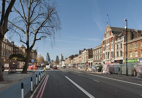
View of Whitechapel Road in 2015, looking east towards the City. (© Survey of London, Derek Kendall)

As many of our readers will know, the Survey has been based at the UCL Bartlett School of Architecture since 2013. Research has recently begun towards an in-depth study of University College London for the Survey’s monograph series, which is devoted to buildings and sites of particular note. The forthcoming monograph will focus on UCL’s Bloomsbury campus, the historic core of the university’s estate. Publication date is intended as 2026, to coincide with celebrations for the bicentenary of the university’s foundation.

View of UCL’s main quadrangle from Gower Street, looking east towards the dignified Corinthian portico of the Wilkins Building. (© UCL Creative Media Services, Mary Hinkley)

Areas covered by the Survey of London in 2017, including current studies in Oxford Street, Whitechapel and South-West Marylebone. Please click to extend the map and view a list of volumes.

The Survey of London’s favourite festive photographs

By the Survey of London, on 21 December 2017

Thank you for taking the time to read the Survey of London’s blog posts over the last year. Here follows a selection of our favourite festive photographs from our past and current studies of the capital’s built environment. Happy Christmas and all good wishes for the New Year.

Oxford Street

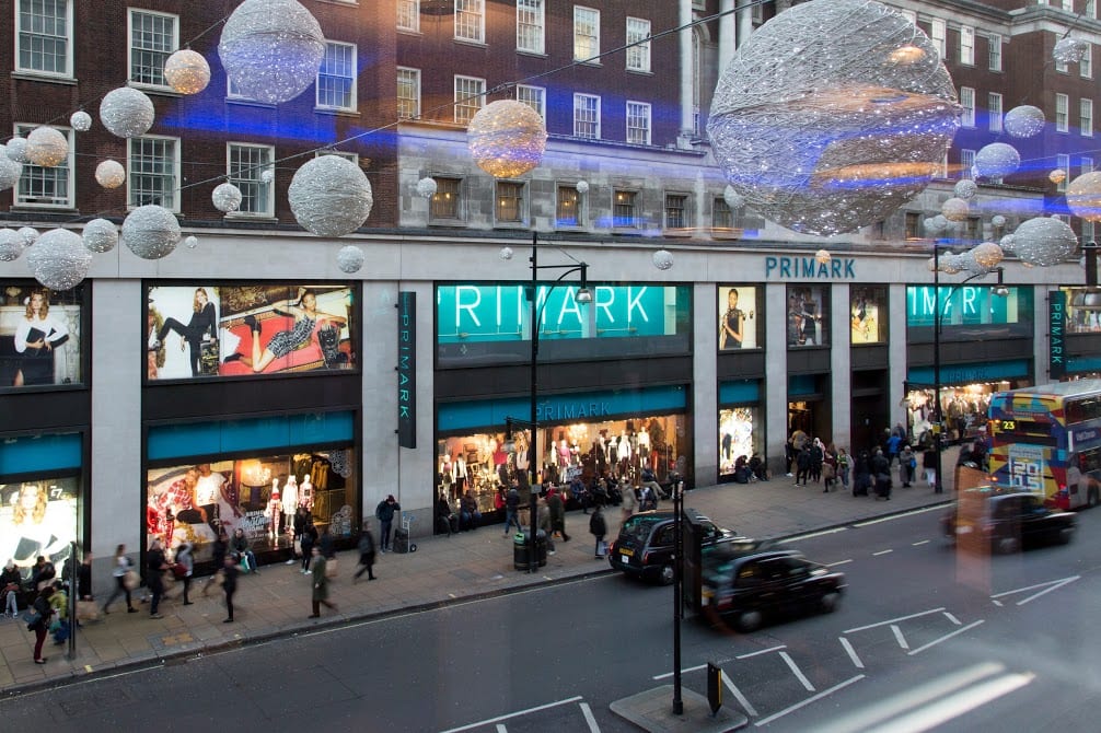
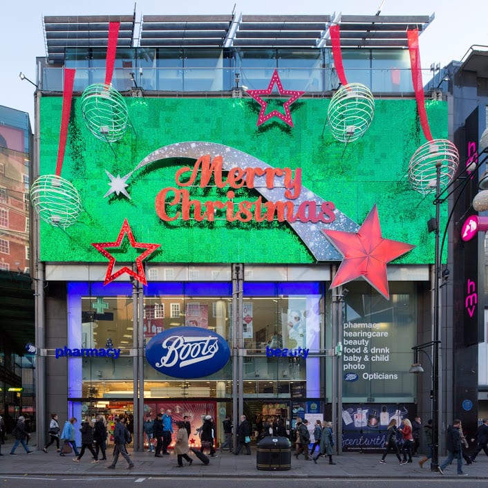
The character of Oxford Street is defined above all by its shops, and Christmas is its busiest time of the year. In 2015 we asked Lucy Millson-Watkins to photograph the lights, sights and decorations of Christmas on Oxford Street. Here is a selection of the photographs that she took, first published online in a blog post which considered the festive season on Oxford Street and its enduring traditions.

Oxford Street at dusk, looking east. (© Survey of London, Lucy Millson-Watkins)

Christmas bauble decorations strung across Oxford Street in December 2015. (© Survey of London, Lucy Millson-Watkins)

Boots, with understated decoration. (© Survey of London, Lucy Millson-Watkins)

Whitechapel

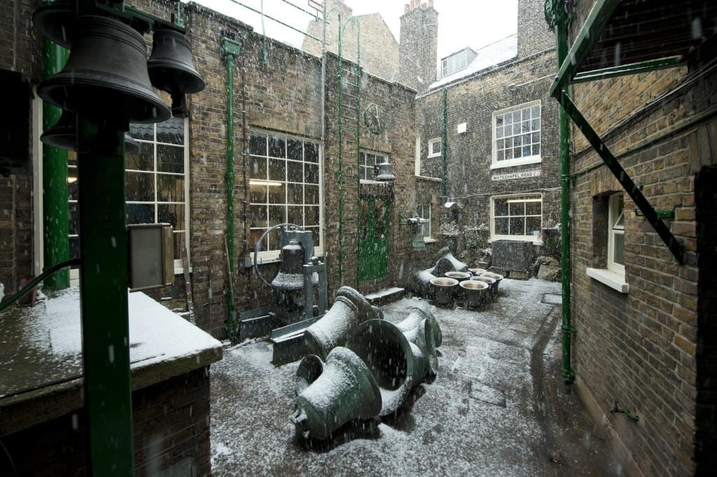
Last December it was announced that the Whitechapel Bell Foundry would close in May 2017, and this year has witnessed its closure and the end of what has been a remarkable story. Business cards claim the bell foundry as ‘Britain’s oldest manufacturing company’ and ‘the world’s most famous bell foundry’ – the first not readily contradicted, the second unverifiable but plausible. The business, principally the making of church bells, had operated continuously in Whitechapel since at least the 1570s. It had been on its present site with the existing house and office buildings since the mid 1740s. Derek Kendall’s wintry photographs of the bell foundry in 2010 provide an insight into its historic buildings and the preservation of traditional craftsmanship until its closure. If you would like to read the Survey’s full account, please click here to find the draft text on the Survey’s ‘Histories of Whitechapel’ website.

Shopfront at the east end of 32–34 Whitechapel Road in 2010. (© Historic England Archive, photographed by Derek Kendall)

Inner yard of the bell foundry, looking north-west in 2010. (© Historic England Archive, photographed by Derek Kendall)

Tuning shop in 2010. (© Historic England Archive, photographed by Derek Kendall)

University College London

There is a Survey of London monograph on University College London in the offing. UCL’s first architectural expression was the grand neoclassical building constructed in 1827–9 to designs by William Wilkins, its portico and dome a prominent statement. Only the central range of this scheme was completed, yet successive wing extensions have formed a dignified quadrangle in Gower Street.

The Corinthian portico and dome of the Wilkins Building is instantly recognizable and has been adopted by UCL as its logo. (© UCL Creative Media Services, Mary Hinkley)

View of the Wilkins Building from Gower Street, looking east. (© UCL Creative Media Services, Mary Hinkley)

Even the railings in front of the Cruciform Building, formerly University College Hospital, received a generous helping of snow in February 2009. Alfred and Paul Waterhouse’s triumphant red-brick and terracotta hospital was built on a cruciform plan in 1896–1906. (© UCL Creative Media Services, photographed in 2009 by Mary Hinkley)

Battersea

Clapham Common is one of London’s most-prized public spaces, notable for its wide-open character and the clear sense of definition and urbanity imposed by its boundaries. An essentially triangular and uniform area of some 220 acres, it has lost less ground to development than most metropolitan commons. Archery was a popular pastime in the eighteenth century, as were boxing and hopping matches, and occasional fairs which attracted larger gatherings. Today the common boasts a mixture of formal and informal planting, tree-lined roads, sports facilities, play areas, and broad open spaces. The ponds and the bandstand (1890) are notable remnants of improvements effected in the nineteenth century, when cricket, football, tennis, golf, horse riding, model yachting and bathing were all enjoyed on the common. If you would like to read the Survey’s full account of Clapham Common from the Battersea volumes (published in 2013), please click here to download the draft chapter on ‘Parks and Open Spaces’ from our website.

Clapham Common, the north-western panhandle under snow in 2013. St Barnabas’s Church on Clapham Common North Side is within view in the distance, its pitched roofs adorned by a dusting of snow. (© Historic England, Chris Redgrave)

Sledging on Clapham Common in 2013. (© Historic England, Chris Redgrave)

Clapham Common under snow in 2013, view towards Clapham Common North Side. (© Historic Englnad, Chris Redgrave)

South-East Marylebone

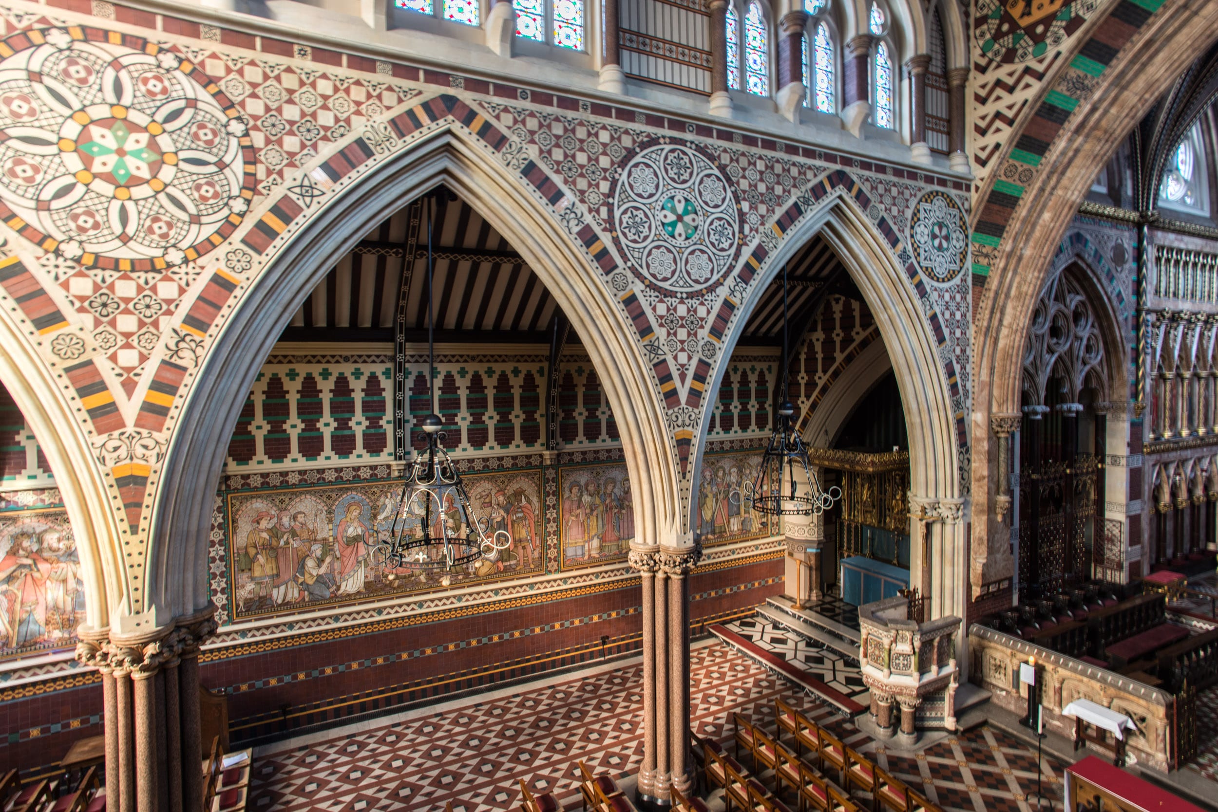
The brick church and lofty spire of All Saints, together with the twin clergy and parish buildings that front it towards Margaret Street, comprise a renowned monument to Victorian religion and architecture. Exuberant and compact, the group was built in 1850–2 by John Kelk to designs by William Butterfield, yet the interior of the church with its painted reredos by William Dyce was not completed and opened till 1859. Butterfield continued to embellish and alter All Saints throughout his lifetime, and it is always regarded as his masterpiece. Among decorative changes to the interior since his death, the foremost were those made by Ninian Comper between 1909 and 1916. Recent restorations have reinforced Butterfield’s original vision of strength, experimental colour and sublimity. A full account of this astonishing church has been published in the Survey’s volumes on South-East Marylebone, published in 2017. Please click here to read the account of All Saints’ Church in the Survey’s draft chapter on Margaret Street.

View of All Saints’ Church, Margaret Street from the west. (© Historic England, Chris Redgrave)

North aisle, looking north-east. (© Historic England, Chris Redgrave)

Nativity scene on the wall of the north aisle. The tilework at All Saints was designed by Butterfield, painted by Alexander Gibbs and executed by Henry Poole & Sons in 1875–6. (© Historic England, Chris Redgrave)

The Royal London Hospital Estate: a self-guided walk in Whitechapel

By the Survey of London, on 3 November 2017

The Survey of London would like to share a self-guided walk around the eastern portion of the Royal London Hospital’s estate, bounded roughly by Whitechapel Road north, Cavell Street east, Commercial Road south, and New Road west. Download our route map and guide for a fuller introduction to the history of the hospital and its estate: Guide to a walking tour of the Royal London Hospital Estate

The Royal London Hospital traces its origins to a charitable infirmary established in 1740 for the working poor of east London. Initially based in converted terraced houses in Moorgate and Prescot Street, the institution secured a permanent home with the construction of a purpose-built hospital (1751–78) in open fields on the south side of Whitechapel Road.

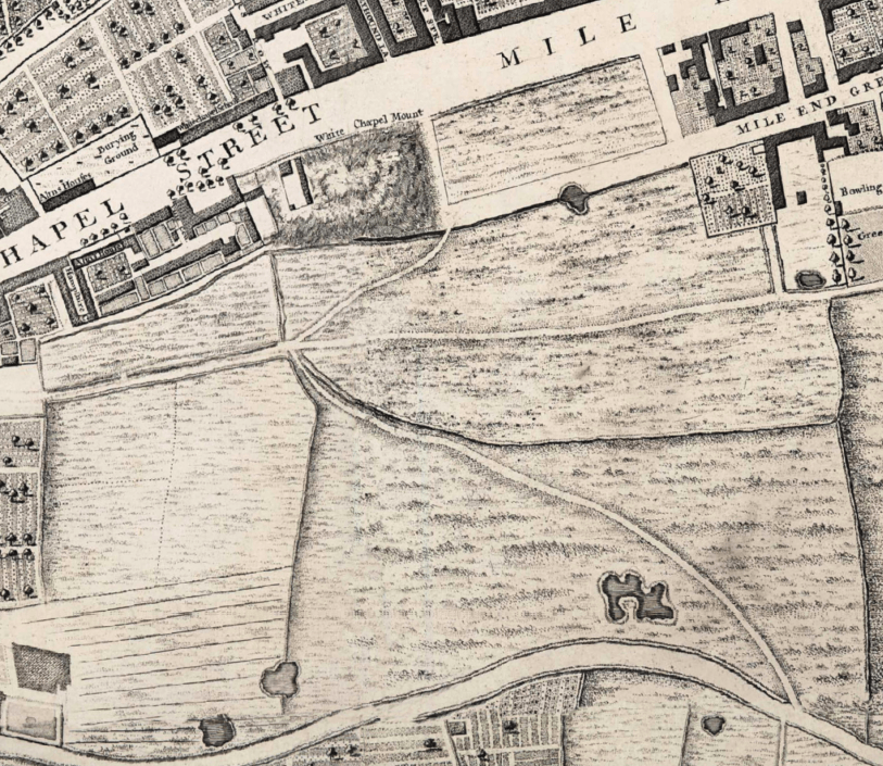
The hospital was built on the rectangular field east of Whitechapel Mount, an artificial hill formed as part of the fortifications built round London in the 1640s. It was bounded by open fields to the south belonging to the Red Lion Farm. (Extract from John Rocque’s map of London c.1746)

The hospital was built on the rectangular field east of Whitechapel Mount, an artificial hill formed as part of the fortifications built round London in the 1640s. It was bounded by open fields to the south belonging to the Red Lion Farm. (Extract from John Rocque’s map of London c.1746)

One of the attractions of the site acquired by the hospital was its healthy location, bounded to the south by meadows and pastures belonging to the Red Lion Farm on Mile End Green. The medical staff promoted the virtues of fresh air and ventilation around the hospital for the recovery of patients. By 1772 the hospital had acquired roughly thirty acres of fields on the south side of Whitechapel Road, stretching as far south as the present course of the Commercial Road. This large swathe of land protected the hospital from the threat of unwanted encroachment and presented an opportunity to raise funds through building development.

The hospital began to offer land on building leases in the 1780s. Building development was initially confined to the west side of New Road, which had been laid out in the 1750s. The eastern portion of the hospital’s estate was developed in the first half of the nineteenth century in an orderly grid of wide, airy streets. Surviving rows of brick-built terraced houses in Walden Street, Nelson Street, Varden Street and Turner Street point to the tension between the hospital’s estate development and the watchful eye which the medical staff exerted over its vicinity to preserve ventilation.

Aerial view of the London Hospital in the 1930s.

Aerial view of the London Hospital in the 1930s.

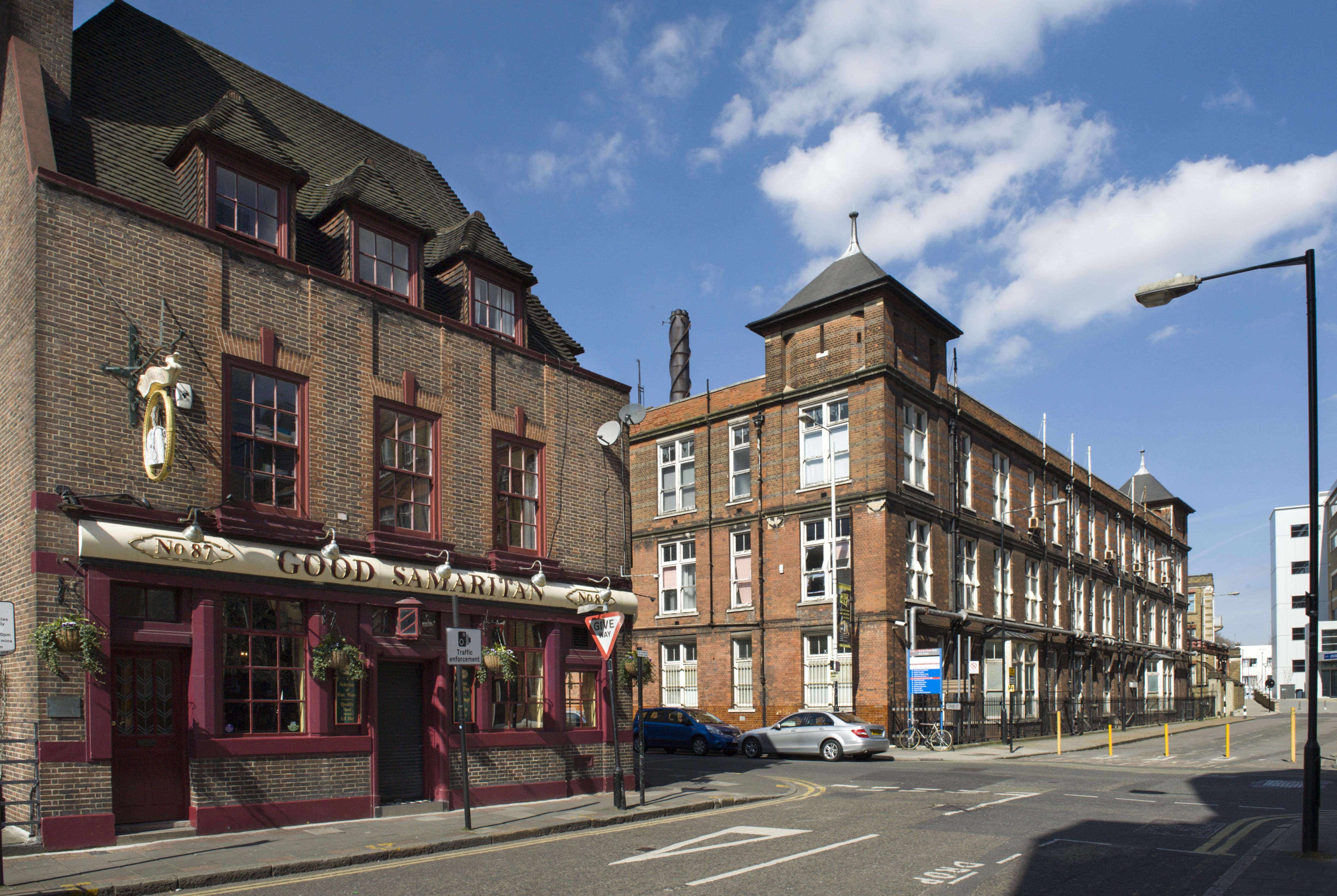
Many of the nineteenth-century terraces built to secure an income for the hospital have been sacrificed for its expansion and success, with the construction of an assortment of medical buildings such as the Outpatients Department (1900–2) and the adjacent Outpatients Annexe (1935–6) in Stepney Way. A remarkable acquisition is the former St Philip’s Church (1888–92), which was converted into a medical and dental library in the 1980s. Despite the concentration of buildings associated with the Royal London Hospital in the area, there are a few interlopers, including the bulky East London Mail Centre (1970), the Good Samaritan Public House (1937–8), and Gwynne House (1937–8). The south end of the estate has resisted the march of medical buildings, and the Nelson Street Synagogue and a former Baptist chapel in Varden Street testify to Whitechapel’s diverse patterns of immigration.

The following photographs give an impression of the Survey’s self-guided walking tour, which is available to download here. These photographs were taken around the hospital’s estate by Derek Kendall in 2016–7; their captions include links to the Survey’s participative ‘Histories of Whitechapel’ website, https://surveyoflondon.org.

Survey of London - Whitechapel Volume The Royal London Hospital, Whitechapel Road, Whitechapel, Tower Hamlets, London. Central entrance block View from north west.

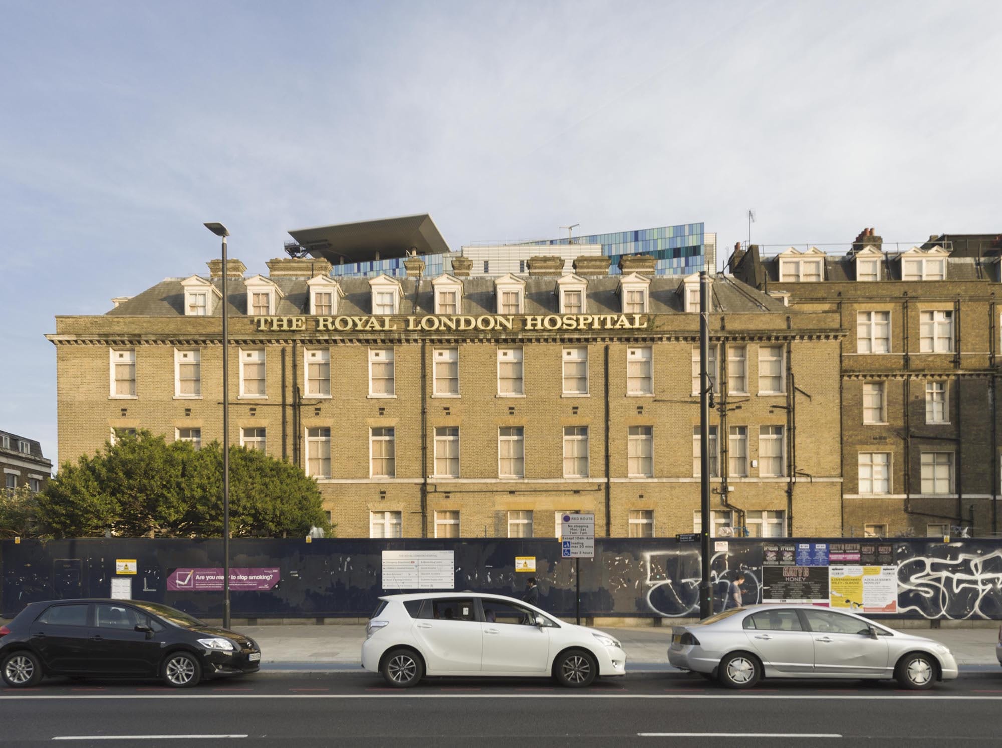
The former Royal London Hospital in Whitechapel Road. In the nineteenth century, the Georgian core of the hospital was concealed by a number of extensions. The Alexandra Wing (west) opened in 1866 and the Grocers’ Company’s Wing (east and donated by the Grocers’ Company) was opened by Queen Victoria in 1876; both were designed by Charles Barry Jr. Further extensions were overseen by Rowland Plumbe, the hospital’s surveyor, in the years around 1900. (© Derek Kendall)

Survey of London - Whitechapel Volume Philpot Street, view from east.

1840s terraced houses at 57–69 Philpot Street. This wide, airy thoroughfare extending from the rear of the hospital to Commercial Road was planned c.1818. It was first known as St Vincent Street in honour of the Earl St Vincent, a vice-president of the hospital. Between 1820 and 1845 the street was gradually laid out with large brick-built terraced houses with round-arched windows and recesses. (© Derek Kendall)

Survey of London - Whitechapel Volume London Hospital Students Hostel Philpot Street. View from south west.

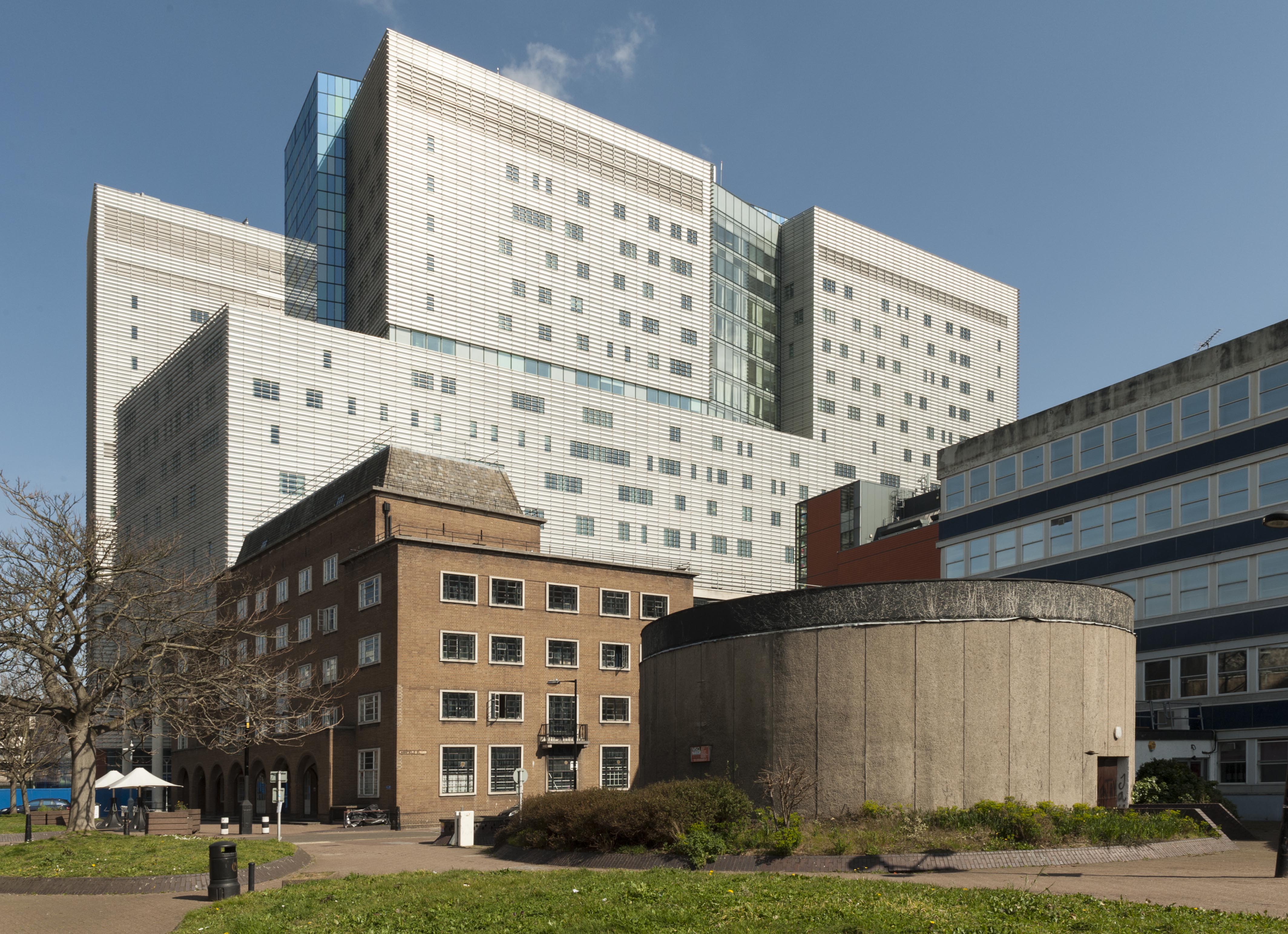
Terraced houses on the east side of Philpot Street were sacrificed in the 1930s for a students’ hostel for the London Hospital Medical College, a neat brick-built block designed by Edward Maufe. The Princess Alexandra School of Nursing was built in the 1960s to designs by T. P. Bennett & Son, incorporating a distinctive circular lecture theatre faced with concrete. Today the Royal London Hospital’s modern block dominates Philpot Street’s northern aspect, rising to seventeen storeys. (© Derek Kendall)

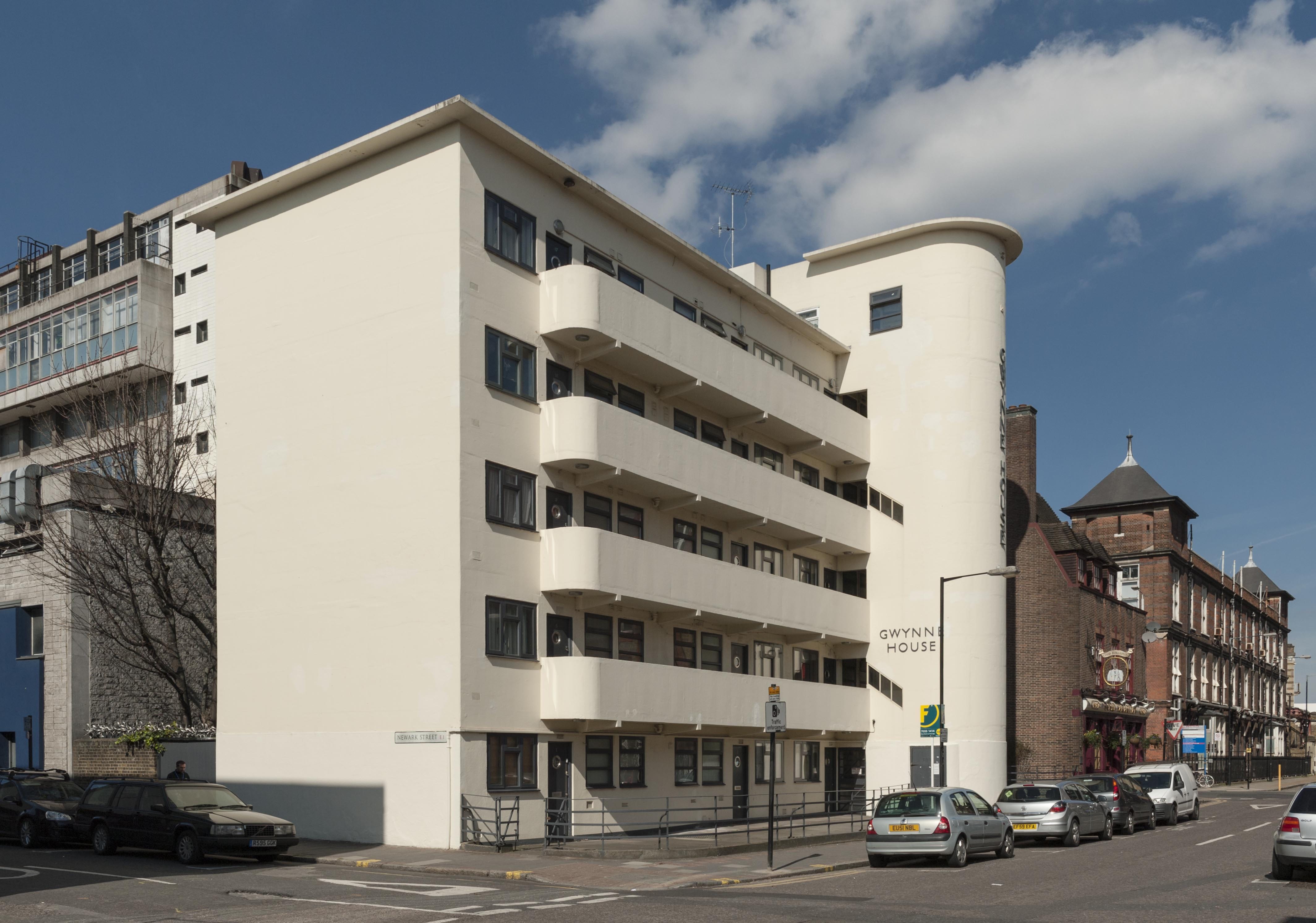
Gwynne House from the south-east. (© Derek Kendall)

Gwynne House, Turner Street. Built in 1937–8 to designs by H. Victor Kerr, the architect of a number of interwar buildings in east London. Of his surviving works in Whitechapel, Gwynne House is the most assertive expression of the Modernist style. The block provided twenty ‘minimum’ flats designed to attract students, social workers and professional people in east London. Gwynne House was swiftly identified as a convenient base for medical practitioners, nurses and students. By the 1980s, it had been acquired for the hospital as rented staff accommodation. The flats are now privately owned. (© Derek Kendall)

Survey of London - Whitechapel Volume Buildings on north side of Ashfield Street, view from south.

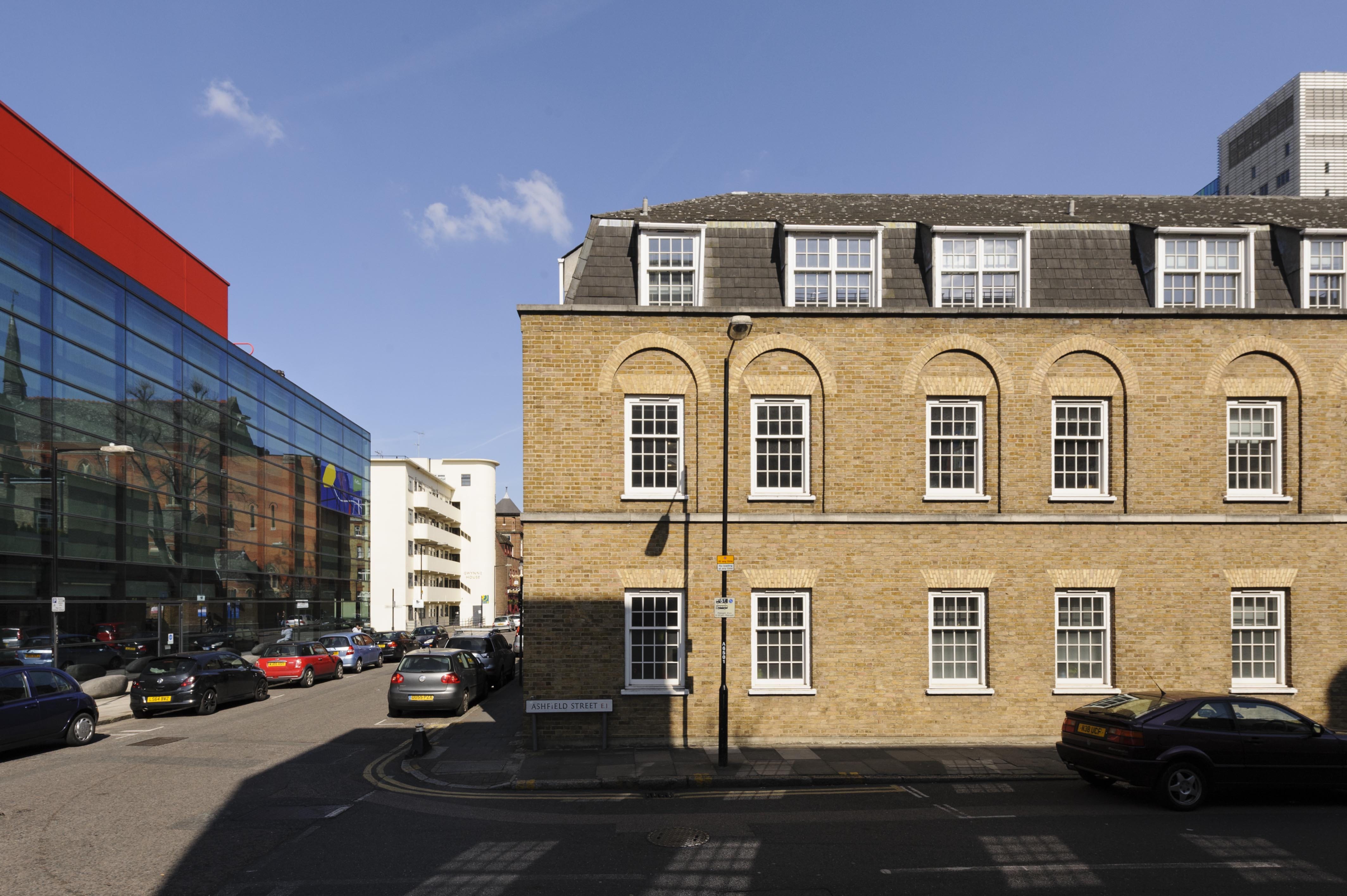
The Yvonne Carter Building, Ashfield Street, built in 1975–7 as laboratories in character with the stock-brick terraced houses built on eastern side of the hospital’s estate in the nineteenth century. It stands opposite the Blizard Building, a sleek glass-fronted block constructed in 2003–5 by AMEC to designs by Will Alsop as teaching and research facilities for the School of Medicine and Dentistry, Queen Mary University of London. (© Derek Kendall)

Survey of London - Whitechapel Volume The Good Samaritan Public House, 87 Turner Street, view from south east.

The Good Samaritan Public House, 87 Turner Street. This public house probably owes its name to the London Hospital, which incorporated a representation of the City of London as a Good Samaritan on its official seal of 1757. The earliest record of the Good Samaritan dates to 1827, yet the present building was raised in 1937–8 to designs by A. E. Sewell, chief architect to Truman’s. Soon after its completion, it was assessed by the brewery’s surveyors as a ‘nice small house, well done’. Its continuing association with the London Hospital and its medical college is commemorated by characterful street signs decorated with busts of white-coated doctors. (© Derek Kendall)

Survey of London - Whitechapel Volume Royal London Hospital Outpatients Annexe block. New Road, View from north west.

The former Outpatients Annexe, New Road. This substantial block was built in 1935–6 to designs by Adams, Holden & Pearson to secure a centre for the hospital’s Department of Physical Medicine and a newly established School of Physiotherapy. The building has been vacant since the building moved to new premises in 2012, and redevelopment seems likely. (© Derek Kendall)

Survey of London - Whitechapel Volume Whitechapel Library in former Church of St Augustine with St Philip, Newark Street. View from south west.

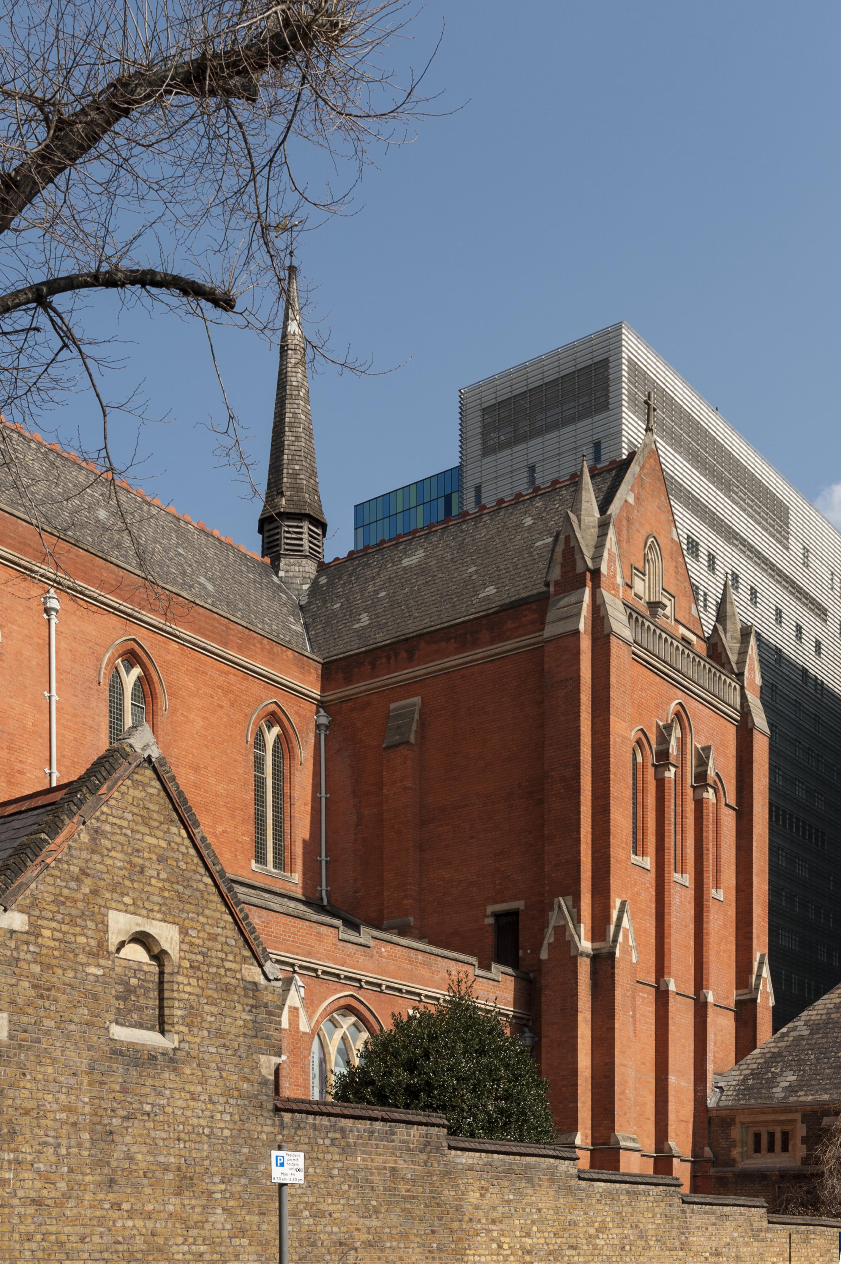
Whitechapel Library (formerly the Church of St Philip with St Augustine), Newark Street. A former red-brick church of 1888–92 built to designs by Arthur Cawston. The quality of the church culminates in its magnificent vaulted interior, deemed to be an ‘architectural masterpiece’ by the Gothic revivalist Stephen Dykes Bower. The church was converted into a medical and dental library for the London Hospital Medical Library in 1985–8 to plans by Fenner & Sibley. Following the assimilation of the college into Queen Mary University of London in 1995, the building continues in use as a medical and dental library. (© Derek Kendall)

Project; Survey of London - Whitechapel. Site; Garrod Building - London Hospital Medical College, Turner Street, Whitechapel, Tower Hamlets, London. Exterior, view from south west.

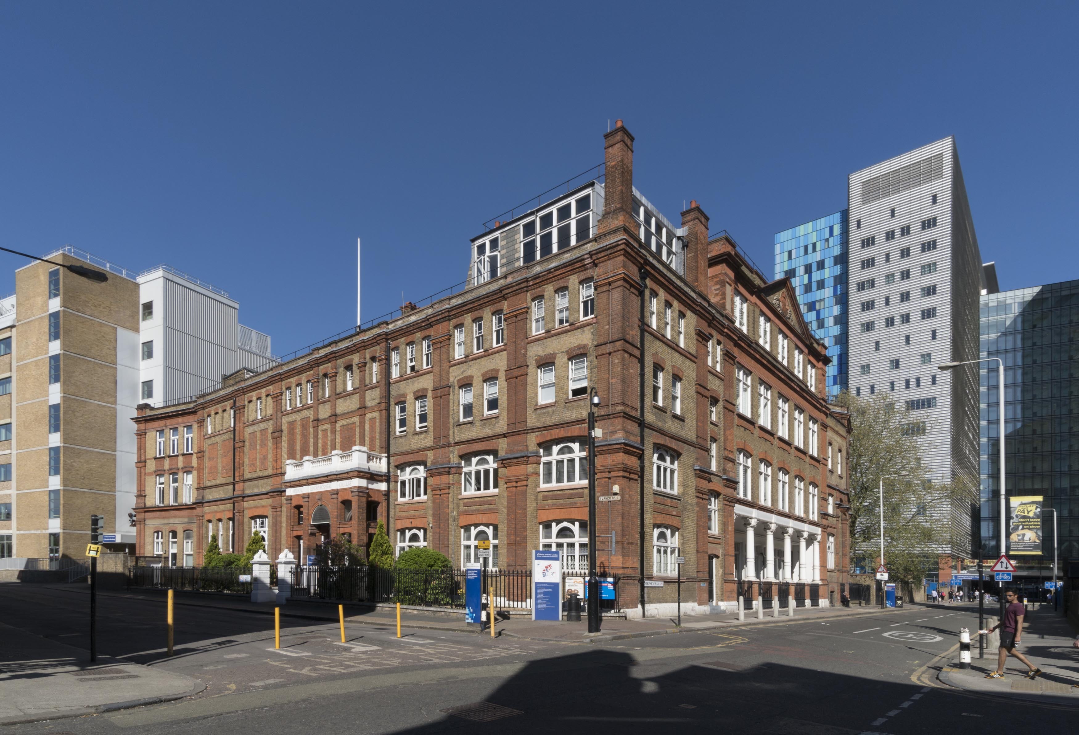
The former London Hospital Medical College, Turner Street. The hospital’s medical college has been based at its present site since 1854, yet the building has undergone successive alterations spurred by a rising volume of students and the need to modernise teaching facilities. Its principal elevation was built in 1886–7 by Rowland Plumbe, the hospital’s surveyor. Now known as the Garrod Building, it continues in educational use as part of Barts and the London School of Medicine and Dentistry. (© Derek Kendall)

(© Derek Kendall)

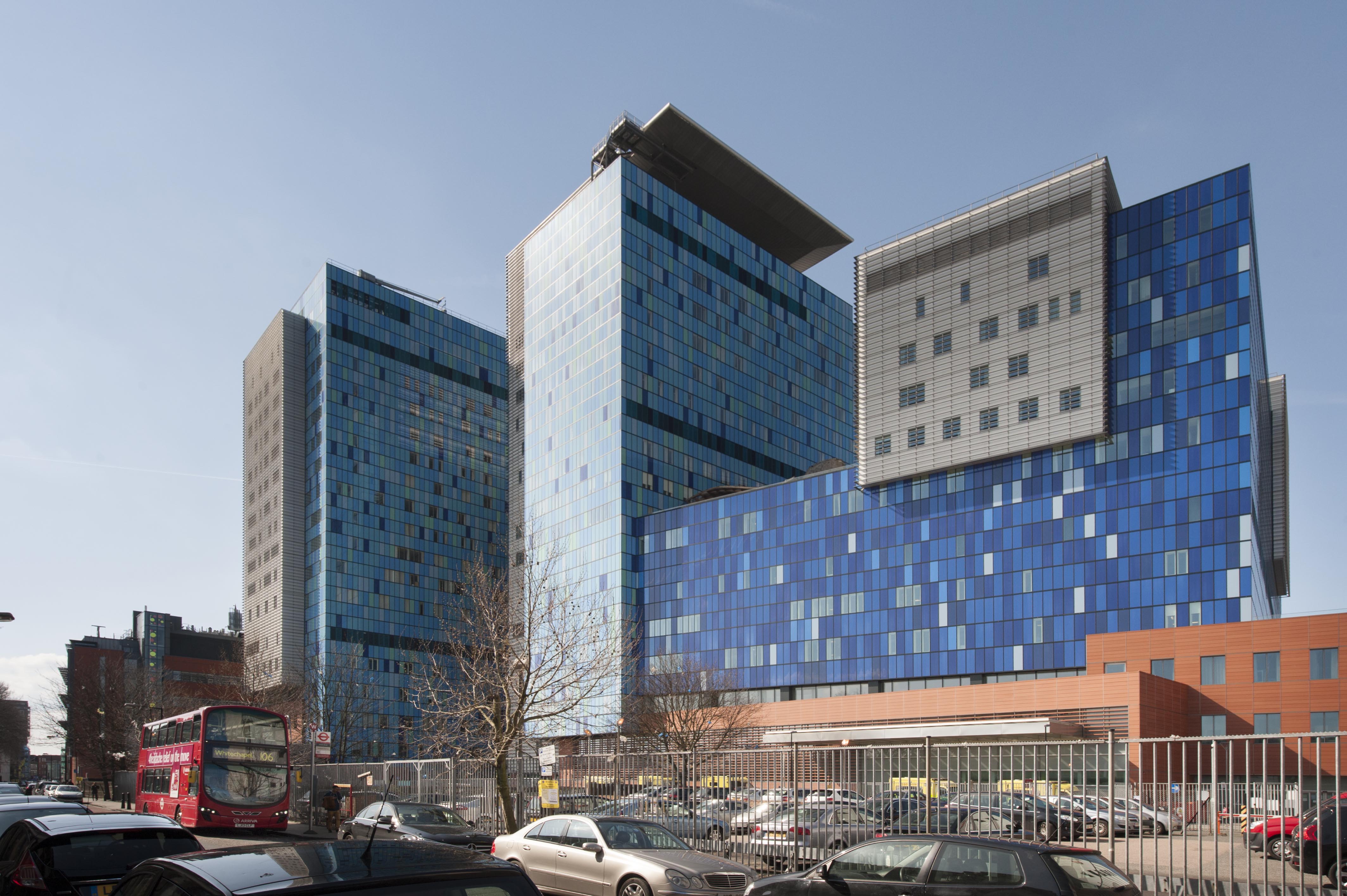
In 2012 the Royal London Hospital transferred to an assertive purpose-built block designed by HOK, located behind its historic base in Whitechapel Road. The former hospital is set to be converted into a new civic centre for Tower Hamlets Council. (© Derek Kendall)

Maersk (formerly Beagle) House

By the Survey of London, on 30 June 2017

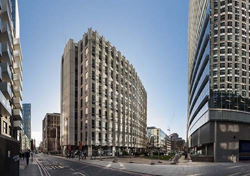
Beagle House opened in January 1974, constructed on a site long connected to the shipping and haulage industry located at the northern end of Leman Street, Whitechapel. Frustrated by difficulties in obtaining planning permission for previous designs, the architect Col. Richard Seifert had been engaged by developer Wharf Holdings to push through a successful outcome for the nine-story office block on account of his well-known fluency in the planning codes. Capitalising on London’s booming market for speculative office developments, Seifert and Partners had grown from twelve employees in 1955 to three hundred in 1969 and Colonel Seifert estimated that his practice was responsible for over 700 office blocks. He remembered of London ‘you only had to lay the first stone and the office was let. The demand was difficult to satisfy.’ [1] Yet while other Seifert buildings such as Centre Point and Space House remained controversially empty years after their opening, Beagle House’s immediate tenancy was sure. Overseas Containers Ltd (OCL) was made up of a consortium of four shipping companies, formed to take advantage of the new opportunities presented by containerisation in the mid-1960s. As the initial excitement associated with OCL’s establishment waned, the move to Beagle House was designed to endear employees to stay with the company. The Board considered that ‘provision of an optimum working environment for all levels of staff [is] the overriding objective.’ [2]

Survey of London - Whitechapel Volume Maersk House, (Formerly Beagle House,) Braham Street, Whitechapel, Tower Hamlets, London. Leman Street/Braham Park elevation, view from north east.

Maersk (formerly Beagle) House from Leman Street, looking south-west. Photographed for the Survey of London by Derek Kendall, December 2016 © Derek Kendall.

As headquarters for OCL, Beagle House was designed to accommodate 900 staff, with rooftop services concealed behind an extension of the angular faceted panels that enveloped its exterior. Some described the building’s unusual plan as lozenge shaped, others ship shaped. The project architect for Beagle House was Henry Grovners, who was also the lead architect on Corinthian House in Croydon. Despite assertions from Seifert’s staff that there was no ‘house-style’, repeated motifs such as angled pilotis, expressive facades and rhythmic concrete panelling are evident in Beagle House as well as in many of the firm’s designs from this period. Ideas and technical details were carried over from one building to the next along with engineers and other design team members.

Facade detail of Maersk (formerly Beagle) House. Photographed for the Survey of London by Derek Kendall, 2017 © Derek Kendall.

Façade detail of Maersk (formerly Beagle) House. Photographed for the Survey of London by Derek Kendall, 2017 © Derek Kendall.

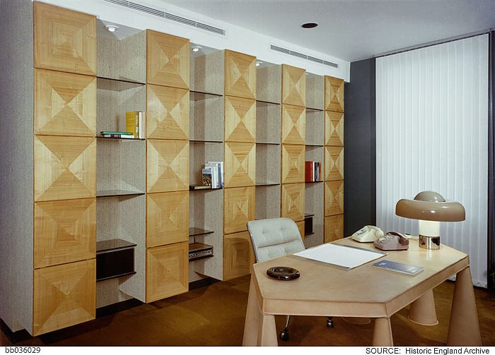
However, rather than utilise Seifert’s in-house team, OCL appointed their own interior designers, husband and wife consultancy Ward Associates. The Wards were favoured designers of passenger-ship interiors in the 1970s, proving themselves capable of considerable creativity in confined spaces. As a result of these ship interiors, Neville Ward was awarded the title of Royal Designer for Industry in 1971. The couple shared a London office with Wyndham Goodden, Professor of Textiles at the Royal College of Art, who designed the Chairman’s office at Beagle House.

Chairman's office designed by Wyndham Goodden. Photographed by Millar & Harris c. 1974 © Historic England Archive, bb036029

Chairman’s office designed by Wyndham Goodden. Photographed by Millar & Harris c.1974 © Historic England Archive

The building’s peculiar shape made provision of individual offices difficult, only a handful were designed, those clinging to the outer corners of the building. The open-plan interior was at first regarded as a six-month experiment in part, to ease anxiety from middle-level managers about the shift away from traditional layouts.

Ward Associates' design for a typical open-plan office floor. Photographed by Millar & Harris c. 1974 © Historic England, bb036033

Ward Associates’ design for a typical open-plan office floor. Photographed by Millar & Harris c.1974 © Historic England Archive

The top floor however was exclusively dedicated to upper-level management and company directors, each of whom was afforded the privileges of a separate office illuminated by plastic-domed roof lights and access to a serviced dining room reserved for their use.

Bar area for directors on the eight floor. Photographed by Millar & Harris c. 1974 © Historic England Archive, bb036022

Bar area for directors on the eight floor. Photographed by Millar & Harris c.1974 © Historic England Archive

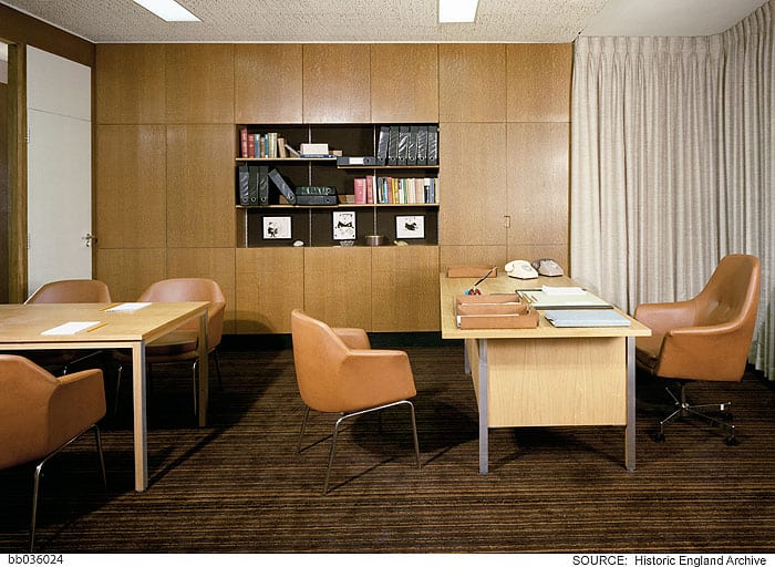
Deep storage units divided each pair of offices leaving the open-plan central space to be occupied by secretaries.

Typical director's office on the eighth floor. Photographed by Millar & Harris c. 1974 © Historic England Archive, bb036024

Typical director’s office on the eighth floor. Photographed by Millar & Harris c.1974 © Historic England Archive

Addressing the concerns of managers on the lower floors who were uneasy about the loss of visual and acoustic privacy, Ward Associates carefully fashioned smaller enclosures using screens, planting and storage cabinets.

Storage cabinets and plants defined spaces within the open-plan layouts. Photographed by Millar & Harris c. 1974 © Historic England Archive, bb036027

Storage cabinets and plants defined spaces within the open-plan layouts. Photographed by Millar & Harris c.1974 © Historic England Archive

Outside Beagle was skeletal and grey, while the interior was decorated in trendy hues of brown, orange and blue, each floor differentiated by a unique colour scheme. Floor-to-ceiling length curtains lined exterior walls and defined meeting spaces. There were coffee areas, a lounge, snack bar and the licensed subsidised canteen, while conference rooms were fitted with well-stocked bars, all intended to provide OCL workers with a palpable sense of home comfort.

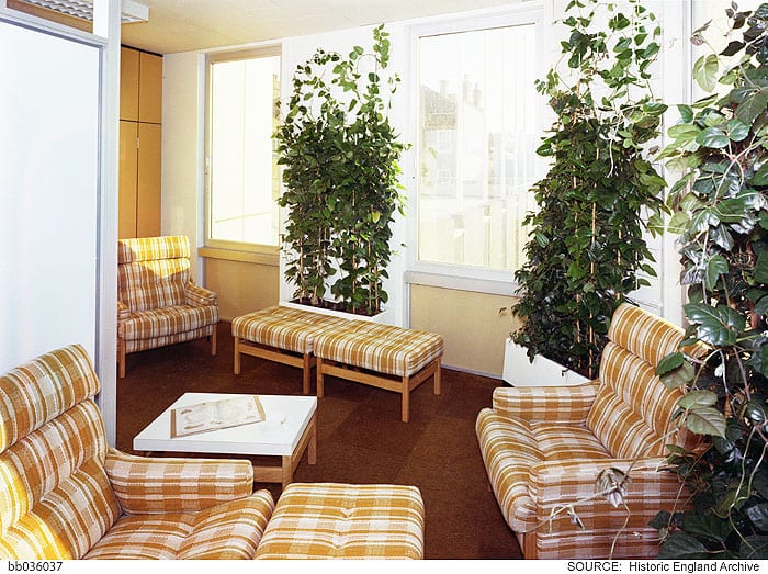
Typical communal lounge area on open-plan floors. Photographed by Millar & Harris c. 1974 © Historic England Archive, bb036037

Typical communal lounge area on open-plan floors. Photographed by Millar & Harris c.1974 © Historic England Archive

As computers and machines increasingly invaded the office environment, the interior-design press claimed that the general introduction of plants to interiors compensated for ‘the ever increasing emergence of soulless concrete edifices all too common today.’ They noted that ‘where a plant will survive so an office-worker’. The entrance hall was graced with a wall-mounted model ship and an interior fish pond. [3]

At this time interior designers were increasingly engaged in office designs that prioritised the comfort of workers and new mechanisms for climate control also worked to humanise working environments. Reflecting the forward-looking spirit of OCL, the new Beagle House claimed its own technological innovations in this respect. Writing in 1975, Interior Design regarded it as ‘London’s first privately developed Integrated Environmental Design (IED) office building…without a doubt, one of the most advanced buildings in the country’. [4] Suspended ceilings throughout Beagle House provided air-conditioning to all spaces powered by a roof-top plant. A resident engineer, responsible for the system’s ongoing maintenance, was allocated a first-floor flat in the building.

Following a number of corporate take-overs, Beagle House was renamed Maersk House in 2005. Standing aloof on pedestrianised Braham Street (since 2012 known as Braham Park), Seifert’s building faces imminent demolition in March 2017. ‘One Braham’, a glassy eighteen-storey office block with commercial units to the ground floor, was scheduled for completion in 2018 but Brexit has reportedly caused American developers, Starwood, to re-assess their involvement in the scheme, leaving Maersk House to languish in uncertainty.

If you would like to read more about the history of this site, or submit a personal memory of Maersk House, please access the Survey of London, Whitechapel, found here.

[1] BL, National Life Stories Collection: Architects’ Lives, Richard Seifert, 1996

[2] Caird Library and Archive, PON/1/3/10

[3] Interior Design, Jan 1975, p. 33, p. 36

[4] Ibid.


Gwynne House, Turner Street

By the Survey of London, on 9 June 2017

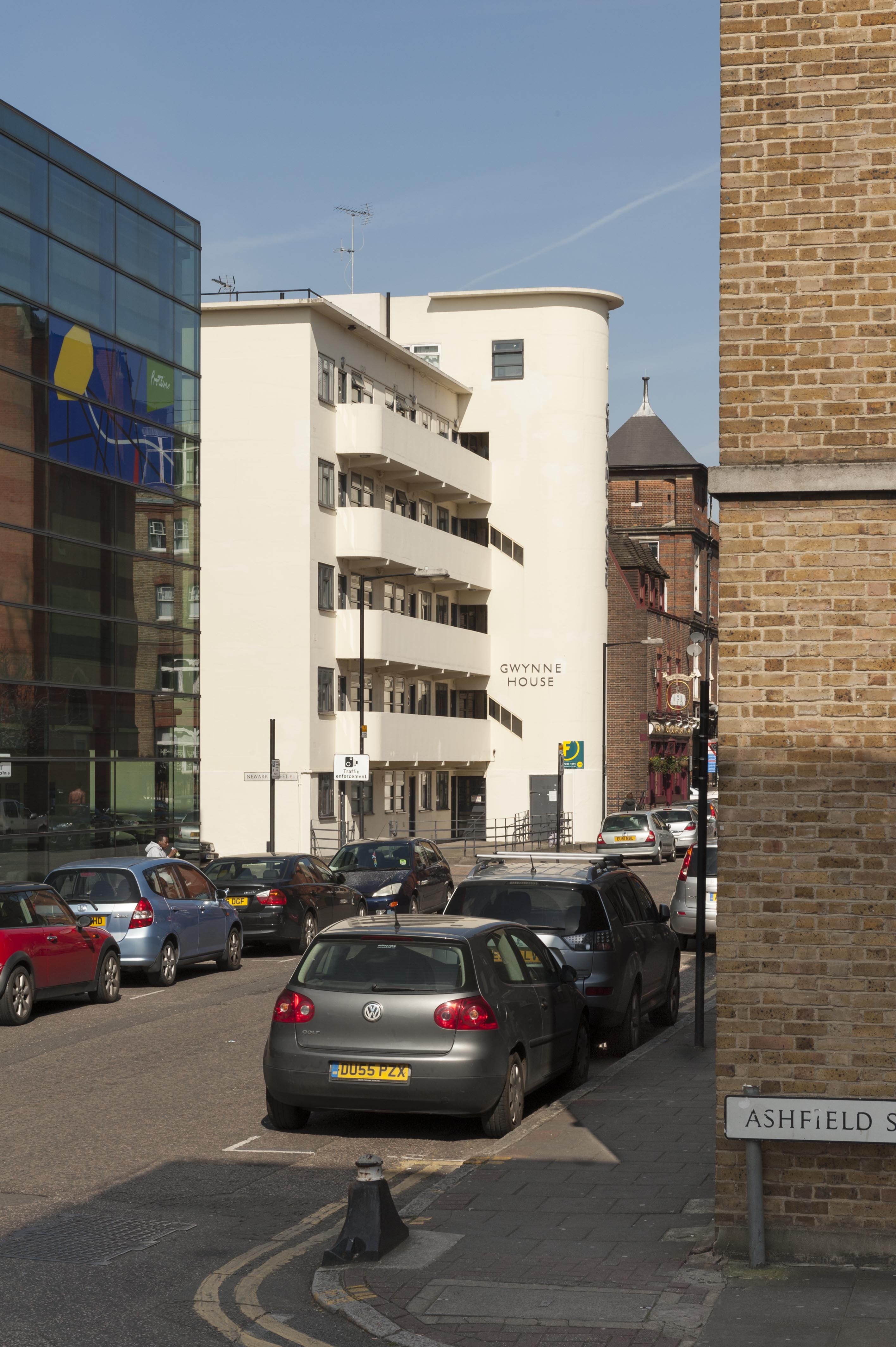
Gwynne House stands at the north-west corner of the Turner Street and Newark Street crossing in bold contrast to its contemporary neo-Georgian neighbour, the Good Samaritan public house. This block of flats was built in 1937–8 to designs by H. Victor Kerr, the architect of a number of interwar buildings in east London, including Commerce and Industry House in Middlesex Street (demolished), 67–75 and 101 New Road, 9–17 Turner Street and 47 Turner Street (demolished). While there is no known professional association between Kerr and the London Hospital, his designs repeatedly found favour on its Whitechapel estate. Kerr practised as an architect during the interlude in his military career between the world wars, in which he ascended to the rank of Major (Hon. Lt. Col.). Of his surviving works in Whitechapel, Gwynne House is the most assertive expression of the Modernist style. This five-storey block has a sleek white-painted façade with a curved staircase tower and a rhythmic succession of slender balconies with rounded edges. Gwynne House bears a resemblance to Wells Coates’s Isokon Building, which set a precedent in style, configuration, and the provision of ‘minimum’ flats intended for professionals.

Gwynne House and the Good Samaritan Public House from the north-east in 2016. © Derek Kendall

Gwynne House and the Good Samaritan Public House from the north-east in 2016. Gwynne House was built in 1937–8 to designs by H. Victor Kerr. © Derek Kendall

Gwynne House replaced five early nineteenth-century terraced houses at 75–83 Turner Street and 23a Newark Street on the London Hospital Estate. By the 1930s this piece of ground had been earmarked for future hospital expansion. Despite initial reluctance to part with the site, the hospital agreed an 80-year lease with Lloyd Rakusen & Co. of Leeds in 1935. After their plans to build a biscuit factory were rejected by the LCC, Rakusen & Co.’s interest in the lease was transferred to a developer for a block of flats. Construction was by Moore & Wood, working as general contractors in association with specialized subcontractors. The reinforced concrete frame was enveloped by smooth external walls filled with cork insulation, and capped with a flat timber roof coated with asphalt. At its completion in 1938, Gwynne House provided twenty modern flats that were designed to attract ‘students, social workers and professional people in east London’. An additional rooftop flat was allocated to a caretaker. Each floor was divided into four small flats built to a standardised rectangular plan with a hallway, two bedrooms, a living room, a kitchenette and a bathroom. The elegant ‘tower feature’ encased an electric lift and a staircase, lit and ventilated by angular slits in the exterior wall. It also concealed a rubbish chute, a telephone kiosk, a switch room, and service ducts that communicated with a basement boiler room. [1]

Gwynne House from the south-east. © Derek Kendall

Gwynne House from the south-east in 2016. © Derek Kendall

Gwynne House was quickly identified by the hospital as a convenient base for medical practitioners, nurses and students, though rents were judged to be ‘somewhat high’. [2] One of its first tenants was a young (Sir) John Ellis, who was later appointed physician to the London Hospital and Dean of the Medical College. Other prominent residents included Edith Ramsay MBE, a local social campaigner, and the nurse educationalist Dr Sheila Collins OBE. By the 1980s Gwynne House had been acquired for the hospital as rented accommodation for staff from all departments. Barts and the London Charity sold the block to a private developer in 2011. The exterior has seen minimal alterations, aside from the replacement of the original Crittall windows and the recent insertion of jaunty porthole doors. The original metal fence at the front of the block survives, characterised by sinuous lines echoing the projection of the tower. A narrow rear garden shelters a sycamore tree, a lime tree, and an ‘ancient’ mulberry tree. [3]

Survey of London - Whitechapel Volume Gwynne House, Turner Street, view from south east.

Gwynne House in 2016. © Derek Kendall

Do you have any memories of Gwynne House? The Survey of London has launched a collaborative website titled ‘Histories of Whitechapel’ and welcomes contributions. Please visit at https://surveyoflondon.org.

References 

  1. The Builder (19 May 1939), p. 948.
  2. Royal London Hospital Archives (RLHA), RLHLH/A/5/64, p. 209.
  3. The Gentle Author, ‘The Whitechapel Mulberry’, Spitalfields Life, 30 March 2015 (online: http://spitalfieldslife.com/2015/04/30/the-whitechapel-mulberry).

The Grocers’ Company’s Wing of the former Royal London Hospital

By the Survey of London, on 3 February 2017

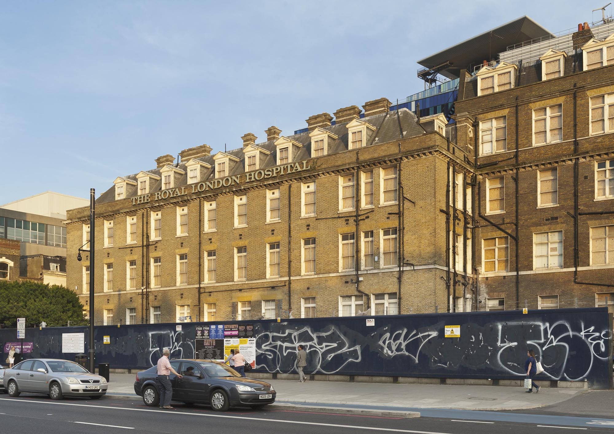
The long former Royal London Hospital complex on the south side of Whitechapel Road has its origins in the hospital built in 1752–78 to designs by Boulton Mainwaring. Its eastern section was constructed in 1873–6 as part of the Grocers’ Company’s Wing, built at the same time as a Post Mortem Department and Nurses Home. Their completion secured the hospital’s status as the largest general hospital in the country, with almost 800 beds. The only remnant of this building programme is the north range of the Grocers’ Company’s Wing, which presents an orderly 120ft frontage to Whitechapel Road terminating at its junction with East Mount Street. Two bays of the south part of the wing survive; the rest was cleared in the 1960s for the construction of the Holland Wing (demolished).

At the time of writing, the north range of the Grocers’ Company Wing lies empty as the former hospital awaits conversion into a civic centre for Tower Hamlets Council. Despite 140-years of hospital use, the surviving portion of the Grocers’ Company’s Wing retains its back-to-back ‘Nightingale’ wards and neat brick frontage overlooking Whitechapel Road.

Survey of London - Whitechapel Volume The Royal London Hospital, Whitechapel Road, Whitechapel, Tower Hamlets, London. Central entrance block View from north west.

The main front of the Royal London Hospital in Whitechapel Road, with the Grocers’ Company’s Wing in the background. Photographed by Derek Kendall in 2016

This significant wing extension was catalysed by rising numbers of inpatients. Despite the completion of the Alexandra Wing in 1866, the hospital struggled to keep pace with demand for beds. In 1870 the House Governor, William Nixon, recorded an ‘extreme pressure of inpatients’, averaging at over 500 at any one time. Despite the opening of quarantine wards in the old medical college, the hospital failed to secure a long-term solution to overcrowding. A few years later, Nixon reported an alarming ‘state of repletion’ in the wards. He declared that the hospital was ‘not large enough’ to fulfil the demands of the surrounding district, despite its strict policy of admitting only urgent cases. [1]

The proposed solution was to extend the hospital to provide 200 additional beds. A public fundraising campaign was launched with the aim of securing £100,000 towards new buildings and the operating costs of an enlarged hospital. A new wing extending east from the front block was deemed preferable to ensure the proximity of new wards to the ‘working centres’ of the hospital, namely the lifts, the staff offices, the laundry, the kitchen, the operating theatre, and the depository. The intended site was occupied by the old medical college and a carriage shed fronting Whitechapel Road, along with various workshops, sheds and stables in East Mount Street.

Survey of London - Whitechapel Volume The Royal London Hospital, Whitechapel Road, Whitechapel, Tower Hamlets, London. East block, View from north west.

The Grocers’ Company’s Wing from the north-west. Photographed by Derek Kendall in 2016

The centrepiece of this wave of hospital expansion was the Grocers’ Company’s Wing, named in recognition of a donation from the City livery company. Their ‘princely gift’ was accompanied by numerous conditions, including that the proposed wing should be completed within three years. Whilst the House Committee had intended to postpone work on the new east wing until the fundraising campaign had realised its target, the Company stipulated that construction should begin immediately.

As the projected cost of the wing exceeded £25,000, it was reasoned that sole responsibility for its design should be entrusted to Charles Barry, Consulting Architect to the hospital. He planned an L-plan three-storey wing with basement and attics, composed of two blocks; a north range extending east from the front block in line with Whitechapel Road, and a south range running along East Mount Street. This arrangement preserved a yard between the extension and the main building, with the benefit of supplying light and ventilation to the inward-facing wards. The plan of the principal floors of each block followed the pattern of the earlier ward wings, comprising paired back-to-back wards separated by a central spine wall with fireplaces. On each floor, the north range was accessed from its south-west corner via lobbies connected with the long corridors of the front block. Partitions at the west end of the wards formed linen stores and areas for water closets, kitchens and sinks. The attics provided dormitories for seventy nurses.

Survey of London - Whitechapel Volume East block, The Royal London Hospital, Whitechapel Road, Whitechapel, Tower Hamlets, London. View from north.

The Grocers’ Company’s Wing from the north side of Whitechapel Road. Photographed by Derek Kendall in 2016

A foundation stone was laid on 27 June 1874. Construction by Perry & Co. was complicated by the intended route of the East London Railway, set to curve beneath the north-east corner of the new wing. As a precautionary measure, the foundations nearest the railway line were excavated to a depth of thirty-five feet and filled with concrete. The outward appearance of the new wing matched the austerity of the Alexandra Wing, with plain brick elevations decorated by a string course and a dentil cornice of Portland stone. The tiled roof was punctuated by pedimented dormer windows that admitted light into the attic dormitories, and tall brick chimneys with oversailing tops and stone string courses. Two rear towers rose above the roofline of the wing, displaying louvered openings and steeply pitched roofs; one contained a water tank and the other was fitted with a ventilation shaft. There were fireproof floors. At street level, a wooden carriage shed built in 1876 occupied the narrow stretch between the north front of the new wing and Whitechapel Road.

The Grocers’ Company’s Wing was formally opened by Queen Victoria in March 1876, in a grand celebration reported to have lent ‘an attractive and joyous aspect to (an) ordinarily dull and dingy but busy quarter’. [2] In the following months, patients were gradually moved into the new wards, which were praised for their ‘light and pleasant aspect’. [3] The wards were fitted with specialised ventilation systems devised by T. Elsey and George Jennings. Two rows of evenly spaced beds extended across the long walls of each ward, facing inwards. This utilitarian arrangement was relieved by potted flowers and pictures on the walls amongst formal plaques bearing the name of each ward. At the time of writing (January 2017), the appearance and plan of the north range of the Grocers’ Company’s Wing had survived with only minor alterations, despite changes in room use. By the 1930s an operating theatre was located on the north side of the ground floor, lit by a large bay window overlooking Whitechapel Road. On the ground floor of the south range, wards were converted into isolation rooms. The X-Ray Department was housed in the basement of the north range and later extended to accommodate a suite of rooms, including several X-Ray rooms, dark rooms, a film store and offices. The building closed in 2012, when the hospital moved into its new premises.

References

[1] Royal London Hospital Archives & Museum (RLHA), RLHLH/A/5/35, pp. 58, 86, 110–1, 123, 208, 425, 439.

[2] ‘London: Saturday, March 11, 1876’, Illustrated London News, Issue 1911, p. 242.

[3] ‘The Queen’s Visit to Whitechapel, Reynolds’s Newspaper, Sunday 12 March 1876.

East London Mail Centre and E1 Delivery Office, 180–206 Whitechapel Road

By the Survey of London, on 11 November 2016

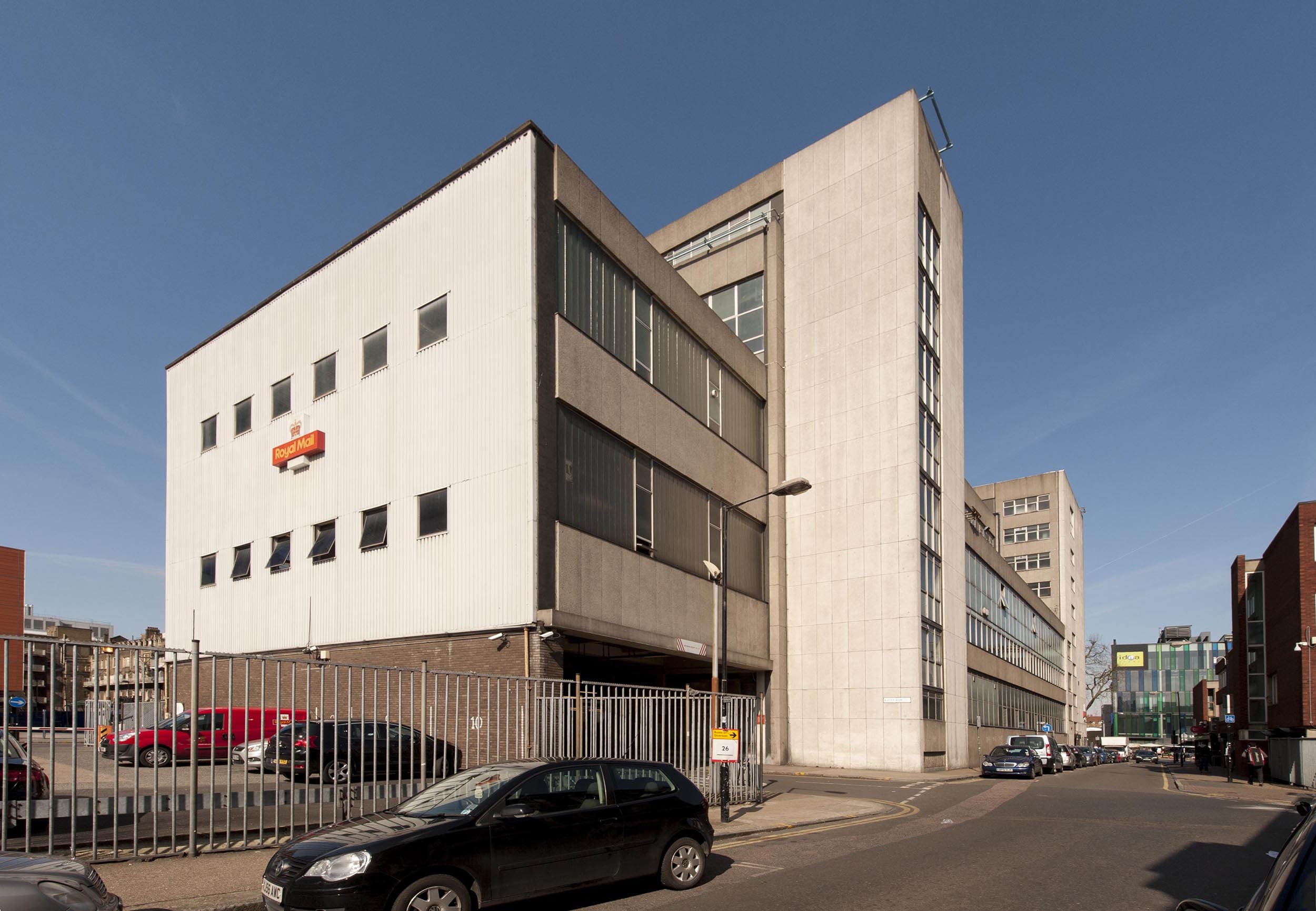
The large concrete building which dominates the corner of Whitechapel Road and Cavell Street represents the last expression of postal activity on an extensive site which was once the centre of the Post Office’s operations in the East End. Before its closure in 2012, the East London Mail Centre (formerly known as the Eastern District Post Office) processed mail for the entire ‘E’ postal district, an area covering over 50 square miles from Chingford to Poplar, and was the eastern terminus of the Post Office Railway. During its 130-year association with the Post Office, the site has seen successive building projects prompted by rising workloads, technological developments and changing patterns of consumption.

Survey of London - Whitechapel Volume East London Mail Centre, Cavell Street. View from south east.

East London Mail Centre, view from Cavell Street in 2016 (© Survey of London, Derek Kendall).

By the 1880s the Eastern District Office had outgrown its premises in Commercial Road and sought land for a chief office with room for expansion. It purchased a piece of former waste ground near the London Hospital, occupied by a paper-stainer’s shop and two cottages. With a 50ft frontage extending south from Whitechapel Road to Raven Row, the site was generous in size and its situation ideal. A new post office was built to designs by Henry Tanner of the Office of Works. It comprised a three-storey red-brick range with a public office fronting Whitechapel Road, and a single-storey sorting office at the rear. The main elevation of the public office was grand in character, with a central pedimented gable and round-arched windows on the third floor. In contrast, the sorting office presented a robust brick elevation to Cavell Street, with a plain staff entrance and large recessed windows.

Rapid growth in demand for postal services sparked plans to extend the building to relieve ‘cramped’ working conditions. By 1899 the number of letters processed at the Eastern District Office had increased twofold. Ground to the west of the building was acquired and a significant extension built to designs by Jasper Wager of the Office of Works, which nearly doubled the floor area. Further alterations followed with the construction of the Post Office Railway, or ‘Mail Rail’, to plans by William Slingo, engineer to the General Post Office, and Harley H. Dalrymple-Hay, consulting engineer. The underground electric railway was conceived in 1911 as a solution to the strain on London’s postal services caused by traffic congestion and a soaring volume of letters and parcels. It opened in 1927 to connect all of the capital’s major post offices, with its eastern terminus at Whitechapel. The line approached from Liverpool Street, following the route of Whitechapel Road before curving southwards to meet the station platform and terminating in a loop to the south of Raven Row. Although the railway was closed in 2003, the infrastructure survives and has attracted proposals for reuse.

Map of the Post Office Railway in 1937 (British Postal Museum and Archive catalogue)

IMG_6274

East London Mail Centre, north elevation overlooking Whitechapel Road.

The introduction of mechanised postal sorting equipment in the 1930s led to new requirements for sorting offices and Whitechapel Road’s was probably considered unsuitable for modernisation. A scheme for redevelopment of the site seems to have been in place by 1956, when plans indicate that the adaptation of the former clothing factory on the east side of Cavell Street for post-office use was considered, most likely as an interim measure. The acquisition of Nos 180–188 Whitechapel Road and the adjacent builder’s works provided a substantial site with a frontage of over 200ft.

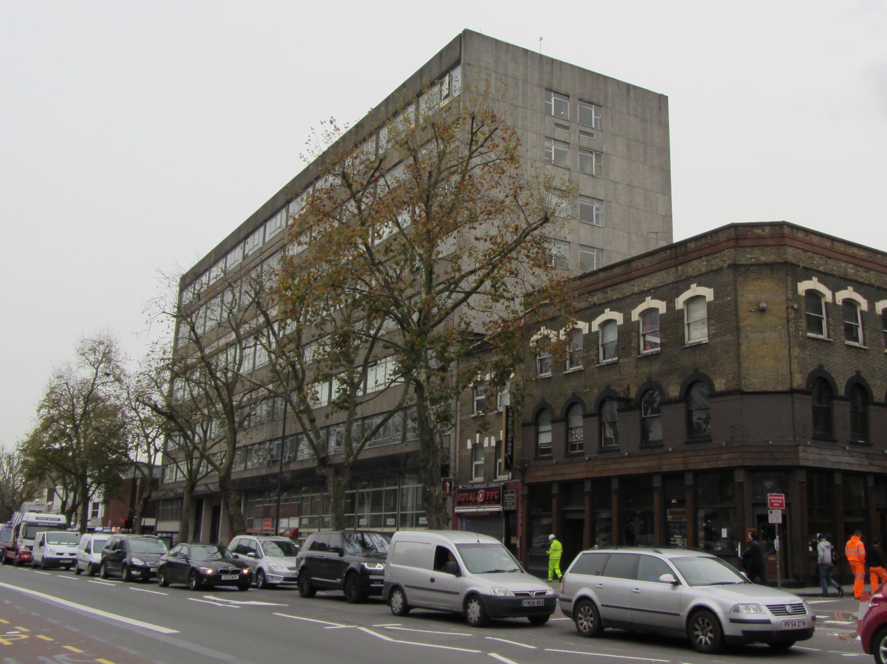
The earlier buildings were demolished and the present Modernist building constructed in two phases by 1970. The first phase comprised the eight-storey west block, which housed a ground-floor public post office with administrative offices above. It was followed by the adjoining four-storey sorting office, which extends along Cavell Street to Raven Row. The drab utilitarian exterior was the product of a short-lived initiative to standardise the design of post office buildings, in a new house style showcased in a 1960s exhibition produced by the architects’ department of the Ministry of Public Building and Works, headed by Eric Bedford. The main elevation facing Whitechapel Road is divided into eleven bays clad with prefabricated-concrete panels and horizontal bands of glazing. The structural frame of the building is exposed on the ground floor by four concrete columns flanking the van entrance to the sorting office. The widely publicised ‘modular system’ was contrived as a ‘common approach’ to building design to make post offices ‘instantly recognisable in any setting’.

Photograph of a model of the Eastern District Office (BPMA catalogue)

ghfhfghf

Van entrance to the former sorting office, flanked by open concrete shafts.

The interior of the sorting office was laid out for a mechanised workflow, which processed four million items each week. The ground floor functioned as a loading yard, with large entrances for postal vans opening onto Whitechapel Road and Raven Row. A warren of chutes and conveyors enabled the flow of letters, parcels and mail bags between stages in the sorting process. A chain conveyor brought inward mail bags from the yard to the sorting floors, to be processed by specialised machinery. The first, second and third floors of the sorting office comprised open-plan rooms with continuous steel-framed windows on each exterior wall to maximise light provision. Offices for inspectors were formed from light partitions. The Eastern District relied on over 2,000 postal staff working through the day and night, and a lounge, games room and bar were provided on the fourth floor.

Isometric plan of the basement, ground floor, first floor and mezzanine (BPMA catalogue)

Isometric plan of the second, third and fourth floors (BPMA catalogue)

The East London Mail Centre did not survive plans announced in 2000 to modernise London’s sorting system and, at the time of writing (2016), its former offices are occupied by tenants and only a modest delivery desk continues to operate. As the site has been earmarked for redevelopment by Tower Hamlets Council, the building is likely to be demolished.

The Survey of London has launched a participative website titled ‘Histories of Whitechapel’. Please visit at https://surveyoflondon.org.

White Church Lane, Whitechapel

By the Survey of London, on 21 October 2016

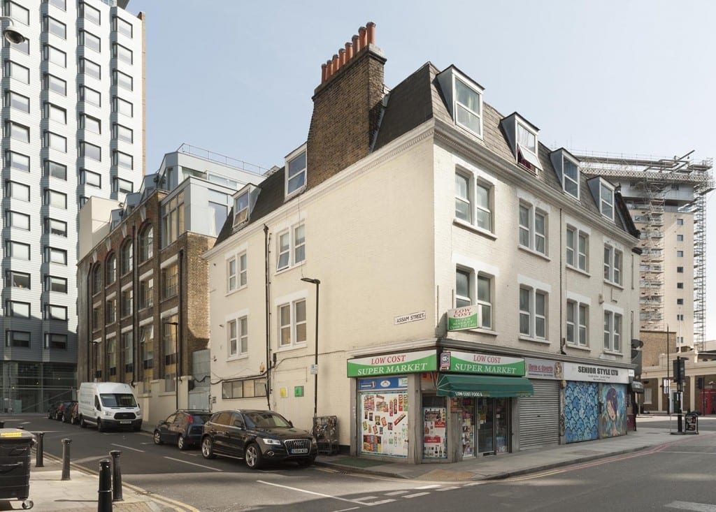
White Church Lane is a last redoubt of Whitechapel’s rag trade, still (or until very recently – it’s hard to be up-to-the-minute) sporting shopfronts pertaining to manufacturers and wholesalers: Tip Top Casual Wear, K. K. Hosiery Ltd, Raw Blue Ltd, N.E.W.S. Urban, Mekyle (Bayfield Trading Ltd), Denim World, Alish (wholesale jewellery and accessories), HIP HOP Collections (wholesalers of American street wear), Senior Style Ltd, Abraham Posh Lady London. There is also an efflorescence of street art, work from 2012 facilitated by Global Street Art’s negotiations with property owners.

The road’s origins are as the north end of Church Lane, the only north-south route through the parish, in existence by the seventeenth century to link Well Close to Whitechapel High Street. The northern stretch may not have been much built up until the 1660s and back building suggests density and low status – Church Rents or Maidenhead Court (later Dyer’s Yard), and Hatchet Alley (later Spectacle Alley, now Whitechurch Passage) which had Adam and Eve Court on its south side, and there was Back Yard off the lane’s west side. All this had gone by 1800. Eighteenth-century property holders included Joel Johnson, the carpenter and architect who worked on local churches and the London Hospital. There was a sugar house near the north end and the Fir Tree public house was at the south end of the east side, adjacent to a site taken in the 1840s for John Furze’s St George’s Brewery (subsequently Johnny Walker’s St George’s Bond, now Hult International Business School). The north end of Church Lane’s east side was redeveloped in the early 1850s and the south end was obliterated by extension of the Commercial Road in 1869–70. Redevelopment since has been piecemeal, with a central section of the east side replaced in 2000-2 by the Naylor West flats, designed by Michael Squire and Partners for Ballymore Properties. That block’s artless greyness was a herald of cleansing, and sites at the street’s south end on both sides are now destined to host tower-block flats.

Survey of London - Whitechapel Volume 4-8 White Church Lane, Whitechapel. View from west. 4-8 White Church Lane, buildings of the 1850s with street art of 2012 (© Derek Kendall).

4-8 White Church Lane, buildings of the 1850s with painted shutters of 2012 (© Derek Kendall, 2016).

The north end of the street’s east side is anchored by what was St Mary’s Clergy House, now a Japanese restaurant, a building of 1894–5, Herbert O. Ellis, architect, that was an adjunct to the parish church that stood on the site of Altab Ali Park (see blog post of 15 April 2016). Next door, No. 4 of 1852–3 was built to be a sale room for Isaac Bird, auctioneer. Hunto has painted its shutter. A workshop behind an entrance passage at No. 4A was built in 1899–1900 for William Nay, a mirror manufacturer, and converted to be a necktie factory in the 1920s. The front-door shutter has a figure by Tizer. Next door at No. 6 the shutter art is by 2Rise, whose tag has also been prominent on the south side of Whitechurch Passage. Nos 8 and 10 were built in 1852 by Jabez Single of New Road, houses with shops first occupied by Mark Berry, a zinc and tinplate worker, and James Fullerton Barber, a printer. Alterations and extensions to the rear were made for a bedding factory that was later a silk-screen and joiners’ workshop. Dining rooms at No. 12, run by Alfonso Pappalardo in the 1930s, were held from the early 1940s to the early 1950s by Narian Singh for one of the area’s first Asian-run restaurants. At the time Bonn & Co Ltd had a large biscuit warehouse behind Nos 16–32.
 

P1180491 adjusted

Kirstein Mansions, 34-40 White Church Lane, shops, tenements and workrooms of 1911 built for Solomon Kirstein (© Derek Kendall).
Solomon Kirstein’s letterhead, showing 29 Commercial Road (Tower Hamlets Local History Library and Archives, Building Control file 41978) and Kirstein Mansions, 34-40 White Church Lane, shops, tenements and workrooms of 1911 built for Solomon Kirstein (© Derek Kendall, 2016).

A house and shop at No. 34 were the premises of Henry Bear, a tobacco manufacturer here from the 1840s to the 1880s. He acquired the freehold of the buildings on the sites of Nos 34–40 and an empty site at 29–31A Commercial Road and in 1901 a lease was transferred to Solomon Kirstein, a printer based at No. 38. By 1902 Kirstein had built three three-storey houses or workrooms with shops at Nos 29–31A, with Herbert O. Ellis as his architect. Kirstein took the shop at No. 29, living above with his wife, three children and a servant. It was not until 1911 that Kirstein redeveloped his Church Lane frontage as Kirstein Mansions, shops, tenements and upper-storey workrooms, this time with John Hamilton & Son, architects. Around 1970 David Abraham began selling knitwear at No. 34. In 2015 the David Abraham Partnership put forward a redevelopment scheme for the whole site proposing a seventeen-storey tower designed by Stock Woolstencroft.

Survey of London - Whitechapel Volume 3 White Church Lane, with embellishments of 2012 (© Derek Kendall).

3 White Church Lane, with embellishments of 2012 (© Derek Kendall, 2016).

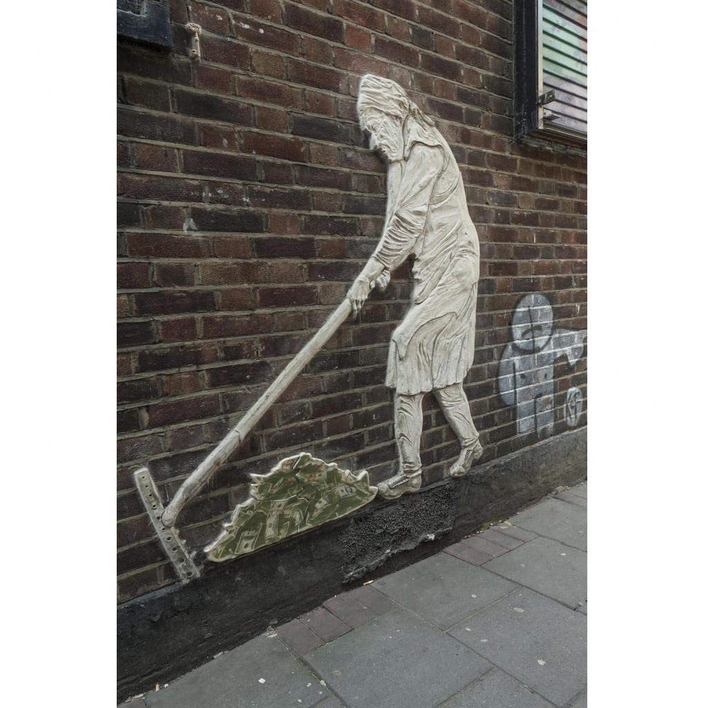
On White Church Lane’s west side a small bomb-damage replacement building of c.1960 at No. 3 was decorated in 2012. The entrance-door shutter has wings by Probs, and the south return to Whitechurch Passage a head by Hunto and ‘The Lady’, a low-relief ceramic by ChinaGirl Tile.

Survey of London - Whitechapel Volume Whitechurch Passage, Whitechapel. Wall art of old woman raking up money, by artist "China Girl."

‘The Lady’, by ChinaGirl Tile (© Derek Kendall, 2016). 

Further south, first-floor blind arcading in a little-altered stock brick front at No. 17 was built around 1840 for Charles Marshall, a veterinary surgeon who probably dealt largely with horses. The shop is infill of what was an open carriageway into the twentieth century. Stables to the rear were rebuilt for Marshall’s successors. Around 1880 Simon Cohen, a pastry cook based at No. 32 across the road, established a refuge for homeless immigrant Jews in a house at No. 19. Named the Poor Jews’ Temporary Shelter, its  closure as insanitary in 1885 led to fundraising that permitted the establishment of better premises on Leman Street. Other properties continued to be used as ad hoc refuges or lodging houses. In late 1885 a Shelter employee took five immigrants from Brest-Litovsk to 11 Church Lane, then occupied by Paul Meczyk, a printer, only for them to be turned out on to the street. By 1891, in which year he fell out with the Shelter Committee, Cohen had converted the house at No. 19 to be a ‘Beth Hamedresh’ (Study Circle and Synagogue). He acted as his own builder and carried out further works in 1895–6. But this did not last. In 1898–9 Jacob King redeveloped the site with 9 Manningtree (formerly Colchester) Street; Arthur C. Payne was his architect. On the corner (No. 21) there was a Horse and Groom pub by 1760. The two-storey pub that had been run by Henry Levy was rebuilt for King in 1902 to designs by Ralph J. Miller, architect. It was a Truman, Hanbury & Buxton pub by 1910.

Survey of London - Whitechapel Volume 29 Commercial Road at junction with White Church Lane, Whitechapel. View from east.

19-37 White Church Lane and 27 Commercial Road, demolished 2016 (© Derek Kendall, 2016). 

Fishel K. Abrahamson converted a house at No. 29 to be a synagogue in 1895–6, and nineteenth-century houses at Nos 35–37 were part rebuilt and perhaps refronted in 1915. The four-storey corner warehouse that was 27 Commercial Road had been built in 1872–3 and more warehousing went up to its west in 1876–8 at No. 27A which accommodated Hyam Goldstein’s cap factory, then Aaram Bagel’s boot factory, Burstein Isaac & Co.’s cigarette factory, and tea packing. Nos 29–33 Church Lane and 27A Commercial Road were redeveloped in 1936–7, with George Coles as architect for M. Freedman, a gown manufacturer. Coles is best known as a cinema architect, and there was a faint echo of his Art Deco skills in the façade fenestration of the factory and showroom block. Shutter painting of 2012 here was by Malarky, Chase and Billy. A scheme for redevelopment of Nos 29–37 and 27–27A Commercial Road was prepared in 2012, approved in 2014 and refined in 2016 prior to clearance of the whole site, now complete. Plans initiated by Reef Estates Aldgate Ltd propose a 270-bedroom hotel in a 21-storey tower to be operated by Motel One, a German firm. The architects are Stock Woolstencroft.

The Survey of London has launched a participative website titled ‘Histories of Whitechapel’. Please visit at https://surveyoflondon.org.

Histories of Whitechapel

By the Survey of London, on 30 September 2016

The Survey of London has launched a participative website titled ‘Histories of Whitechapel’. Please visit at https://surveyoflondon.org.
We are inviting anyone with an interest in or experiences of Whitechapel’s rich history to contribute anything from research to memories, sketches to film clips. Visitors can explore an interactive map of the area and click on any building to discover or contribute more. The website will be active and evolving until the end of 2018 and will include the Survey’s own work in progress. It will continue in static form thereafter and the reservoir of material on Whitechapel will be edited to make volume 54 in the Survey’s main series of books.
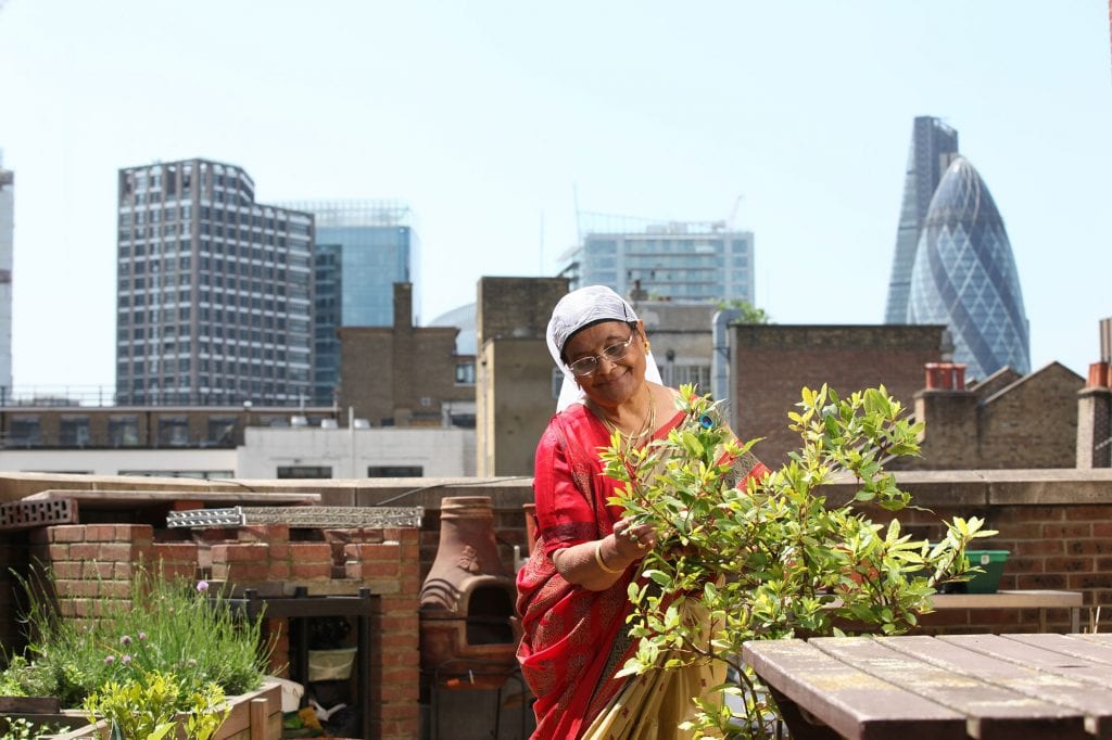
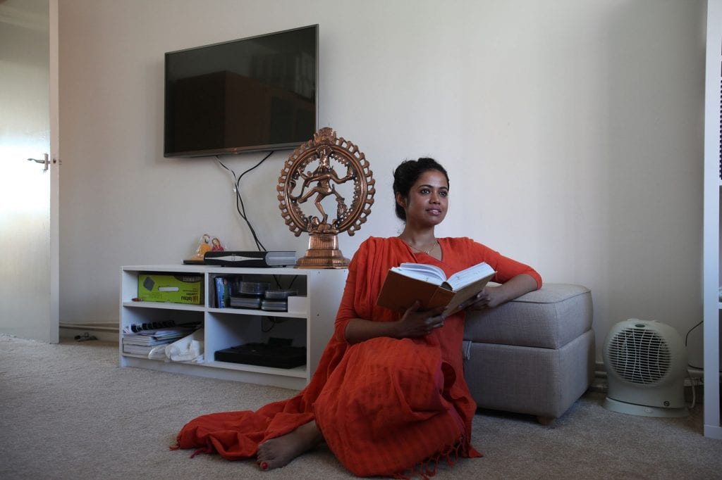
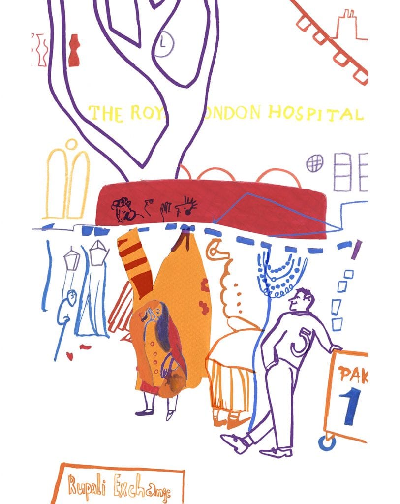
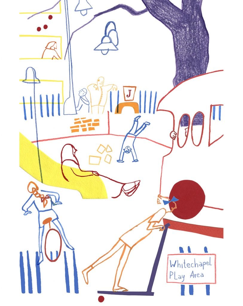
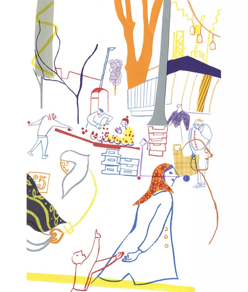
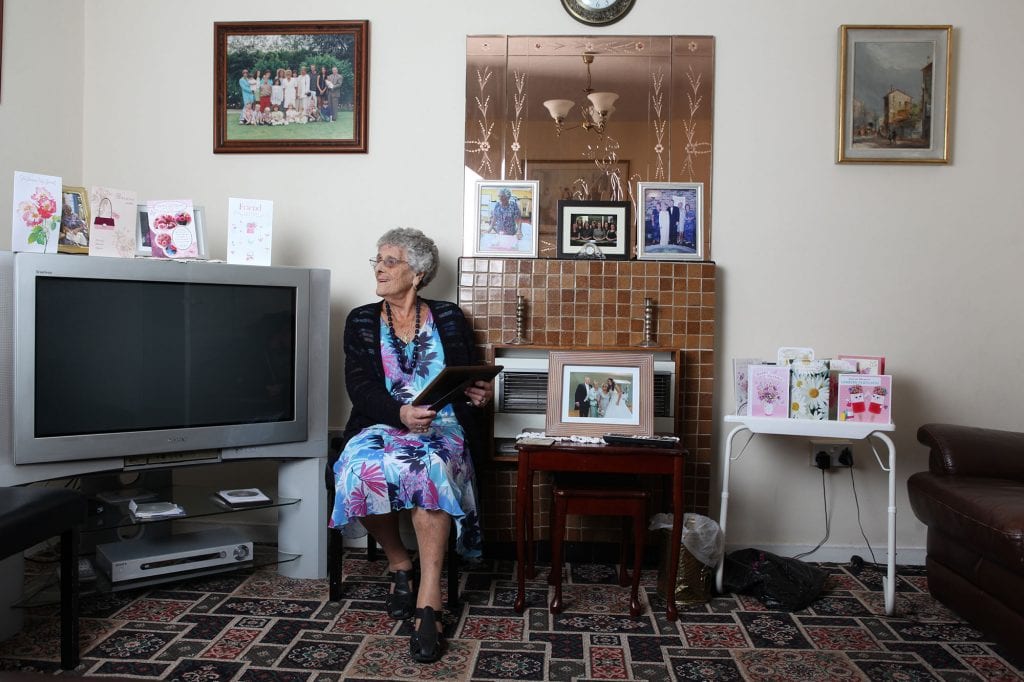
To help to get the website off to a lively start we commissioned some illustrations of kinds not heretofore typical of the Survey of London, to evoke aspects of the character of Whitechapel. Judit Ferencz has given us some delightful illustrations based on observed outdoor life and Rehan Jamil has photographed some local domestic interiors to depict ordinary people in their homes.
We hope you enjoy their work. Please do have a look at the website. New contributions will be very welcome.

altabali2_w

Altab Ali Park, illustrated by Judit Ferencz. Please click here to view Altab Ali Park on the ‘Histories of Whitechapel’ website.

IMG_1103-for-web

Rehan Jamil, photographer.

Altabali1_w

Altab Ali Park, illustrated by Judit Ferencz.

IMG_7270-for-web

Rehan Jamil, photographer.

Market2_w

Whitechapel Market, illustrated by Judit Ferencz. Please click here to view Whitechapel Market on the ‘Histories of Whitechapel’ website; new contributions are very welcome.

IMG_7699-for-web

Rehan Jamil, photographer.

Peabody_w

Peabody Estate, illustrated by Judit Ferencz. Please click here to view the Peabody Estate on the ‘Histories of Whitechapel’ website.

IMG_6894-for-web

Rehan Jamil, photographer.

Market1_w

Whitechapel Market, illustrated by Judit Ferencz

IMG_7898-for-web

Rehan Jamil, photographer.

The Church of St Mary Matfelon, Whitechapel: part two

By the Survey of London, on 1 July 2016

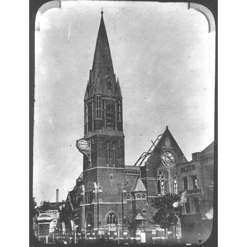
In 1873 an inspection in advance of an intended redecoration led to a condemnation of the seventeenth-century church of St Mary Matfelon as structurally unsafe (see earlier post). The parish reluctantly geared up to spend £4,000 on essential repairs. Then, in June 1874, Octavius Edward Coope came to the rescue. Coope was a wealthy brewer, a founder of Ind Coope & Co. in Romford in 1845, which firm expanded to Burton-on-Trent in 1856. He had been an MP in 1847–8, but was unseated on grounds of bribery. After a long interval he was again elected to Parliament as a Conservative MP for Middlesex in 1874. With that newly acquired status, Coope stepped forward claiming to be a Whitechapel parishioner – Ind Coope & Co. had offices and a depot on the west side of Osborn Street. Coope himself lived in Essex and, when in London, on Upper Brook Street in Mayfair. He offered to pay up to £12,500 towards a new church, presenting plans by his architect nephew, Ernest Claude Lee, who had been a pupil of William Burges’s, for a red-brick and stone-dressed High Gothic Revival building to seat 1,400. The offer was initially accepted with great relief and joy, but Coope had soon to defend the proposed use of red brick, averring, wrongly, that ‘our great church architect Street invariably uses it’. [1] In fact, for comparative inspection a Vestry committee turned to James Brooks’s recent red-brick churches in Haggerston, St Columba and St Chad. This committee was led by the Rev. James Cohen, a converted Jew who had been Whitechapel’s rector since 1860; it was subsequently spearheaded by Augustus William Gadesden, a sugar refiner. They were not impressed, convinced in their dislike of red brick, and anyway keen to have a larger church. Overall costs were estimated to be about £6,000 more than Coope was offering. Cohen’s committee concluded in September, with diminished alacrity, that ‘it is expedient that the offer of Mr Coope be accepted.’ [2] Rebuilding began in 1875 when Cohen was succeeded by the Rev. John Fenwick Kitto. Work was completed in October 1876 and there was a consecration in February 1877. The upper stage of the tower and spire followed in 1878. The estimated total final cost had risen to about £30,000 of which it was later said around £10,000 came from public subscription, the rest from Coope.

The Church of St Mary Matfelon was rebuilt with a tall spire in 1875-8, but it had to be largely rebuilt again after it was burnt out in 1880 (The East of London Family History Society, reproduced via Wikimedia Commons).

The large brick church comprised a nave and aisles, a round-apsed chancel, a baptistery under a west gallery and a three-stage north-west tower with an octagonal spire and corner turrets rising 175ft in all, sited so as to be prominent on the main road. It extended further west and south than had its predecessor and was set less squarely to the road, to minimise disturbance of the graveyard and avoid southerly ground that was only leasehold. While adhering to red brick, Lee had amended his plans. The church had only 1,250 sittings and omitted a full-height north transept in favour of a gabled organ bay at the east end of the north aisle. An unusual feature, reflecting the local evangelical mission, was an external pulpit, placed on a staircase turret at the north-west corner of the nave. There was a large ‘church room’ to the south-east in which relics from the old church were displayed. The interior had ornamentally carved Bath stone dressings to naked brick surfaces (perhaps intended for decoration), Minton floor tiles and a ceiled wagon-vault, a form chosen for auditory reasons, ill-advisedly as the building had very poor acoustics. The old clock and bells were reset. Lee deployed thirteenth-century style details and himself designed fittings including the pulpit, lectern, font and a mosaic apse floor, executed by Burke & Co. of Regent Street. Horatio Walter Lonsdale, Lee’s brother-in-law, supplied stained-glass windows. Stone carving was by Thomas Earp of Lambeth.

 View of the interior of the 1876 church, looking towards the chancel (Building News, 8 September 1876).

View of the interior of the 1876 church, looking towards the chancel (Building News, 8 September 1876).

This church was short-lived, suddenly gutted by fire on a summer’s Thursday afternoon, on 27 August 1880. Flames in the organ chamber swept up the organ pipes into the timber roof. The tower survived. Kitto and Gadesden led an approach to Coope, still an MP, who undertook to use his influence to secure insurance cover of £16,800 and to stump up further rebuilding costs. The acoustical shortcomings of the destroyed interior led him to make replacement conditional on a redesign by nephew Lee. The church was rebuilt in 1881–2 on the same plan, but with a polygonal apse and an open pseudo-hammerbeam roof beneath a lower ridge which did bring acoustical success. The nave west wall was given three windows in place of two, and there were other detailed variations that favoured a style more characteristic of the fourteenth century. The interior was yet more richly sculpted than its predecessor, and this time lavishly decorated with stencilling that shows the influence of Burges. Lonsdale supervised painting and glass.

St Mary Matfelon, 9-5-1941, HELR F237

The church was gutted by firebombs in 1940 (Historic England London Region).

An alabaster reredos intended since 1878 was at last made in 1886–7 as a memorial to Coope. Carved by Earp, it represented the Last Supper and the Tree of Jesse, and stood in front of stencilled decoration of the early 1880s by Lonsdale that included large angels for the Twelve Gates of the Heavenly Jerusalem.

Rebuilds notwithstanding, church attendance declined. It was estimated in the early 1880s to be around 1,500 across Sunday services, the main impediment being what the Rev. Arthur James Robinson called ‘the old story of indifference’. [3] Yet this was among the best attended of East London churches, with fully choral services and psalms chanted morning and evening. By 1884 Robinson’s team included two Missioners to Jews, the Rev. J. H. Bruhl and the Rev. A. Bernstein. The open-air pulpit was in regular use, and by the 1890s and well into the twentieth century special services were conducted for Jews in Hebrew and German, with sermons preached in Yiddish to congregations of up to 500. A last notable rector was the Rev. John A. Mayo, who gave the first ever radio sermon in 1922.

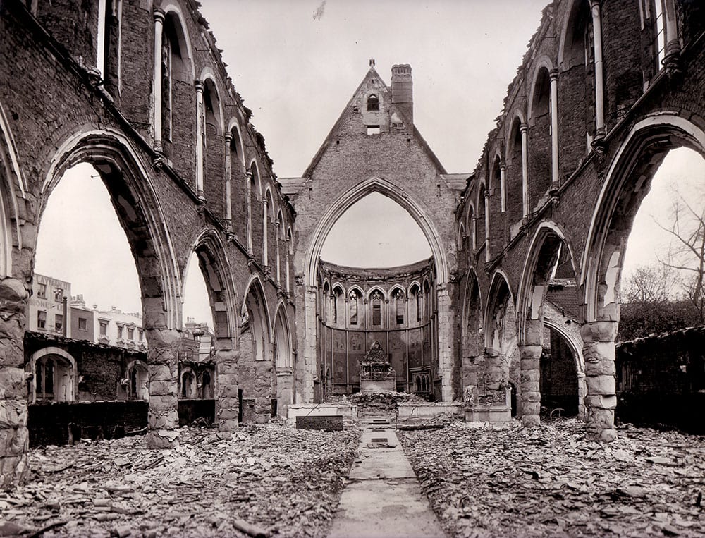
St Mary’s Church was gutted once again, this time by fire bombs on 29 December 1940. The ruined shell of the building was cleared in 1952.

St Mary Matfelon, 9-5-1941, HELR F238

Nave of the church in 1941 after bomb damage (Historic England London Region).

References

  1. Tower Hamlets Local History Library and Archives, L/SMW/A/1/1
  2. THLHLA, L/SMW/A/1/1
  3. Lambeth Palace Library, FP Jackson 2, f.513