X Close

Risk and Disaster Reduction Blog

Home

UCL Department of Risk and Disaster Reduction

Menu

Using Fault data in seismic hazard and risk assessment: A fault2SHA initiative

By Joanna P Faure Walker, on 22 March 2021

Effective fault data presentation helps make progress in the calculation of earthquake hazard and risk. 

Cross-disciplinary working can help progress. For calculating seismic hazard, the Fault2SHA Working Group has brought together data providers, modellers and seismic hazard and risk practitioners to help promote the use of fault data in seismic hazard assessment… Fault2SHA representing fault – to – seismic hazard assessment.

In the case of earthquake hazard and risk calculations, a key barrier to fault-based seismic hazard assessment has been the availability of data in a format that can be easily incorporated into calculations of hazard and risk. This has hindered efforts to provide long-term views of hazard and risk. Long-term, multi-millennia time frames cover several seismic cycles such that the long-term behaviour of faults can be identified and not miss out faults capable of hosting earthquakes which have not ruptured within a short-term observation periods (tens or hundreds of years). A further restriction has been the difficulty for modellers to interrogate the detail and uncertainties in primary data. To address these issues, the Fault2SHA Central Apennines laboratory, led by Dr Joanna Faure Walker (UCL IRDR), has created a database structure demonstrating a usable format by which geologists can present data that can be directly incorporated into hazard and risk calculations. To demonstrate its effectiveness, the laboratory has tested the database to calculate simplified calculations of risk in the Central Apennines and demonstrated the effectiveness, even at a simple level, for identifying which faults threaten the public the most and where additional data would have the most impact on current calculations. It is hoped those working in other regions can help the endeavour of promoting the use of faults in seismic hazard assessment through adopting a similar approach.

This work brings together researchers from different research groups in the UK, Italy and France: Joanna Faure Walker, Paolo Boncio, Bruno Pace, Gerald Roberts, Lucilla Benedetti, Oona Scotti, Francesco Visini, and Laura Peruzza

The two papers are published Scientific Data and Frontiers in Earth Science, while the database is available through PANGAEA.

Fault2SHA Central Apennines Database and structuring active fault data for seismic hazard assessment 

Which Fault Threatens Me Most? Bridging the Gap Between Geologic Data-Providers and Seismic Risk Practitioners

Fault2SHA Central Apennines Database

The Fault2SHA working group runs a monthly online learning series to help cross-disciplinary working and annual workshops.  The learning series and 2020 workshop is available through the Fault2SHA youtube channel. A summary of the database is provided by Joanna at 17 mins into the first session of the Fault2SHA 5th workshop:Promoting Faults in Seismic Hazard Assessment


Creating a relative suitability score for school buildings as evacuation shelters

By Joanna P Faure Walker, on 30 October 2020

A new paper published in Natural Hazards provides a method and worked case study from the Philippines for creating a relative suitability score of school buildings as use for evacuation shelters.

Tsioulou et  al., 2020, A method for determining the suitability of schools as evacuation shelters and aid distribution hubs following disasters: case study from Cagayan de Oro, Philippines

How can we make a decision based on multiple criteria?  How can we take qualitative expert opinions and create a quantitative comparison of the importance of different factors for decision-making?  What factors should be considered when evaluating the relative suitability of different buildings as evacuation shelters?  How can we identify which buildings could benefit most from cost-effective improvements? What do you think about whether school buildings should be used as evacuation shelters?

Alexandra Tsioulou (Willis Tower Watson, formerly UCL IRDR), Joanna Faure Walker (UCL IRDR), Dexter Sumaylo Lo (Xavier University, Cagayan de Oro) and Rebekah Yore (UCL IRDR and Rescue Global), as part of the PRISMH project, carried out expert opinion questionnaires and used the Analytical Hierarchy Process to create weightings of different criteria that should be considered when evaluating the relative suitability of different school buildings as evacuation shelters in Cagayan de Oro, the Philippines. Site surveys were carried out to evaluate the scores for each criteria and these were then combined to provide the relative suitabilities.  The paper provides an example methodology that can be applied elsewhere. The findings will be used to help make local recommendations.

Study of Icelandic active faults shows fault bends must be considered throughout fault development and maturity

By Joanna P Faure Walker, on 9 July 2020

Iezzi, Roberts & Faure Walker (2020) Throw-rate variations within linkage zones during the growth of normal faults: Case studies from the Western Volcanic Zone, Iceland, J. Struct. Geol., 133, 103977

Fault throw-rates and slip-rates are a fundamental input into fault-based seismic hazard assessments (SHA) i.e. how likely are earthquakes to occur….

Francesco Iezzi, Gerald Roberts and Joanna Faure Walker studied active faults in the Western Volcanic Zone, Iceland, to determine whether changes in fault throw-rates across fault bends, as identified in previous works in central Italy, are present in other tectonic settings.

This study shows that fault throw-rate increases within fault bends in response to non-planar fault geometry are present at a range of stages of maturity of the bend and extends examples of this phenomenon to mid-ocean ridge settings. This suggests that extrapolating fault slip-rates and slip during past earthquakes from individual sites along a fault must consider the location of data collection in relation to the geometry of the fault.

Why is this so important? Because if we use individual measurements of how fast a fault is moving, we need to understand whether this measurement is representative of the fault as a whole or whether it is underestimating or overestimating the slip. If we do not do this, we will overestimate or underestimate earthquake hazard.

A step closer in earthquake forecasting

By Joanna P Faure Walker, on 16 August 2019

Dr Zoe Mildon, former IRDR PhD student and now lecturer at University of Plymouth, together with Dr Joanna Faure Walker  (UCL IRDR), Prof Gerald Roberts (Birkbeck) and Prof Shinji Toda (Tohoku University IRIDeS), have published a paper in Nature Communications showing we are a step closer in understanding which faults could rupture in the next earthquake:

Coulomb pre-stress and fault bends are ignored yet vital factors for earthquake triggering and hazard

In this paper, we use long-term stress loading on faults in the central Apennines, Italy, together with stress loading from historical earthquakes in the region to test whether we can identify faults which have a positive stress and hence are ripe for rupture.  We found that 97% large earthquakes within the central Italian Apennines from 1703-2006 occurred on positively stressed faults. Therefore, we can use our modelling to calculate which faults are currently positively stressed and hence help us to determine which faults could rupture in the future. This is not the same as earthquake prediction – saying exactly when and where an earthquake will occur, but it is a step closer to better seismic hazard assessments and understanding why, how and when earthquakes occur.

Dr Joanna Faure Walker standing by a limestone fault scarp in the central Italian Apennines

The paper is available through open access: Mildon et al. (2019)

An article was written about the paper in the Daily Mail

The original press release is available here.

This work is part of the IRDR’s continuing collaboration with Tohoku University, IRIDeS (International Research Institute for Disaster Science). Our collaboration has led to papers including topics such as earthquake stress transfer (Mildon et al., 2016), disaster fatalities (Suppasri et al., 2016), and temporary housing (e.g. Naylor et al., 2018).

New paper on segmented normal fault systems

By Joanna P Faure Walker, on 19 June 2019

Publication of: Occurrence of partial and total coseismic ruptures of segmented normal fault systems: Insights from the Central Apennines, Italy by Iezzi et al. (2019)

Francesco Iezzi (PhD student, Birkbeck) together with Prof Gerald Roberts (Birkbeck), Dr Joanna Faure Walker (IRDR) and Ioannis Papanikolaou (Agricultural University of Athens) have published a detailed study of the long-term displacements across the fault responsible for the 2009 L’Aquila Earthquake, Italy, and the surrounding faults. This reveals that the different faults are behaving together so that the displacement across the system of faults looks similar to if it were one larger fault on ten thousand and million year timescales. This finding can help provide clues regarding the relative local seismic hazard between the different fault segments. The study also provides evidence that the vertical displacement (throw) across a fault increases across fault bends, a result that has been demonstrated in previous papers by the research group (e.g. Faure Walker et al., 2009; Wilkinson et al., 2015, Iezzi et al., 2018). The Iezzi et al. (2019) paper discusses the synchronised and geometrically controlled activity rates on the studied faults in terms of the propensity for floating earthquakes, multi-fault earthquakes, and seismic hazard.


Photograph of damage following the 2009 L’Aquila earthquake, taken by Joanna Faure Walker while accompanying the EEFIT mission.

Can you write about your research using the 1,000 most common words in the English language?

By Joanna P Faure Walker, on 10 May 2019

At the IRDR Spring Academy, I set each member of the IRDR the challenge of explaining their research using only the 1,000 most commonly used words in the English language (taken from this website).  We were allowed the odd exception for a few essential keywords (in my case “earthquake” and “fault”). We had about ten minutes to do this. Below we share some of our attempts. Would you like to try the same exercise?

IRDR Spring Academy 2019

Mohamed Alwahedi:

Some scientists think that all earthquakes happen in the same way, and by the same reason. That is called the self-similarity theory. I am going to test that theory.

David Alexander:

My latest research is on a sunken ship that is full of thousands of live bombs. The work looks at how the risk has been managed and what might happen to the wreck. There are several reasons why the ship might explode. Unfortunately, for 75 years, nothing has been done to reduce the risk, which has grown as the wreck has become older. The British Government has failed to create a clear picture of the danger posed by the ship. Hence, in terms of details, the risk is poorly known. An explosion could cause a terrible disaster. It is time to act, defuse the bombs and clear away the ship, but the options are limited by the danger.

Lucy Buck:

I study how a tsunami changes the land after the water has gone and what this means for the people who live there.

Joanna Faure Walker:

What makes an earthquake occur when and where it does? Scientists seek to answer this question using many different methods. My current work has two main approaches. First, if we collect more field data can we improve risk knowledge? Second, how much more can we learn when we measure details of fault structures? Through my work we have learnt more about how faults join and grow, where earthquakes occur and why, and what next steps need to be taken to help us reduce risk from earthquakes.

Jessica Field:

I have been researching in archives (which is a place where old documents are kept) in Delhi to better understand how the Indian government managed aid during emergencies like floods, earthquakes and conflicts during the 1940s-1960s.

Nathanael Harwood:

Not all ‘Global Warming’ has an equal impact across the Globe; the Arctic in particular has warmed at twice the rate of the rest of the globe, causing the region to be warmer and moister than it should be according to the last half-century of records.  At the same time weather extremes, including hot and cold waves that stick around for longer, have become a common occurrence further south of the Arctic where billions of people live in the warmer ‘midlatitudes’.  As Londoners, that includes us.  Normal weather conditions, or at least weather we would expect given the record, rely on a stable temperature and pressure difference between the Arctic and the midlatitudes which drives the wind and blows weather patterns like storms away at a reasonable pace.  But when these differences are changed, and the Arctic warms at a rate never seen before, it seems obvious that wind patterns and the atmosphere as a whole could be disturbed, made wavier and slower, or even blocked.

Despite this, we still don’t know the specific details on how the Arctic is impacting our weather, or the main driver of our weather called the ‘Jet Stream’, which blows above us at about the height you would take a jet plane at.  Computer models have given a wide range of results, and traditional techniques to look at climate records have failed to provide any robust answers.  This project uses ‘Bayesian Networks’, a way of considering how different things relate to each other in a large network, to look at how the Arctic region fits into relationships between the atmosphere and different parts of the world.  These large-scale disturbances of the jet stream, wind and weather are a crucial part of the climate change puzzle because they can cause devastating cold conditions, like on the US East Coast, unbearable heat waves across parts of Europe, as well as floods and droughts.  If we want to understand what the future holds for us in terms of extreme weather, we need to understand the relationships between these different drivers so that we can predict and better prepare for a future with a very warm Arctic.

Ilan Kelman:

There is a lot of talk that people must move because the climate is changing. Counting these numbers of people is very difficult and cannot really be done. People move for many reasons and do not always make decisions using long times. It is hard to pick only one factor.

Claudia Sgambato:

Earthquakes are some of the most dangerous natural events, causing many deaths and damage. It is important to contribute to the knowledge of when and where the next earthquakes will occur, and how destructive they can be. However, it is not an easy task: at present there is no way to predict an earthquake. My research addresses this problem, by studying where the structures responsible for producing earthquakes, called faults, are, and how often they rupture. I also study the geometry of the faults, in other words their changes in shape, because these may have an important role in the seismic hazard, causing a higher rate of deformation.

Mark Shortt:

Alone, I travelled to the north to research sea ice. It was very cold with a lot of wind, but with the help of other scientists I got some strength values. This will be important for oil and gas companies.

Omar Velazquez Ortiz:

I am trying to understand and improve the different escape ways that structures’ occupants can use under a shaking event, considering early warnings

Rory Walshe:

How does the history of risk from major cyclones effect society and culture for institutions and individuals and how can we research history to understand response.

Caroline Wood:

International professional instructions are available to help doctors give drugs to stop disease. Doctors can find it difficult to use these instructions in their practice, particularly for operations. Our research designs digital decision resources (apps) to help improve knowledge and educate doctors about the correct drugs to give.

Punam Yadav:

My recent research, which focusses on political participation of women and their agency, examines the life experiences of women who have been elected at the local government. The aim of this research is to examine the impact of reservation on the everyday life of these women politicians.

I carried out 25 interviews with women politicians and 5 interviews with male politicians. Despite increase in women’s representation in politics in Nepal, these women politicians talked about how difficult it was for them to work in a male dominated environment. They also spoke about opportunities their new roles had brought for them. They have access to new space and earned more respect due to their new roles.

Fault responsible for 1908 Messina Earthquake found

By Joanna P Faure Walker, on 9 May 2019

In 1908 a Mw7.1 earthquake struck the town of Messina in Sicily, Italy.  This earthquake killed over 80,000 people making it the most deadly earthquake in Europe since 1900. Despite causing great losses and prompting research into earthquake environmental effects worldwide, the fault responsible for this earthquake has before now remained a source of contention.

However, new research has identified the fault responsible for this event. This was done using elastic half-space modelling and levelling data from 1907–1909. This research has highlighted the importance of studying mapped faults to locate past events.

This work was led by PhD student Marco Meschis (Birkbeck College) in collaboration with researchers from UCL IRDR, Birkbeck College, University of Plymouth and Università degli Studi dell’Insubria.

Meschis, Roberts, Mildon, Robertson, Michetti and Faure Walker (2019) Slip on a mapped normal fault for the 28thDecember 1908 Messina earthquake (Mw 7.1) in Italy, Scientific Reports, doi:10.1038/s41598-019-42915-2

Recent IRDR research on Italian earthquakes includes:

Iezzi,  Mildon, Faure Walker, Roberts, Wilkinson, Robertson, (2018) Coseismic Throw Variation Across Along-Strike Bends on Active Normal Faults: Implications for Displacement Versus Length Scaling of Earthquake Ruptures, Journal of Geophysical Research: Solid Earth 

Faure Walker J.P., Visini F., Roberts G., Galasso C., McCaffrey K., and Mildon Z., (2018) Variable Fault Geometry Suggests Detailed Fault-Slip-Rate Profiles and Geometries Are Needed for Fault-Based Probabilistic Seismic Hazard Assessment (PSHA), BSSA 109 (1), 110-123


Earthquake surface measurements reveal new revelations about how faults rupture

By Joanna P Faure Walker, on 12 November 2018

PhD student Francesco Iezzi (Birkbeck College), supervised by Prof Gerald Roberts (Birkbeck College) and Dr Joanna Faure Walker (UCL IRDR), has published a paper that could revolutionalise how geologists and seismic hazard modellers use long established scaling relationships between fault lengths and surface rupture parameters.

The paper is freely available to all and can be found here.

What new observations have been made?

For five earthquakes studied, the surface fault slip (the amount the fault surface moved during the earthquake) and the throw (the vertical component of the slip) was higher where there was a bend along the length of the fault.

Following the central Italy August and October 2017 earthquakes that ruptured the ground surface, we made detailed high spatial resolution measurements of surface fault displacement along the length of the surface fault ruptures. A study of the amount of vertical and horizontal displacement that occurred along the length of the fault revealed that the throw and slip that occurred during the earthquakes increased where there are bends in the fault. This result is critical and has not been identified before for individual earthquakes.

Damage in Amatrice from the August 2016 Earthquake. Photograph take during EEFIT fieldwork by Dr Joanna Faure Walker.

Why does this occur?

We hypothesis that this occurs in order to maintain the horizontal strain (change in length relative to the original length) across a fault during an earthquake and the long-term horizontal strain-rate that accumulates from multiple earthquakes over thousands of years.

Are there other examples of this?

We then went back and studied other examples earthquakes where there was enough information to determine whether a similar pattern of higher throw and slip could be seen across bends in the fault. In the three further events studied in USA Basin and Range, Greece, and Mexico, we found the same relationship. So it seems this phenomenon occurs worldwide in normal (extensional) faults.

This was the first time that the change in vertical component of slip during an earthquake has been shown to be predictable. However, the observed relationship of increased throw across fault bends has been identified previously in long-term displacements that have accumulated over 15 thousand years as a result of multiple earthquakes in Italy (Faure Walker et al., 2009, Wilkinson et al., 2015). Before now, it was not known whether this increase was caused by there being more earthquakes across the bends or more movement during individual events.  We now know that there can be more slip during individual events, however we do not know whether this is the only mechanism for creating a long-term higher throw-rate across the bends.

What does this mean for earthquake science?

This paper suggests that slip during an earthquake will change where there is a bend along the length of the fault and this change can be quantified and predicted using the proposed theory. This means that close to the fault, earthquakes may be more damaging near a bend in the fault. This finding suggests that we cannot use fault scaling relationships between fault length and expected slip in earthquakes without consideration of fault geometry. This paper can also explain much of the scatter seen in existing plots of maximum surface slip against fault length because when collecting the data as input for such relationships, consideration was not given about whether the measurements were taken across fault bends or not.

These changes in slip along faults in individual earthquakes related to the fault geometry should be included in probabilistic seismic hazard assessments (PSHA).

What other research in the IRDR relates to this?

This work contributes to the IRDR and colleagues’ work on investigating fault behaviour to improve our understanding of earthquake hazard. Recent papers have demonstrated the importance of including detailed fault geometry and slip-rates in seismic hazard calculations (Faure Walker et al., 2018) and Coulomb stress transfer calculations (Mildon et al., 2016, 2017).

Iezzi et al (2018), Coseismic Throw Variation Across Along‐Strike Bends on Active Normal Faults: Implications for Displacement Versus Length Scaling of Earthquake Ruptures, Journal of Geophysical Research, https://doi.org/10.1029/2018JB016732 

More data needed for better earthquake hazard and risk calculations

By Joanna P Faure Walker, on 6 November 2018

New research demonstrates the importance of having detailed measurements at multiple sites along a fault of how fast the fault is moving and how the surface orientation of the fault changes. To access the full paper click here.

Why do we need fault measurements?

Measurements of fault slip rate and the geometry of the fault (it’s 3d orientation) can be used to calculate earthquake recurrence intervals to give probabilities of how likely earthquakes of different magnitudes are to occur. We also need these measurements to model how much ground shaking there will be at given locations. Hazard maps of expected ground shaking can be used to inform building codes and identify where buildings including homes and schools might need retrofitting to improve their resistance to earthquake shaking.

There are other methods available for creating earthquake hazard maps, such as using historical records of earthquake shaking. However, these records unlikely go back far enough in time to capture all faults capable of hosting large earthquakes because some faults will not have hosted earthquake within the time period covered by such records. Therefore, the hazard from some faults would be missing in hazard maps based solely on historical seismicity leading to underestimations in earthquake hazard.

What new insights have been revealed in the research publication?

The paper, entitled “Variable fault geometry suggests detailed fault slip rate profiles and geometries are needed for fault-based probabilistic seismic hazard assessment (PSHA)” demonstrates that relying on only one or a few measurements of how fast the fault is moving along a fault and projecting these measurements along the entire fault may lead to underestimating the uncertainty in the earthquake hazard calculations. Crucially, there may be locations where the hazard is underestimated, meaning people could be at more risk than suggested by simpler models (the converse is also possible). Therefore, earthquake hazard assessments based on fault parameters need to either use detailed measurements including measurements of how fast the fault is moving at multiple sites along the fault or to incorporate how the lack of such data increases the uncertainty in calculated earthquake hazard assessments.

Why are detailed measurements not being already used?

In many regions it is difficult to constrain the fault slip rate (how much the fault has moved in a given time) or throw rate (vertical component of slip rate) along a fault at even one location, let alone several. However, there are regions where this is possible so as more data is collected, this detail should help to improve earthquake hazard assessments both in those regions and worldwide.

Where can I find out more?

Faure Walker J., Visini F., Roberts G., Galasso C., McCaffrey K., and Mildon Z., (2018) Variable fault geometry suggests detailed fault slip rate profiles and geometries are needed for fault-based probabilistic seismic hazard assessment (PSHA), Bulletin of the Seismological Society of America, doi: 10.1785/0120180137

The Fault2SHA Working Group is an ESC (European Seismological Commission) group of researchers in both universities and civil protection authorities collaborating to increase incorporation of fault data in seismic hazard assessments and to improve our understanding of how such data should be used.

Disaster Science is one of five key themes for partnership between UCL and Tohoku University

By Joanna P Faure Walker, on 21 October 2018

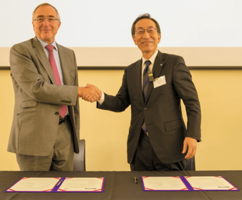
UCL and Tohoku University signed a Memorandum of Understanding on Thursday 11th October 2018 as part of the kickoff partnership event. President Arthur and President Ohno stated their commitment to continuing research exchange, following the agreement of the previous five years.

President Arthur and President Ohno sign memorandum of understanding Photo source: https://www.tohoku.ac.jp/japanese/2018/10/news20181018-02.html

Workshops for five key themes were held on the 11th and 12th October as part of the event that saw 50 delegates come to UCL from Tohoku University. The five themes were disaster science, data science, neuroscience, higher education and material science and spintronics.

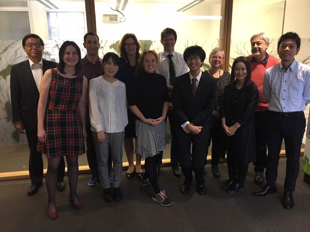
The disaster science delegation (From left to right) Prof. Shinichi Kuriyama Dr Katerina Stavrianaki Dr Ilan Kelman Ms Anna Shinka Dr Tiziana Rossetto Dr Joanan Faure Walker Dr David Robinson Assist. Prof. Shuji Seto Prof Maureen Fordham Ms Miwako Kitamura Prof David Alexander Assoc. Prof. Anawat Suppasri

The disaster science delegation comprised representatives from UCL IRDR, Tohoku University IRIDes (International Research Institute for Disaster Science), and UCL EPICentre. The workshop has helped form new collaboration opportunities building on the existing relationship between these research institutions. Our collaboration cincludes joint publications in earthquake stress transfer (e.g. Mildon et al., 2016), disaster fatalities (Suppasri et al., 2016), and temporary housing (e.g. Naylor et al., 2018). We look forward to the next five years of working with all our colleagues at IRIDeS to enhance the field of disaster science.

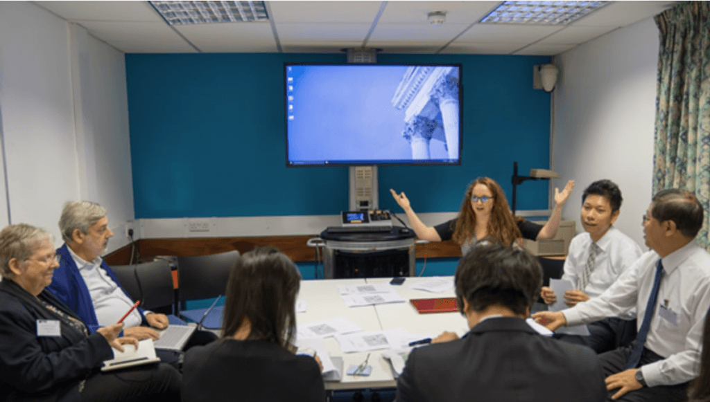
Discussions during the disaster science workshop Photo source: https://www.tohoku.ac.jp/japanese/2018/10/news20181018-02.html

The disaster science workshop included the following talks, which prompted discussions of further questions we would like to research together:

  • Assist. Prof. Shuji Seto (IRIDeS)
    • New Research Project on the Fatality Process in the 2011 Tohoku Earthquake for Survival Study from Tsunami Disaster
  • Dr Ilan Kelman (UCL IRDR)
    • Disaster, Health, and Islands
  • Prof. Shinichi Kuriyama (IRIDeS)
    • Challenge of Public Health to Disaster – Using Public Health Approach and Artificial Intelligence Techniques
  • Prof Maureen Fordman (UCL IRDR)
    • Gender and Disasters
  • Ms Miwako Kitamura (IRIDeS)
    • Gender problems as seen from the oral history of the bereaved families of the deceased Tsunami in Otsuchi Town, during the Great East Japan Earthquake
  • Ms Anna Shinka (IRIDeS)
    • A questionnaire study on disaster folklore and evacuation behavior for human casualty reduction – Case of Kesennnuma City, Miyagi Prefecture.
  • Prof Tiziana Rossetto (UCL EPICentre)
    • Building response under sequential earthquakes and tsunami
  • Assoc. Prof. Anawat Suppasri (IRIDeS)
    • Building damage assessment considering lateral resistance and loss estimation using an economic model “Input-Output table”
  • Prof David Alexander (UCL IRDR)
    • A framework for Cascading Disasters
  • Dr Joanna Faure Walker (UCL IRDR)
    • Disaster Warning, Evacuation and Shelter

NHK, the largest broadcaster in Japan, reported the workshop with a focus on Miwako Kitamura and the UCL Gender and Disaster Centre:  NHK report (in Japanese)