 Close
Close

The Search for a Natural River
By Joshua Anthony, on 27 January 2023
Following the UK’s exit from the European Union, the legacy leftover from the EU’s Water Framework and Flood Directives, which jointly encourage sustainable management of flood risk, lives on. The UK has seen a number of similar national policy frameworks implemented aiming to reduce flood risk while improving water quality and biodiversity, with over 100 river restoration projects seen in London alone between 2000 and 2019. Most of these efforts are geared towards sustainability in the face of climate change, but, with regards to the long-term, the river itself is often left out of the plans.
The historic human efforts to manage rivers have been progressively called into question over their sustained maintenance costs and an incongruity with environmental and ecological health. An alternative solution is to renaturalise and restore natural processes—reconnecting rivers with their floodplains, reintroducing wild species, run-off targeted tree planting—but this would also be to submit to a changing and dynamic landscape. Rivers can change course—sometimes very suddenly—or silt-up and become unnavigable. True sustainability should therefore account for the long term changes of rivers, but these changes are rarely accounted for in flood risk management policy. As Andrew Revkin asks: “sustain what?”
The problem with “natural”
The problem is partially semantical. The terms renaturalisation, restoration, and rewilding carry with them the image of an implied prior state or a “Lost Paradise”. Ironically, it is precisely the long legacy of human engineering, which some modern schemes are trying to reverse, that denies us the knowledge of a natural state; it is difficult to look into the past, when the waters are so muddied by our imprint. As a result, our ability to assess the future impact of renaturalisation is equally hindered.
Arguably nowhere in the UK is this problem illustrated better than in the Somerset Levels, which as far back as the roman occupation of Britain has seen artificial drainage and reclamation in order to take advantage of its pastoral and arable potential. At present, the flat, largely reclaimed floodplain relies heavily on a vast network of excavated drainage ditches (rhynes in the local vernacular), sluice gates (clyces), and pumping stations that push the water through the highly banked and augmented river channels; a £100 million tidal barrier has just been approved on the River Parrett, while existing rivers continue to be enlarged to carry extra flood water. Clearly, it is hard to imagine what natural means in this context.
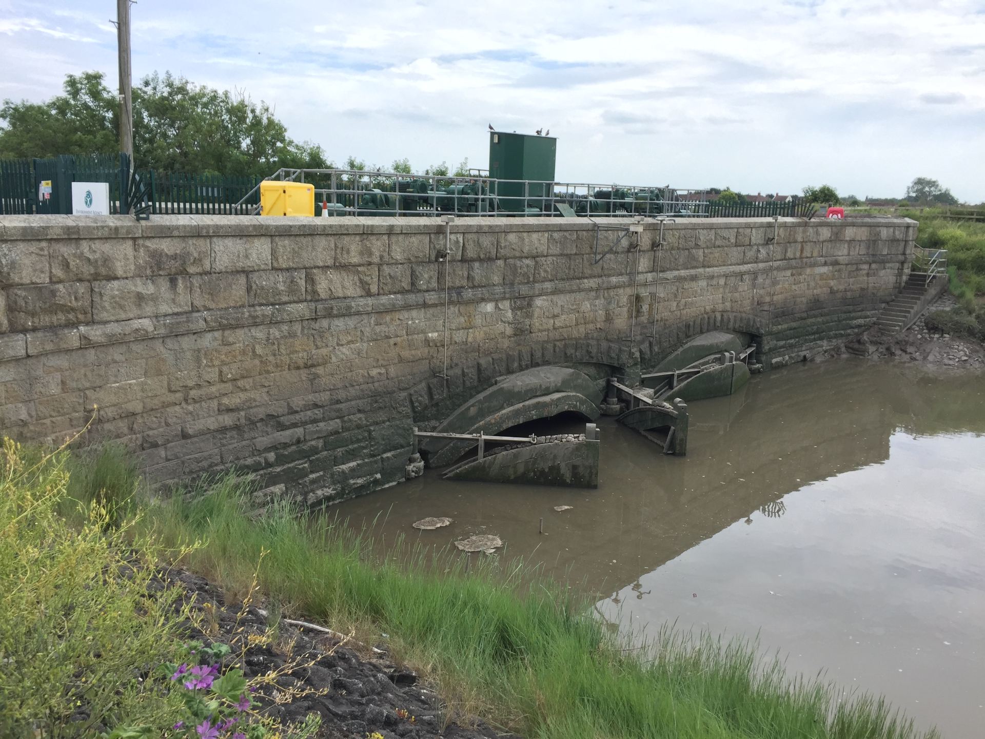
A clyce (sluice gate) in Highbridge that stops in the inflow of tidal water.
Seeing Into the Past
Fortunately, remnants of abandoned rivers—palaeochannels—that have long since stopped flowing through the Levels litter its landscape and offer a glimpse into the past. There are numerous examples of such ancient rivers still visible on the Somerset landscape today, which often surface during high flood stages, but are now easily identifiable with the advent of Light Detection and Ranging (LiDAR) technology, which provides high-resolution elevation data. Palaeochannels have been of interest to researchers in this area because they reveal historic drainage patterns, showing in which direction rivers used to flow before being redirected or abandoned long ago.
Where archaeological records are unavailable—often early in or before human occupation—the reasons for change are less clear. Were the causes human made, or related to a historical climatic shift? And could this inform the way we plan rivers today? To find out more, it is necessary to dig deeper into the landscape.

The Somerset Levels have experienced their own fair share of devastating floods and are intensely embroiled in the debate between hard engineering measures and natural flood management, which has previously culminated in fierce criticism of the Environment Agency for not carrying out regular dredging. This image reveals an ancient river channel emerging from the flood waters of 2013/2014 around Burrowbridge, Somerset.
Seeing Beneath the Surface
Beneath the sediment that buries them are rivers preserved from a past time. Within the sediment is contained information from the processes and conditions that presided over the river’s eventual abandonment. Here we can see the geometry of the river and look for signs of erosion and migration, and indicators for the causes of abandonment.

A seismic refraction survey conducted in the Somerset Levels.
To overcome the logical problem of seeing buried features, geophysical methods offer a quick and non-invasive way of imaging the subsurface. By applying a force to the ground and measuring a response from beneath, a model of the rivers can be produced. These methods have been tested extensively by scientists for many years in a variety of environments, including floodplain sediments, and are in the UK probably most famously associated with Time Team’s “geofizz”, due to their strong archaeological applications.
This research uses a combination of electrical resistivity, seismic refraction, and ground penetrating radar methods to image the buried cross-section of ancient rivers. In this way, the river acts as an archaeological feature for investigating the past, and is hoped to provide reference states for river systems that have existed prior to and throughout different periods of human occupation. Surveys have been completed on two sites on either side of the River Parrett, clearly showing the extent of the historical river systems. More are to follow at different sites across the Somerset Levels.

Imagery of a buried channel as depicted by measurements of resistivity to an electrical current.
Glimpsing into the past of ancient river systems could help in planning for the future development of renaturalised rivers, by exploring scenarios where the measures that humans (and rivers) have grown accustomed to are absent. It may be that, like a river, management plans must be dynamic and adaptable to natural change; otherwise, a one-size-fits-all approach to sustainability is bound to become unsustainable.
To find out more about this project, email me at joshua.anthony.19@ucl.ac.uk
Josh Anthony is a PhD Candidate at IRDR and Editor of the IRDR blog.