X Close

UCL IRDR Blog

Home

UCL Department of Risk and Disaster Reduction

Menu

More data needed for better earthquake hazard and risk calculations

By Joanna P Faure Walker, on 6 November 2018

New research demonstrates the importance of having detailed measurements at multiple sites along a fault of how fast the fault is moving and how the surface orientation of the fault changes. To access the full paper click here.

Why do we need fault measurements?

Measurements of fault slip rate and the geometry of the fault (it’s 3d orientation) can be used to calculate earthquake recurrence intervals to give probabilities of how likely earthquakes of different magnitudes are to occur. We also need these measurements to model how much ground shaking there will be at given locations. Hazard maps of expected ground shaking can be used to inform building codes and identify where buildings including homes and schools might need retrofitting to improve their resistance to earthquake shaking.

There are other methods available for creating earthquake hazard maps, such as using historical records of earthquake shaking. However, these records unlikely go back far enough in time to capture all faults capable of hosting large earthquakes because some faults will not have hosted earthquake within the time period covered by such records. Therefore, the hazard from some faults would be missing in hazard maps based solely on historical seismicity leading to underestimations in earthquake hazard.

What new insights have been revealed in the research publication?

The paper, entitled “Variable fault geometry suggests detailed fault slip rate profiles and geometries are needed for fault-based probabilistic seismic hazard assessment (PSHA)” demonstrates that relying on only one or a few measurements of how fast the fault is moving along a fault and projecting these measurements along the entire fault may lead to underestimating the uncertainty in the earthquake hazard calculations. Crucially, there may be locations where the hazard is underestimated, meaning people could be at more risk than suggested by simpler models (the converse is also possible). Therefore, earthquake hazard assessments based on fault parameters need to either use detailed measurements including measurements of how fast the fault is moving at multiple sites along the fault or to incorporate how the lack of such data increases the uncertainty in calculated earthquake hazard assessments.

Why are detailed measurements not being already used?

In many regions it is difficult to constrain the fault slip rate (how much the fault has moved in a given time) or throw rate (vertical component of slip rate) along a fault at even one location, let alone several. However, there are regions where this is possible so as more data is collected, this detail should help to improve earthquake hazard assessments both in those regions and worldwide.

Where can I find out more?

Faure Walker J., Visini F., Roberts G., Galasso C., McCaffrey K., and Mildon Z., (2018) Variable fault geometry suggests detailed fault slip rate profiles and geometries are needed for fault-based probabilistic seismic hazard assessment (PSHA), Bulletin of the Seismological Society of America, doi: 10.1785/0120180137

The Fault2SHA Working Group is an ESC (European Seismological Commission) group of researchers in both universities and civil protection authorities collaborating to increase incorporation of fault data in seismic hazard assessments and to improve our understanding of how such data should be used.

Induced earthquakes – how and when they have occurred, and why should anyone care

By Joanna P Faure Walker, on 27 September 2018

Despite the high volume of material out there about induced earthquakes, it can be hard to separate fact from opinion. To help explain what induced seismicity is, how it is caused and what the risks are, a group of researchers from UCL Department of Chemical Engineering and Institute for Risk and Disaster Reduction have published “Addressing the risks of induced seismicity in subsurface energy operations”.

What causes “induced seismicity”? Induced earthquakes, those mainly caused by human action, can invoke strong feelings towards the processes that cause them, the most widely known among these is hydraulic fracturing (less favourably known as “fracking”). But hydraulic fracturing for shale gas extraction is not the only cause of induced earthquakes – several industrial activities are capable of inducing or triggering earthquakes, including mining, dams, conventional oil and gas operations, groundwater extraction, CO2 Capture and Storage (CCS), underground waste fluid disposal and the creation of geothermal energy systems. Rightly or wrongly, negative public perception and local public opposition to induced seismicity has led to numerous international projections having been suspended, delayed or curtailed.

How does industrial operation induce earthquakes? The Earth’s crust is believed to be in a state where it is critically stressed and only small stress changes in the right direction can cause an earthquake. Industrial action can alter the stress field in the most shallow part of the Earth’s crust, inducing a seismic event.

Are these events getting more likely? The number of documented cases of man-made earthquakes in different industrial activities is rapidly increasing: In 2017 alone, there were two reported record-breaking magnitude induced seismic events. One of the more well-known areas of induced seismicity is in the United States: The notable increase in seismicity within the last decade in the previously seismically quiet State of Oklahoma has been widely attributed to large scale waste water injection wells connected to the hydrocarbon production industry.

How big are induced earthquakes? Most induced earthquakes are low in magnitude (typically less than magnitude 4). However, even these small events are capable of causing structural damage to properties and evoking widespread fear and anxiety. We say most are small, but there are some examples where large magnitude earthquakes have been alleged to be caused by human activities. For example, in China in 2008, a dam was built that filled a reservoir behind it. A short time later, a magnitude 8 earthquake occurred in the region. Some scientists proposed this large earthquake was caused by the mass loading of the water in the dam and its penetration into rock, affecting the subsurface pressure in an underlying fault line and possibly setting off a series of ruptures that led to the earthquake.

So what is being done about it? Minimising seismic risk should be a high priority for industrial operators. All fluid injection processes should require detailed seismic hazard assessments for imaging and characterising faults prior to operations, with dedicated monitoring systems in addition to existing national seismic monitoring facilities. For assessing the risks, monitoring the operations, and designing mitigation strategies using predictive models that can characterise the spatiotemporal evolution of induced seismicity would be extremely helpful. Examples of best practice approaches show that maintaining a transparent dialogue between operator and the public, while adhering to the regulatory processes can allow safe operations in an atmosphere of public acceptance.

Where can I find out more? With all the controversy around such events, we need to understand what are the risks of induced earthquakes and how can we model them. In the published article in Wiley Interdisciplinary Reviews, Richard Porter, Alberto Atriolo, Haroun Mahgerefteh and Joanna Faure Walker provide a review of several alleged induced seismicity case studies that have occurred in the last 15 years covering a variety of causal mechanisms. We discuss issues relating to public perception and procedures and strategies that could be implemented to help prevent and mitigate future occurrences.

The above work was funded by Horizon 2020 research and innovation programme, Grant/Award Number: 640979

Fault2SHA has successful session at ESC 2018 in Malta

By Joanna P Faure Walker, on 7 September 2018

The Fault2SHA ESC (European Seismological Commission) Working Group hosted a session on Wednesday 5th September at the ESC 2018 Meeting held in Valletta, Malta. Oona Scotti represented the group in her keynote on the opening day of the conference, in which she addressed “Modelling fault systems in PSHA: Challenges Ahead”. The Fault2SHA Working Group, for which I am on the Executive Committee, links different researchers working on faults and seismic hazard assessment (SHA) in Europe and beyond. This collaboration has brought together field geologists, fault-modellers and probabilistic seismic hazard modellers. The group provides a forum in which data, results, modelling capabilities, and improvements in scientific understanding can be shared. If you want more information, and to join, see Fault2SHA. The next Fault2SHA workshop will be in Kaust, Saudi Arabia, in November 2018 and the next meeting will run on 3rd-5th June 2019 in Barcelona, Spain.

I lead the Fault2SHA Central Apennines Laboratory. Our team comprises researchers from Italy (Paolo Boncio, Bruno Pace, Laura Peruzza, Francesco Visini), France (Lucilla Benedetti, Ooona Scotti) and the UK (Joanna Faure Walker, Gerald Roberts). At ESC in Malta, I introduced the central Apennines Laboratory and our current activities to the wider working group. The Central Apennines, as well as being a beautiful place to conduct fieldwork with the opportunity to obtain detailed datasets, suffers from large magnitude earthquakes. Indeed, earthquakes in the Central Apennines have featured widely in the UK press due hosting the two deadliest earthquakes in Europe of the last ten years: the 2009 L’Aquila sequence and the 2016 Amatrice-Norcia sequence.


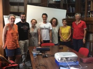
The Fault2SHA Central Apennines Laboratory, which formed in January 2018, held an in-person meeting in July at the University of Chieti-Pescara, Italy. The photograph shows (from left to right) Oona Scotti, Francesco Visini, Joanna Faure Walker, Bruno Pace, Laura Peruzzi, Lucilla Benedetti, and Paolo Boncio.

During the Fault2SHA ESC session, I presented a second talk and a poster about my research investigating the importance of incorporating detailed fault geometry for understanding seismic hazard. The oral presentation demonstrated the importance of incorporating detailed fault geometry and loading on faults between earthquakes in Coulomb Stress Transfer modelling, a process that causes the stress on faults to change in response to an earthquake on a neighbouring fault. This was based on work carried out by Zoe Mildon (former IRDR PhD student, now a lecturer at the University of Plymouth) in collaboration with Gerald Roberts, Shinji Toda and myself (see Midon et al. 2016 and Mildon et al. submitted preprint). The poster displayed the importance of detailed fault geometry and slip-rate data for calculating earthquake probabilities and ground shaking intensities. I further represented Zoe for her poster within the session on earthquakes in regions of distributed deformation, that showed surface ruptures from the 1997 Colfiorito Earthquake in the central Apennines was due to primary earthquake slip (see Mildon et al., 2016 for details).

I thank all those at the conference with whom I had interesting discussions and I look forward to seeing all of our research progress.

IRDR Masters student publishes Early Warning and Temporary Housing Research. This is part of the on-going collaboration between UCL-IRDR and IRIDeS-Tohoku University

By Joanna P Faure Walker, on 4 June 2018

Angus Naylor, an IRDR Masters student alumni and Masters Prize Winner, has published the research conducted for his Independent Research Project. The research was carried out as part of his MSc Risk, Disaster and Resilience with me, his project supervisor, and our collaborator at Tohoku University IRIDeS (International Research Institute of Disaster Science), Dr Anawat Suppasri.

Following the Great East Japan Earthquake and Tsunami in 2011, UCL-IRDR and Tohoku University IRIDeS wanted to join forces to learn more about both the fundamental science and impacts of disasters both in Japan and around the world. Naylor’s recently published paper adds to other collaborative outputs from the two institutes: Mildon et al., 2016, investigating Coulomb Stress Transfer within the area of earthquake hazard research; Suppasri et al., 2016 investigating fatality ratios following the 2011 Great East Japan Tsunami; and IRDR Special Report 2014-01 on the destruction from Typhoon Yolanda in the Philippines. The two institutions have met on a number of occasions, and have an upcoming symposium in October 2018.

In 2014, three and half years after the Great East Japan Earthquake and Tsunami destroyed much of Tohoku’s coastline, I led and Dr Anawat Suppasri organised a joint UCL-IRDR and Tohoku University IRIDeS team, visiting residents of six temporary housing complexes in Miyagi and Iwate prefectures. While there, we used written questionnaires and informal group interviews to investigate the suitability of early warning systems and the temporary housing among the elderly population affected by this event.

When analysing the results, we found overall that age was not the principal factor in affecting whether a warning was received, but did play a significant role regarding what was known before the warning was received, whether action was taken and how temporary and permanent housing was viewed. The results suggest that although the majority of respondents received some form of warning (81%), no one method of warning reached more than 45% of them, demonstrating the need for multiple forms of early warning system alerts. Furthermore, only half the respondents had prior knowledge of evacuation plans with few attending evacuation drills and there was a general lack of knowledge regarding shelter plans following a disaster. Regarding shelter, it seems that the “lessons learned” from the 1995 Kobe Earthquake were perhaps not so learnt, but rather many of the concerns raised among the elderly in temporary housing echoed the complaints from 16 years earlier: solitary living, too small, not enough heating or sound insulation and a lack of privacy.

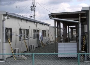
An example of Temporary Housing following the Great East Japan Earthquake and Tsunami visited during the fieldwork for this study (Photograph: Dr Joanna Faure Walker)

The research supports previous assertions that disasters can increase the relative vulnerabilities of those already amongst the most vulnerable in society. This highlights that in order to increase resilience against future disasters, we need to consider the elderly and other vulnerable groups within the entire Early Warning System process from education to evacuation and for temporary housing in the transitional phase of recovery.

The paper, ‘Suitability of the early warning systems and temporary housing for the elderly population in the immediacy and transitional recovery phase of the 2011 Great East Japan Earthquake and Tsunami’ published in the International Journal of Disaster Risk Reduction, can be accessed for free until 26th July here, after this date please click here for standard access.

The authors are grateful for the fieldwork funds which came from The Great British Sasakawa Foundation funding to UCL-IRDR and MEXT’s funding to IRIDeS. The joint UCL-IRDR1 and IRIDeS2 fieldwork team comprised Joanna Faure Walker1, Anawat Suppasri2, David Alexander1, Sebastian Penmellen Boret2, Peter Sammonds1, Rosanna Smith1, and Carine Yi2.

Angus Naylor is currently doing a PhD at Leeds University
Dr Joanna Faure Walker is a Senior Lecturer at UCL IRDR
Dr Anawat Suppasri is an Associate Professor at IRIDeS-Tohoku University

Not working in Japan, aka travelling

By Zoe Mildon, on 13 May 2016

As well as working during my fellowship in Japan (see previous blog post), I have been able to travel around much of the country and see a variety of sights.

My first travels outside Sendai were to the Fukushima prefecture to meet with a group of UCL students who were in the country for a cultural exchange to commemorate five years since the Great Tohoku earthquake and tsunami (see recent blog article). I joined them for a weekend, and a lot was packed into two days, including visiting Fukushima Dachii nuclear power plan, a Japanese castle, painting Japanese candles and staying in a ryokan (Japanese  style hotel) with an onsen (hot springs).

My second long weekend trip was partly geological and partly touristy. Shinji (my supervisor in Japan) took my husband Peter and I (he had come to visit me while I was in Japan) to Kobe and the area that was damaged during the 1995 Hanshin earthquake. We visited a museum on Awaji Island where the surface

Preserved surface rupture from the 1995 Kobe earthquake

Preserved fault cross-section from the 1995 Kobe earthquake


offset from the earthquake has been preserved by pumping glue and preservatives into the soil. They had also dug down to reveal a cross-section of the fault at the surface. To get to Awaji Island we crossed the Akashi Kaikyō bridge which is the longest suspension bridge in the world. The 1995 earthquake actually affected its construction. The fault, which moved with strike-slip motion, passed between two pillars that had been constructed and offset them by ~1m relative to each other, hence they had to be realigned following the earthquake. After this, Shinji took me to one of the oldest seismic observatories in Japan, near Kyoto, which has a collection of seismometers from ~1900 to the present day.

Peter and I feeding the tame deer in Nara park

Peter and I feeding the tame deer in Nara park

The earliest seismometers took up an entire room, whereas the most modern one was the size of a brick and weighed only 1.5kg. Then our trip became more touristy, Shinji took us to Nara, the first capital of a united Japan in 710 AD. The biggest tourist attraction is the largest Buddha statue in Japan, housed inside the largest wooden building the world. There are also tame deer that wander around the old part of the city and can be fed. Peter and I spent the rest of the weekend in Kyoto and Nagoya (most famous for the Toyota factory) being tourists.

After a couple of weeks of hard work, I took a week off to travel with my husband and a friend visiting from the UK. This was quite unusual for the other people in my office, I think Japanese people don’t usually take such long holidays! We went right off the tourist track, into a small town in the central Japanese Alps, in order to climb a small active-ish volcano. We were probably the only westerners in the town, and we caused a bit of a stir when we went to the local onsen, which was otherwise full of old Japanese people, who spoke no English whatsoever! Before I came to

Sakura blossoms in Kenroku-en park, Kanazawa

Sakura blossoms in Kenroku-en park, Kanazawa

Japan, many people had told me about seeing the sakura (cherry blossoms) and how special an occasion it is. We were in a city called Kanazawa on what was probably the most spectacular day for viewing the blossoms, warm, blue skies and all the blossoms were out. Sakura really is a fabulous sight, both in the cities and the countryside. Our last stop was Tokyo, where we spent three days. Tokyo is as huge and crazy as I was expecting. Travelling into Tokyo on the Shinkansen (bullet train), for about an hour before you arrive at Tokyo station there are dense buildings almost as far as the eye can see. Much of Tokyo is busy, built up and lots of neon lights, but there are pockets of quieter (and usually older) districts.

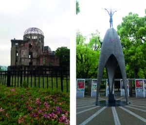
Left: The Genbaku Dome in Hiroshima, the bomb exploded about 600m above this building. Everyone inside was killed instantly. Right: Children's Peace Monument to commemorate all the children who dies as a result of the bomb.

Left: The Genbaku Dome in Hiroshima, the bomb exploded about 600m above this building. Everyone inside was killed instantly. Right: Children’s Peace Monument to commemorate all the children who dies as a result of the bomb.

Last week, four friends from university came out for Golden Week (national holidays). We mainly stayed in Kyoto and did a couple of day trips out, including to Hiroshima. The Peace Museum in Hiroshima is an incredibly informative and moving museum, documenting the physical effects of the atomic bomb, from short-term thermal radiation to long-term cancer, as well as the physics behind the bomb and why it was dropped on Hiroshima in particular. We visited a geisha show in a theatre in Kyoto, as well as numerous temples and shrines. The highlight of my week was going to the opening day of the sumo grand tournament in Tokyo. It was not at all like I expected it to be, there was a lot of ritual and ceremony involved, but the fighting only lasts 5-30 seconds!

Beginning of a sumo bout at the sumo arena, Tokyo

Beginning of a sumo bout at the Ryogoku Sumo Hall, Tokyo

Travelling around Japan by Shinkansen is incredible for so many reasons. Firstly (and probably most well known) they are incredibly fast, Sendai is about 350km from Tokyo, which is about the distance between London and Newcastle, and the Shinkansen takes only 90 minutes! The trains are also spacious and comfortable, even in standard class. Their only disadvantage is how expensive they are to buy tickets, but in my opinion the speed is worth paying for. At the other end of the spectrum, local lines out of cities are typically very cheap, for example I got a train to a place called Matsushima, just outside Sendai, a 50min train ride which cost 400yen (about £2).

My overall impression so far of Japan is that it is a culture of extremes, between the very old and the very new and technologically advanced. Wherever I have been, people are very friendly and helpful, even through the language barrier. Before I came, I have to admit I didn’t have a burning desire to visit Japan, but having been here, I would thoroughly recommend it as a country to visit.

Roots of earthquake-prone faults brought to light

By Joanna P Faure Walker, on 25 November 2013

Earthquakes affect many highly populated areas around the world so understanding what controls the distribution and frequency of them is a top priority for the earth science and disaster risk reduction communities. Often, however, the controlling factors remain elusive because scientists have limited information about what happens deep down in the Earth’s crust where earthquakes initiate. A recent Nature Geoscience article (Cowie et al. (2013) published online on 3rd November, 2013) has shed light on the problem, and has shown how phenomena on the surface can be linked to the movement of rocks in the deep crust.

(more…)

Two NGOs set up by the young people of Rikuzentakata, Iwate, Japan

By Joanna P Faure Walker, on 7 June 2013

Dr Joanna Faure Walker visited Rikuzentakata, one of the worst affected towns in the Iwate Prefecture, as part of the Great East Japan Earthquake EEFIT return mission. While there, she and her associates met with two NGOs: ‘Save Takata’ and ‘Sakura Line’ that were set up following the disaster.

Okamoto Shoma  and his mother Keiko Shoma in the Save Takata office

Okamoto Shoma and his
mother Keiko Shoma in the
Save Takata office,
Rikuzentakata

In March 2011, Okamoto Shoma was a twenty-year-old architecture student in Tokyo who had grown up in Rikuzentakata. Following the tsunami, Okamoto and some class mates from Tokyo spent one and a half days driving to Rikuzentakata with recovery supplies and gasoline.  Communications were down so Okamoto could not contact his mother, Keiko, whose house in Rikuzentakata had been destroyed by the tsunami. Fortunately he found her in an evacuation centre.

During the first month after the disaster, there were many requests from those outside the region about the residents’ safety and to make donations. Okamoto and his classmates formed Save Takata to help with coordination of the relief work; public services provided large-scale food and services, but additional help was needed to get smaller donations and reach small groups that needed assistance. It currently has a number of activities to help Rikuzentakata and its residents:

  1. Acting as a conduit and passive coordinator for people in Tokyo who want to donate money and expertise (examples include teaching and entertainment such as dance shows).
  2. Making up-to-date maps of Rikuzentakata permanent and temporary structures showing shop locations and distributing them to residents.  (Initially conditions were changing rapidly so maps were updated every two months, going forward they will be updated every six months.)
  3. Promoting Rikuzentakata products and selling them in Tokyo and other big cities. (In 2011, 200,000 volunteers went to Rikuzentakata and in 2012 there were 130,000; Save Takata hopes to use this network)
  4. Providing internet services and I.T. training for small businesses.
  5. Informing residents and businesses about which relevant schemes are available to help them from around the country. (A particularly popular donation – especially amongst the elderly population – were small Buddha statues for people’s temporary homes.)
  6. Coordinating entertainment events such as festivals for children.  (Keiko explained that although two years after the event the housing situation has become stable, people are bored and need community activities.)
  7. Renting a house for visiting volunteers; this house also acts as a meeting place and hub for activities for young people.

The Prefectural Government has made arrangements to employ people and dispatch them into jobs in NGOs; three of Save Takata’s eight full-time staff are with this scheme. Save Takata also has 2 part-time staff and 30 volunteer members. All staff originally volunteered their time, but now some salaries are being paid.  In the early stages they relied on donations from private companies, however now they need to apply for support from both the private and public sectors.  The organization is trying to transform from being a voluntary organization to having an increased amount of self-funding from the activities it organizes.

Save Takata’s future plans include producing a manual comprising the lessons learnt from setting up and running a NGO in a post disaster situation and being a NGO coordinator in potential future disasters as they recognize in a large disaster it is important to have good communication, coordination and organization between the different parties in the recovery process.

Okamoto is now also helping Sakura Line  – the NGO that shares an office with Save Takata in a one-year-old temporary shopping centre – that was started by Hashizume Takumi.

Temporary shopping centre housing Save Takata and Sakura Line

Temporary shopping centre housing
the offices of
Save Takata and Sakura Line

Hashizume, who acted as a volunteer fireman helping people evacuate and closing the tsunami gate, escaped to high ground with only a few minutes to spare before the tsunami arrived.  The disaster killed over fifty of his family and friends. Hashizume saw on television that historical tsunami had reached sacred places within cities in the region; he was angered when he saw there was a stone in Hinota marking where a historical tsunami had reached with a message instructing not to build houses lower than it. Hashizume feels it is his duty to pass on the message to future generations so decided to start Sakura Line, a project to create a continuous line of trees marking the border of the 2011 tsunami inundation.

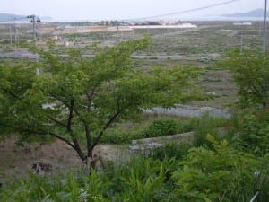
One of the first cherry trees to be planted as part of the Sakura Line programme. Behind the tree is where downtown Rikuzentakata used to be.  The local government is currently raising the ground level to 12m above sea level  before reconstructing the town.

One of the first cherry trees to be planted as part
of the Sakura Line programme. Behind the tree is
where downtown Rikuzentakata used to be.
The local government is currently raising the
ground level to 12m above sea level before
reconstructing the town.

The first trees were planted near the Judo Temple and other sites around Rikuzentakata. So far they have planted 520 trees.   If completed, the line will extend beyond the city to become 170km long comprising 17,000 cherry trees. It is anticipated that it will take many years to finish. These trees live for about 100yrs so it is hoped that future generations will care for the trees and keep the line going. I hope his project receives the support it needs and acts as a successful reminder to future generations to help reduce the risk from future tsunami.


For more information on these projects see http://www.savetakata.org/en/ and http://www.sakura-line311.org/.

Dr Joanna Faure Walker was funded by EPSRC through EEFIT (http://www.eefit.org.uk). A new EEFIT report about observations made on the most recent trip in June 2013 will be available soon. The IRDR Special Report 2013-01 provides details about the observed damage and recovery of the Great East Japan Earthquake at and Tsunami in October 2012 (http://www.ucl.ac.uk/rdr/publications/IRDR-Special-Report-UK-Japan-Workshop) and the EEFIT Report provides observations from May-June 2011 (http://www.istructe.org/webtest/files/1d/1d158684-b77b-4856-99f8-2522fa25533b.pdf).