UCL Humanitarian Institute Masterclass: Earth Observation and Natural Hazards
By Saqar ' M Al Zaabi, on 5 March 2020
Written by Dr Akhtar Alam, Research Fellow at UCL IRDR
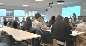
A masterclass was organised by UCL Institute for Risk and Disaster Reduction (IRDR) on February 20, 2020. Attended by twenty-five researchers, practitioners and students from different institutions, the event included lectures, proactive sessions and a laboratory exercise.
 The morning session started with a lecture on the application of Earth Observation (EO) technology in monitoring and mitigating natural hazards, delivered by Aisha Aldosery, a PhD student at UCL IRDR. She presented an overview of the fundamental principles of remote sensing, data products and space programmes. She also discussed the applications of this technology to collect information on various natural hazards.
The second lecture was an illustration of a case study – “Cyclone risk assessment of the Cox’s Bazar district (CBD) in SE Bangladesh”, delivered by Dr Akhtar Alam, Research Fellow at UCL IRDR. He demonstrated the use of EO data, statistical methods and GIS for simulating risk scenarios at varied spatial scales of the study area. He also discussed the issues concerning the availability and selection of the data, uncertainties and limitations of the procedures, and validation of the results in the risk assessment process.
 In addition to the conceptual discussions, the participants were given an exercise on risk mapping. The objective was to simulate the spatial patterns of risk with a manual procedure. It imitated the complementary use of EO technology, Geographic Information System (GIS) and Analytic Hierarchy Process (AHP) for mapping the risk. This was an exciting session where participants were divided into groups and engaged in the activity. At the end of the session, they were given a chance to express their views and present the results of the exercise.
The afternoon session was devoted to a GIS exercise in the laboratory. Original raster data layers were provided to the participants to perform a landslide hazard analysis. The learning outcomes included visualization, interpretation and integration of the standardized raster data layers for weighted overlay analysis in ArcGIS, deriving weights of different parameters and checking the consistency of the weighting process using AHP, and developing a landslide hazard map of the study area from the given data layers.
The participants expressed positive feedback about the event.
 Close
Close

