Interview with Gianluca Pescaroli, founder of the Cascading Disasters Research Group at IRDR
By ucfbtag, on 29 July 2016
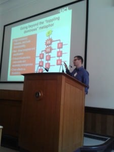
Gianluca Pescaroli is a third year PhD student in the IRDR and one of the founders of the Casc ading Disasters Research Group (https://www.ucl.ac.uk/rdr/cascading). The group aims to understand, assess, and mitigate the escalation of crises in the global interconnected system.
– Gianluca, how did you come up with the idea of creating a research groups on cascading disasters?
The idea was the natural consequence of a cross-disciplinary dialogue started with Dr. Robert Wicks and Prof. David Alexander (both based in the IRDR) on extreme space weather events. We recognised the potential to do something different, challenging our approaches and evolving them together into something new. This was supported by other discussions with Dr. Ilan Kelman on climate change and disaster diplomacy, as well as by the interest of engineering colleagues working on floods and earthquake early warning systems. The Knowledge Exchange Grant Award was the perfect chance to translate a vision into reality, and make it happen.
-What is the Knowledge Exchange Grant? How did you win it?
The Knowledge Exchange Grant is a UCL-based grant to promote knowledge transfer between UCL and small and medium-sized enterprises. In other words, it helps to create a bridge between academia and the end users, and turning theoretical knowledge into practical solutions. The KE Grant is supporting us in the development of activities related to cascading disasters, including a website (https://www.ucl.ac.uk/rdr/cascading) and various workshops.
– You recently organised a closed-door workshop on cascading disasters and extreme space weather. Can you tell us more about the outcomes of this workshop?
We are producing two guideline documents on cascading disasters and extreme space weather events, which we are going to release by early August. We will explain the key issues for a non-academic audience in the form of bullet points and graphics. I hope there will be the chance to disseminate them through websites such as PreventionWeb (http://www.preventionweb.net/english/) or with a self-standing event.
– What goals would you like to achieve in the near and far future?
In the short term, I wish to publish my work on cascading disasters, extreme space weather
 and cybersecurity that applies our general theory to scenario building. The second step would be to have a special issue on cascading disasters for a peer-reviewed journal, which will be not easy! In the medium term, after finishing my doctorate, my goal is to have the resources for developing the idea of vulnerability paths and scaling up of emergencies, producing some practical outputs that could make the difference in crises.
– Which stakeholders do you plan to involve in the projects that will be developed by this research group?
We are already working a project with major stakeholders from the public and private sector, but this is just one of the early steps. It will be very interesting to work more on the intersection between physical and social vulnerabilities that is in the interest of governments, service providers and society. The evolution of the research group needs be driven by dialogue, and I think that many of the possible ways to cooperate haven’t been considered yet… I am sure they will become natural when it is the right moment.
– Will be room for other academic partners to join the research group?
Definitively, this will be vital for the future. The more we discuss and the more we cooperate, then the more we will be able to understand cascading events. The complexity of this world is too great to solve it on our own so we need the efforts and ideas of other practitioners. From my experience, some interesting collaborations can come from the most unexpected areas and in the most unexpected circumstances, such as a walk at the Flood Barriers or a beer after work. The important thing is keeping an open mind and following our intuition.
 Close
Close


