Close
Close

The Royal London Hospital Estate: a self-guided walk in Whitechapel
By the Survey of London, on 3 November 2017
The Survey of London would like to share a self-guided walk around the eastern portion of the Royal London Hospital’s estate, bounded roughly by Whitechapel Road north, Cavell Street east, Commercial Road south, and New Road west. Download our route map and guide for a fuller introduction to the history of the hospital and its estate: Guide to a walking tour of the Royal London Hospital Estate
The Royal London Hospital traces its origins to a charitable infirmary established in 1740 for the working poor of east London. Initially based in converted terraced houses in Moorgate and Prescot Street, the institution secured a permanent home with the construction of a purpose-built hospital (1751–78) in open fields on the south side of Whitechapel Road.
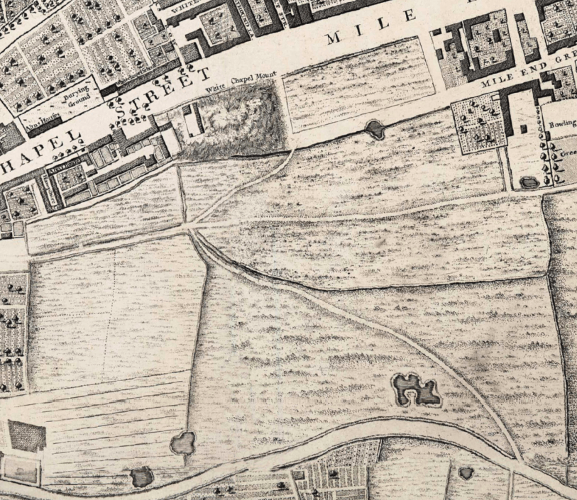
The hospital was built on the rectangular field east of Whitechapel Mount, an artificial hill formed as part of the fortifications built round London in the 1640s. It was bounded by open fields to the south belonging to the Red Lion Farm. (Extract from John Rocque’s map of London c.1746)
One of the attractions of the site acquired by the hospital was its healthy location, bounded to the south by meadows and pastures belonging to the Red Lion Farm on Mile End Green. The medical staff promoted the virtues of fresh air and ventilation around the hospital for the recovery of patients. By 1772 the hospital had acquired roughly thirty acres of fields on the south side of Whitechapel Road, stretching as far south as the present course of the Commercial Road. This large swathe of land protected the hospital from the threat of unwanted encroachment and presented an opportunity to raise funds through building development.
The hospital began to offer land on building leases in the 1780s. Building development was initially confined to the west side of New Road, which had been laid out in the 1750s. The eastern portion of the hospital’s estate was developed in the first half of the nineteenth century in an orderly grid of wide, airy streets. Surviving rows of brick-built terraced houses in Walden Street, Nelson Street, Varden Street and Turner Street point to the tension between the hospital’s estate development and the watchful eye which the medical staff exerted over its vicinity to preserve ventilation.

Aerial view of the London Hospital in the 1930s.
Many of the nineteenth-century terraces built to secure an income for the hospital have been sacrificed for its expansion and success, with the construction of an assortment of medical buildings such as the Outpatients Department (1900–2) and the adjacent Outpatients Annexe (1935–6) in Stepney Way. A remarkable acquisition is the former St Philip’s Church (1888–92), which was converted into a medical and dental library in the 1980s. Despite the concentration of buildings associated with the Royal London Hospital in the area, there are a few interlopers, including the bulky East London Mail Centre (1970), the Good Samaritan Public House (1937–8), and Gwynne House (1937–8). The south end of the estate has resisted the march of medical buildings, and the Nelson Street Synagogue and a former Baptist chapel in Varden Street testify to Whitechapel’s diverse patterns of immigration.
The following photographs give an impression of the Survey’s self-guided walking tour, which is available to download here. These photographs were taken around the hospital’s estate by Derek Kendall in 2016–7; their captions include links to the Survey’s participative ‘Histories of Whitechapel’ website, https://surveyoflondon.org.

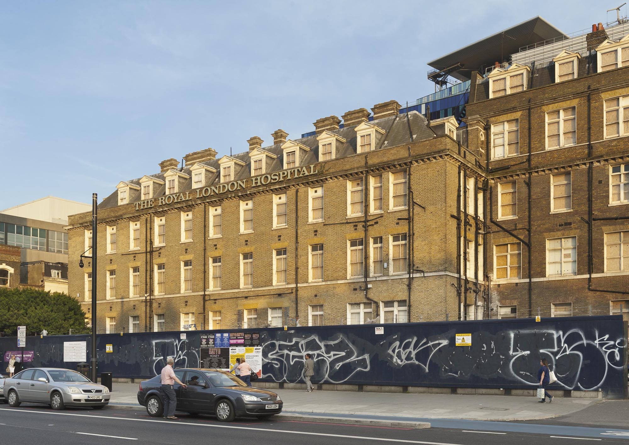
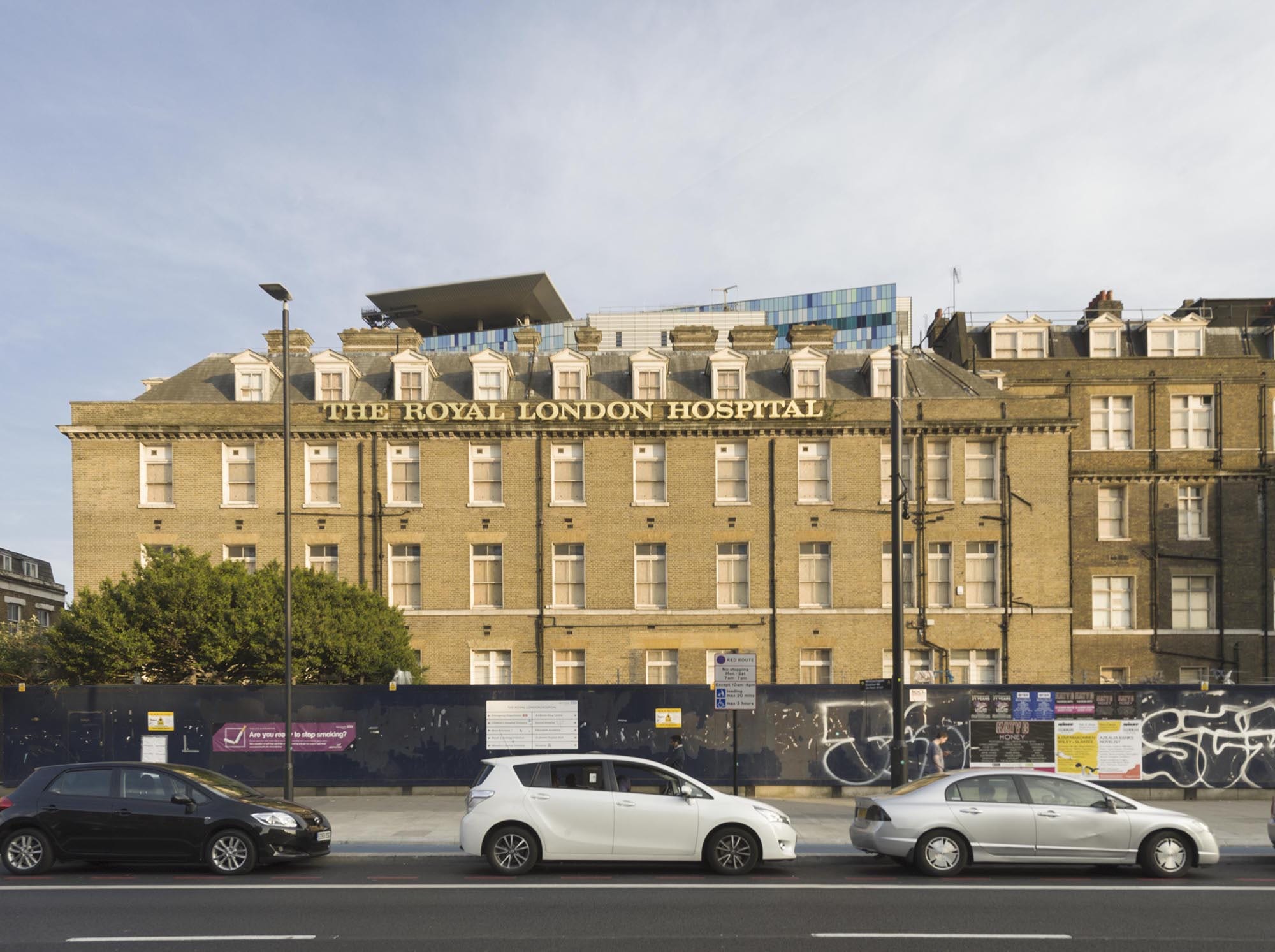
The former Royal London Hospital in Whitechapel Road. In the nineteenth century, the Georgian core of the hospital was concealed by a number of extensions. The Alexandra Wing (west) opened in 1866 and the Grocers’ Company’s Wing (east and donated by the Grocers’ Company) was opened by Queen Victoria in 1876; both were designed by Charles Barry Jr. Further extensions were overseen by Rowland Plumbe, the hospital’s surveyor, in the years around 1900. (© Derek Kendall)

1840s terraced houses at 57–69 Philpot Street. This wide, airy thoroughfare extending from the rear of the hospital to Commercial Road was planned c.1818. It was first known as St Vincent Street in honour of the Earl St Vincent, a vice-president of the hospital. Between 1820 and 1845 the street was gradually laid out with large brick-built terraced houses with round-arched windows and recesses. (© Derek Kendall)
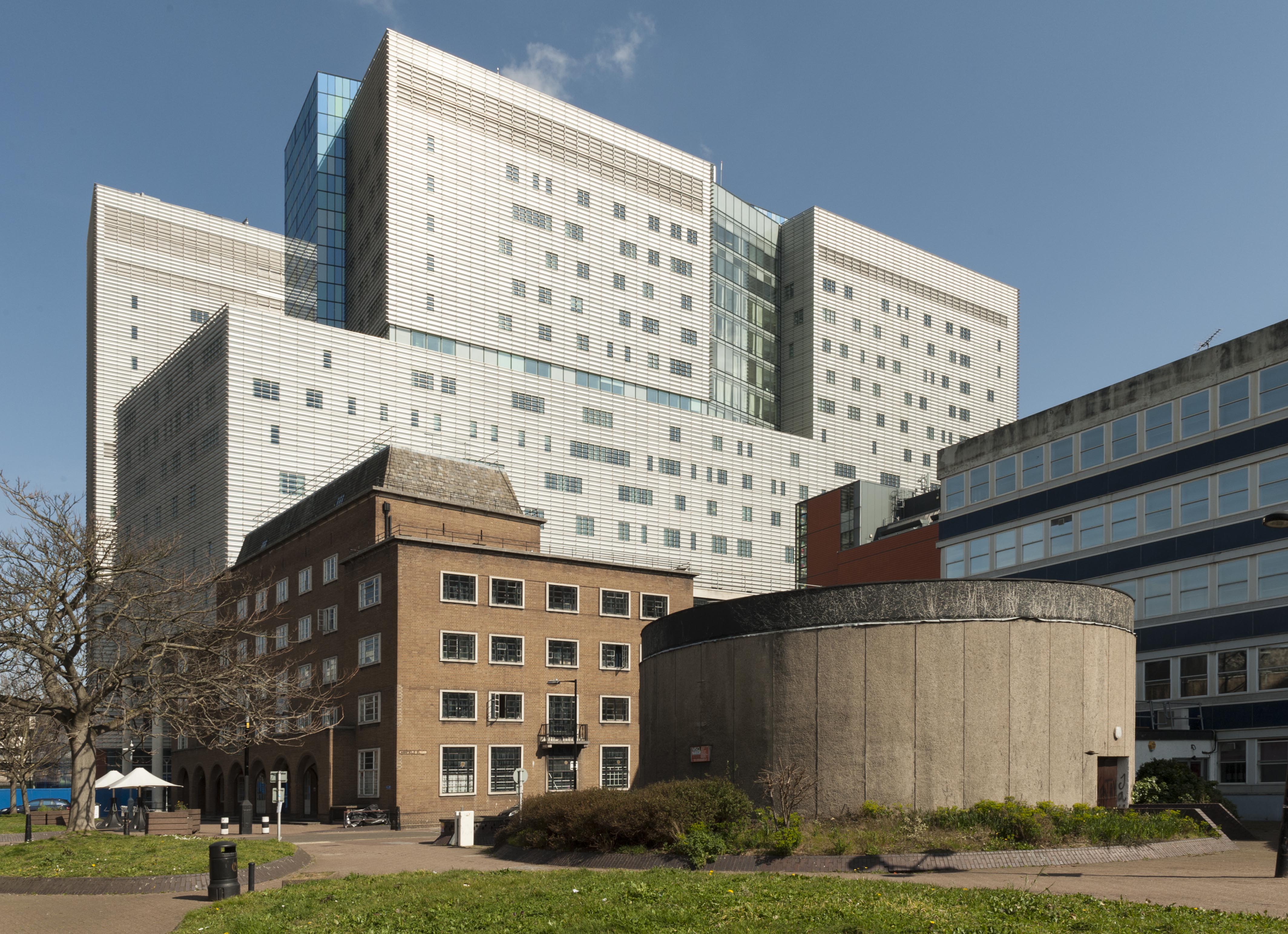
Terraced houses on the east side of Philpot Street were sacrificed in the 1930s for a students’ hostel for the London Hospital Medical College, a neat brick-built block designed by Edward Maufe. The Princess Alexandra School of Nursing was built in the 1960s to designs by T. P. Bennett & Son, incorporating a distinctive circular lecture theatre faced with concrete. Today the Royal London Hospital’s modern block dominates Philpot Street’s northern aspect, rising to seventeen storeys. (© Derek Kendall)
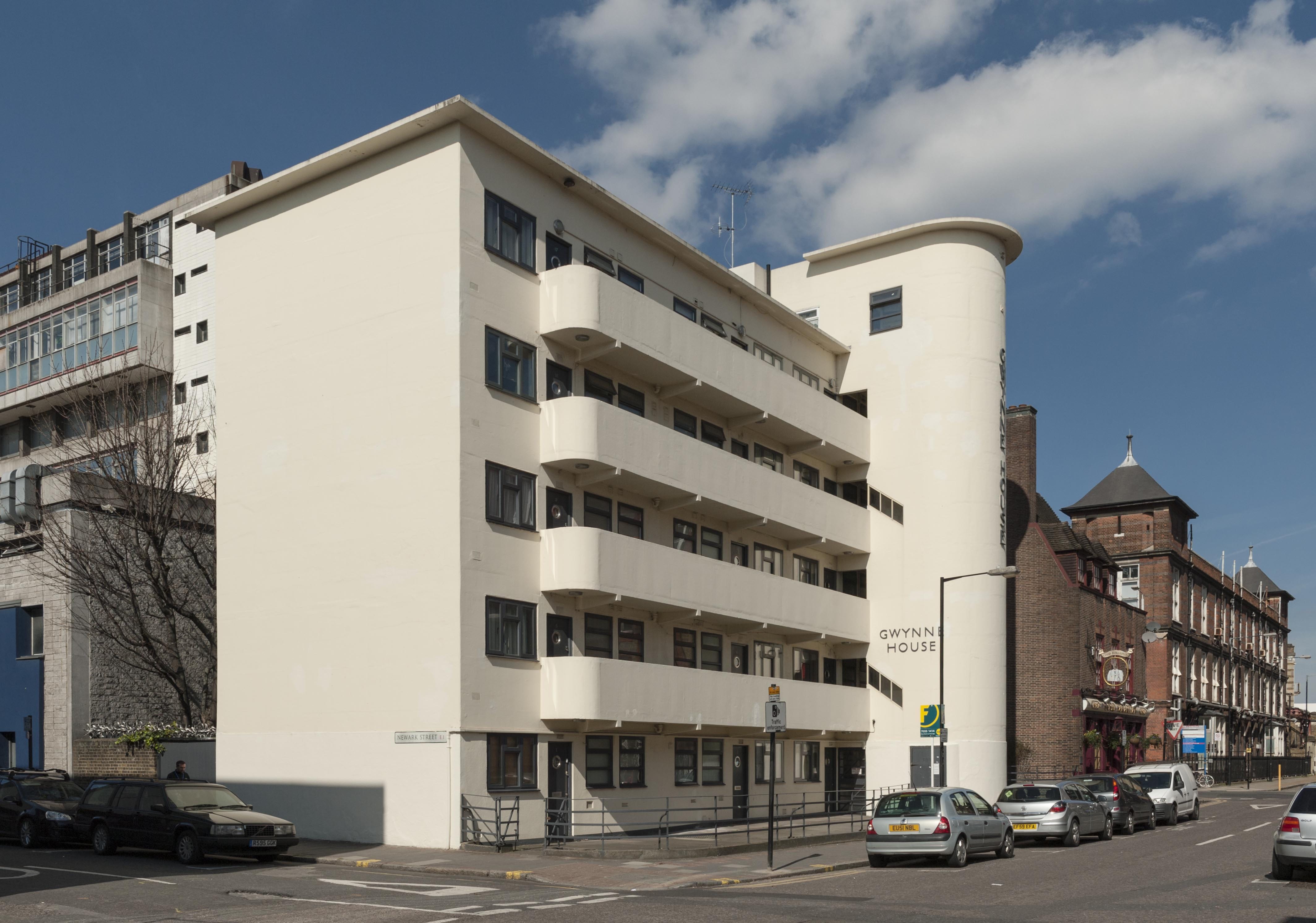
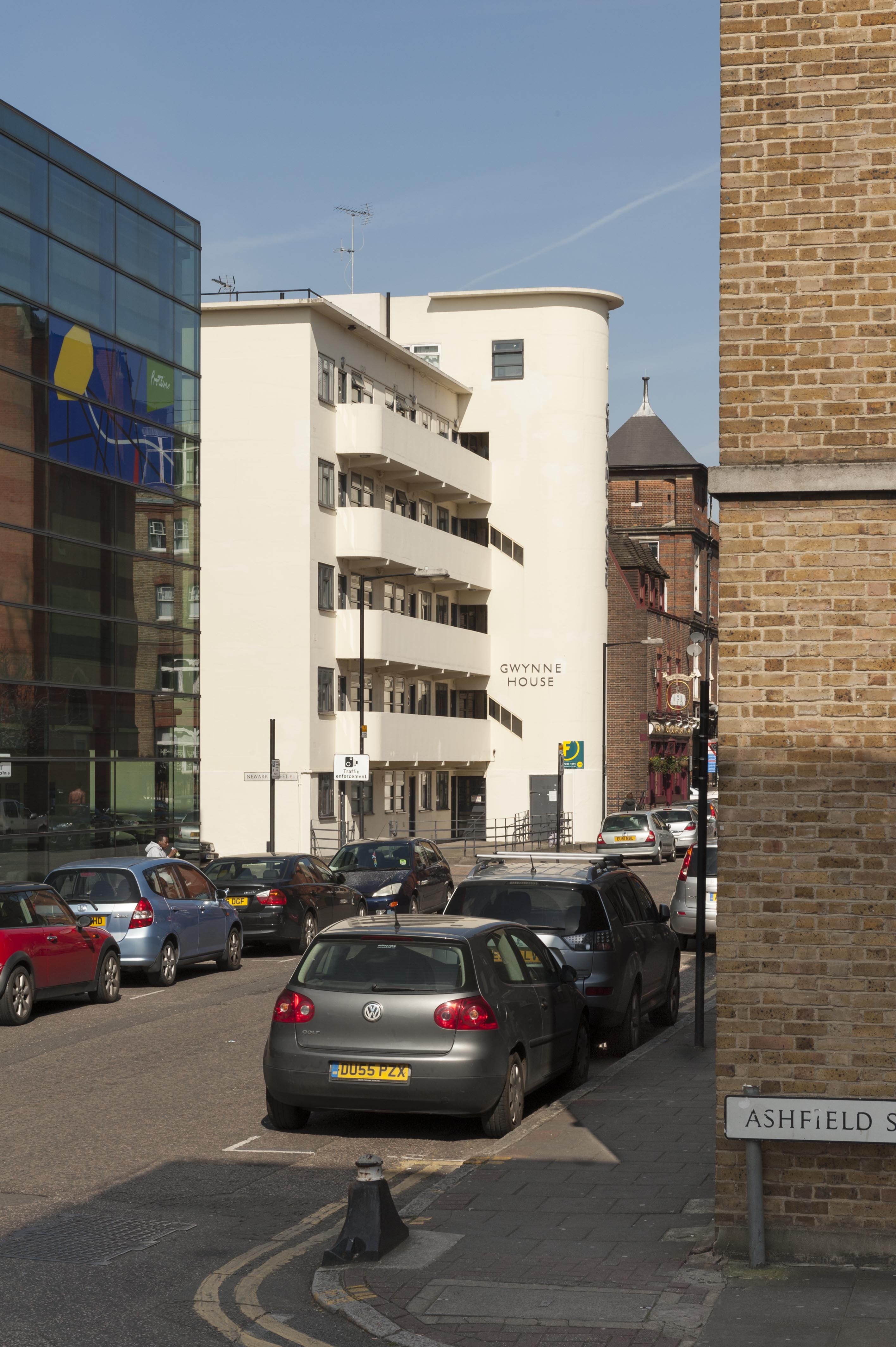
Gwynne House, Turner Street. Built in 1937–8 to designs by H. Victor Kerr, the architect of a number of interwar buildings in east London. Of his surviving works in Whitechapel, Gwynne House is the most assertive expression of the Modernist style. The block provided twenty ‘minimum’ flats designed to attract students, social workers and professional people in east London. Gwynne House was swiftly identified as a convenient base for medical practitioners, nurses and students. By the 1980s, it had been acquired for the hospital as rented staff accommodation. The flats are now privately owned. (© Derek Kendall)
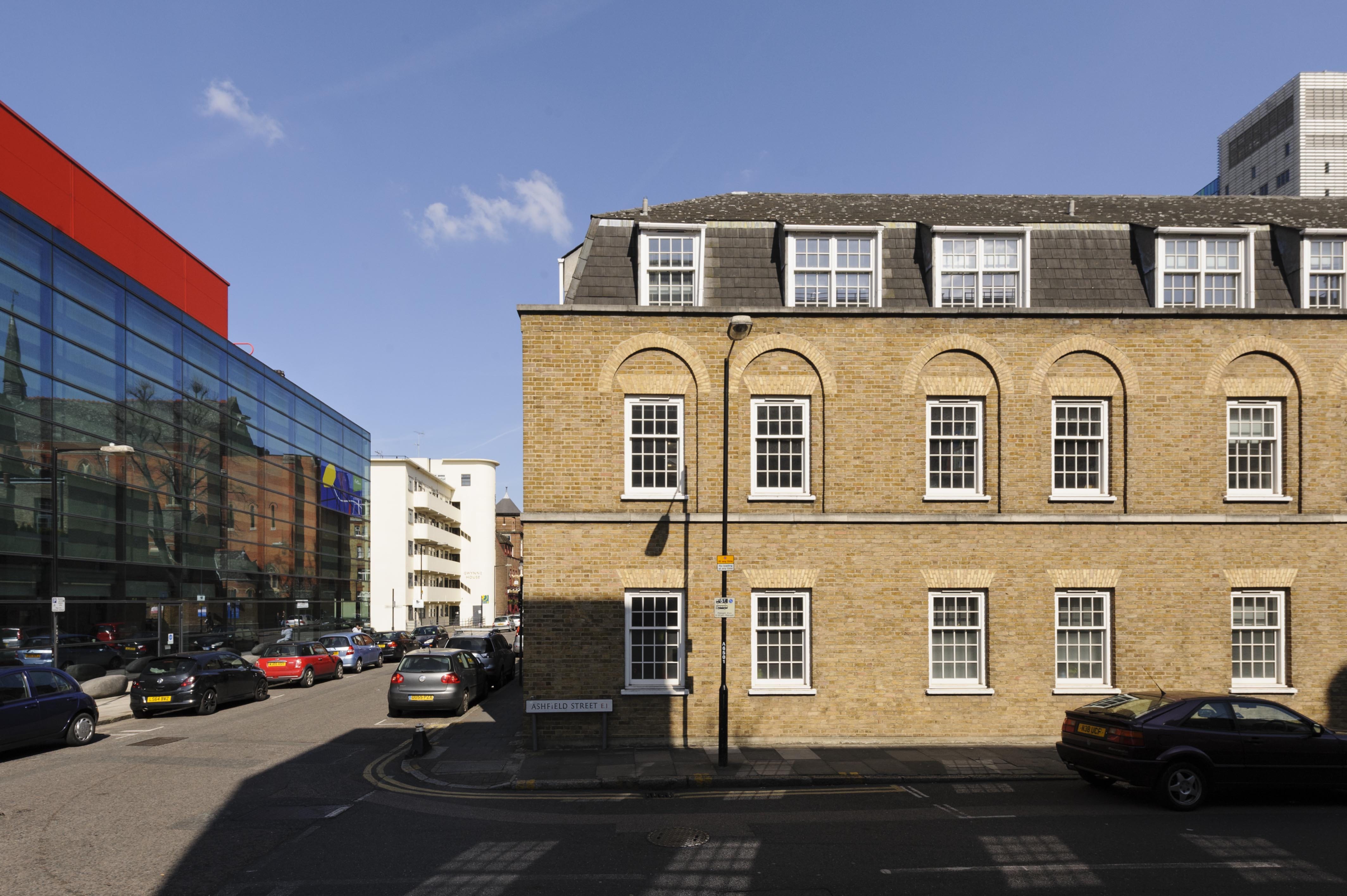
The Yvonne Carter Building, Ashfield Street, built in 1975–7 as laboratories in character with the stock-brick terraced houses built on eastern side of the hospital’s estate in the nineteenth century. It stands opposite the Blizard Building, a sleek glass-fronted block constructed in 2003–5 by AMEC to designs by Will Alsop as teaching and research facilities for the School of Medicine and Dentistry, Queen Mary University of London. (© Derek Kendall)
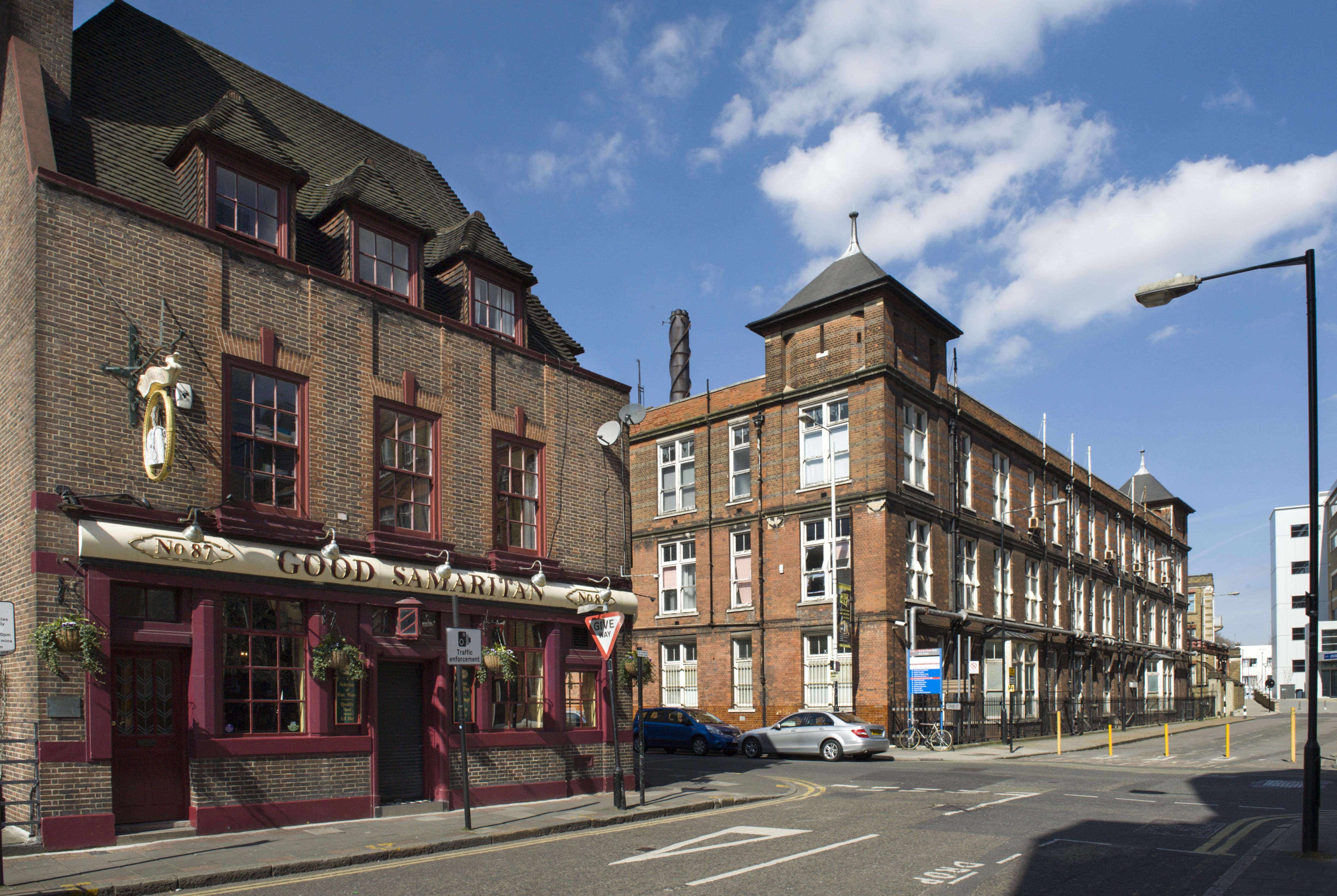
The Good Samaritan Public House, 87 Turner Street. This public house probably owes its name to the London Hospital, which incorporated a representation of the City of London as a Good Samaritan on its official seal of 1757. The earliest record of the Good Samaritan dates to 1827, yet the present building was raised in 1937–8 to designs by A. E. Sewell, chief architect to Truman’s. Soon after its completion, it was assessed by the brewery’s surveyors as a ‘nice small house, well done’. Its continuing association with the London Hospital and its medical college is commemorated by characterful street signs decorated with busts of white-coated doctors. (© Derek Kendall)

The former Outpatients Annexe, New Road. This substantial block was built in 1935–6 to designs by Adams, Holden & Pearson to secure a centre for the hospital’s Department of Physical Medicine and a newly established School of Physiotherapy. The building has been vacant since the building moved to new premises in 2012, and redevelopment seems likely. (© Derek Kendall)
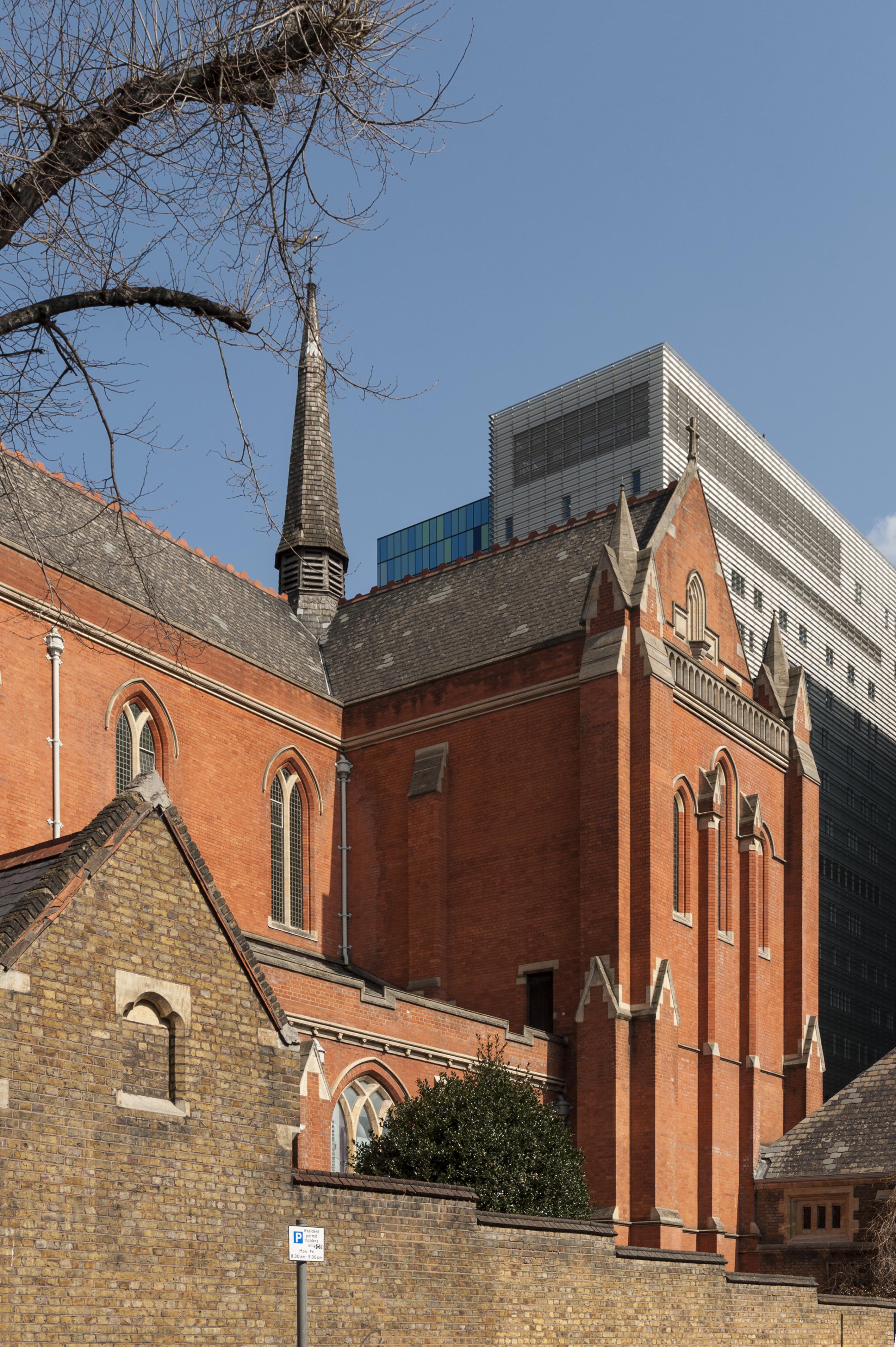
Whitechapel Library (formerly the Church of St Philip with St Augustine), Newark Street. A former red-brick church of 1888–92 built to designs by Arthur Cawston. The quality of the church culminates in its magnificent vaulted interior, deemed to be an ‘architectural masterpiece’ by the Gothic revivalist Stephen Dykes Bower. The church was converted into a medical and dental library for the London Hospital Medical Library in 1985–8 to plans by Fenner & Sibley. Following the assimilation of the college into Queen Mary University of London in 1995, the building continues in use as a medical and dental library. (© Derek Kendall)
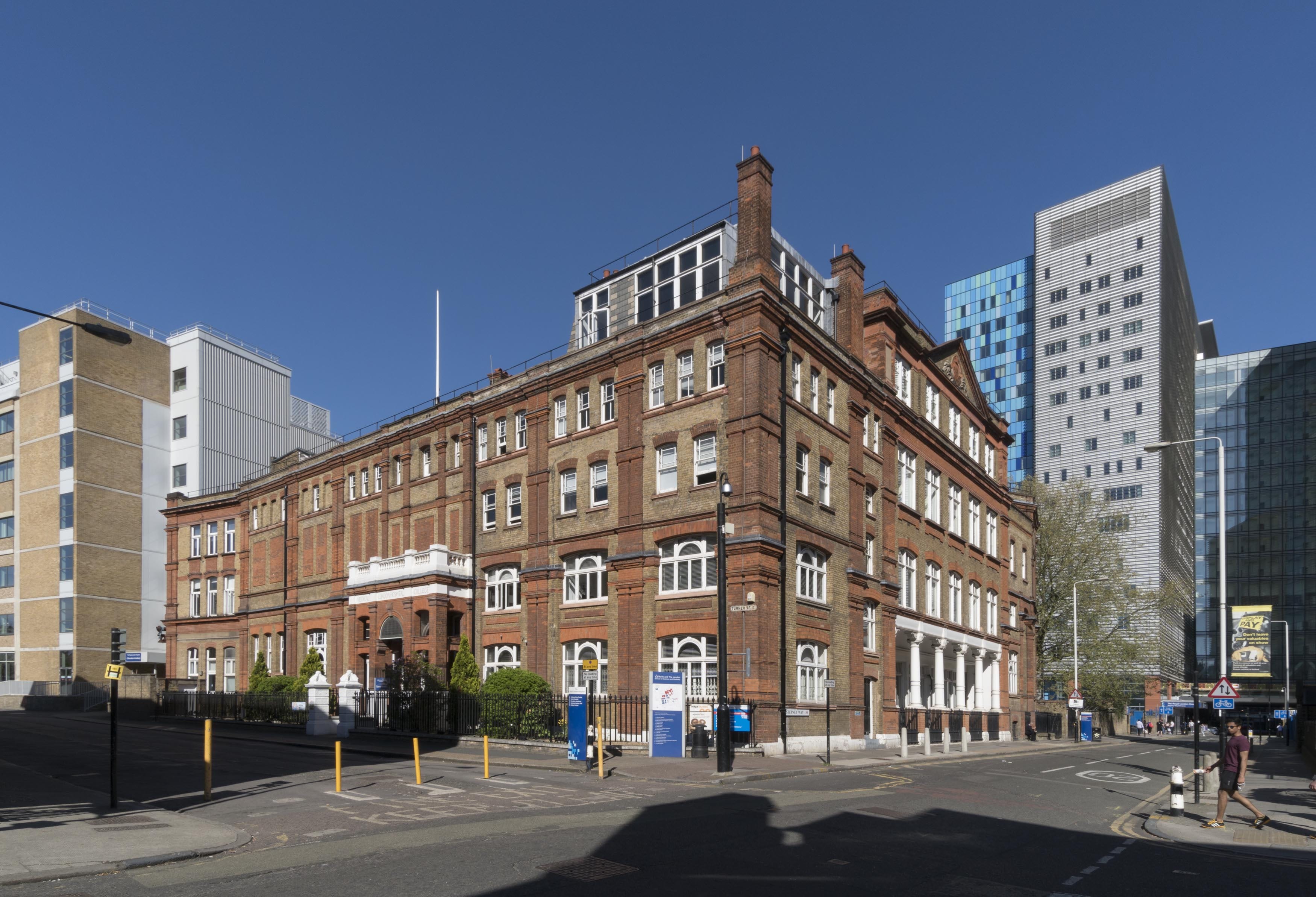
The former London Hospital Medical College, Turner Street. The hospital’s medical college has been based at its present site since 1854, yet the building has undergone successive alterations spurred by a rising volume of students and the need to modernise teaching facilities. Its principal elevation was built in 1886–7 by Rowland Plumbe, the hospital’s surveyor. Now known as the Garrod Building, it continues in educational use as part of Barts and the London School of Medicine and Dentistry. (© Derek Kendall)
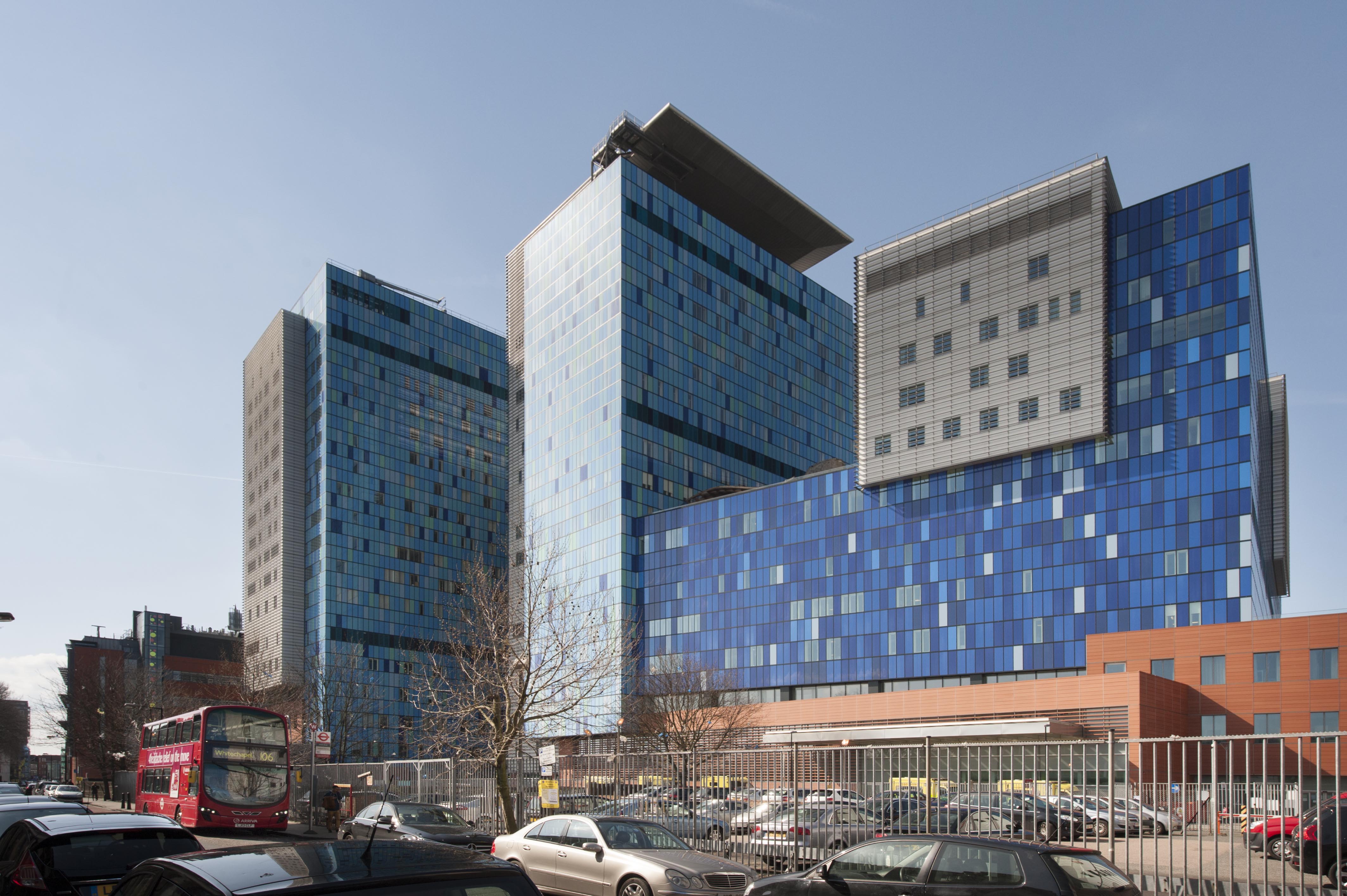
In 2012 the Royal London Hospital transferred to an assertive purpose-built block designed by HOK, located behind its historic base in Whitechapel Road. The former hospital is set to be converted into a new civic centre for Tower Hamlets Council. (© Derek Kendall)